Wikimedi'Òc
Modes d'emploi

Cet album fait partie des albums
Cet album photos contient les sous-albums suivants :


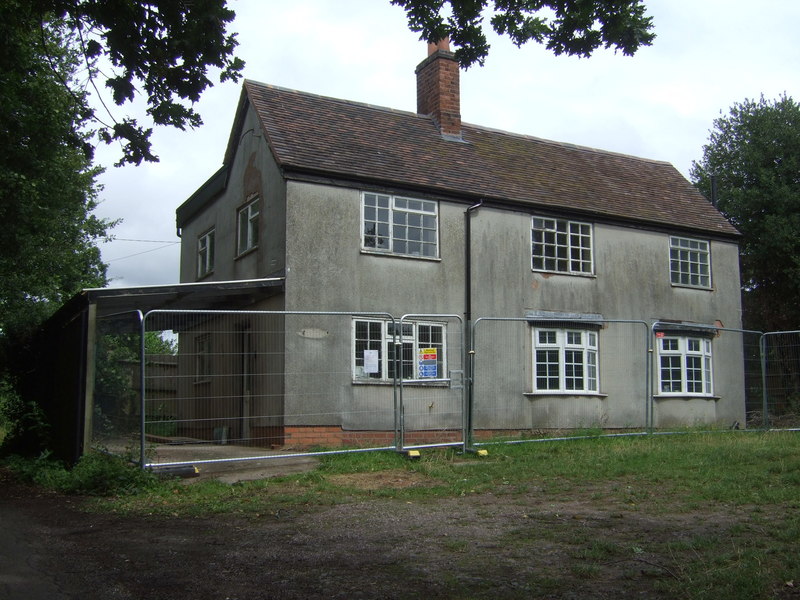
In need of some TLC - geograph.org.uk - 697309.jpg - GeographBot

Houses on the horizon - geograph.org.uk - 832672.jpg - GeographBot

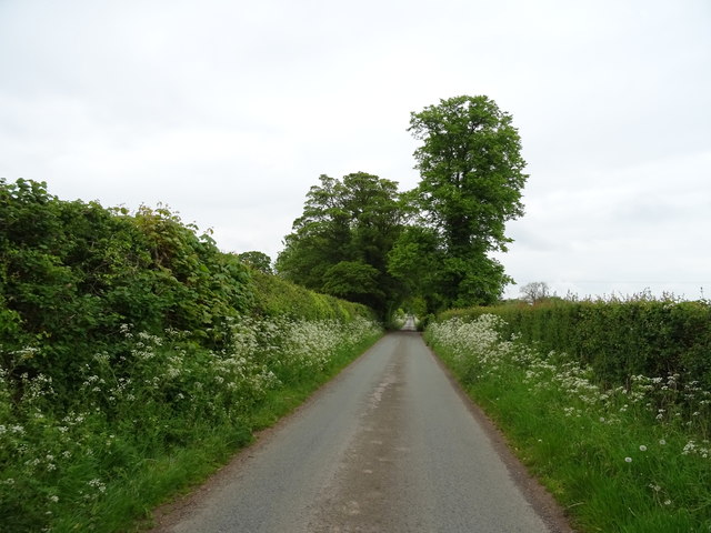
Just another tree-lined lane - geograph.org.uk - 832663.jpg - GeographBot

Polytunnels at New House Farm - geograph.org.uk - 832694.jpg - GeographBot

Tree planting - geograph.org.uk - 1523640.jpg - GeographBot

Woodland edge - geograph.org.uk - 1523632.jpg - GeographBot

St Mary's Church, Blymhill - geograph.org.uk - 7453230.jpg - GeographBot

Remains of a pond in Picmoor Wood - geograph.org.uk - 1811223.jpg - GeographBot

The western edge of Picmoor Wood - geograph.org.uk - 1811228.jpg - GeographBot

Woodlands Lodge cottage - geograph.org.uk - 1937857.jpg - GeographBot

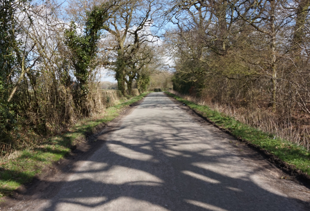
Just a narrow lane, with a bend or two - geograph.org.uk - 1938723.jpg - GeographBot

Beighterton Farm - geograph.org.uk - 1938727.jpg - GeographBot

Beighterton crossroads - geograph.org.uk - 1939327.jpg - GeographBot

The lane towards Blymhill Lawns - geograph.org.uk - 1939330.jpg - GeographBot

The southern end of Park Pool - geograph.org.uk - 1940928.jpg - GeographBot

Former shepherd's bothy, and a horse trials obstacle - geograph.org.uk - 1941034.jpg - GeographBot

Crossroads of estate tracks - geograph.org.uk - 1942141.jpg - GeographBot
Weston Central station - geograph.org.uk - 1942452.jpg - GeographBot

Unrideable bridleway - geograph.org.uk - 1942457.jpg - GeographBot

Cottage at Ivetsey Bank - geograph.org.uk - 1942788.jpg - GeographBot

"No Tipping", it says.... - geograph.org.uk - 1942795.jpg - GeographBot

Southeast across fields to Bishops Wood - geograph.org.uk - 1942800.jpg - GeographBot

Park Oak Farm, Bishops Wood - geograph.org.uk - 1942805.jpg - GeographBot

Access to a field near Lodge Farm - geograph.org.uk - 2031169.jpg - GeographBot

Cycling home - geograph.org.uk - 2031419.jpg - GeographBot

Lane at High Hall summit - geograph.org.uk - 2031443.jpg - GeographBot

Watling Street beside Weston Park - geograph.org.uk - 2031571.jpg - GeographBot

Old shop ^ Post Office - geograph.org.uk - 2031575.jpg - GeographBot

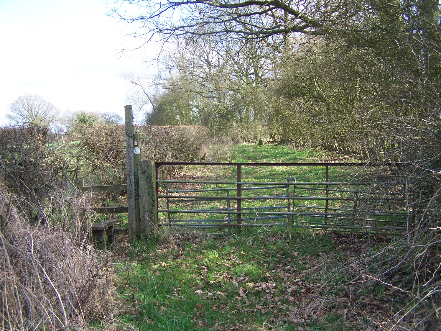
Gate to a footpath - geograph.org.uk - 2031591.jpg - GeographBot

A narrow lane - geograph.org.uk - 2034258.jpg - GeographBot

Border country - geograph.org.uk - 2119547.jpg - GeographBot

Footpath Junction At Ivetsey Bank - geograph.org.uk - 2322825.jpg - GeographBot

Footpath To Ivetsey Bank - geograph.org.uk - 2322830.jpg - GeographBot

Footpath Near Ivetsey Bank - geograph.org.uk - 2322834.jpg - GeographBot

Footpath To Blymhill Lawns - geograph.org.uk - 2322841.jpg - GeographBot

Footpath To Blymhill Lawns - geograph.org.uk - 2323868.jpg - GeographBot
Footpath To Ivetsey Bank - geograph.org.uk - 2323876.jpg - GeographBot

Bridleway To Wheaton Aston - geograph.org.uk - 2323910.jpg - GeographBot

Footpath To Wheaton Aston - geograph.org.uk - 2323922.jpg - GeographBot

Footpath To Wheaton Aston - geograph.org.uk - 2323930.jpg - GeographBot

Farm track across Guy's Bank - geograph.org.uk - 2462227.jpg - GeographBot

The Orslow Brook at Coneygreaves - geograph.org.uk - 2462234.jpg - GeographBot

Bridleway at Coneygreaves - geograph.org.uk - 2462600.jpg - GeographBot

Chatwell Park Farm - geograph.org.uk - 2462656.jpg - GeographBot
House on Chatwell Lane - geograph.org.uk - 2462658.jpg - GeographBot

Ivetsey Bank Farm - geograph.org.uk - 2467169.jpg - GeographBot

Typical Narrow Lane in this Area - geograph.org.uk - 2565425.jpg - GeographBot

The Road to Orslow - geograph.org.uk - 2565443.jpg - GeographBot

Derelict Barn and Calves - geograph.org.uk - 2565459.jpg - GeographBot

Entrance to Orslow Manor Farm - geograph.org.uk - 2565466.jpg - GeographBot

Country Crossroads - geograph.org.uk - 2565485.jpg - GeographBot

Out on the open road - geograph.org.uk - 2565814.jpg - GeographBot

Roadside Pool - geograph.org.uk - 2565823.jpg - GeographBot
Another Country Lane - geograph.org.uk - 2570274.jpg - GeographBot
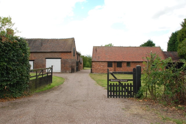
Brineton Grange - geograph.org.uk - 2570755.jpg - GeographBot

Farm Track Between Fields - geograph.org.uk - 2570760.jpg - GeographBot

Entrance to a Farm - geograph.org.uk - 2570808.jpg - GeographBot

Over the Farm Gate - geograph.org.uk - 2570813.jpg - GeographBot

A Long Narrow Lane - geograph.org.uk - 2570819.jpg - GeographBot

Footpath on a Tee Junction - geograph.org.uk - 2570823.jpg - GeographBot

Another Crop Gathered In - geograph.org.uk - 2570835.jpg - GeographBot

Approaching the A5 - geograph.org.uk - 2570841.jpg - GeographBot

Through the Hedge to Stacks of Bales - geograph.org.uk - 2585899.jpg - GeographBot

Entrance to The Old Rectory - geograph.org.uk - 2585917.jpg - GeographBot

Red Brick Barn - geograph.org.uk - 2586003.jpg - GeographBot

Red Brick Storage Barn on T Junction - geograph.org.uk - 2586018.jpg - GeographBot

Narrow Country Lane - geograph.org.uk - 2586033.jpg - GeographBot

Past Houses to Road Junction - geograph.org.uk - 2588578.jpg - GeographBot

Caravan in Field Near White Sitch - geograph.org.uk - 2588879.jpg - GeographBot

Field on the side of the B5314 - geograph.org.uk - 2588895.jpg - GeographBot

View down the B5314 - geograph.org.uk - 2588914.jpg - GeographBot

Hole in the Hedge, A5 - geograph.org.uk - 2588945.jpg - GeographBot

Entrance to Beighterton House Farm - geograph.org.uk - 2588973.jpg - GeographBot

Mill Lane at Woodlands Lodge - geograph.org.uk - 2725904.jpg - GeographBot

Hatch Lane at Beighterton Lane - geograph.org.uk - 2725911.jpg - GeographBot

Beighterton Lane - geograph.org.uk - 2725912.jpg - GeographBot

Lower Beighterton Cottage - geograph.org.uk - 2725919.jpg - GeographBot

Lower Beighterton Farm - geograph.org.uk - 2725922.jpg - GeographBot

A house near Merry Hill - geograph.org.uk - 2725932.jpg - GeographBot

Dried pond in Burnt Withy copse - geograph.org.uk - 2740967.jpg - GeographBot

Wrestler's Farm from the south - geograph.org.uk - 2740968.jpg - GeographBot

Springtime colour - geograph.org.uk - 2927628.jpg - GeographBot

A fishing pool at Lucknow Farm - geograph.org.uk - 2949542.jpg - GeographBot

Caravan Club site at Wyndford Mill farm - geograph.org.uk - 2969752.jpg - GeographBot

Footpath to Bithams Plantation and Orslow - geograph.org.uk - 2969755.jpg - GeographBot

Farm pool in the corner of a field - geograph.org.uk - 2969757.jpg - GeographBot

Polytunnels in fields north of New House Farm - geograph.org.uk - 2969759.jpg - GeographBot

New House Farm from the north - geograph.org.uk - 2969762.jpg - GeographBot

Staffordshire farmland - geograph.org.uk - 2969767.jpg - GeographBot

Bridleway towards Walton - geograph.org.uk - 2969781.jpg - GeographBot

There's a bridleway in there somewhere - geograph.org.uk - 2969785.jpg - GeographBot

The Pheasantry - geograph.org.uk - 2969787.jpg - GeographBot

Winter polytunnels - geograph.org.uk - 3402932.jpg - GeographBot
Along King Street - geograph.org.uk - 3402937.jpg - GeographBot

Birchmoor Lane leaves King Street - geograph.org.uk - 3402942.jpg - GeographBot

The Marston Brook - geograph.org.uk - 3402951.jpg - GeographBot

A5 at Staffordshire border - geograph.org.uk - 3518852.jpg - GeographBot

Approaching Weston under Lizard on A5 - geograph.org.uk - 3518855.jpg - GeographBot

Entrance to Weston Hall - geograph.org.uk - 3518859.jpg - GeographBot

A5 through Weston under Lizard - geograph.org.uk - 3518866.jpg - GeographBot

East end of Weston under Lizard - geograph.org.uk - 3518872.jpg - GeographBot

Weston under Lizard at east end - geograph.org.uk - 3518874.jpg - GeographBot

Lay by near Brickyard Plantation - geograph.org.uk - 3518876.jpg - GeographBot

A5 at Weston Park east entrance - geograph.org.uk - 3518883.jpg - GeographBot

Road junction at Wollary House - geograph.org.uk - 3518887.jpg - GeographBot

Crossroads at Ivetsey Bank - geograph.org.uk - 3518889.jpg - GeographBot

OS Flush Bracket 2490 - Merry Hill - geograph.org.uk - 3563275.jpg - GeographBot

No entry to Weston Park - geograph.org.uk - 3594467.jpg - GeographBot

Estate Cottages - geograph.org.uk - 3674615.jpg - GeographBot

Small Estate Cottages - geograph.org.uk - 3674623.jpg - GeographBot

Cow pasture at High Hall Farm - geograph.org.uk - 3674650.jpg - GeographBot

Village Farm Farmhouse - geograph.org.uk - 3674664.jpg - GeographBot

Old Schoolhouse - geograph.org.uk - 3674671.jpg - GeographBot
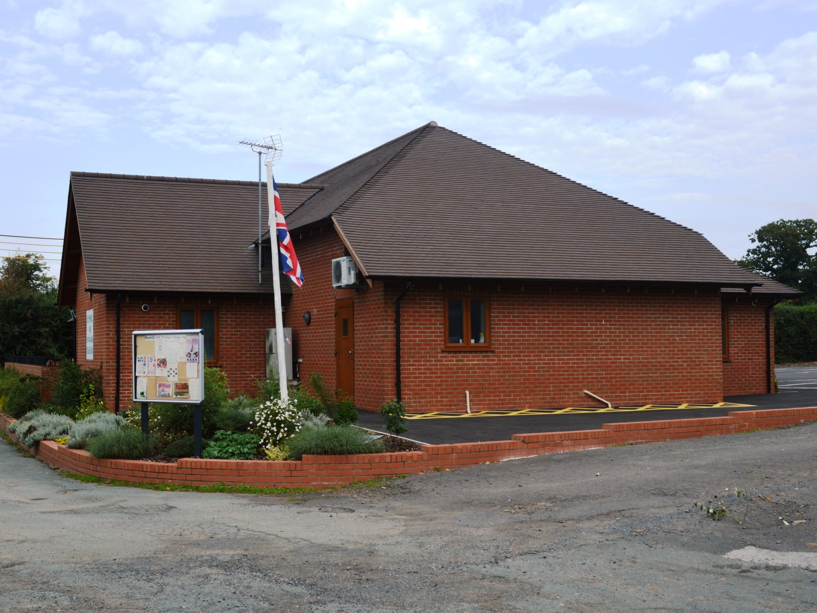
New Village Hall - geograph.org.uk - 3674676.jpg - GeographBot

Farmland at Beighterton crossroads - geograph.org.uk - 3674688.jpg - GeographBot

Bridleway to Brockton Grange - geograph.org.uk - 3674700.jpg - GeographBot

PDM Salads - geograph.org.uk - 3674771.jpg - GeographBot

Irrigation equipment at PDM salads - geograph.org.uk - 3674783.jpg - GeographBot

Barn at Cross Roads Farm - geograph.org.uk - 3674830.jpg - GeographBot

Pool at Blymhill Common - geograph.org.uk - 3675471.jpg - GeographBot

Victorian Postbox at High Hall Farm - geograph.org.uk - 3685020.jpg - GeographBot

Jubilee Grove - geograph.org.uk - 3685076.jpg - GeographBot

OS Flush Bracket 2488 - Peartree Cottage - geograph.org.uk - 4092575.jpg - GeographBot

Weston Park Horse Trials, cross-country obstacle - geograph.org.uk - 4201219.jpg - GeographBot

Weston Park Horse Trials, ditch on cross-country course - geograph.org.uk - 4201234.jpg - GeographBot

Weston Park Horse Trials, sponsors' tent - geograph.org.uk - 4218117.jpg - GeographBot

Weston Park Horse Trials, trade stands - geograph.org.uk - 4244664.jpg - GeographBot

Prospect of Weston Park - geograph.org.uk - 4245238.jpg - GeographBot

Weston Park Horse Trials, cross-country obstacles - geograph.org.uk - 4254277.jpg - GeographBot

Weston Park Horse Trials, 'Ted's Bed', cross-country obstacle - geograph.org.uk - 4254292.jpg - GeographBot

Weston Park Horse Trials, showjumping arena - geograph.org.uk - 4426694.jpg - GeographBot

Weston Park Horse Trials, the Picnic Ditch - geograph.org.uk - 4426707.jpg - GeographBot

Weston Park Horse Trials, corners - geograph.org.uk - 4426724.jpg - GeographBot

OS benchmark - entrance to Weston Park - geograph.org.uk - 4429428.jpg - GeographBot
OS benchmark - Woodlands Lodge - geograph.org.uk - 4429444.jpg - GeographBot

OS benchmark - Cow Hey Wood, boundary wall - geograph.org.uk - 4432653.jpg - GeographBot

OS benchmark - Weston-under-Lizard, east end - geograph.org.uk - 4572177.jpg - GeographBot

OS benchmark - Weston Park eastern entrance - geograph.org.uk - 4572863.jpg - GeographBot

OS benchmark - Weston Park roadside wall - geograph.org.uk - 4648911.jpg - GeographBot

OS benchmark - Weston Park roadside wall - geograph.org.uk - 4648914.jpg - GeographBot

OS benchmark - Weston Park boundary wall - geograph.org.uk - 4648916.jpg - GeographBot

Weston Park Horse Trials, Kidney Pool - geograph.org.uk - 4701187.jpg - GeographBot

Weston Park Horse Trials, cross-country obstacles - geograph.org.uk - 4701213.jpg - GeographBot

Weston Park Horse Trials, Kidney Pool - geograph.org.uk - 4701233.jpg - GeographBot

Entrance to Tong Lodge from Mill Lane - geograph.org.uk - 4898821.jpg - GeographBot

Shrewsbury Gate, Weston Park - geograph.org.uk - 4898823.jpg - GeographBot

Beighterton Lane from Hatch Lane - geograph.org.uk - 4898840.jpg - GeographBot
Hatch Lane towards Blymill - geograph.org.uk - 4898847.jpg - GeographBot

Hatch Lane, Blymhill - geograph.org.uk - 4898992.jpg - GeographBot

Entrance to the Old Rectory, Blymhill - geograph.org.uk - 4898995.jpg - GeographBot

Village Hall, Blymill - geograph.org.uk - 4898997.jpg - GeographBot

Former Village School, Blymhill - geograph.org.uk - 4899003.jpg - GeographBot

Footpath off School Lane, Blymhill - geograph.org.uk - 4899007.jpg - GeographBot

St Mary's Church, Blymhill - geograph.org.uk - 4899015.jpg - GeographBot

St Mary's Church, Blymhill - geograph.org.uk - 4899019.jpg - GeographBot

Former Village School, Blymhill - geograph.org.uk - 4899024.jpg - GeographBot

War memorial at Blymhill - geograph.org.uk - 4899029.jpg - GeographBot

Sundial at St Mary's Church, Blymhill - geograph.org.uk - 4899034.jpg - GeographBot

Former Village School, Blymhill - geograph.org.uk - 4899041.jpg - GeographBot

The Old Post Office on School Lane, Blymhill - geograph.org.uk - 4899044.jpg - GeographBot

Disused postbox at Blymhill - geograph.org.uk - 4899045.jpg - GeographBot

Entrance to Grange Barn, Blymhill - geograph.org.uk - 4899047.jpg - GeographBot

Brockhurst Lane towards the A5 - geograph.org.uk - 4899051.jpg - GeographBot

Houses on Brockhurst Lane - geograph.org.uk - 4899056.jpg - GeographBot

Victorian Postbox on Brockhurst Lane - geograph.org.uk - 4899060.jpg - GeographBot

Barns on Brockhurst Lane - geograph.org.uk - 4899065.jpg - GeographBot

Houses on Brockhurst Lane - geograph.org.uk - 4899068.jpg - GeographBot

Weston Park Horse Trials, cross-country course - geograph.org.uk - 4962104.jpg - GeographBot

Weston Park Horse Trials, cross-country obstacle - geograph.org.uk - 4962122.jpg - GeographBot

Weston Park Horse Trials, cross-country obstacle - geograph.org.uk - 4962148.jpg - GeographBot

Weston Park Horse Trials, cross-country course and Park Pool - geograph.org.uk - 4962162.jpg - GeographBot

Weston Park Horse Trials, cross-country obstacle - geograph.org.uk - 4962175.jpg - GeographBot

Weston Park, AGBO Rally Stages - geograph.org.uk - 5062355.jpg - GeographBot

Weston Park, The main car park - geograph.org.uk - 5754076.jpg - GeographBot

Weston Hall - geograph.org.uk - 5754078.jpg - GeographBot

Weston Hall, The Bradford family coach - geograph.org.uk - 5754082.jpg - GeographBot

Weston Hall - geograph.org.uk - 5754086.jpg - GeographBot

Weston Hall, The Breakfast Room - geograph.org.uk - 5754087.jpg - GeographBot

Weston Hall, display item, The bag which held the Great Seal of 1660 - geograph.org.uk - 5754090.jpg - GeographBot

Weston Hall, The Salon 1 - geograph.org.uk - 5754091.jpg - GeographBot

Weston Hall, The Salon 2 - geograph.org.uk - 5754092.jpg - GeographBot

Weston Hall, The Salon 3 - geograph.org.uk - 5754094.jpg - GeographBot

Weston Hall, The Dining Room 1 - geograph.org.uk - 5754096.jpg - GeographBot

Weston Hall, The Dining Room 2 - geograph.org.uk - 5754099.jpg - GeographBot

Weston Hall, The library 1 - geograph.org.uk - 5754102.jpg - GeographBot

Weston Hall, The library 2 - geograph.org.uk - 5754108.jpg - GeographBot

Weston Hall, The Drawing Room 1 - geograph.org.uk - 5754112.jpg - GeographBot

Weston Hall, The Drawing Room 2 highlighting Disraeli's gift of a yellow parrot - geograph.org.uk - 5754121.jpg - GeographBot

Weston Hall, The Drawing Room 3 - geograph.org.uk - 5754126.jpg - GeographBot

Weston Hall, The Drawing Room 4 - geograph.org.uk - 5754129.jpg - GeographBot

Weston Hall, The Drawing Room 5, Lady Wilbraham by Lely - geograph.org.uk - 5754133.jpg - GeographBot

Weston Hall, The Marble Hall - geograph.org.uk - 5754138.jpg - GeographBot

Weston Hall, 1899 wrought iron balustrade in the Marble Hall - geograph.org.uk - 5754143.jpg - GeographBot

Weston Hall from the south 1 - geograph.org.uk - 5754148.jpg - GeographBot

Weston Hall from the south 2 - geograph.org.uk - 5754151.jpg - GeographBot

Weston Park, Access to the park through an exceedingly thick hedge - geograph.org.uk - 5754155.jpg - GeographBot

Weston Park, The Town Pool 1 - geograph.org.uk - 5754173.jpg - GeographBot

Weston Park, The Town Pool 2 - geograph.org.uk - 5754179.jpg - GeographBot

Weston Park - Tong Lodge - geograph.org.uk - 5803865.jpg - GeographBot

Weston Park - Glasshouse - geograph.org.uk - 5803913.jpg - GeographBot

Weston Park - The Town Pool and Granary - geograph.org.uk - 5804216.jpg - GeographBot

Weston Park - Teardrop Garden - geograph.org.uk - 5804237.jpg - GeographBot

Road to Blymhil - geograph.org.uk - 5869379.jpg - GeographBot

Farmland near Weston-under-Lizard - geograph.org.uk - 5869380.jpg - GeographBot

View to Blymhill church - geograph.org.uk - 5869383.jpg - GeographBot

Farming activity - geograph.org.uk - 5869387.jpg - GeographBot

Farmland opposite High Hall - geograph.org.uk - 5869393.jpg - GeographBot

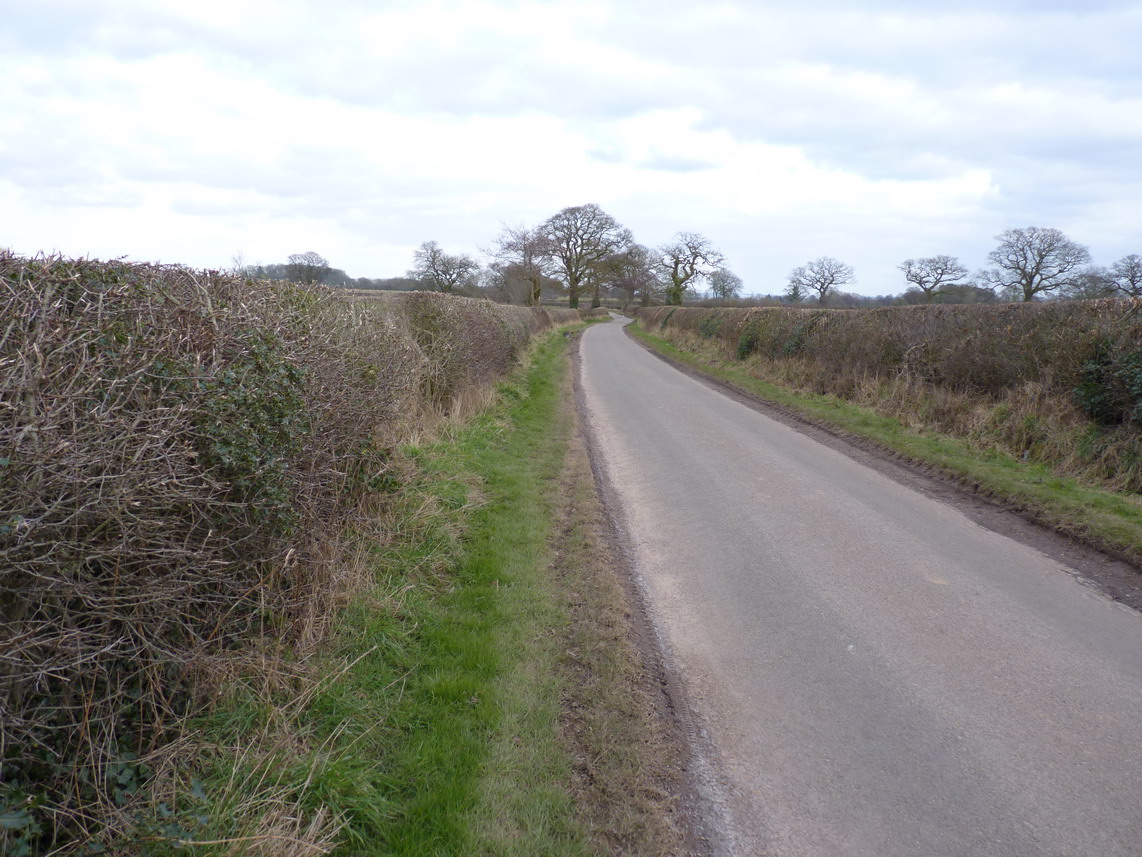
Narrow country road - geograph.org.uk - 5869415.jpg - GeographBot

Weston Park - geograph.org.uk - 5887215.jpg - GeographBot

Crop field beside the A41 - geograph.org.uk - 6157101.jpg - GeographBot

Crop field south of Watling Street (A5) - geograph.org.uk - 6157104.jpg - GeographBot

Watling Street (A5) - geograph.org.uk - 6157105.jpg - GeographBot

Woodlands Farm - geograph.org.uk - 6157106.jpg - GeographBot

Cereal crop south of Watling Street (A5) - geograph.org.uk - 6157107.jpg - GeographBot

No overtaking on Watling Street (A5) - geograph.org.uk - 6157108.jpg - GeographBot

Oilseed rape towards The Mount woodland - geograph.org.uk - 6157110.jpg - GeographBot

Crop field off the B5314 - geograph.org.uk - 6157111.jpg - GeographBot

B5314 towards the A41 - geograph.org.uk - 6157112.jpg - GeographBot

Cottages, Weston under Lizard - geograph.org.uk - 6157113.jpg - GeographBot

A5, Weston under Lizard - geograph.org.uk - 6157126.jpg - GeographBot

Oilseed rape crop, Weston under Lizard - geograph.org.uk - 6157128.jpg - GeographBot
Beighterton Lane, Weston under Lizard - geograph.org.uk - 6157129.jpg - GeographBot

Oilseed rape crop towards Brickyard Plantation - geograph.org.uk - 6157282.jpg - GeographBot

Watling Street (A5) - geograph.org.uk - 6157285.jpg - GeographBot

Watling Street (A5) - geograph.org.uk - 6157292.jpg - GeographBot

Watling Street (A5) - geograph.org.uk - 6158076.jpg - GeographBot

Elizabeth II postbox on Watling Street, Weston-under-Lizard - geograph.org.uk - 6159155.jpg - GeographBot

Close up, Elizabeth II postbox on Watling Street, Weston-under-Lizard - geograph.org.uk - 6159156.jpg - GeographBot

Entering Staffordshire - geograph.org.uk - 6237002.jpg - GeographBot

Grazing, Blymhill Common - geograph.org.uk - 6237005.jpg - GeographBot

Minor road junction, Blymhill Common - geograph.org.uk - 6237006.jpg - GeographBot
House being renovated, Blymhill Common - geograph.org.uk - 6237008.jpg - GeographBot

House on Back Lane, Blymhill Common - geograph.org.uk - 6237009.jpg - GeographBot

Bend on Back Lane, Blymhill Common - geograph.org.uk - 6237011.jpg - GeographBot

Houses, Gatherwynd - geograph.org.uk - 6237015.jpg - GeographBot

Gatherwynd Lane, Gatherwynd - geograph.org.uk - 6237016.jpg - GeographBot

Field entrance off Gatherwynd Lane - geograph.org.uk - 6237017.jpg - GeographBot

Minor road junction on Gatherwynd Lane - geograph.org.uk - 6237020.jpg - GeographBot
Grazing near Blymhill Marsh - geograph.org.uk - 6237167.jpg - GeographBot

Minor road near Blymhill Marsh - geograph.org.uk - 6237169.jpg - GeographBot

House on School Lane, Blymhill - geograph.org.uk - 6237173.jpg - GeographBot

Grove Farm, Blymhill - geograph.org.uk - 6237175.jpg - GeographBot

Grazing, Blymhill - geograph.org.uk - 6237176.jpg - GeographBot

Barn, Grove Farm, Blymhill - geograph.org.uk - 6237177.jpg - GeographBot

Brockhurst Lane, Blymhill - geograph.org.uk - 6237178.jpg - GeographBot

Cottage on Brockhurst Lane, Blymhill - geograph.org.uk - 6237180.jpg - GeographBot

Farm buildings, High Hall Farm - geograph.org.uk - 6237181.jpg - GeographBot

Chatwell Lane, Cross Roads - geograph.org.uk - 6237204.jpg - GeographBot

Victorian postbox on Brockhurst Lane, Blymhill Lawn - geograph.org.uk - 6237211.jpg - GeographBot

House on Brockhurst Lane, Blymhill Lawn - geograph.org.uk - 6237213.jpg - GeographBot

Elizabeth II postbox on Brockhurst Lane, Blymhill - geograph.org.uk - 6237220.jpg - GeographBot

Houses on Brockhurst Lane, Blymhill - geograph.org.uk - 6237221.jpg - GeographBot

Grazing near High Hall Farm, Blymhill - geograph.org.uk - 6237224.jpg - GeographBot

Farm track off Brockhurst Lane, Blymhill - geograph.org.uk - 6237225.jpg - GeographBot

Brockhurst Lane, Blymhill - geograph.org.uk - 6237226.jpg - GeographBot

Farm building, Blymhill Lawn - geograph.org.uk - 6237285.jpg - GeographBot

Grazing, Blymhill Lawn - geograph.org.uk - 6237287.jpg - GeographBot

Minor road junction on Brockhurst Lane, Blymhill Lawn - geograph.org.uk - 6237289.jpg - GeographBot
Cereal crop near Lower Brockhurst Farm - geograph.org.uk - 6237291.jpg - GeographBot

Brockhurst Road beside Brockhurst Coppice - geograph.org.uk - 6237293.jpg - GeographBot

Grazing near Wrestlers Farm - geograph.org.uk - 6237294.jpg - GeographBot

Muddy track (footpath) near Wrestlers Farm - geograph.org.uk - 6237295.jpg - GeographBot

Brockhurst Road - geograph.org.uk - 6237297.jpg - GeographBot

Cereal crop near Wrestlers Farm - geograph.org.uk - 6237299.jpg - GeographBot

Brockhurst Road - geograph.org.uk - 6237302.jpg - GeographBot

New House Farm - geograph.org.uk - 6237303.jpg - GeographBot

Minor road near New House Farm - geograph.org.uk - 6237304.jpg - GeographBot

Stubble field near New House Farm - geograph.org.uk - 6237308.jpg - GeographBot

Drain off King Street - geograph.org.uk - 6237309.jpg - GeographBot

Grazing off King Street - geograph.org.uk - 6237310.jpg - GeographBot

King Street towards Marston - geograph.org.uk - 6237312.jpg - GeographBot

Weston under Lizard, St Andrew - geograph.org.uk - 6692349.jpg - GeographBot

Two cottages on the north side of Blymhill village - geograph.org.uk - 6759267.jpg - GeographBot

Former village school and schoolhouse, Blymhill - geograph.org.uk - 6759270.jpg - GeographBot

Gates and pillars to the churchyard of St Mary's - geograph.org.uk - 6771993.jpg - GeographBot

Gates and pillars to the churchyard of St Mary's - geograph.org.uk - 6771994.jpg - GeographBot

The Yates memorial in the churchyard of St Mary - geograph.org.uk - 6777019.jpg - GeographBot

The Old Rectory at Blymhill - geograph.org.uk - 6777998.jpg - GeographBot

The Stockley memorial at Blymhill - geograph.org.uk - 6778790.jpg - GeographBot

The Fowler memorial in the churchyard of St Mary - geograph.org.uk - 6778793.jpg - GeographBot

2, Rectory Cottages, Blymhill - geograph.org.uk - 6778798.jpg - GeographBot

Grove farmhouse at Blymhill - geograph.org.uk - 6778802.jpg - GeographBot

Hedgerow tree - geograph.org.uk - 6912152.jpg - GeographBot

Road with hedgerows - geograph.org.uk - 6912164.jpg - GeographBot

Hedgerow and field - geograph.org.uk - 6912170.jpg - GeographBot

Orslow Manor Farm - geograph.org.uk - 6913226.jpg - GeographBot

Caravan Site - geograph.org.uk - 6913241.jpg - GeographBot

Great Chatwell - geograph.org.uk - 6913260.jpg - GeographBot

Front of Weston House - geograph.org.uk - 7072247.jpg - GeographBot

Weston House - geograph.org.uk - 7072250.jpg - GeographBot

Formal garden at Weston Park - geograph.org.uk - 7072254.jpg - GeographBot

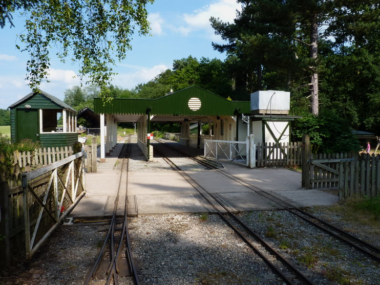
The railway in Weston Park - geograph.org.uk - 7072270.jpg - GeographBot

Formal garden at Weston Park - geograph.org.uk - 7072274.jpg - GeographBot

Knot garden at Weston Park - geograph.org.uk - 7072560.jpg - GeographBot

Knot garden at Weston Park - geograph.org.uk - 7072562.jpg - GeographBot

View of the woods from the house - geograph.org.uk - 7072563.jpg - GeographBot

The view from the house - geograph.org.uk - 7072567.jpg - GeographBot

View from the house - geograph.org.uk - 7072568.jpg - GeographBot

Weston House - geograph.org.uk - 7072571.jpg - GeographBot

The knot garden at the front of the house - geograph.org.uk - 7072574.jpg - GeographBot

Sloping flower beds down to the next level - geograph.org.uk - 7072576.jpg - GeographBot

Herbaceous beds along the edge of the lower terrace - geograph.org.uk - 7072582.jpg - GeographBot

Weston House - geograph.org.uk - 7072584.jpg - GeographBot

Cubist style horse - geograph.org.uk - 7072587.jpg - GeographBot

Cottages on the Weston Park Estate - geograph.org.uk - 7072933.jpg - GeographBot

View across the Town pool - geograph.org.uk - 7072935.jpg - GeographBot

Camellias in the glasshouse - geograph.org.uk - 7072940.jpg - GeographBot

Pink Camellia - geograph.org.uk - 7072941.jpg - GeographBot

Half timbered house - geograph.org.uk - 7072959.jpg - GeographBot

Sandstone wall - geograph.org.uk - 7072961.jpg - GeographBot

Information about Pendrill's Cave - geograph.org.uk - 7072963.jpg - GeographBot

Pendrill's Cave - geograph.org.uk - 7072966.jpg - GeographBot

Close up of Pendrill's Cave - geograph.org.uk - 7072967.jpg - GeographBot

Building in the grounds of Weston Park - geograph.org.uk - 7072972.jpg - GeographBot

Pauslip’s Tunnel - geograph.org.uk - 7073102.jpg - GeographBot

The end of the tunnel - geograph.org.uk - 7073104.jpg - GeographBot

Sun dial - geograph.org.uk - 7073107.jpg - GeographBot

The Temple of Diana - geograph.org.uk - 7073109.jpg - GeographBot

Notice with information about the Temple of Diana - geograph.org.uk - 7073111.jpg - GeographBot

The Temple of Diana - geograph.org.uk - 7073114.jpg - GeographBot

View across the Temple pool - geograph.org.uk - 7073116.jpg - GeographBot

The Roman Bridge - geograph.org.uk - 7073266.jpg - GeographBot

Stone built seating area - geograph.org.uk - 7073275.jpg - GeographBot

The miniature railway - geograph.org.uk - 7073280.jpg - GeographBot

Ready for fence judging at Weston Park - geograph.org.uk - 7336766.jpg - GeographBot

Cross-country fence at Weston Park Horse Trials - geograph.org.uk - 7336769.jpg - GeographBot

Weston Park - geograph.org.uk - 7337712.jpg - GeographBot

Cross-country obstacle at Weston Park Horse Trials - geograph.org.uk - 7344683.jpg - GeographBot

Kissing gate in Bishopswood, Staffordshire - geograph.org.uk - 7358416.jpg - GeographBot

Pasture and footpath west of Bishopswood, Staffordshire - geograph.org.uk - 7358418.jpg - GeographBot

Temple Pool, Weston Park - geograph.org.uk - 7553001.jpg - GeographBot

Great Chatwell House farmhouse - geograph.org.uk - 7656941.jpg - GeographBot

Chatwell Court screen and entrance wall - geograph.org.uk - 7657279.jpg - GeographBot

Chadwell-Chatwell Lodge - geograph.org.uk - 7657283.jpg - GeographBot

Shrewsbury Lodge to Weston Park - geograph.org.uk - 7657284.jpg - GeographBot