Wikimedi'Òc
Modes d'emploi


Cet album fait partie des albums
Cet album photos contient les sous-albums suivants :


James River Valley and Town of Buchanan from Parkway (53666cacf0e34a7b951853e3f7cf806e) (cropped).tif - BMacZero
Grade crossing near Milepost 2.2 (dab75a9b3509498b8c9c2e315363774d) (cropped).tif - BMacZero
Grade crossing near Milepost 2.2 (daf0ed374db9452ca083a56cf841808b) (cropped).tif - BMacZero
Grade crossing at Milepost 4.4 (2a9489a81c3e4a2782019cf37e1efc60) (cropped).tif - BMacZero
Montebello Subdistrict, Milepost 16 (637b299207b8439993a6469e916c2ec2) (cropped).tif - BMacZero
Parkway not yet opened near James River (2a2ecb70ffc04cf99cdc5947d73d330d) (cropped).tif - BMacZero

BlackMountains.jpg - Jan Kronsell

Mount Mitchell-27527.jpg - Ken Thomas

Rainy Blue Ridge-27527.jpg - Ken Thomas
Blue Ridge Parkway.JPG - Slick-o-bot

Blue Ridge Mountains-27527-1.jpg - Ken Thomas

Cold Mountain-27527.jpg - Ken Thomas

Black Mountains-27527-2.jpg - Ken Thomas

Altapass Orchard-27527.jpg - Ken Thomas
PilotMtfromVA8910.JPG - Baseball Bugs

Blue Ridge Parkway.jpg - Flickr upload bot
Blue Ridge Parkway View Little Switzerland 8-1-09.JPG - File Upload Bot (Magnus Manske)

"Smart View" near the Blue Ridge Parkway in North Carolina.jpeg - File Upload Bot (Magnus Manske)

Fall colors from the Blue Ridge Parkway just south of Ashville.jpg - Miguel.v

Black Mountain Range.jpg - Tsimmons~commonswiki

Shining Rock.jpg - Badfishrd

Blue Ridge Parkway - North Carolina (14790977383).jpg - Ser Amantio di Nicolao

Blue Ridge Parkway - North Carolina (14790983143).jpg - Ser Amantio di Nicolao

Blue Ridge Parkway - North Carolina (14584479698).jpg - Ser Amantio di Nicolao

Blue Ridge Parkway - North Carolina (14790987733).jpg - Ser Amantio di Nicolao

Blue Ridge Parkway - North Carolina (14584475719).jpg - Ser Amantio di Nicolao

Blue Ridge Parkway - North Carolina (14791014603).jpg - Ser Amantio di Nicolao

Blue Ridge Parkway - North Carolina (14791023003).jpg - Ser Amantio di Nicolao

Blue Ridge Parkway - North Carolina (14791025463).jpg - Ser Amantio di Nicolao

Blue Ridge Parkway - North Carolina (14791024623).jpg - Ser Amantio di Nicolao

Blue Ridge Parkway - North Carolina (14791028433).jpg - Ser Amantio di Nicolao

Blue Ridge Parkway - North Carolina (14791030853).jpg - Ser Amantio di Nicolao

Blue Ridge Parkway - North Carolina (14771169425).jpg - Ser Amantio di Nicolao

Blue Ridge Parkway - North Carolina (14791036303).jpg - Ser Amantio di Nicolao

Blue Ridge Parkway - North Carolina (14768815344).jpg - Ser Amantio di Nicolao

Blue Ridge Parkway - North Carolina (14768822644).jpg - Ser Amantio di Nicolao

Blue Ridge Parkway - North Carolina (14771189495).jpg - Ser Amantio di Nicolao

Blue Ridge Parkway - North Carolina (14771190445).jpg - Ser Amantio di Nicolao

Blue Ridge Parkway - North Carolina (14791057553).jpg - Ser Amantio di Nicolao

Blue Ridge Parkway - North Carolina (14771194475).jpg - Ser Amantio di Nicolao

Blue Ridge Parkway - North Carolina (14768834414).jpg - Ser Amantio di Nicolao

Blue Ridge Parkway - North Carolina (14791063213).jpg - Ser Amantio di Nicolao

Blue Ridge Parkway - North Carolina (14770863862).jpg - Ser Amantio di Nicolao

Blue Ridge Parkway - North Carolina (14791072193).jpg - Ser Amantio di Nicolao

Blue Ridge Parkway - North Carolina (14768844824).jpg - Ser Amantio di Nicolao

Blue Ridge Parkway - North Carolina (14791077083).jpg - Ser Amantio di Nicolao

Blue Ridge Parkway - North Carolina (14770878402).jpg - Ser Amantio di Nicolao

Blue Ridge Parkway - North Carolina (14771218605).jpg - Ser Amantio di Nicolao

Blue Ridge Parkway - North Carolina (14768860724).jpg - Ser Amantio di Nicolao

Blue Ridge Parkway - North Carolina (14768864354).jpg - Ser Amantio di Nicolao

Blue Ridge Parkway - North Carolina (14770889942).jpg - Ser Amantio di Nicolao

Blue Ridge Parkway - North Carolina (14770891842).jpg - Ser Amantio di Nicolao

Blue Ridge Parkway - North Carolina (14791094063).jpg - Ser Amantio di Nicolao

Blue Ridge Parkway - North Carolina (14770892632).jpg - Ser Amantio di Nicolao

Blue Ridge Parkway - North Carolina (14768870064).jpg - Ser Amantio di Nicolao

Blue Ridge Parkway - North Carolina (14771234725).jpg - Ser Amantio di Nicolao

Blue Ridge Parkway - North Carolina (14771236565).jpg - Ser Amantio di Nicolao

Blue Ridge Parkway - North Carolina (14771237275).jpg - Ser Amantio di Nicolao

Blue Ridge Parkway - North Carolina (14791104293).jpg - Ser Amantio di Nicolao

Blue Ridge Parkway - North Carolina (14771243385).jpg - Ser Amantio di Nicolao

Blue Ridge Parkway - North Carolina (14768884404).jpg - Ser Amantio di Nicolao

Blue Ridge Parkway - North Carolina (14770911072).jpg - Ser Amantio di Nicolao

Blue Ridge Parkway - North Carolina (14791120383).jpg - Ser Amantio di Nicolao

Blue Ridge Parkway - North Carolina (14791121533).jpg - Ser Amantio di Nicolao

Blue Ridge Parkway - North Carolina (14791122183).jpg - Ser Amantio di Nicolao

Blue Ridge Parkway - North Carolina (14771259525).jpg - Ser Amantio di Nicolao

Blue Ridge Parkway - North Carolina (14791134743).jpg - Ser Amantio di Nicolao

Blue Ridge Parkway - North Carolina (14771274655).jpg - Ser Amantio di Nicolao

Autumn along Blue Ridge Parkway.jpg - Frankaustx
Meadow Creek Culvert. This is an example of a triple arch concrete box culvert with stone facing mimicking rigid frame structures. - Blue Ridge Parkway, Between Shenandoah HAER NC,11-ASHV.V,2-71.tif - Fæ

Blue Ridge Parkway North Carolina.jpg - ShantellSmith

Tanasee Bald October 2016.jpg - Thomson200

Mount Pisgah (North Carolina) Oct 2016.jpg - Thomson200

Pisgah NF from BRP NC1.jpg - Acroterion

Whitehead, NC, USA - panoramio.jpg - Panoramio upload bot

Whitehead, NC, USA - panoramio - Idawriter.jpg - Panoramio upload bot

Stone Mountain - panoramio - Idawriter.jpg - Panoramio upload bot

Lake in the Hills - panoramio.jpg - Panoramio upload bot

Blue Ridge Parkway - panoramio.jpg - Panoramio upload bot

Blue Ridge Parkway - panoramio (1).jpg - Panoramio upload bot

Appalachian Afterglow - panoramio.jpg - Panoramio upload bot

Appalachian Afterglow - panoramio (1).jpg - Panoramio upload bot

Linville, NC, USA - panoramio.jpg - Panoramio upload bot

Linville, NC, USA - panoramio (1).jpg - Panoramio upload bot

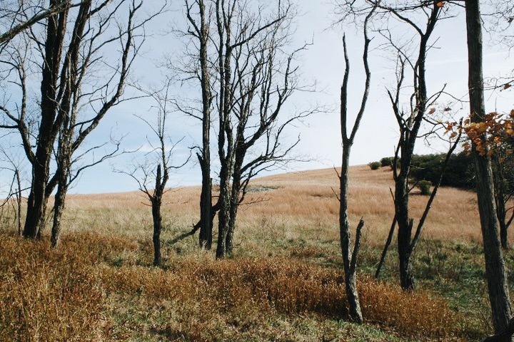
Trees in Doughton Park.jpg - Willthacheerleader18

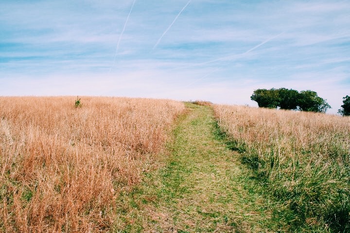
Trail in Doughton Park.jpg - Willthacheerleader18

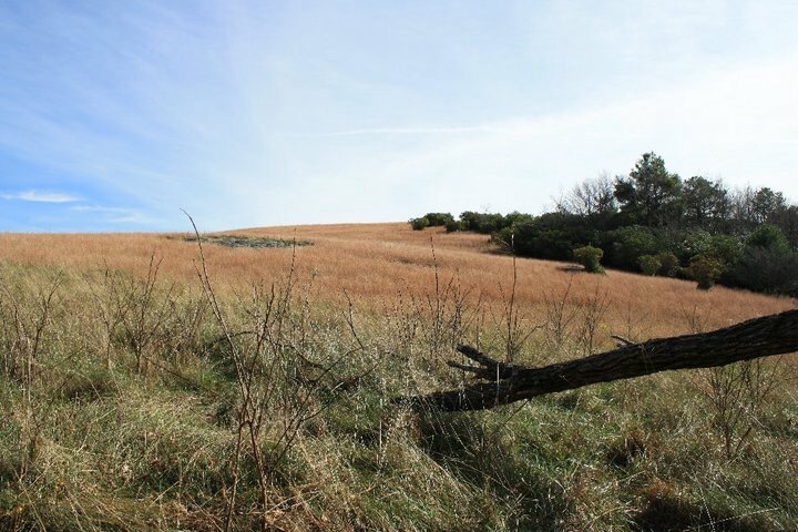
Pasture in Doughton Park.jpg - Willthacheerleader18

View from Black Balsam - panoramio.jpg - Panoramio upload bot

Red Ford F-150 frontal view, roadside (6236852826).jpg - Fæ

Sunrise at Craggy - panoramio.jpg - Panoramio upload bot

Craggy Gardens Sunrise - panoramio.jpg - Panoramio upload bot

Road leading to Craggy Gardens - panoramio.jpg - Panoramio upload bot

View from Blue Ridge Parkway - panoramio.jpg - Panoramio upload bot

Clouds rolling through Blue Ridge Parkway - panoramio.jpg - Panoramio upload bot

View of Looking Glass - panoramio.jpg - Panoramio upload bot

Looking south from the summit of Waterrock Knob.jpg - MateoTimateo

Graveyard-Fields.jpg - MateoTimateo

View Raven Fork, NC May 2017.jpg - Thomson200

NC191 from Blue Ridge Parkway (42398016861).jpg - Tyler ser Noche

Blue Ridge Parkway - Standing by the Blue Ridge Parkway in 1996 - NARA - 7717443.jpg - US National Archives bot

Blue Ridge Parkway - Abbott Lake - NARA - 7717406.jpg - US National Archives bot

Bridge over a highway with a railroad in the middle in Blue Ridge Parkway. There is a sign by the railroad that says it is a (3e6920c680054d3ca222260cdb284415).jpg - BMacZeroBot
Horace Cottrell, brother and sisters at Mons school (f427c4b9e9624afaa63ed1eccbbe29e1).tif - BMacZeroBot
Sharp Top Mountain Shelter, Bldg. 165 (0007fa0e32eb43d68b3c6dff37e217d2).tif - BMacZeroBot
Roanoke Mountain Campground, Milepost 120.4 (0f7efd37e4c64965a7c6e60c9788a88a).tif - BMacZeroBot
Saunders Farmhouse from front view (20aaa97764db48b7b7e73c408654b669).tif - BMacZeroBot
Spring House, Humpback Rocks Pioneer Farm (Bldg No. 270) (2ca064d21d75494db97812911413e621).tif - BMacZeroBot
T. T. Trail Chickenhouse 3, Bldg. 577 (34b668ffa0a540a18aca7e68e8654718).tif - BMacZeroBot
Sharp Top Mountain Shelter, Bldg. 165 (4255a2e781434323ac8361bc446fda2f).tif - BMacZeroBot
Sharp Top Mountain Shelter, Bldg. 165 (62a2caa0c65c43378241d722ffe08aeb).tif - BMacZeroBot
Sharp Top Mountain Shelter, Bldg. 165 (75884bf6bd3140b9913a3d53ddbcad9c).tif - BMacZeroBot
Shortt House, Bldg. 762 (99bfe5b37db24bc097988b014fd4e53e).tif - BMacZeroBot
T. T. Trail Chickenhouse 2, Bldg. 576 (99e86d281a554788b49b3ba498faaa01).tif - BMacZeroBot
T. T. Trail outhouse, Bldg. 597 (razed) (be103b9dedab474992b88a5083f81fe1).tif - BMacZeroBot
West side of Shaver House (d031b6690f4f49da92173d0572a3e5d1).tif - BMacZeroBot
Shortt House, Bldg. 762 (ef6f3733a8a44737a4cab036e5fbeae0).tif - BMacZeroBot
Sharp Top Mountain Shelter, Bldg. 165 (fef9160c331e444b94d92a45bcf55511).tif - BMacZeroBot

Car on Bridge (49862587978).jpg - Matlin

Fallen Tree (49863123311).jpg - Matlin

Light and Darkness (49863125436).jpg - Matlin

Grassy Knoll and Berm (49863126296).jpg - Matlin

Muddy Banks (49863438822).jpg - Matlin

HFCA 1607 People Volume 2 015.jpg (a92663b0a77045f09110f030a4c7c839).jpg - BMacZeroBot
Smith House-outbuildings at Sweet Annie Hollow (017cfe2675e7423cbda4a52fbdc3084f).tif - BMacZeroBot
Parkway near Rock Castle Gorge Parking Overlook (01b7101ee4fe4cb9916e3026a2d2f766).tif - BMacZeroBot
Shenandoah Overlook Sign, Milepost 2.9 (02f867b57ad64e3388e0829d5891d7f3).tif - BMacZeroBot
ESA Workshop at Humpback Rocks (0583373e1ccf492f8f5f0bd1b513ed31).tif - BMacZeroBot
People standing by washout of Parkway (069b9850b3ce4362963c716b28505836).tif - BMacZeroBot
Sharp Top Mountain from Peaks of Otter (096857dacf204a4c811a374bbd7f560f).tif - BMacZeroBot
Parkway near Rocky Knob Maintenance Area (0f2af408468844d2a1681eb7e8224002).tif - BMacZeroBot
T. T. Trail House and outbuildings (149176a86e7b4e4c91c4e2835104c196).tif - BMacZeroBot
Fountain and sign at Stillhouse Hollow Parking Overlook (1555be3de4034d44a60718ab84cc84df).tif - BMacZeroBot
ESA Workshop at Humpback Rocks (1a1f2003da084f13bfcc8743a4df4c0b).tif - BMacZeroBot
Parkway through Rocky Knob Park (1e8405c5f7bf4f4391b9f447df350750).tif - BMacZeroBot
Boston Knob Overlook sign (1f84458171cd4a108c8f2b4532e38724).tif - BMacZeroBot
Replacing rail fence (21ff9282e5d74137b6c3b4f85deb818c).tif - BMacZeroBot
Parkway scene with fence (22ba0451f5ad4803860054361d396ad8).tif - BMacZeroBot
Washout of motor road near Milepost 131.8 (2365c125b2a24815964e7039db061167).tif - BMacZeroBot
Trucks moving Parkway signs (256bd6e596eb4291baa767a81c258b9b).tif - BMacZeroBot
Non-conforming "No Parking" sign (2a18d158cd0b40e0a12ec05d4efb26cb).tif - BMacZeroBot
Otter Creek Dam (2a29c4aa69244bd4bb09a1f773d1210c).tif - BMacZeroBot
Parkway not yet opened near James River (2a2ecb70ffc04cf99cdc5947d73d330d).tif - BMacZeroBot
Looking north near Peaks of Otter Lodge (2a4edfae2bcb4f99b69b629dddafd949).tif - BMacZeroBot
Grade crossing at Milepost 4.4 (2a9489a81c3e4a2782019cf37e1efc60).tif - BMacZeroBot
Youth Conservation Corps (YCC) repairing fences (2b5f650c61cc4eb29b9c8ae36ff61a93).tif - BMacZeroBot
Smith House-outbuildings at Sweet Annie Hollow (2e1d9447ef4a46feaabbc2373755e7a9).tif - BMacZeroBot
Smart View Trails Cabin (31c5f45715d14d658654b52f4fdd6091).tif - BMacZeroBot
Environmental Message label sign (34b285ba7efd43bbb310df6d415f9fd8).tif - BMacZeroBot
Parkway south of Rocky Knob (369522f908b3452b9ae39a099dde975e).tif - BMacZeroBot
Water Fountain at Hickory Spring Parking Widening (37c7a2d697944702b59a65391271a475).tif - BMacZeroBot
Backwater of Otter Creek Dam (37fc7440d08a4afdbeb926bb3eca9dec).tif - BMacZeroBot
Milepost 3.3, Blue Ridge Parkway (3ca8d7dde9a94cc6b739fca4f124d3c4).tif - BMacZeroBot
Parkway at US 60 in Virginia (3dcd65caf75b4ed8874d5537b057d1c4).tif - BMacZeroBot
Replacing rail fence in Rocky Knob District (3fbe93324b724ad3981614c0076888d8).tif - BMacZeroBot
Milepost 62. From the NPS, Springfield, VA Collection (4358d001d6424d14b65b6c6df6686ff7).tif - BMacZeroBot
Youth Conservation Corps (YCC) repairing fences (47be28eb407742f9b7b972c176861982).tif - BMacZeroBot
Roadside Easel Exhibit (4805459748ab42638f3a4590e06b393c).tif - BMacZeroBot
Smith House-outbuildings at Milepost 138.5, razed (489020c4a16d40318f0a905f408824e5).tif - BMacZeroBot
Fence with Stile (49c738354a57485587dc1ec93c98f818).tif - BMacZeroBot
Parkway sign near Milepost 90 (4b4f59c4329e45728242fbe184526f96).tif - BMacZeroBot
Montebello District, Milepost 6 (4c6013b50a594862bded5960bd810e47).tif - BMacZeroBot
Site of proposed lunchroom at Whetstone Ridge (4c8a7acf931344d68165eeb647f2ee31).tif - BMacZeroBot
James River Valley and Town of Buchanan from Parkway (53666cacf0e34a7b951853e3f7cf806e).tif - BMacZeroBot
Parkway along ridge south of Peaks of Otter (5473e2e1c2bc472993162523bf0bb4d1).tif - BMacZeroBot
VIP Bill Burger leading interpretive walk (569f9f2d250c48f4afb4c477dee8dcc4).tif - BMacZeroBot
Trucks moving Parkway signs (58baa7d473894ad2942d6d0f1c69605b).tif - BMacZeroBot
Car driving down Parkway near Milepost 100 (5976b9ade33443578ef9617e3641a4ee).tif - BMacZeroBot
Sharp Top from Sharp Top Overlook (5b557ed0a4bc4a29a69ca21cac896e8b).tif - BMacZeroBot
Milepost 4, Blue Ridge Parkway (60389b993c694de9978bc78c029e87ba).tif - BMacZeroBot
Devils Backbone Parking Overlook sign (60adecb35485488a90a44048c195bcbb).tif - BMacZeroBot
Youth Conservation Corps (YCC) volunteers repairing fences (635104f977d64750879df9598bab2aa2).tif - BMacZeroBot
Montebello Subdistrict, Milepost 16 (637b299207b8439993a6469e916c2ec2).tif - BMacZeroBot
District Ranger Shilts with Parkway visitors at 20 Minute Cliffs (63fcfa75683d49db9e0b202020572e44).tif - BMacZeroBot
Youth Conservation Corps (YCC) volunteers repairing fences (64b01388506c4215b3b2db0cb150f473).tif - BMacZeroBot
Washout of motor road showing debris (6940a4b971964f8f97277dd4d80a8e81).tif - BMacZeroBot
Washout of motor road (6ae6c95e2edb4473a4d22515aa8a59dd).tif - BMacZeroBot
Parkway visitors taking photos (6c9c3940b33041c5b39784041e09c8ea).tif - BMacZeroBot
View of Roanoke Valley from Parkway (6f5815fb10494520b94b6f86f91a7dd4).tif - BMacZeroBot
Junction of complete Parkway with unopened and unpaved road (78b759686b79416e9d6e549ade849c39).tif - BMacZeroBot
View near Sharp Top Mountain sign (7b48f08f724c4eb08007bb6959071fa7).tif - BMacZeroBot
Youth Conservation Corps (YCC) repairing fences (7de789d43e104ae3a8f6500f362b86eb).tif - BMacZeroBot
View of Roanoke Valley, with city in distance (7e8839a5e19d468f982ed3cc4300c553).tif - BMacZeroBot
View from Parkway near Whetstone Ridge (83548a3831b946fca7e8bad17690a2b8).tif - BMacZeroBot
Placing beam on bridge construction at Metz Run Creek (84ee2b88f5ee4b5f948d7c0463c620e5).tif - BMacZeroBot
Milepost 60, Blue Ridge Parkway (8779f0f0e20d41069dd88d722b2006c1).tif - BMacZeroBot
Washout of motor road with car (8b3e4edf2b38457c81c628157167b38a).tif - BMacZeroBot
ESA Workshop at Humpback Rocks (9113080e17d6412d9afb4d1a2f2d6493).tif - BMacZeroBot
"Leg-stretcher Trail" at Boston Knob Overlook (9610777854314f6180dce6785d122a2b).tif - BMacZeroBot
Turkey vultures taken with telephoto 300mm (9743cf1103394518843ce5d341c09d6b).tif - BMacZeroBot
Grade crossing at Route 814 (988b9043a9454e0a87b897acdc8fd609).tif - BMacZeroBot
Pond just North of James River (9ac2eaabd41b44e1906f99dbcb75c2d2).tif - BMacZeroBot
Along the Blue Ridge from the Bald Mountain Area (9bce21f2a43a4161a165705d88e2a099).tif - BMacZeroBot
VIP Bill Burger leading interpretive walk (9cd7ffcc503845bb950c26f6d0528e08).tif - BMacZeroBot
Youth Conservation Corps (YCC) volunteers repairing fences (a8476e561799465297bb0780a2c78ed4).tif - BMacZeroBot
Roadside Easel Exhibit (a978e68841db49eb903dc429cbc701cf).tif - BMacZeroBot
View of Shenandoah Valley from Parkway (a9a7e037eb33483ca74e96200779acda).tif - BMacZeroBot
Parking along ridge south of Peaks of Otter (a9ee096f128a45b3b246f3d549fc9291).tif - BMacZeroBot
Do Not Climb Sign (ab0a0866a4d8409cbff5301406e0680e).tif - BMacZeroBot
Stillhouse Hollow Parking Area sign (af7c11e32c494ade9a4a1cf389e4b9cb).tif - BMacZeroBot
James River - upstream from bridge (b201a28f701c46b8b53f473cf3655f62).tif - BMacZeroBot
Parkway views with stone fence (b3c902b147de4701a749799ef9aa71ec).tif - BMacZeroBot
Environmental Message label near bench (b45a2354ebdb457ca328d5033c90de81).tif - BMacZeroBot
Parkway near Milepost 100 (b503c43e754e4e1b83398ed6668cc290).tif - BMacZeroBot
ESA Workshop at Humpback Rocks (b6580df262e648c19137777c128928e7).tif - BMacZeroBot
Near Milepost 170, from NPS, Springfield, VA Collection (b72cd54288b24e18bea5c403c47d77d3).tif - BMacZeroBot
US 460, near Milepost 105.8 (b83f85ca4bf74a3d8815717d34209583).tif - BMacZeroBot
Milepost 62. From the NPS, Springfield, VA Collection (babd1085c90d43eeb760d889a47a30e9).tif - BMacZeroBot
Section 1-N, near Milepost 130-131 (bba2ab2aebf447c784f8b092f8ed4d3b).tif - BMacZeroBot
Accomodations Bulletin Board (bc6b57d880ad43a5be28d45f48cc42b1).tif - BMacZeroBot
Pots and Kettles Parkway (bcb8fda45c394782811429b233b01065).tif - BMacZeroBot
T. T. Trail House and outbuildings (c01d8bfa20e74eccb0093fe9bb7258cc).tif - BMacZeroBot
Picnic group at Humpback Rocks (c2ca3eed9ccb44f482b3c902a8abfe70).tif - BMacZeroBot
Pots and Kettles Parkway (c3b45ec5927744008eb64d81b287c296).tif - BMacZeroBot
Trucks moving Parkway signs (caaf850a08ed47a0be082be00564eb28).tif - BMacZeroBot
Milepost 63.7, Blue Ridge Parkway (cf9af17e8e3c457cba222fcbba9de7ca).tif - BMacZeroBot
Sharp Top Trail sign (d153c6e375cc43a5ac21c7e6abd549c9).tif - BMacZeroBot
Youth Conservation Corps (YCC) volunteers repairing fences (d1799c1aa638485da093366db5bc45b6).tif - BMacZeroBot
Site of visitor area before construction (d2054fd8664a4783944e55b7c0b2998e).tif - BMacZeroBot
Parkway south of Peaks of Otter (d348e53117904f2983d333eb90f759cb).tif - BMacZeroBot
Looking north near Milepost 90 (d3760239720e413f903fb8a1e2f65ff0).tif - BMacZeroBot
Cars at Boston Knob Parking Area (d85e48d03fa64c32af0df133b5c6675b).tif - BMacZeroBot
Grade crossing near Milepost 2.2 (dab75a9b3509498b8c9c2e315363774d).tif - BMacZeroBot
Grade crossing near Milepost 2.2 (daf0ed374db9452ca083a56cf841808b).tif - BMacZeroBot
Washout of motor road (dbca7cb5ac934ef2a40e0205e56301f5).tif - BMacZeroBot
New Parkway construction with equipment (e1cc5e07006343bbbc7b3d362d9dcf6e).tif - BMacZeroBot
Replacing rail fence (e20633508c864474b9a28ecc710a7832).tif - BMacZeroBot
Scenic, Humpback Rocks (e4be9b5788ae432e9dcc925e39d14791).tif - BMacZeroBot
"Site of service station north of James River" (e56819d960f648f78b896c1ed2148cee).tif - BMacZeroBot
ESA Workshop at Humpback Rocks (e66d05fae70e4ff79f0a7df9a047e611).tif - BMacZeroBot
View of Chestnut Creek near state line (e79a90f717834d9ca67941e945b75c60).tif - BMacZeroBot
Raccoon roadkill at Milepost 25 (f21b52d42c50459d888a00cf3191677a).tif - BMacZeroBot
20 Minute Cliff Overlook (f286394c87e649b09c60de8f823298e6).tif - BMacZeroBot
Temporary end of Parkway and new construction near Bent Mountain (f5ff31c625a5426487094631294feb57).tif - BMacZeroBot
Milepost 63.6 and sawmill opposite (f6a9d426a66b492382a10252ed0eb8bb).tif - BMacZeroBot
The River Gap Area (f894557959894754bbe3c7f2dc6e5d31).tif - BMacZeroBot
Parkway Sign by State (fcd3be921fad461c96aba18e1882626d).tif - BMacZeroBot
Prestressed bridge beams on way to Back Creek Bridge (fd48874eab504987b93394ca4e9953e2).tif - BMacZeroBot
Washout of motor road near Milepost 131.8 (fd9ec113db364390b7207f656552e91b).tif - BMacZeroBot
Raven's Roost Parking Overlook, Milepost 10.7 (fdae6282d0514e46972c719a976bfcbc).tif - BMacZeroBot
Section 1-N, near Milepost 130-131 (fe8dc0753af04f0886441f79b2b2407a).tif - BMacZeroBot
Backwater of Otter Creek Dam (37fc7440d08a4afdbeb926bb3eca9dec) (foto).tif - Sebastian Wallroth
Large billboard sign on Highway US 221, just before Parkway turn-off (1934b21658db490e9250863bf48a6177).tif - BMacZeroBot
Washout of motor road near Milepost 131.8 (6791264edaab439bbf65b69826b57513).tif - BMacZeroBot
"Leg-stretcher Trail" at Boston Knob Overlook (9610777854314f6180dce6785d122a2b) (cropped).tif - BMacZero
"Site of service station north of James River" (e56819d960f648f78b896c1ed2148cee) (cropped).tif - BMacZero
Accomodations Bulletin Board (bc6b57d880ad43a5be28d45f48cc42b1) (cropped).tif - BMacZero
Along the Blue Ridge from the Bald Mountain Area (9bce21f2a43a4161a165705d88e2a099) (cropped).tif - BMacZero
Boston Knob Overlook sign (1f84458171cd4a108c8f2b4532e38724) (cropped).tif - BMacZero
Car driving down Parkway near Milepost 100 (5976b9ade33443578ef9617e3641a4ee) (cropped).tif - BMacZero
Cars at Boston Knob Parking Area (d85e48d03fa64c32af0df133b5c6675b) (cropped).tif - BMacZero
Close up of campground bulletin board (3c836ff0c139407193a336bd89cd6ffe) (cropped).tif - BMacZero
Devils Backbone Parking Overlook sign (60adecb35485488a90a44048c195bcbb) (cropped).tif - BMacZero
District Ranger Shilts with Parkway visitors at 20 Minute Cliffs (63fcfa75683d49db9e0b202020572e44) (cropped).tif - BMacZero
Do Not Climb Sign (ab0a0866a4d8409cbff5301406e0680e) (cropped).tif - BMacZero

Blue Ridge Parkway by Grandfather Mountain.jpg - Bigmacthealmanac
20 Minute Cliff Overlook (f286394c87e649b09c60de8f823298e6) (cropped).tif - Sebastian Wallroth
Mount Mitchell State Park sign (0290715ae70644d59274a1b93474c92f).tif - BMacZeroBot
Mahogany Rock Road Access (054bf81ec294445d826aedb4ce2cc814).tif - BMacZeroBot
Section 2-P, Milepost 359.8-375.3, Blue Ridge Parkway (0584b78fa3544f0c94c140b115b40160).tif - BMacZeroBot
The Migrating Monarch roadside exhibit (05983780f64a4115be5346172ffea3d4).tif - BMacZeroBot
Trail at Beacon Heights (081ac4244ae54390aeacba697e43b358).tif - BMacZeroBot
Section 2-B, Milepost 235, Blue Ridge Parkway (09a52198d6fb47be8a75088c21328f54).tif - BMacZeroBot
Milepost 344.7, Blue Ridge Parkway (09bd48f569ad4f408cc8341e1e4bbb92).tif - BMacZeroBot
Section 2-P, Milepost 359.8-375.3, Blue Ridge Parkway (0da4115d21b440fc86b0243bac276ad7).tif - BMacZeroBot
Leaning sign at The Loops Overlook (10704d2d63e9464fb43d9fa470ce45ba).tif - BMacZeroBot
Parkway to Waterrock Knob (16660d18a2c942edaa63509136fcd102).tif - BMacZeroBot
Roadside exhibit at Elk Mountain Overlook (18c0a0f62b134efe9e609a41ca1db5bb).tif - BMacZeroBot
Section 2-B, Milepost 234, Blue Ridge Parkway (19cc6215fddd40fe8b7fdaa9f484729b).tif - BMacZeroBot
Section 2-P, Milepost 359.8-375.3, Blue Ridge Parkway (1cd1efdbbf044396adff237ffb96205f).tif - BMacZeroBot
Section 2-P, Milepost 359.8-375.3, Blue Ridge Parkway (21a61da2dd68480492804938950bd368).tif - BMacZeroBot
Section 2-B, Milepost 235, Blue Ridge Parkway (2320368a1c5240d696575d7f07b26568).tif - BMacZeroBot
Truck striping the Parkway (2b16f95c39ed4c8b937b96f369b58f79).tif - BMacZeroBot
Section 2-P, Milepost 359.8-375.3, Blue Ridge Parkway (2bee0fb0df794253968e9bf8df5ffbf6).tif - BMacZeroBot
Section 2-P, Milepost 359.8-375.3, Blue Ridge Parkway (2c2fa7e3f2c64ad49f0237c625a90156).tif - BMacZeroBot
Section 2-P, Milepost 359.8-375.3, Blue Ridge Parkway (2ccb623aa1bd45a9bc9ac0b578f33796).tif - BMacZeroBot
Davey House Guest Cottage (2d692b7d1d3c483dafe68b0bafd6511d).tif - BMacZeroBot
Stone Mountain sign near Parkway (2f8aa9507c704e9a8c9de0638d65294b).tif - BMacZeroBot
Leaning sign at The Loops Overlook (30452e182b3245558927eae9a37bdebe).tif - BMacZeroBot
Section 2-P, Milepost 359.8-375.3, Blue Ridge Parkway (3a1ef09e5d3c4a74bdafcd01ccebddc0).tif - BMacZeroBot
Trail at Beacon Heights (3c50d0aa7bf44e05a143314451467a21).tif - BMacZeroBot
Vandalism on Black Mountains sign (3f93a9c1c6524387ad5576b19ae107ad).tif - BMacZeroBot
US 21 through Bluffs District (4405e832a3f343aa8138b3895b0f11a6).tif - BMacZeroBot
US 21 through Bluffs District (49380ea88e03476fbc95f2ee92ad8d3e).tif - BMacZeroBot
Boone's Trace Overlook and historical marker (4af4205c593c48e084211462fd296df2).tif - BMacZeroBot
Section 2-B, approximately Milepost 231 (4c02edb5dd394d7dbeed8d484a162857).tif - BMacZeroBot
Section 2-B, Milepost 235, Blue Ridge Parkway (4f49e19508264992acf0f51f83221ca8).tif - BMacZeroBot
Poor drainage along Parkway (5ba1c77490cc4e23a238d1034c479506).tif - BMacZeroBot
Section 2-P, Milepost 359.8-375.3, Blue Ridge Parkway (5dfd8593e8cf410ea4c40c35874a0019).tif - BMacZeroBot
Section 2-P, Milepost 359.8-375.3, Blue Ridge Parkway (60ca0d7001cc4f0f9723597af80b79d9).tif - BMacZeroBot
Section 2-P, Milepost 359.8-375.3, Blue Ridge Parkway (622d0099653445b3832a17fe32b2070a).tif - BMacZeroBot
Section 2-B, Milepost 230, Blue Ridge Parkway (64bb0115a83a4e47882511aeaa2207e9).tif - BMacZeroBot
Section 2-B, Milepost 235, Blue Ridge Parkway (68d8b5c5793b4b37bd538d34acb21b58).tif - BMacZeroBot
Foggy day at Craggy Gardens (68e701fb366540a297431355dbcc01f0).tif - BMacZeroBot
Boone's Trace Overlook and historical marker (69cef798298d436ba85b6abb8fe90bb9).tif - BMacZeroBot
Section 2-P, Milepost 359.8-375.3, Blue Ridge Parkway (6d0728504fb447769eb2da4399233afd).tif - BMacZeroBot
Truck striping the Parkway (6fe6eac860cc44499166228ac6112401).tif - BMacZeroBot
Shufford Log Spring House, Bldg. 594 (79115b39442247a9b5a1efeeb3301e0e).tif - BMacZeroBot
Visitors on Beacon Heights Trail (7a174e9d11d248f7866366233d129c03).tif - BMacZeroBot
US 21 through Bluffs District (7f39a9d78b53402888235ceb62a8509e).tif - BMacZeroBot
Section 2-E, Milepost 272.5, Blue Ridge Parkway (80facc88da9c4981847dce26d0212e50).tif - BMacZeroBot
Section 2-B, Milepost 230, Blue Ridge Parkway (818e8971421244d494cbb8d641fcc431).tif - BMacZeroBot
Parkway sign before Doughton Park sign (85482c2cc18442ef976041b6b0636fde).tif - BMacZeroBot
Vandalism on Black Mountains sign (8a4ff9674d724a4dae8a11daf8208784).tif - BMacZeroBot
Truck striping the Parkway (8c9490316af94c0bb7cb5eb2297dcadc).tif - BMacZeroBot
Pilot Mountain sign at Pilot Ridge Overlook (8de9679971b94f4db8f74436a785b2c7).tif - BMacZeroBot
Mount Mitchell State Park sign (8f180b087d6c41709ff661f8b6dfd927).tif - BMacZeroBot
Section 2-B, Milepost 229-237, Blue Ridge Parkway (94e15af2ec344d6584643d053b2d3735).tif - BMacZeroBot
Mahogany Rock Road showing living quarters (97f1878d343b4bb5aa6da3e86bdbe15e).tif - BMacZeroBot
Asheville District, Blue Ridge Parkway (9971bb0bfb964f409d949854ec83fc20).tif - BMacZeroBot
Section 2-P, Milepost 359.8-375.3, Blue Ridge Parkway (9bcb767add204e98857ec03d1ccec13e).tif - BMacZeroBot
US 21 through Bluffs District (9f472c05fcb14993a234262fc57a6655).tif - BMacZeroBot
Poor drainage along Parkway (aa2706b124af493387514cfc13e82722).tif - BMacZeroBot
Section 2-B, approximately Milepost 231 (acff747fe1844f4fb48111aee20a0ed6).tif - BMacZeroBot
Waterrock Knob showing Parkway (af65f6cdd781498aaef6ea4f1560c425).tif - BMacZeroBot
Trail, environmental sign, and view at Beacon Heights (b32258105d8549c9a05e30370caef21e).tif - BMacZeroBot
Section 2-P, Milepost 359.8-375.3, Blue Ridge Parkway (ba378e9b2c90499b99857e081a39b247).tif - BMacZeroBot
Section 2-B, approximately Milepost 231 (c407dab0d64b475abc65a179263095e0).tif - BMacZeroBot
Shufford Cabin, Bldg. 616 (c47982f936654eb1b5e5b4cf72b6dde7).tif - BMacZeroBot
Beacon Heights Parking Area sign (c59a25213b9d4f7789de0f376c7ce3c6).tif - BMacZeroBot
Section 2-P, Milepost 359.8-375.3, Blue Ridge Parkway (c73e9e3fbbe440ce8ae5bdbba81bc3b4).tif - BMacZeroBot
Parkway near Sheets Cabin (d11d4e9f8b9f481ba7de2bcdc2536db4).tif - BMacZeroBot
Truck striping the Parkway (d693fb3e8fc94aaab65c55b2f335d503).tif - BMacZeroBot
Section 2-P, Milepost 359.8-375.3, Blue Ridge Parkway (d6d774e2904949e29093dfcefaab0f0d).tif - BMacZeroBot
Section 2-P, Milepost 359.8-375.3, Blue Ridge Parkway (dee735e92b5b4d40a6c87a653dbbd300).tif - BMacZeroBot
US 21 through Bluffs District (deede0ef16f849509a70bc022e15fa41).tif - BMacZeroBot
Section 2-B, Milepost 229-237, Blue Ridge Parkway (e20684e0db46495181f03ec5f2e6b2e8).tif - BMacZeroBot
Shufford Log Spring House, Bldg. 594 (e2a738ba53434645bd2ebb7ae8e73fdd).tif - BMacZeroBot
Mahogany Rock Road Access near Milepost 234 (e528f74c69e84882b4398f79de7cc9a8).tif - BMacZeroBot
Section 2-B, Milepost 229-237, Blue Ridge Parkway (e58e590a19c941f4b022cf943d890c80).tif - BMacZeroBot
Section 2-P, Milepost 359.8-375.3, Blue Ridge Parkway (ead03926bb5840429824df211e1f3379).tif - BMacZeroBot
Waterrock Knob showing Parkway (eeb252fac7164a80ba32bb1f414ea65c).tif - BMacZeroBot
Roadside exhibit at Elk Mountain Overlook (f0a1196806904ceaa89c31230abad72d).tif - BMacZeroBot
Parkway showing morning mist (f4c9b4c3cae947188cd07531bd4fe1e5).tif - BMacZeroBot
Vista from NC Route 226 (f532de792b9d48c4a69c2a61d9ed70c0).tif - BMacZeroBot
Visitors on Beacon Heights Trail (fd41a02701f4419dbe1b886dcfc5438a).tif - BMacZeroBot
Visitors on Beacon Heights Trail (fdfb72040ac9422babe53b7d967dedfc).tif - BMacZeroBot

Fox Hunters Paradise.png - Marshallhash89

Bluff Mountain Overlook.png - Marshallhash89
Milepost 400, Blue Ridge Parkway (a0f6f35f6b294ad58a902f8f2011d956).tif - BMacZeroBot
Section 2-P, Milepost 359.8-375.3, Blue Ridge Parkway (a48409027b3f4074bb950f746de9271c).tif - BMacZeroBot
Vandalism on Black Mountains sign (a913e65c1dac40c8927c483d7b5ad536).tif - BMacZeroBot
Youth Conservation Corps (YCC) volunteers repairing fences (64b01388506c4215b3b2db0cb150f473) (cropped).tif - BMacZero
Water Tank on Hilltop Loop (0454e026-bdc9-306e-3248-91e1e324e56f).JPG - BMacZeroBot
Parking Lot at Bluffs Picnic Area (22dd3275-b2b6-d95e-3fad-798bd175b0c8).JPG - BMacZeroBot
Ridge Road at Bluffs Picnic Area (22df6e5c-a7e8-2062-fd20-91d153a160a0).JPG - BMacZeroBot
Picnic Area Drinking Fountain (22dffb61-9e69-e02e-188a-0d7c665baf1f).JPG - BMacZeroBot
Drinking Fountain at Brinegar Cabin (2ef47cd5-a7ef-01a6-8ad0-8281a9490a68).JPG - BMacZeroBot

Trailhead Near Brinegar Cabin (2efd8d53-ed9a-710b-b266-6d4414ea55d0).jpg - BMacZeroBot
Tree Well at Bluffs Residence Area (76453640-a87c-7f49-1e3f-c83ae49c4cd2).JPG - BMacZeroBot
Stone Steps to the Picnic Area (8fd492d7-abda-a468-42b2-4f947224ec9c).JPG - BMacZeroBot
Entry Road from parkway to Bluffs Lodge (c0f4fcde-902b-323f-3550-8c9159b443ce).JPG - BMacZeroBot
Caudill Cabin Interpretive Marker (c0f716a5-d365-4928-0887-166f309280db).JPG - BMacZeroBot

View along of the parkway between the James River Visitor Center and Humpback Rocks Visitor Center in Virginia. (0fce4ee7-022c-414e-817a-e9cea9424086).jpg - BMacZeroBot

View along of the parkway between the James River Visitor Center and Humpback Rocks Visitor Center in Virginia. (27ef5db4-dcaa-451d-9617-7a686a4f6667).jpg - BMacZeroBot

View along of the parkway between the James River Visitor Center and Humpback Rocks Visitor Center in Virginia. (2c875f8d-7393-4976-b84c-198ef86120e5).jpg - BMacZeroBot

View along of the parkway between the James River Visitor Center and Humpback Rocks Visitor Center in Virginia. (3a47f329-a568-4e84-89b0-34369917d75b).jpg - BMacZeroBot

View along of the parkway between the James River Visitor Center and Humpback Rocks Visitor Center in Virginia. (3be40981-cedd-4bf6-bf9b-87b812883f81).jpg - BMacZeroBot

View along of the parkway between the James River Visitor Center and Humpback Rocks Visitor Center in Virginia. (3d564cf0-5dde-4d68-b4dd-b45352987f5e).jpg - BMacZeroBot

View along of the parkway between the James River Visitor Center and Humpback Rocks Visitor Center in Virginia. (56842b57-7761-4a68-ae6b-ec0b42c90503).jpg - BMacZeroBot

View along of the parkway between the James River Visitor Center and Humpback Rocks Visitor Center in Virginia. (6797d83a-3666-4a82-bffd-4774bd6f04bb).jpg - BMacZeroBot

View along of the parkway between the James River Visitor Center and Humpback Rocks Visitor Center in Virginia. (717704f0-ac9c-485e-94b4-891f957218f0).jpg - BMacZeroBot

View along of the parkway between the James River Visitor Center and Humpback Rocks Visitor Center in Virginia. (77a405cd-35af-49ce-8394-7ee003b8360e).jpg - BMacZeroBot

View along of the parkway between the James River Visitor Center and Humpback Rocks Visitor Center in Virginia. (8934e710-658f-4c3b-bf2c-58ec448cb300).jpg - BMacZeroBot

View along of the parkway between the James River Visitor Center and Humpback Rocks Visitor Center in Virginia. (99c080a0-9c44-4002-9d03-33bf072a71d9).jpg - BMacZeroBot

MP 382 Folk Art Center Debris Pile (a81e74d6-a290-4e11-99fe-69eaa60ace6b).jpg - BMacZeroBot

MP 296 Julian Price Lake Area (b7c1d4e7-67f1-449b-9b56-0e6428b51aca).jpeg - BMacZeroBot

View along of the parkway between the James River Visitor Center and Humpback Rocks Visitor Center in Virginia. (f58351de-5b04-43bb-89e8-913adc10c83c).jpg - BMacZeroBot

View along of the parkway between the James River Visitor Center and Humpback Rocks Visitor Center in Virginia. (f5e32bdd-e39e-4e08-9fc6-23a71eedc3a6).jpg - BMacZeroBot
ESA Workshop at Humpback Rocks (0583373e1ccf492f8f5f0bd1b513ed31) (cropped).tif - BMacZero
Horace Cottrell, brother and sisters at Mons school (f427c4b9e9624afaa63ed1eccbbe29e1) (cropped).tif - BMacZero