Wikimedi'Òc
Modes d'emploi

Cet album fait partie des albums
Cet album photos contient les sous-albums suivants :


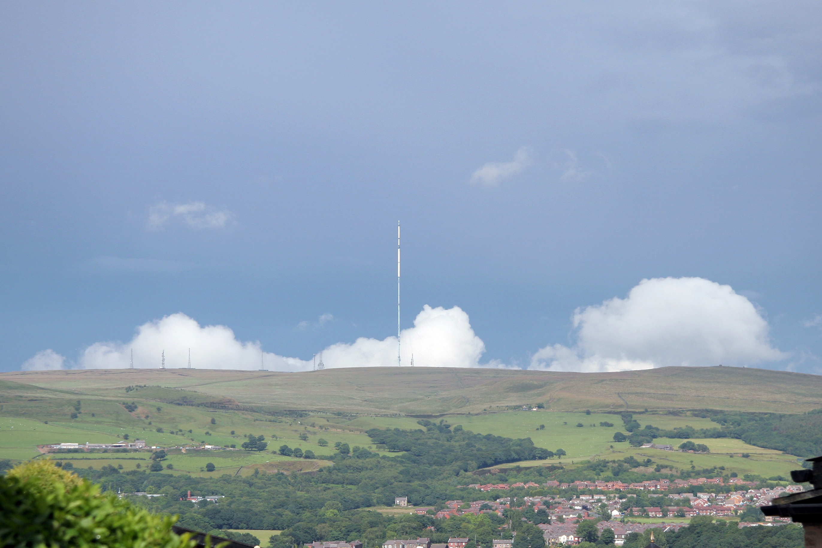
Winter Hill From Blackrod.jpg - Paypwip

Blackrod.jpg - The Real Galatas

Blackrod, Greater Manchester.jpg - Jza84

Leeds-Liverpool Canal at Red Rock - geograph.org.uk - 23677.jpg - GeographBot

Aspull Civic Hall - geograph.org.uk - 50500.jpg - GeographBot
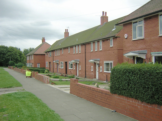
Council Houses - geograph.org.uk - 50694.jpg - GeographBot

Fishing Pond at Meadow Pit - geograph.org.uk - 50690.jpg - GeographBot

NewBuild - geograph.org.uk - 35552.jpg - GeographBot

Hollins Head - quite close to Aberdeen - geograph.org.uk - 50387.jpg - GeographBot

Private Coarse Fishing - geograph.org.uk - 50410.jpg - GeographBot

The Packet House - geograph.org.uk - 50463.jpg - GeographBot

The Pumping Station - geograph.org.uk - 52325.jpg - GeographBot

Waterhouse Bridge - geograph.org.uk - 52322.jpg - GeographBot

Farmhouse, Scot Lane, Aspull - geograph.org.uk - 80323.jpg - GeographBot

Ridgway Arms, A6, B5238, Blackrod - geograph.org.uk - 80315.jpg - GeographBot

The Poacher at Scot Lane Ends, Blackrod - geograph.org.uk - 80319.jpg - GeographBot

Dismantled railway near Dicconson Lane - geograph.org.uk - 113275.jpg - GeographBot

Haigh Steam Rally - geograph.org.uk - 121878.jpg - GeographBot

On the Border - geograph.org.uk - 122768.jpg - GeographBot

On the Border - geograph.org.uk - 122774.jpg - GeographBot

Site of Moor Pit No 5 - geograph.org.uk - 122354.jpg - GeographBot

Sheep in Little Scotland - geograph.org.uk - 370142.jpg - GeographBot

Leeds Liverpool Canal," Adlington to Red Rock" - geograph.org.uk - 391063.jpg - GeographBot

Blackrod Junction and signalbox - geograph.org.uk - 823694.jpg - GeographBot

Arley Hall - geograph.org.uk - 921704.jpg - GeographBot

Circus in field beside the A6 at Blackrod - geograph.org.uk - 1501750.jpg - GeographBot

View from Blackrod cemetery - geograph.org.uk - 1528095.jpg - GeographBot

View from graveyard at Blackrod cemetery - geograph.org.uk - 1528093.jpg - GeographBot

Blackrod and Winter Hill - geograph.org.uk - 1537028.jpg - GeographBot

Entering Adlington on A6 - geograph.org.uk - 1535113.jpg - GeographBot

Aqueduct carrying canal over the river Douglas (geograph 2265374).jpg - Trappedinburnley

Arley Bridge, Blackrod.jpg - Geograph Update Bot

Waterhouse Bridge, Blackrod.jpg - Geograph Update Bot

Anderton Bridge, Blackrod.jpg - Geograph Update Bot

Aberdeen Bridge, Blackrod.jpg - Geograph Update Bot

Georgian House Hotel, Blackrod.jpg - Geograph Update Bot

St Katharines from Winterhill.jpg - Stevelaycock21

Blackrod Village from Winterhill.jpg - Stevelaycock21

Chorley Road (A6) - geograph.org.uk - 2042379.jpg - GeographBot

Chorley Road (A6) Blackrod - geograph.org.uk - 2042385.jpg - GeographBot

A6 Blackrod Bypass - geograph.org.uk - 2042388.jpg - GeographBot

Station Road Bridge - geograph.org.uk - 2042393.jpg - GeographBot

Blackrod Station - geograph.org.uk - 2042396.jpg - GeographBot

Ridgway Arms - geograph.org.uk - 2042398.jpg - GeographBot

A6 Blackrod Bypass - geograph.org.uk - 2042449.jpg - GeographBot

A6 Between Blackrod And Adlington - geograph.org.uk - 2042460.jpg - GeographBot

A6 Chorley Road - geograph.org.uk - 2042474.jpg - GeographBot

Chorley Road (A6) - geograph.org.uk - 2042479.jpg - GeographBot

Waterhouse Bridge, Adlington - geograph.org.uk - 2042523.jpg - GeographBot

Private Fishing - geograph.org.uk - 2091097.jpg - GeographBot

Horses grazing in a field by the B5408 - geograph.org.uk - 2135503.jpg - GeographBot

Gradient marker - geograph.org.uk - 2265130.jpg - GeographBot

Arley Lane Bridge 64 - geograph.org.uk - 2265246.jpg - GeographBot

Wigan Golf Club seen from canal - geograph.org.uk - 2265247.jpg - GeographBot

Leeds and Liverpool canal - geograph.org.uk - 2265249.jpg - GeographBot

Bridges over the old railway - geograph.org.uk - 2265251.jpg - GeographBot

The old railway line - geograph.org.uk - 2265255.jpg - GeographBot

House through the trees - geograph.org.uk - 2265278.jpg - GeographBot

Bridges over the old railway - geograph.org.uk - 2265283.jpg - GeographBot

Arley Lane Bridge - geograph.org.uk - 2265286.jpg - GeographBot

Former railway line - geograph.org.uk - 2265292.jpg - GeographBot

Aberdeen farm - geograph.org.uk - 2265296.jpg - GeographBot

Canal Bridge - geograph.org.uk - 2265301.jpg - GeographBot

Five Barred Gate - geograph.org.uk - 2265307.jpg - GeographBot

Track to Aberdeen Farm - geograph.org.uk - 2265311.jpg - GeographBot

Path to Canal - geograph.org.uk - 2265315.jpg - GeographBot

Path to Adlington - geograph.org.uk - 2265320.jpg - GeographBot

Canal Bridge - geograph.org.uk - 2265323.jpg - GeographBot

Footpath - geograph.org.uk - 2265325.jpg - GeographBot

Gates on footpath - geograph.org.uk - 2265329.jpg - GeographBot

Farm track - geograph.org.uk - 2265333.jpg - GeographBot

Driveway to house - geograph.org.uk - 2265334.jpg - GeographBot

Farmland view - geograph.org.uk - 2265342.jpg - GeographBot

Bridge 66 - geograph.org.uk - 2265345.jpg - GeographBot

Adlington View - geograph.org.uk - 2265348.jpg - GeographBot

Muddy path - geograph.org.uk - 2265353.jpg - GeographBot

Path along former railway line - geograph.org.uk - 2265361.jpg - GeographBot

The old railway meets the canal - geograph.org.uk - 2265365.jpg - GeographBot

Fishing on the canal - geograph.org.uk - 2265367.jpg - GeographBot

Path to Adlington - geograph.org.uk - 2265369.jpg - GeographBot

Hairpin bend - geograph.org.uk - 2265371.jpg - GeographBot

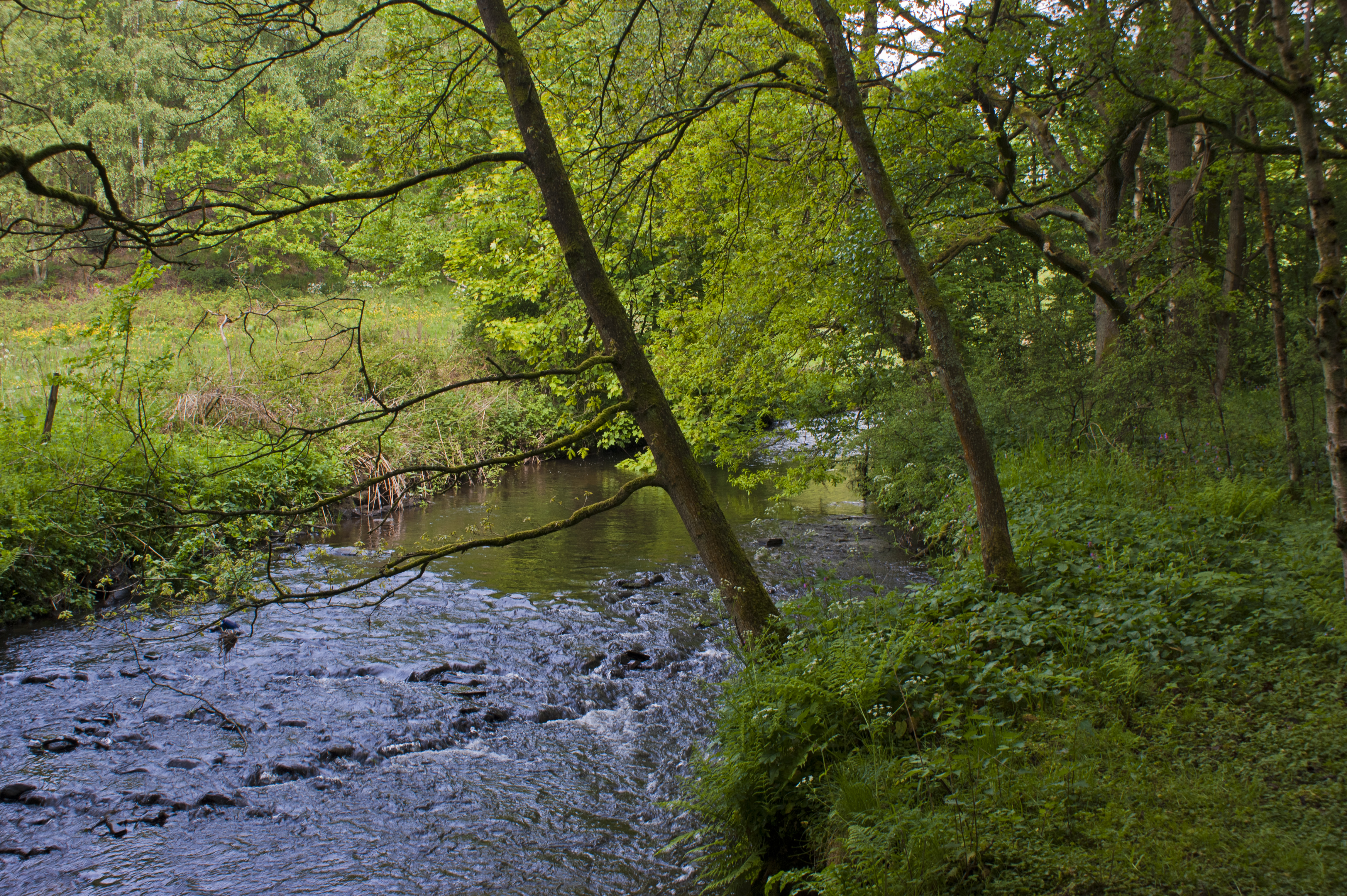
Footbridge over the river Douglas - geograph.org.uk - 2265372.jpg - GeographBot

Footbridge over the river Douglas - geograph.org.uk - 2265375.jpg - GeographBot

Path towards the aqueduct - geograph.org.uk - 2265378.jpg - GeographBot

Pipeline over the river Douglas - geograph.org.uk - 2265380.jpg - GeographBot

Riverbank - geograph.org.uk - 2265381.jpg - GeographBot

Footpath - geograph.org.uk - 2265383.jpg - GeographBot

Bridge 67 - geograph.org.uk - 2265413.jpg - GeographBot

Bridge 65 - geograph.org.uk - 2265416.jpg - GeographBot

Roadworks on the A6 - geograph.org.uk - 2312969.jpg - GeographBot

Blackrod Cemetery Chapel - geograph.org.uk - 2350556.jpg - GeographBot

Blackrod Cemetery - geograph.org.uk - 2350563.jpg - GeographBot

War Memorial and Chapel, Blackrod - geograph.org.uk - 2350571.jpg - GeographBot

Blackrod War Memorial - geograph.org.uk - 2350580.jpg - GeographBot

Blackrod War Memorial (2) - geograph.org.uk - 2350602.jpg - GeographBot

Blackrod War Memorial (detail) - geograph.org.uk - 2350611.jpg - GeographBot

Blackrod Cemetery - geograph.org.uk - 2350619.jpg - GeographBot

Blackrod Royal British Legion - geograph.org.uk - 2350627.jpg - GeographBot

The Parish Church of Saint Katharine Blackrod - geograph.org.uk - 2350688.jpg - GeographBot

The Red Lion, Blackrod - geograph.org.uk - 2350692.jpg - GeographBot

The Red Lion, Blackrod - geograph.org.uk - 2350697.jpg - GeographBot

Lion Lane, Blackrod - geograph.org.uk - 2350699.jpg - GeographBot

St Katharine's Parish Church, Blackrod - geograph.org.uk - 2350706.jpg - GeographBot

Blackrod National and Sunday School - geograph.org.uk - 2350724.jpg - GeographBot

St Katharine's Churchyard - geograph.org.uk - 2350736.jpg - GeographBot

A footpath through Arley Wood - geograph.org.uk - 2396558.jpg - GeographBot
A river running through Arley Wood - geograph.org.uk - 2396589.jpg - GeographBot

A tree and farm buildings between Freezeland Farm and Sibberings Farm - geograph.org.uk - 2396746.jpg - GeographBot

The footpath near Copperas House - geograph.org.uk - 2396800.jpg - GeographBot

The junction with Dark Lane is right on a bend - geograph.org.uk - 2396835.jpg - GeographBot

Dark Lane - geograph.org.uk - 2396853.jpg - GeographBot

Vicarage Road, Blackrod - geograph.org.uk - 2396866.jpg - GeographBot

The B 5409 at Blackrod - geograph.org.uk - 2396935.jpg - GeographBot

The Poachers on Scot Lane - geograph.org.uk - 2426026.jpg - GeographBot

Entrance to The Red Lion on Church Street - geograph.org.uk - 2426056.jpg - GeographBot

Barristers on Manchester Road in Blackrod - geograph.org.uk - 2426079.jpg - GeographBot

The railway towards Manchester from Station Road bridge Blackrod - geograph.org.uk - 2426471.jpg - GeographBot

Blackrod Brow joins Chorley Road - geograph.org.uk - 2426482.jpg - GeographBot

Public footpath sign on Scot Lane - geograph.org.uk - 2443322.jpg - GeographBot

M61 Red Moss - geograph.org.uk - 2474576.jpg - GeographBot

The Ramada Bolton Hotel, A6 near Blackrod - geograph.org.uk - 2629001.jpg - GeographBot

New houses on Marchwood Close off the A6 - geograph.org.uk - 2629165.jpg - GeographBot

Blackrod Ambulance Station, Scot Lane End - geograph.org.uk - 2629178.jpg - GeographBot

A farm track heading to the A6 - geograph.org.uk - 2629189.jpg - GeographBot

Shoemaker Fold near Scot Lane End - geograph.org.uk - 2629200.jpg - GeographBot

The car park at the Ramada Bolton Hotel - geograph.org.uk - 2629406.jpg - GeographBot

M61, Red Moss - geograph.org.uk - 2669484.jpg - GeographBot

Holly on bridge over dismantled Whelley Loop railway - geograph.org.uk - 2698472.jpg - GeographBot

Public Footpath sign shows the right of way - geograph.org.uk - 2698477.jpg - GeographBot

Trackbed of Whelley Loop line from Arley Lane bridge - geograph.org.uk - 2698482.jpg - GeographBot

A6 Approaching Scot Lane End - geograph.org.uk - 2742470.jpg - GeographBot

A6 Blackrod By-pass - geograph.org.uk - 2742476.jpg - GeographBot

A6 near Woods Barn Farm - geograph.org.uk - 2742481.jpg - GeographBot

Road to Douglas Valley Golf Club from the A6 - geograph.org.uk - 2742485.jpg - GeographBot

Depot beside the A6 - geograph.org.uk - 2742489.jpg - GeographBot

Entering Chorley on the A6 - geograph.org.uk - 2742496.jpg - GeographBot

This brook marks the Metropolitan District Boundary - geograph.org.uk - 2754360.jpg - GeographBot

A bridge in Grimeford Lane - geograph.org.uk - 2754384.jpg - GeographBot

Footbridge over the M61 - geograph.org.uk - 2774225.jpg - GeographBot

Little Scotland - geograph.org.uk - 2781799.jpg - GeographBot

New House, Little Scotland - geograph.org.uk - 2892876.jpg - GeographBot

Motorway M61 - geograph.org.uk - 2939209.jpg - GeographBot

St. Katharine's, Blackrod - geograph.org.uk - 2955953.jpg - GeographBot

St Katherine's Church, Blackrod - geograph.org.uk - 2985267.jpg - GeographBot

Blackrod boundary at Little Scotland - geograph.org.uk - 3150138.jpg - GeographBot

Hill Lane at Dark Lane junction - geograph.org.uk - 3151474.jpg - GeographBot

Church Street at The Red Lion - geograph.org.uk - 3151487.jpg - GeographBot

Station Road with Winter Hill beyond - geograph.org.uk - 3151503.jpg - GeographBot

Blackrod By-Pass Road - geograph.org.uk - 3151525.jpg - GeographBot

Chorley Road at Crow's Nest Farm - geograph.org.uk - 3151545.jpg - GeographBot

Blackrod railway station, Lancashire, 2010 - geograph.org.uk - 3231005.jpg - GeographBot

St Katharine Church, Blackrod - geograph.org.uk - 3258292.jpg - GeographBot

Woodland near Ridgway Bridge - geograph.org.uk - 3381815.jpg - GeographBot

Farmland near Blackrod - geograph.org.uk - 3381817.jpg - GeographBot

Dark Lane, Blackrod - geograph.org.uk - 3387381.jpg - GeographBot

Old Milestone by the A5408, Scot Lane End, Blackrod parish (geograph 6050785).jpg - Sic19

Old Milestone by the B5408, Church Street, Blackrod Parish (geograph 6044055).jpg - Sic19

Approaching Little Scotland - geograph.org.uk - 3495896.jpg - GeographBot

Blackrod War Memorial - geograph.org.uk - 3599231.jpg - GeographBot

From Blackrod Cemetery - geograph.org.uk - 3599236.jpg - GeographBot

St. Katharine's Church, Blackrod - geograph.org.uk - 3599240.jpg - GeographBot

Ain't dead yet - geograph.org.uk - 3910845.jpg - GeographBot

Ewes and lambs at Aberdeen Farm - geograph.org.uk - 3910856.jpg - GeographBot

Leeds Liverpool Canal - geograph.org.uk - 3910868.jpg - GeographBot

Arley Wood - geograph.org.uk - 3910890.jpg - GeographBot

Silver birch, towpath and canal - geograph.org.uk - 3910899.jpg - GeographBot

Canal overflow - geograph.org.uk - 3910906.jpg - GeographBot

Leeds Liverpool Canal - geograph.org.uk - 3910914.jpg - GeographBot

Bridge 64 - geograph.org.uk - 3910931.jpg - GeographBot

Dilapidated sheds - geograph.org.uk - 3910935.jpg - GeographBot

Arley Lane - geograph.org.uk - 3910945.jpg - GeographBot

Gate and field at Hollins Head - geograph.org.uk - 3910953.jpg - GeographBot

Track to Aberdeen Farm - geograph.org.uk - 3910958.jpg - GeographBot

Leeds and Liverpool Canal at Arley Wood - geograph.org.uk - 3918145.jpg - GeographBot

River Douglas at Adlington - geograph.org.uk - 3918163.jpg - GeographBot

Boats on the Leeds and Liverpool Canal - geograph.org.uk - 3942901.jpg - GeographBot

Arley Bridge, Leeds and Liverpool Canal - geograph.org.uk - 3942909.jpg - GeographBot

Leeds and Liverpool Canal, View Northwards from Arley Bridge - geograph.org.uk - 3942915.jpg - GeographBot

Leeds and Liverpool Canal, View South from Arley Bridge - geograph.org.uk - 3942921.jpg - GeographBot

Path at the Side of The Leeds and Liverpool Canal - geograph.org.uk - 3943126.jpg - GeographBot

Arley Lane - geograph.org.uk - 3943143.jpg - GeographBot

Footpath Sign on Arley Lane - geograph.org.uk - 3943149.jpg - GeographBot

Track to Maxwell Farm - geograph.org.uk - 3943152.jpg - GeographBot

Bridge over Disused Railway - geograph.org.uk - 3943156.jpg - GeographBot

Approaching Anderton Bridge - geograph.org.uk - 3943571.jpg - GeographBot

Bridge^65 (Anderton Bridge) Leeds and Liverpool Canal - geograph.org.uk - 3943576.jpg - GeographBot

Leeds and Liverpool Canal, Anderton Bridge - geograph.org.uk - 3943577.jpg - GeographBot

Canals and River Trust Barge on the Leeds and Liverpool Canal - geograph.org.uk - 3943591.jpg - GeographBot

Leeds and Liverpool Canal - geograph.org.uk - 3943594.jpg - GeographBot

Leeds and Liverpool Canal near Arley Hall - geograph.org.uk - 3943596.jpg - GeographBot

Narrowboat Millie Maize Moored at Arley Bridge - geograph.org.uk - 3943601.jpg - GeographBot

Leeds Liverpool Canal near Adlington - geograph.org.uk - 4354461.jpg - GeographBot

Poolgreen, Blackrod - geograph.org.uk - 4397638.jpg - GeographBot

Railway heading north west - geograph.org.uk - 4408896.jpg - GeographBot

Farmland off Grimeford Lane - geograph.org.uk - 4408898.jpg - GeographBot

Grimeford Lane - geograph.org.uk - 4408900.jpg - GeographBot

Marker stone in farmland off Grimeford Lane - geograph.org.uk - 4408902.jpg - GeographBot

The Cherry Tree at Blackrod - geograph.org.uk - 4408903.jpg - GeographBot

Sign for the Cherry Tree at Blackrod - geograph.org.uk - 4408905.jpg - GeographBot

Chorley Road (A6) - geograph.org.uk - 4408906.jpg - GeographBot

House on Chorley Road (B5408), Blackrod - geograph.org.uk - 4408908.jpg - GeographBot

Chorley Road (B5408), Blackrod - geograph.org.uk - 4408909.jpg - GeographBot

Apartments, Blackrod - geograph.org.uk - 4408911.jpg - GeographBot

Hilltops Sports ^ Social Club - geograph.org.uk - 4409229.jpg - GeographBot

Sign for the Hilltops Sports ^ Social Club - geograph.org.uk - 4409231.jpg - GeographBot

Corner on Hill Lane, Blackrod - geograph.org.uk - 4409237.jpg - GeographBot

House on Vicarage Road West, Blackrod - geograph.org.uk - 4409238.jpg - GeographBot

Hill Lane, Blackrod - geograph.org.uk - 4409241.jpg - GeographBot

Suzanna's at Little Scotland - geograph.org.uk - 4409245.jpg - GeographBot

Sign for Suzanna's at Little Scotland - geograph.org.uk - 4409248.jpg - GeographBot

Little Scotland - geograph.org.uk - 4409252.jpg - GeographBot

Leaving Little Scotland - geograph.org.uk - 4409253.jpg - GeographBot

Arley Lane bridge crossing cycle trail - geograph.org.uk - 4409983.jpg - GeographBot

Arley Lane - geograph.org.uk - 4409984.jpg - GeographBot

Farmland near Aberdeen Farm - geograph.org.uk - 4409985.jpg - GeographBot

Blundell Lane - geograph.org.uk - 4409986.jpg - GeographBot

Grazing off Blundell Lane - geograph.org.uk - 4409987.jpg - GeographBot

Blundell Lane - geograph.org.uk - 4409988.jpg - GeographBot

Grazing off Scot Lane - geograph.org.uk - 4410033.jpg - GeographBot
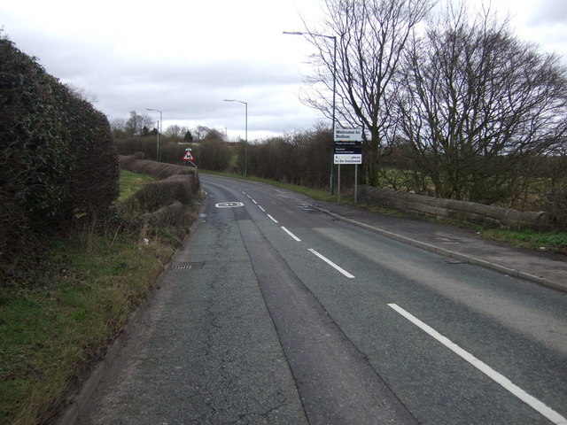
Welcome to Bolton - geograph.org.uk - 4410036.jpg - GeographBot

Scot Lane (B5238) - geograph.org.uk - 4410039.jpg - GeographBot

Blackrod Ambulance Station - geograph.org.uk - 4410041.jpg - GeographBot

Bus stop on Scot Lane (B5238) - geograph.org.uk - 4410044.jpg - GeographBot

The Poacher, Scot Lane End - geograph.org.uk - 4410047.jpg - GeographBot

Sign for the Poacher, Scot Lane End - geograph.org.uk - 4410050.jpg - GeographBot

Manchester Road, Scot Lane End - geograph.org.uk - 4410054.jpg - GeographBot

Manchester Road (A6) - geograph.org.uk - 4410057.jpg - GeographBot

M61 southbound towards junction 6 - geograph.org.uk - 4506115.jpg - GeographBot

M61 southbound towards junction 6 - geograph.org.uk - 4507047.jpg - GeographBot

Ford over the River Douglas on Stony Lane, Adlington - geograph.org.uk - 4581304.jpg - GeographBot

Approaching Weavers Bridge - geograph.org.uk - 4617985.jpg - GeographBot

B5238 Scot Lane at Bolton (Blackrod) boundary - geograph.org.uk - 4685074.jpg - GeographBot

B5238 at Scot Lane End - geograph.org.uk - 4685082.jpg - GeographBot

Leeds-Liverpool Canal - geograph.org.uk - 4757112.jpg - GeographBot

Entrance to Baxter's Landscape Supplies - geograph.org.uk - 4785730.jpg - GeographBot

The Rivington - geograph.org.uk - 5023622.jpg - GeographBot

Blackrod, Station Road - geograph.org.uk - 5023629.jpg - GeographBot

Blackrod Railway Station - geograph.org.uk - 5023645.jpg - GeographBot

Waterhouse Bridge No 67 - geograph.org.uk - 5041694.jpg - GeographBot

Leeds and Liverpool Canal - geograph.org.uk - 5509482.jpg - GeographBot

Leeds and Liverpool Canal - geograph.org.uk - 5509486.jpg - GeographBot

Woodland footpath - geograph.org.uk - 5509589.jpg - GeographBot

Seven cygnets swimming - geograph.org.uk - 5509597.jpg - GeographBot

Little Scotland - geograph.org.uk - 5699415.jpg - GeographBot

Grimeford Lane at Blackrod - geograph.org.uk - 5702694.jpg - GeographBot

View towards Winter Hill - geograph.org.uk - 5702726.jpg - GeographBot

Hill Lane in Blackrod - geograph.org.uk - 5702864.jpg - GeographBot

Shops on Blackhorse Street in Blackrod - geograph.org.uk - 5702917.jpg - GeographBot

Arley Bridge No 64 - geograph.org.uk - 5705294.jpg - GeographBot

Leeds and Liverpool Canal at Arley Wood - geograph.org.uk - 5705302.jpg - GeographBot

Weavers Bridge No 65 - geograph.org.uk - 5705316.jpg - GeographBot

Tree next to the Leeds and Liverpool Canal - geograph.org.uk - 5705319.jpg - GeographBot

The Boatman's House - geograph.org.uk - 5705321.jpg - GeographBot

Aberdeen Bridge No 66 - geograph.org.uk - 5705899.jpg - GeographBot

Aberdeen Bridge No 66 - geograph.org.uk - 5705904.jpg - GeographBot

Leeds and Liverpool Canal near Adlington Park - geograph.org.uk - 5705911.jpg - GeographBot

Adlington Aqueduct No 19 - geograph.org.uk - 5705981.jpg - GeographBot

Adlington Aqueduct No 19 - geograph.org.uk - 5705991.jpg - GeographBot

Moss Lane passing under the M61 - geograph.org.uk - 5950941.jpg - GeographBot

Ridgway Bridge - geograph.org.uk - 5950943.jpg - GeographBot

Railway line viewed from Ridgway Bridge - geograph.org.uk - 5950945.jpg - GeographBot

Footpath in the woods near Park Hall Farm - geograph.org.uk - 5950950.jpg - GeographBot

Old Direction Sign - Signpost by the B5408, Manchester Road, Blackrod - geograph.org.uk - 6037831.jpg - GeographBot

Old Direction Sign - Signpost by the B5408, Manchester Road, Scot Lane End - geograph.org.uk - 6051286.jpg - GeographBot

Stile on footpath at Arley Lane, Haigh - geograph.org.uk - 6097281.jpg - GeographBot

Arley Lane, Haigh - geograph.org.uk - 6097285.jpg - GeographBot

Footpath North of Arley Lane, Haigh - geograph.org.uk - 6097292.jpg - GeographBot

Path North of Arley Lane, Haigh - geograph.org.uk - 6097295.jpg - GeographBot

Footpath North of Arley Lane, Haigh - geograph.org.uk - 6097300.jpg - GeographBot

Arley Lane Bridge on the Leeds - Liverpool Canal - geograph.org.uk - 6097303.jpg - GeographBot

Leeds ^ Liverpool Canal - geograph.org.uk - 6181120.jpg - GeographBot

Leeds ^ Liverpool Canal - geograph.org.uk - 6181121.jpg - GeographBot

Leeds ^ Liverpool Canal - geograph.org.uk - 6181122.jpg - GeographBot

Leeds ^ Liverpool Canal - geograph.org.uk - 6181124.jpg - GeographBot

Leeds ^ Liverpool Canal - geograph.org.uk - 6181125.jpg - GeographBot

Leeds ^ Liverpool Canal - geograph.org.uk - 6181126.jpg - GeographBot

Leeds ^ Liverpool Canal - geograph.org.uk - 6181127.jpg - GeographBot

Leeds ^ Liverpool Canal - geograph.org.uk - 6181128.jpg - GeographBot

Leeds ^ Liverpool Canal - geograph.org.uk - 6181132.jpg - GeographBot

Leeds ^ Liverpool Canal - geograph.org.uk - 6181133.jpg - GeographBot

Leeds ^ Liverpool Canal - geograph.org.uk - 6181136.jpg - GeographBot

Leeds ^ Liverpool Canal - geograph.org.uk - 6181141.jpg - GeographBot

Leeds ^ Liverpool Canal - geograph.org.uk - 6181144.jpg - GeographBot

Leeds ^ Liverpool Canal - geograph.org.uk - 6181146.jpg - GeographBot

Leeds ^ Liverpool Canal - geograph.org.uk - 6181150.jpg - GeographBot

Leeds ^ Liverpool Canal - geograph.org.uk - 6181152.jpg - GeographBot

Leeds ^ Liverpool Canal - geograph.org.uk - 6181156.jpg - GeographBot

Leeds ^ Liverpool Canal - geograph.org.uk - 6181158.jpg - GeographBot

Leeds ^ Liverpool Canal - geograph.org.uk - 6181162.jpg - GeographBot

Leeds ^ Liverpool Canal - geograph.org.uk - 6181163.jpg - GeographBot

Leeds ^ Liverpool Canal - geograph.org.uk - 6181165.jpg - GeographBot

Leeds ^ Liverpool Canal - geograph.org.uk - 6181168.jpg - GeographBot

Leeds ^ Liverpool Canal - geograph.org.uk - 6181170.jpg - GeographBot

Leeds ^ Liverpool Canal - geograph.org.uk - 6181174.jpg - GeographBot

Leeds ^ Liverpool Canal - geograph.org.uk - 6181176.jpg - GeographBot

Leeds ^ Liverpool Canal - geograph.org.uk - 6181181.jpg - GeographBot

Blackrod Town Council 2024.svg - RandomEditsForWhenIRemember

Works - geograph.org.uk - 6717661.jpg - GeographBot

Grimeford - geograph.org.uk - 6717669.jpg - GeographBot

Pennington Hill - geograph.org.uk - 6717671.jpg - GeographBot

Rollinson House Farm - geograph.org.uk - 6717677.jpg - GeographBot

Leeds and Liverpool Canal - geograph.org.uk - 6717701.jpg - GeographBot

The Boatman's - geograph.org.uk - 6717707.jpg - GeographBot

Winter Hill - geograph.org.uk - 6717724.jpg - GeographBot

Leeds and Liverpool Canal - geograph.org.uk - 6717859.jpg - GeographBot

Leeds and Liverpool Canal - geograph.org.uk - 6717861.jpg - GeographBot

Leeds and Liverpool Canal - geograph.org.uk - 6718107.jpg - GeographBot

Blackrod - geograph.org.uk - 6718109.jpg - GeographBot

Anglezarke Moor - geograph.org.uk - 6718111.jpg - GeographBot

Blackrod - geograph.org.uk - 7014092.jpg - GeographBot

St Katharine Church, Blackrod - geograph.org.uk - 7014093.jpg - GeographBot

Word on the street, Blackrod - geograph.org.uk - 7014094.jpg - GeographBot

A fine bridleway near Aberdeen Farm - geograph.org.uk - 7637935.jpg - GeographBot

Fields near Aberdeen Farm - geograph.org.uk - 7637966.jpg - GeographBot

Milestone or gatepost^ - geograph.org.uk - 7638923.jpg - GeographBot