Wikimedi'Òc
Modes d'emploi

Cet album fait partie des albums
Cet album photos contient les sous-albums suivants :


Cliff House Restaurant -1956.jpg - OptimusPrimeBot

Drone Golden Gate Bridge (Unsplash).jpg - Fæ
Photograph of San Francisco in ruins from Lawrence Captive Airship, 2000 feet above San Francisco Bay overlooking water front. Sunset over Golden (Gat)e LCCN2007663901.tif - Fæ

1906 San Francisco earthquake aftermath panorama.jpg - GreenMeansGo

San Francisco in ruins from Lawrence Captive Airship, 1906.jpg - Brian0918

San Francisco in ruin edit2.jpg - Grook Da Oger

Curtiss SNC-1 in flight c1941.jpeg - Cobatfor

San Francisco Naval Shipyard aerial 24 May 1945.jpg - Cobatfor

Fort Point Aerial2.jpg - Martin H.

Fort Point Aerial.jpg - Martin H.

Dow-afb-maine-may-9-1996.jpg - Bwmoll3
Presque Isle Air Force Base Maine-9 May 1996.jpg - Bwmoll3

Deblois Flight Strip - USGS 16 May 1996.jpg - Zyxw
Frank Deras Jr., Photographer July 1998 AERIAL VIEW OF CANTILEVER TRUSS, SOUTH SIDE, WITH YERBA BUENA ISLAND IN FOREGROUND, FACING NORTHEAST. - San Francisco Oakland Bay HAER CAL,38-SANFRA,141-250.tif - Fæ

Spenceapt-31jan1993.jpg - Bwmoll3

Moultrieapt-31jan1993.jpg - Bwmoll3

Cordeleapt-31jan1993.jpg - Bwmoll3
Aerial view looking northeast. Photograph taken over historic district looking toward buildings 1 and 2 at right center. City of San Diego in distance. - Naval Air Station North HABS CAL,37-SANDI,33-5.tif - Fæ

Columbia Glacier, Calving Terminus, November 21, 1990 (GLACIERS 1545).jpg - BMacZeroBot

Columbia Glacier, Calving terminus, Terentiev Lake, November 21, 1990 (GLACIERS 1546).jpg - BMacZeroBot

ARC-1946-A-9943.jpg - OptimusPrimeBot

SF-Oakland-Bay-Bridge-Construction.jpg - Wolfgang K

CCAFS-LC34.jpg - Mlowin

The Prairie School aerial-greyscale.png - BetacommandBot

Plum Brook Aerial GPN-2000-000384.jpg - CarolSpears

Harrisburg, IL Areal Junior High.jpg - Kranar drogin~commonswiki

Hunters Point NS CVS-12 CVA-14 1966.jpg - Cobatfor
Minneapolis North High School overhead 1991.jpg - Eóin

1923CapitolComplex.jpg - John Bot II
Elpasoaaf-28jan1996.jpg - File Upload Bot (Magnus Manske)

NAS Akron OH NAN4-48.jpg - Cobatfor

R3Y over Alcatraz NAN1-58.jpg - Cobatfor

Lowry AFB CO - 9 Oct 1999.jpg - Bwmoll3

Beale AFB CA - 28 Jul 1999.jpg - Bwmoll3

Bolling AFB DC - 5 Apr 1988.jpg - Bwmoll3
Seymour Johnson Air Force Base NC - 9 Mar 1993.jpg - Bwmoll3

Cabrini Green Housing Project.jpg - Martin H.

Lake County Airport (Colorado) 12 Oct 1999.jpg - Bwmoll3
Annistonafb-al-12feb1949.jpg - Bwmoll3
Johnson High School 1921 aerial.jpg - Eóin

Duluth-apt-17may1991.jpg - Bwmoll3

Union Station Washington DC from the air.png - Fordmadoxfraud

Youngstown-map-20apr1994.jpg - Bwmoll3
Pruitt-Igoe 1968March03.jpg - Junkyardsparkle

Wright Field 1920.JPG - Pmcyclist

Palmbeachafb-1968.jpg - Bwmoll3

Lockheed R6V Constitutions over SF 1950.jpg - Cobatfor

Aerial Fort Peck Dam before slide B.jpg - Rickstat

Cleveland Ohio 1937.jpg - Johnny S.

Lockheed A-29s over Mt McKinley Feb 1942.jpg - Cobatfor
Quaker Oats factory, Akron.jpg - Nyttend

11thstreetbridges 1992.jpg - Martin H.

Norfolk International Airport=VA-9Apr1990-USGS.jpg - Bwmoll3
Stead Air Force Base-NV-11 September 1999-USGS.jpg - Bwmoll3
NOLF Whitehouse.jpg - The Bushranger

72d SRS - RB-36H-40-CF Peacemaker 51-13741.png - Bwmoll3

NASA Crows Landing - USGS 29 July 1999.jpg - Zyxw

B&P Tunnel West 1977.jpg - Caseyjonz

USS Philippine Sea arrives at San Francisco from Korea June 1951.jpg - Cobatfor

Saugatuck River Bridge, Saugatuck (Fairfield County, Connecticut).jpg - Krib

1875 East Cambridge from Memorial Tower Massachusetts 140113v.jpg - Daderot

140117v.jpg - Jbarta

LOC 140114v.jpg - Daderot
Norfolknavalbase3.jpg - ديفيد عادل وهبة خليل 2

A-1H VA-196 in flight over Treasure Island CA c1958.jpeg - Cobatfor

ThreeMileIsland LakeWinipesaukee USGS.jpg - File Upload Bot (Magnus Manske)

Kuaua ruins, Coronado State Monument, 1940.jpg - ZooFari

Downtown Cleveland, Ohio, in winter, from the air, 12-1937 - NARA - 512842.jpg - InductiveBot

Aerial view of San Antonio. Texas, and the surrounding plains, 12-1939 - NARA - 512843.jpg - US National Archives bot

Chicago River, 1953.jpg - Flickr upload bot
West Mesa Field 30 Sep 1945.jpg - Bwmoll3

Albuquerque AAB 28 April 1942.jpg - Bwmoll3
Hourglass Field over Miramar College B&W.jpg - SreeBot

Prado Dam, Santa Ana Canyon, Riverside County.jpg - Flickr upload bot

Berry Field.jpg - Huntster

Dodger Stadium PSA 06-00755.jpg - Flickr upload bot
Charleston Navy Hospital aerial view on 7-7-49.jpg - Darkwind

Readville aerial and Boston skyline 1977.jpg - Pi.1415926535

Mitchel Field - New York - 1968.jpg - Bwmoll3

Aerial of Roxhill, West Seattle, 1969.jpg - Flickr upload bot

USAF F-4E Phantom II 310.jpg - Chesipiero

USAF F-4E Phantom II over Mount McKinley.jpg - Chesipiero
Photograph of Aerial View of Murry City, Ohio - NARA - 2128905.jpg - US National Archives bot
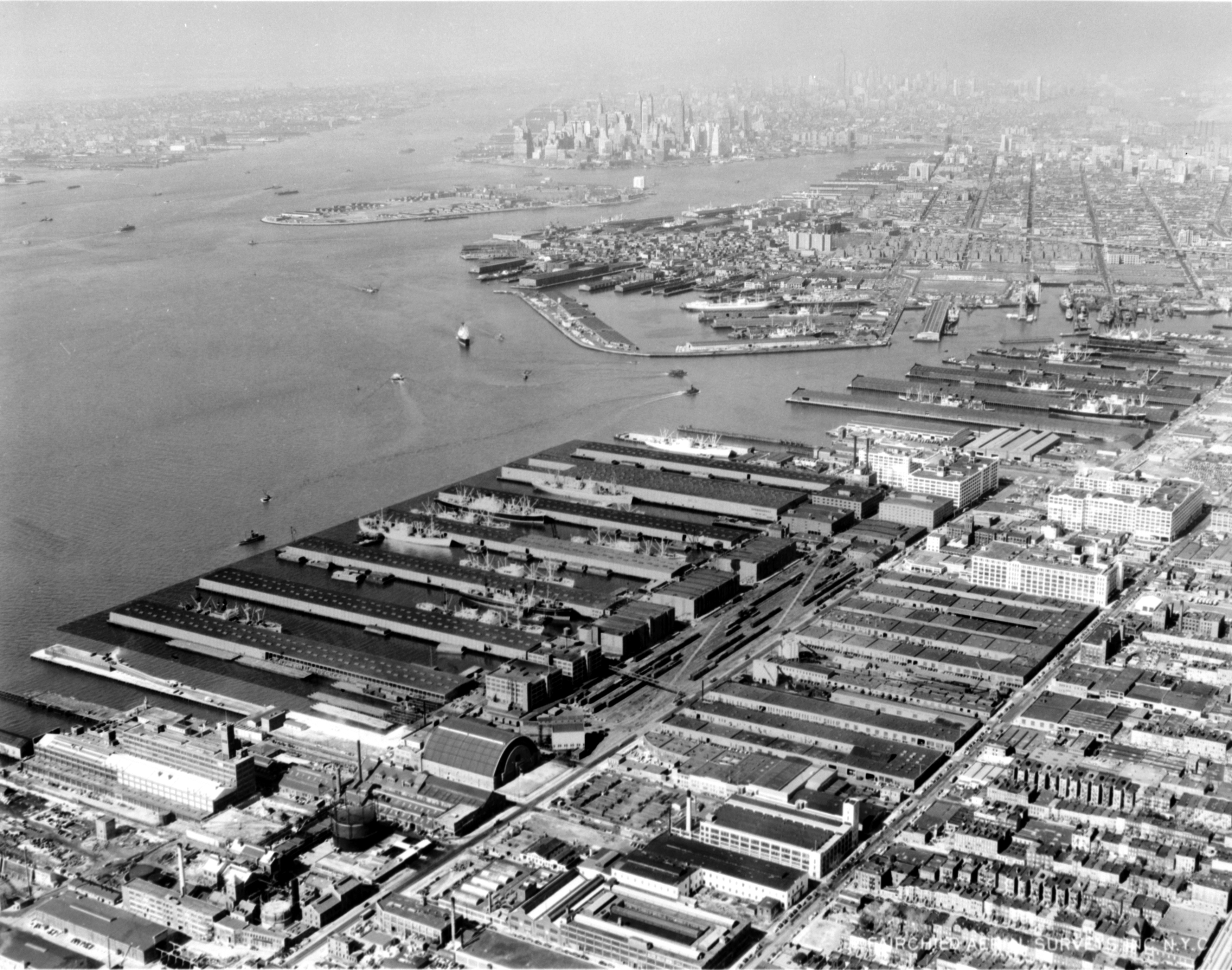
Bush Terminal - North aerial - 1958.jpg - Caseyjonz

071809 aboveSF 2617 (3735901157).jpg - File Upload Bot (Magnus Manske)

USS Kearsarge (CVA-33) under Golden Gate Bridge c1952.jpg - Cobatfor

Aerial of waterfront and downtown Seattle, 1968.jpg - Flickr upload bot

Mercury control center 4june1963.jpg - Soerfm

Aerial of northwest Seattle, 1970.jpg - Flickr upload bot

Cascade Mountain Peaks (3387044159).jpg - File Upload Bot (Magnus Manske)

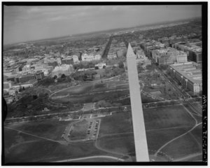
Aerial view of U.S. Capitol, Washington, D.C..jpg - Slowking4

Aerial View Of Suspension Bridge To Yerba Buena Island And Beyond From San Francisco.jpg - Minesweeper

CAPITOL, U.S. VIEW FROM AIR.jpg - Slowking4
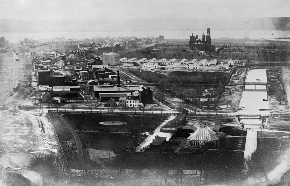
Early photographic view of Washington, D.C. from the Capitol looking west-southwest.jpg - Slowking4

James River Flooding (7790613462).jpg - File Upload Bot (Magnus Manske)
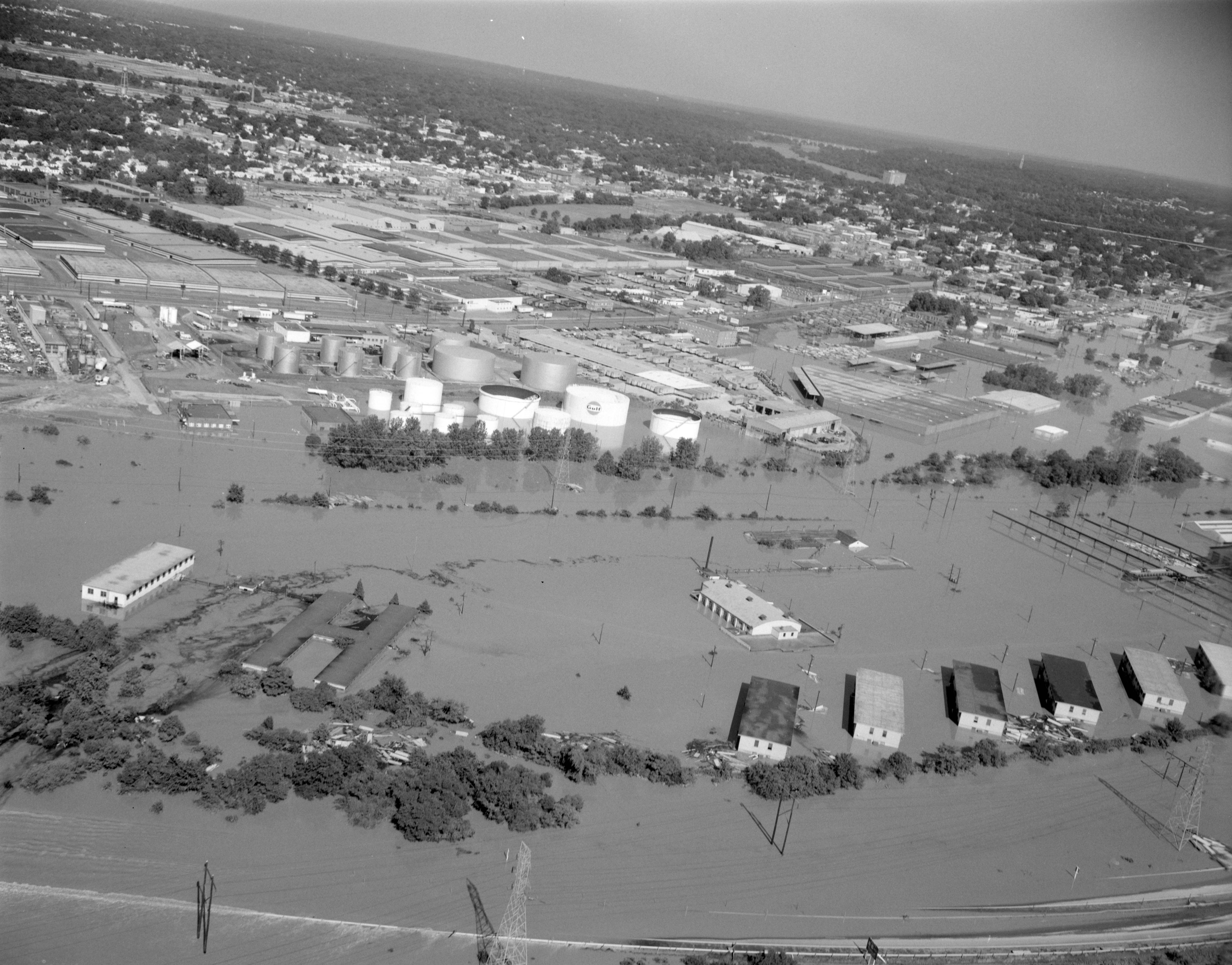
Aerial view of Southside (7790616584).jpg - File Upload Bot (Magnus Manske)

Aerial view of Richmond (7790616898).jpg - File Upload Bot (Magnus Manske)

I-95 Flooding in Richmond (7790618046).jpg - File Upload Bot (Magnus Manske)

14th Street Bridge Under Water (7790618724).jpg - File Upload Bot (Magnus Manske)

Eastern View in Richmond (7790621328).jpg - File Upload Bot (Magnus Manske)
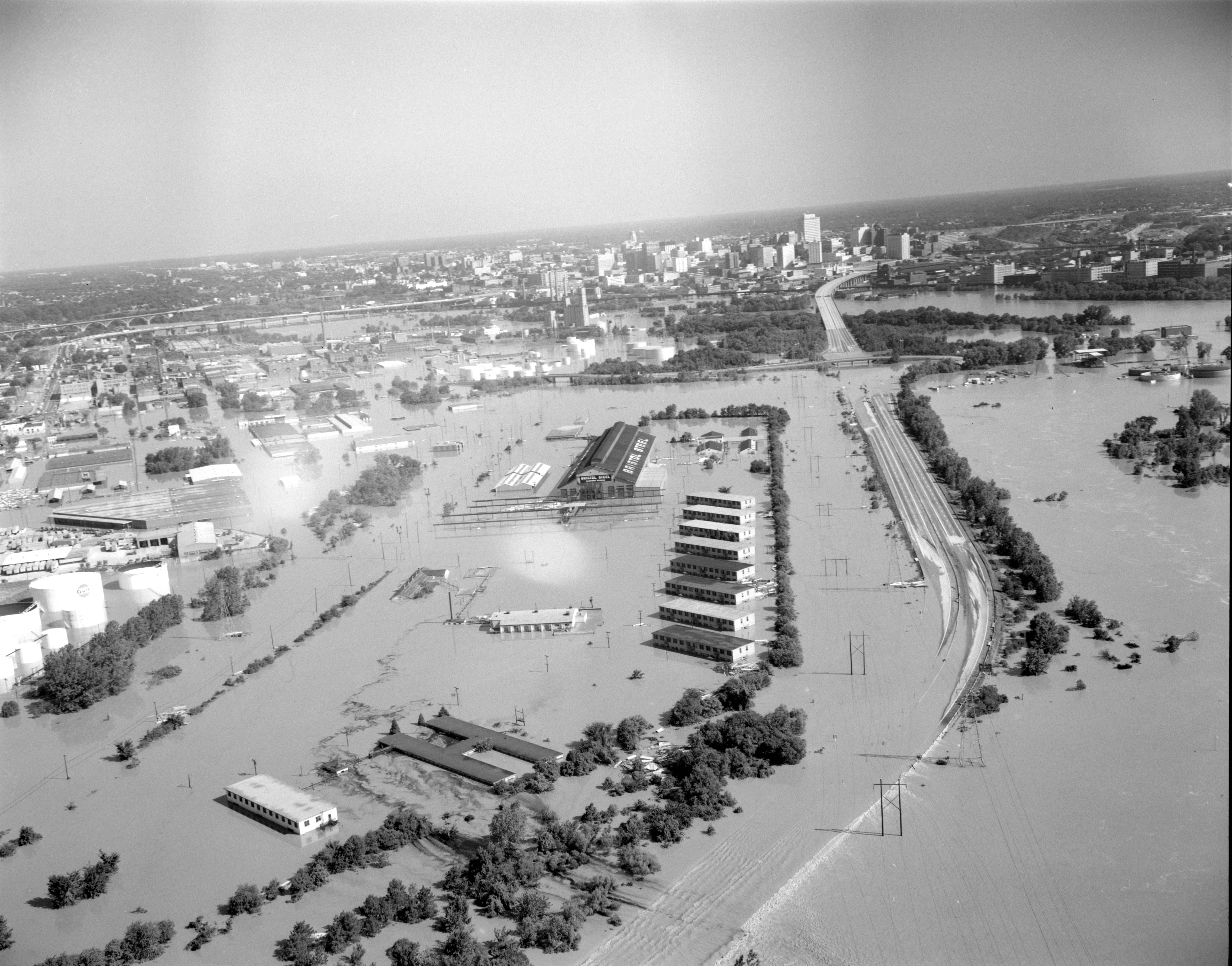
I-95 Under Water (7790622800).jpg - File Upload Bot (Magnus Manske)

Flooding in Richmond (7790620884).jpg - File Upload Bot (Magnus Manske)

Byrd Field terminal area, diesel housing unit (2899349146).jpg - File Upload Bot (Magnus Manske)

High school (2899349104).jpg - File Upload Bot (Magnus Manske)

New school buildings (2899338836).jpg - File Upload Bot (Magnus Manske)

Unidentified aerial view, Richmond (2899347690).jpg - File Upload Bot (Magnus Manske)

New school buildings (4990841700).jpg - File Upload Bot (Magnus Manske)

Aerial view looking toward U.S. Capitol with snow.jpg - Slowking4

Aerial view of marchers in the shadow of the Washington Monument.jpg - Yann

Capitol, from air30431v.jpg - Slowking4

San Francisco aerial view in 1962.jpg - Cobatfor
Flax twine plant st paul minn 6a34562u.tif - Slowking4
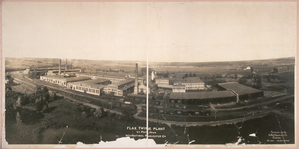
Flax Twine Plant, St. Paul, Minn. 6a34562v.jpg - Slowking4

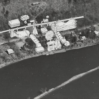
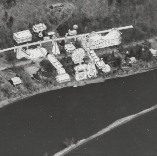
Jantzen Beach Amusement Park, 1950.JPG - Halvorsen brian
Vassar College academic quad aerial 1995.jpeg - Bobamnertiopsis

Whittier Narrows dam project (copy), 1957 (EXM-N-12231-007~1).jpg - Junkyardsparkle

Aerial view of Nome (9511349455).jpg - Ser Amantio di Nicolao
Frank Deras Jr., Photographer June 1998 CONTEXTUAL AERIAL VIEW OF EAST BAY CROSSING FROM YERBA BUENA ISLAND TO OAKLAND, FACING NORTHEAST. - San Francisco Oakland Bay Bridge, HAER CAL,38-SANFRA,141-89.tif - Fæ
Frank Deras Jr., Photographer June 1998 CONTEXTUAL AERIAL VIEW OF EAST BAY CROSSING FROM YERBA BUENA ISLAND TO OAKLAND, NORTH SIDE, FACING EAST. - San Francisco Oakland Bay HAER CAL,38-SANFRA,141-83.tif - Fæ
Frank Deras Jr., Photographer May 1998 CONTEXTUAL AERIAL VIEW OF CANTILEVER TRUSS AND DECK TRUSS, EAST SIDE OF YERBA BUENA ISLAND, FACING SOUTHWEST. - San Francisco Oakland HAER CAL,38-SANFRA,141-86.tif - Fæ
Frank Deras Jr., Photographer June 1998 AERIAL VIEW OF CANTILEVER TRUSS AND DECK TRUSS AT PIER E-l, NORTH SIDE, FACING SOUTHEAST. - San Francisco Oakland Bay Bridge, HAER CAL,38-SANFRA,141-257.tif - Fæ
Frank Deras Jr., Photographer April 1999 AERIAL VIEW OF EAST BAY CROSSING, SOUTH SIDE, FACING NORTH NORTHWEST. - San Francisco Oakland Bay Bridge, Spanning San Francisco Bay HAER CAL,38-SANFRA,141-276.tif - Fæ

Aerial view of U.S. Capitol building29453v.jpg - Slowking4
HISTORIC IMAGE- AERIAL VIEW OF CEMETERY AND ITS ENVIRONS. PHOTOGRAPH 15 SEPTEMBER 1950. NCA HISTORY COLLECTION. - San Francisco National Cemetery, 1 Lincoln Boulevard, San Francisco, San HALS CA-1-33.tif - Fæ
Aerial view from the southeast. Jack Boucher, photographer; February 1992. - Lincoln Memorial, West Potomac Park, Washington, District of Columbia, DC HABS DC,WASH,462-5.tif - Fæ
Aerial view from the northwest. Jack Boucher, photographer; February 1992. - Lincoln Memorial, West Potomac Park, Washington, District of Columbia, DC HABS DC,WASH,462-8.tif - Fæ
Aerial view from the northeast. Jack Boucher, photographer; February 1992. - Lincoln Memorial, West Potomac Park, Washington, District of Columbia, DC HABS DC,WASH,462-9.tif - Fæ
Aerial view from the west. Jack Boucher, photographer; February 1992. - Lincoln Memorial, West Potomac Park, Washington, District of Columbia, DC HABS DC,WASH,462-7.tif - Fæ
Aerial view from the east. Jack Boucher, photographer; February 1992. - Lincoln Memorial, West Potomac Park, Washington, District of Columbia, DC HABS DC,WASH,462-4.tif - Fæ
Aerial view from the southwest. Jack Boucher, photographer; February 1992. - Lincoln Memorial, West Potomac Park, Washington, District of Columbia, DC HABS DC,WASH,462-6.tif - Fæ
Aerial view from the northwest. Jack Boucher, photographer; February 1992. - Jefferson Memorial, East Potomac Park, Washington, District of Columbia, DC HABS DC,WASH,453-16.tif - Fæ
Aerial view from the north. Jack Boucher, photographer; February 1992. - Jefferson Memorial, East Potomac Park, Washington, District of Columbia, DC HABS DC,WASH,453-15.tif - Fæ
Aerial view from the southwest. Jack Boucher, photographer; February 1992. - Jefferson Memorial, East Potomac Park, Washington, District of Columbia, DC HABS DC,WASH,453-17.tif - Fæ
Aerial view from the south. Jack Boucher, photographer; February 1992. - Jefferson Memorial, East Potomac Park, Washington, District of Columbia, DC HABS DC,WASH,453-18.tif - Fæ
Aerial view from the southeast. Jack Boucher, photographer; February 1992. - Jefferson Memorial, East Potomac Park, Washington, District of Columbia, DC HABS DC,WASH,453-19.tif - Fæ
Aerial view from the northeast. Jack Boucher, photographer; February 1992. - Jefferson Memorial, East Potomac Park, Washington, District of Columbia, DC HABS DC,WASH,453-20.tif - Fæ
Pennsylvania Railroad Improvements, Vandever Street and Baltimore and Ohio Railroad Vicinity, Wilmington, New Castle County, DE HAER DEL,2-WILM,33-1.tif - Fæ
Pennsylvania Railroad Improvements, Brick Arch Viaduct, Liberty Street to Baltimore and Ohio Railroad, Wilmington, New Castle County, DE HAER DEL,2-WILM,33C-4.tif - Fæ
Pennsylvania Railroad Improvements, Brick Arch Viaduct, Liberty Street to Baltimore and Ohio Railroad, Wilmington, New Castle County, DE HAER DEL,2-WILM,33C-3.tif - Fæ
AERIAL VIEW OF THE MONUMENT GROUNDS AND ELLIPSE, LOOKING NORTH UP THE 16TH STREET AXIS. - National Mall and Monument Grounds, Washington, District of Columbia, DC HABS DC,WASH,615-4.tif - Fæ
AERIAL VIEW SOUTHWEST ALONG DELAWARE AVENUE CORRIDOR FROM ABOVE UNION STATION. - Delaware Avenue, Washington, District of Columbia, DC HABS DC,WASH,592-4.tif - Fæ
AERIAL VIEW SOUTHWEST ALONG DELAWARE AVENUE CORRIDOR FROM FLORIDA AVENUE, NE. - Delaware Avenue, Washington, District of Columbia, DC HABS DC,WASH,592-5.tif - Fæ
AERIAL VIEW OF DELAWARE AVENUE, LOOKING SOUTHWEST FROM FLORIDA AVENUE, NE. - Delaware Avenue, Washington, District of Columbia, DC HABS DC,WASH,592-6.tif - Fæ
AERIAL VIEW NORTHEAST ALONG THE DELAWARE AVENUE CORRIDOR FROM FORT MCNAIR. - Delaware Avenue, Washington, District of Columbia, DC HABS DC,WASH,592-1.tif - Fæ
AERIAL VIEW SOUTHWEST ON DELAWARE AVENUE CORRIDOR, SHOWING RAIL YARDS NORTHEAST OF FLORIDA AVENUE. (Photograph enlarged from 4x5 negative.) - Delaware Avenue, Washington, District HABS DC,WASH,592-7.tif - Fæ
AERIAL VIEW LOOKING NORTHEAST - Long Bridge, Spanning Potomac River near Jefferson Memorial, Washington, District of Columbia, DC HAER DC,WASH,585-5.tif - Fæ
AERIAL VIEW LOOKING SOUTHEAST - Long Bridge, Spanning Potomac River near Jefferson Memorial, Washington, District of Columbia, DC HAER DC,WASH,585-2.tif - Fæ
AERIAL VIEW LOOKING NORTH TOWARDS D.C. (George Mason Bridge (14th Street Bridge) at far left, Jefferson Memorial and Washington Monument in background) - Long Bridge, Spanning HAER DC,WASH,585-4.tif - Fæ
AERIAL VIEW LOOKING SOUTHEAST - Long Bridge, Spanning Potomac River near Jefferson Memorial, Washington, District of Columbia, DC HAER DC,WASH,585-3.tif - Fæ

USS Canberra (CAG-2) at San Francisco c1964.jpg - Cobatfor
AERIAL VIEW OF GOOSE ISLAND, LOOKING SOUTH, CIRCA 1960. BRIDGE No. Z-2 AT LOWER LEFT OF FRAME. - Chicago, Milwaukee and St. Paul Railway, Bridge No. Z-2, Spanning North HAER ILL, 16-CHIG, 119-16.tif - Fæ
AERIAL VIEW OF PEORIA LOCK AND DAM. LOOKING WEST. - Illinois Waterway, Peoria Lock and Dam, 1071 Wesley Road, Creve Coeur, Tazewell County, IL HAER IL-164-B-31.tif - Fæ
HISTORIC IMAGE- AERIAL VIEW WITH THE CEMETERY IN BACKGROUND. PHOTOGRAPH SEPTEMBER 1976. NCA HISTORY COLLECTION. - Black Hills National Cemetery, 20901 Pleasant Valley Drive, Sturgis, HALS SD-2-21.tif - Fæ
HISTORIC IMAGE- AERIAL VIEW WITH THE CEMETERY IN BACKGROUND. PHOTOGRAPH 29 OCTOBER 1959. NCA HISTORY COLLECTION. - Black Hills National Cemetery, 20901 Pleasant Valley Drive, Sturgis, HALS SD-2-22.tif - Fæ

HD.11C.076 (13956785672).jpg - Bomazi

HD.11C.076 (12460028355).jpg - Bomazi

Aerial of west Queen Anne, Seattle, 1969.jpg - Jmabel

Lettermanhistory6.jpg - Valerius Tygart

Bird's Eye View of East Akron (12840820484).jpg - Pixeltoo

Atlas 84F to 556-2(PAFB); On Lake Champlain Bridge, New York Side; Aerial View North to Ft. Montgomery of Canada. Date- 07-26-1962 (21007981063).jpg - Sumita Roy Dutta

Plum Brook Station (9467810678).jpg - Sumita Roy Dutta

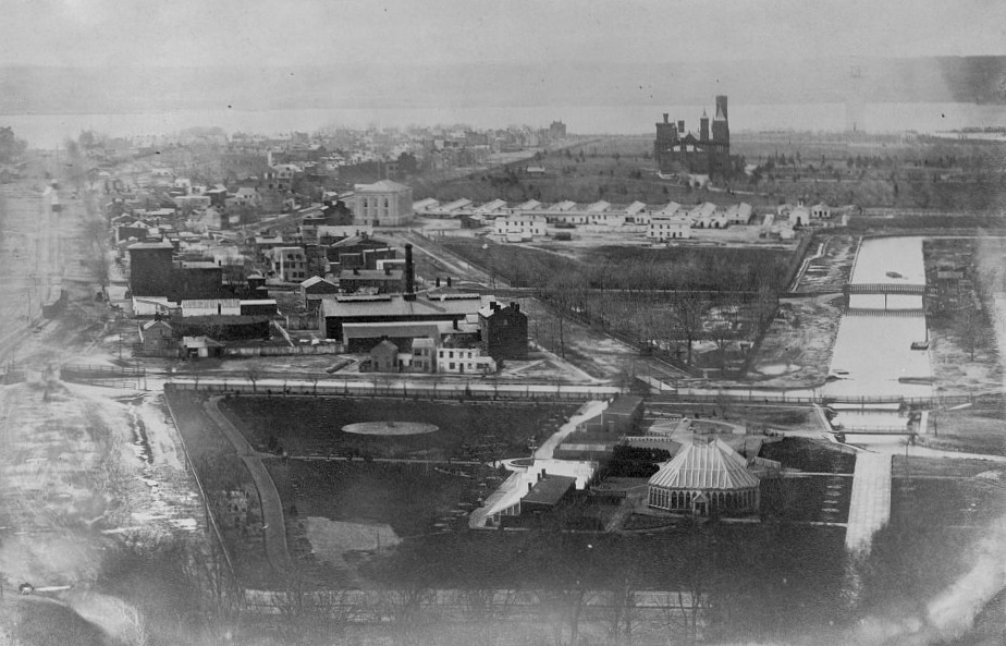
The Island and Old St. Anthony.jpg - Eco84

The Big Depot and It's Friends.jpg - Eco84

USS Hancock (CVA-19) in San Francisco Bay on 3 March 1969.jpg - Cobatfor

84th Fighter-Interceptor Squadron McDonnell F-101Bs over the Golden Gate Bridge.jpg - Connor7617

PBY-1 Catalinas of VP-9 over the Golden Gate Bridge in May 1937.jpg - Cobatfor
South National Mall Washington DC 1863.jpg - Tim1965

Aerial view of the Glen Canyon Dam, 1965, US Bureau of Reclamation.jpg - Geo Swan

Prudential Sm.png - Daulisg

Photograph of Aerial View of Capitol and Federal Triangle, 1936 (13587899923).jpg - Vanished Account Byeznhpyxeuztibuo
Aerial view of Grafton, West Virginia LCCN2011636547.tif - Fæ
Oakland Naval Air Reserve Grumman S2F-1 Trackers in flight on 23 December 1956.jpg - Cobatfor

The Capitol and Mall, Washington, D. C. (3678123521).jpg - Fæ

The Mall, Washington, D. C. (3678940338).jpg - Fæ

The Big Depot and It's Friends (cropped).jpg - Monopoly31121993
Aerial-view-of-Rexford-NY-showing-location-of-amusement-park.jpg - F6xJLa2myqx32u2ghj

1962 - View Of Central Buisness District Looking Northeast - Allentown PA.jpg - Atwngirl

Aerial view of CCAFS Industrial Area, 1966 (KSC-66C-8056).jpg - Huntster

Aerial view of CCAFS Hangar S, 1963 (LOC-63-4897).jpg - Huntster

Aerial view of CCAFS Hangar N, 1962 (LOC-62-162).jpg - Huntster

Aerial view of Hangar AE before additions, 1961 (PL-61-90012).jpg - Huntster

Aerial view of Hangar AE after additions, 1964 (KSC-64-10286).jpg - Huntster

Jefferson memorial aerial 9c841eb5c7dd0373287ecb4cb0066aa1.jpg - Slowking4

Twin bridges marriott aerial eea50d47356a82474625f8b10bc9346f.jpg - Slowking4

Jefferson memorial aerial 1948fb995807bef84a37f96873d5d0ea.jpg - Slowking4

Tidal basin aerial b260f91686a6bc5af276f0ac2705c8d8.jpg - Slowking4
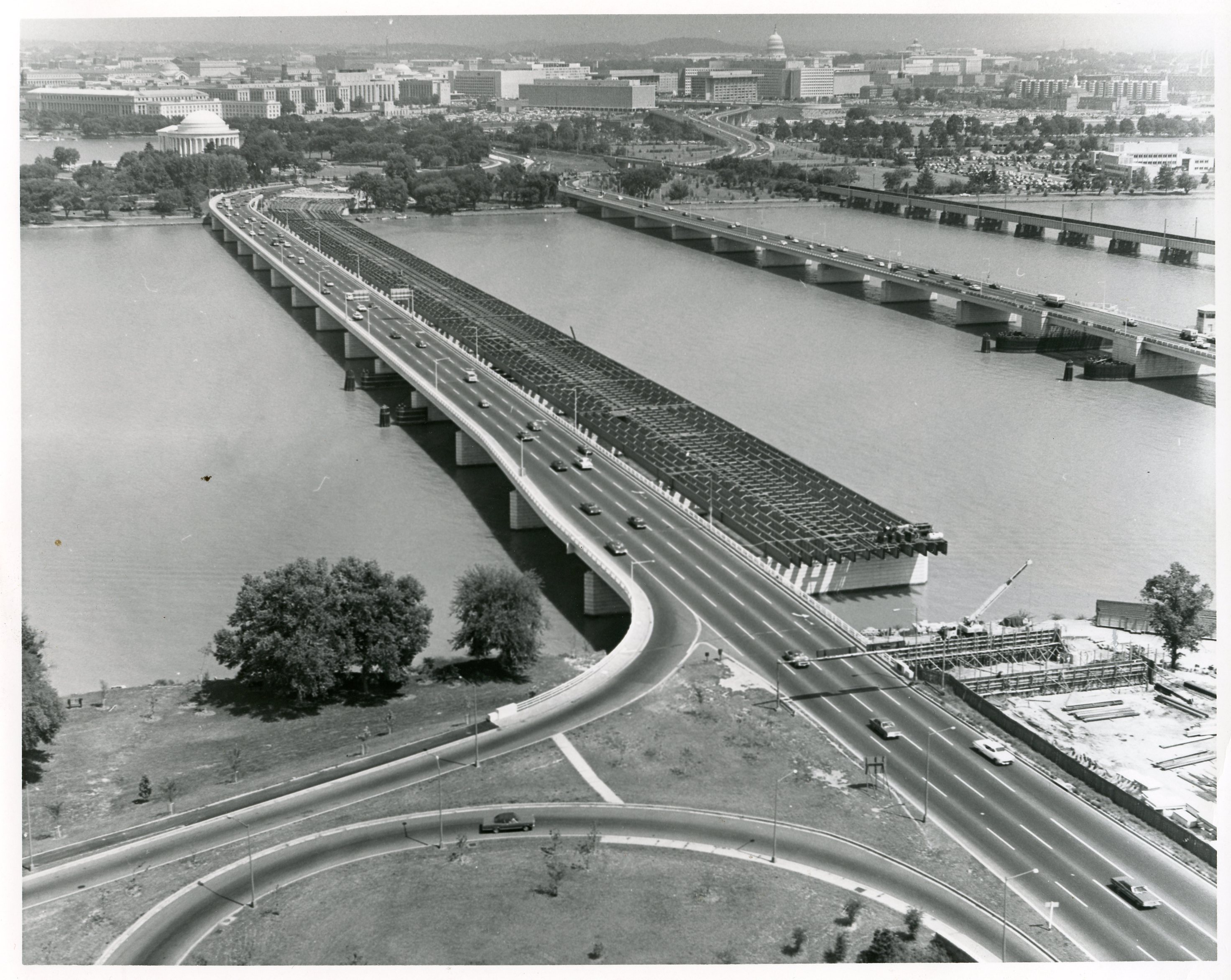
14th street bridge aerial c04055058dfd70e4a67dfe9f17d14f60.jpg - Slowking4

111-SC-1248 - Caproni airplane in flight from Langley Field, Hampton, VA to Washington D.C. - Aerial view of the United States Capitol and surroundings - NARA - 55163821.jpg - US National Archives bot

1951 03 21 - NARA ON004379 -471 - Nr 172 per Seth Washburne and The Thirsty 13th.jpg - Sethpw

1947 10 11 - NARA ON003001-426 - Nr 608 per Seth Washburne and The Thirsty 13th.jpg - Sethpw

1951 03 21 - NARA ON004379 - 471 rotated (from Seth Washburne for The Thirsty 13th).jpg - Sethpw

Photograph of Aerial View of Capitol and Federal Triangle, 1936 (3873916673).jpg - Artix Kreiger 2

Het Capitool, Bestanddeelnr 921-6081.jpg - Jeff5102

Southern Freeway construction at Balboa Park, 1964.jpg - Pi.1415926535

Aerial view of Washington, D.C., looking north toward White House LCCN2016889054.jpg - Fæ

Aerial view looking toward U.S. Capitol with snow, Washington, D.C. LCCN2016891199.jpg - Fæ

80-G-457011 (28571515505).jpg - Hiàn (alt)

80-G-454982 (31734220046).jpg - Hiàn (alt)
Confluence of Clearwater River (left) and Snake River, showing Lewiston, Idaho (CURTIS 492).jpeg - BMacZeroBot

P403A McNary Dam, Oregon and Washington 1 (22488643612).jpg - Tyler ser Noche

P403A McNary Dam, Oregon and Washington 2 (22502063755).jpg - Tyler ser Noche

Looking east toward Mount Hood across the Willamette River in Portland, Oregon, circa 1887 (AL+CA 1556).jpg - BMacZeroBot

Bird's-eye view of the Umatilla River Bridge in Pendleton, Oregon, 1910 (AL+CA 1790).jpg - BMacZeroBot

Aerial view of Nome, Alaska, between 1900 and 1908 (AL+CA 6601).jpg - BMacZeroBot

Kukak Glacier, mountain glacier with bergschrund, August 24, 1960 (GLACIERS 7018).jpg - BMacZeroBot

Alaska - Mt. McKinley - NARA - 23940959.jpg - US National Archives bot
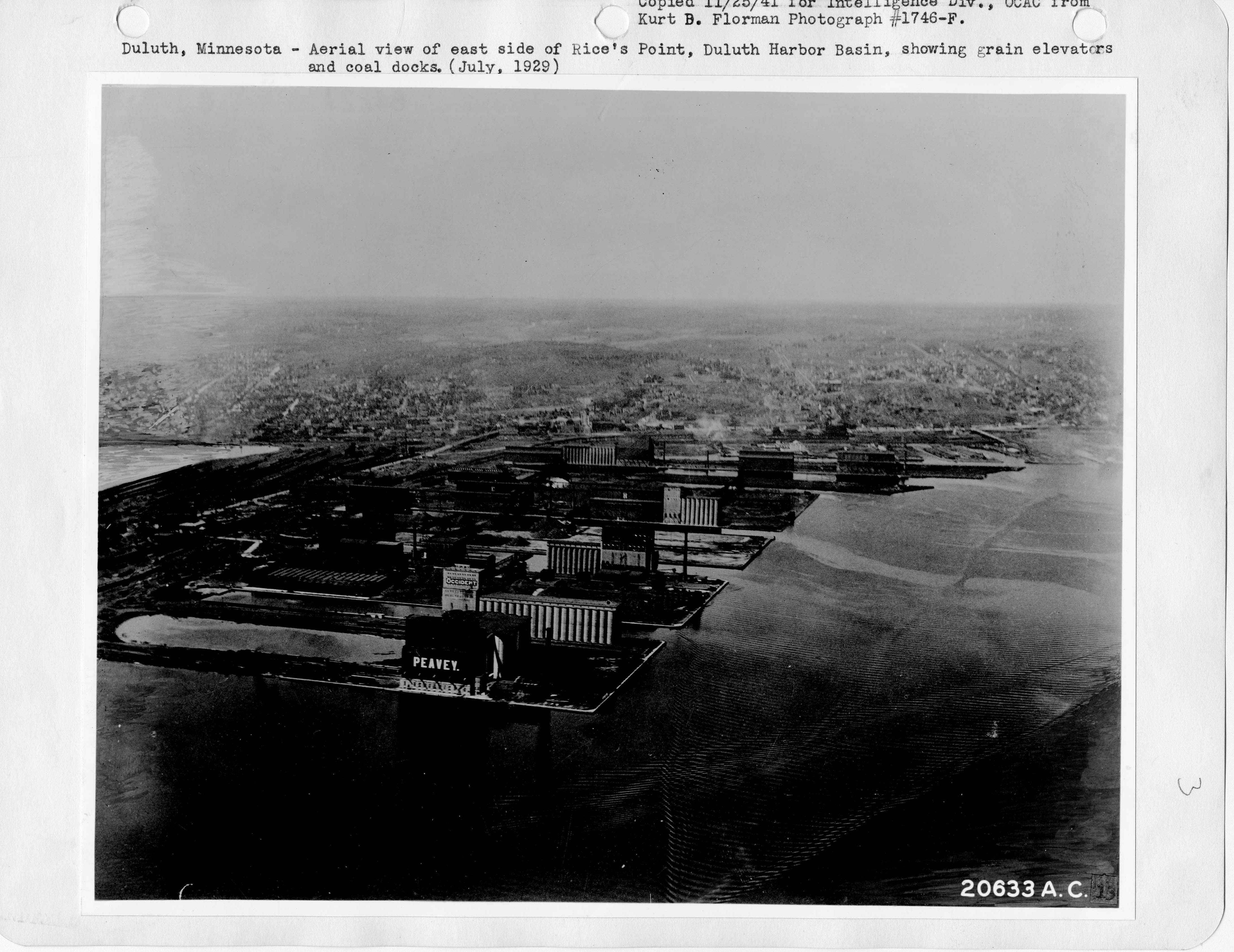
Minnesota - Duluth - NARA - 23941595.jpg - US National Archives bot

Minnesota - Duluth - NARA - 23941597.jpg - US National Archives bot

Minnesota - Duluth - NARA - 23941599.jpg - US National Archives bot

Minnesota - Duluth - NARA - 23941601.jpg - US National Archives bot

Minnesota - Duluth - NARA - 23941603.jpg - US National Archives bot

Minnesota - Duluth - NARA - 23941605.jpg - US National Archives bot

Minnesota - Minneapolis - NARA - 23941613.jpg - US National Archives bot

Minnesota - St.Paul - NARA - 23941619.jpg - US National Archives bot

Minnesota - St.Paul - NARA - 23941623.jpg - US National Archives bot

Minnesota - St.Paul - NARA - 23941625.jpg - US National Archives bot

-CALIFORNIA-L-0028- Sherman Island Flood (50006741643).jpg - Kingofthedead

Aerial View of Sentinel Project Site at Camp Curtis Guild, Reading, Massachusetts - DPLA - eb872bb1209760685916eeb1911e79f2.jpg - DPLA bot
Aerial view capitol with snow 41953a (crop).tif - John P. Sadowski (NIOSH)

Plum Brook Station (9467810678) (cropped).jpg - Huntster
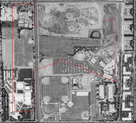
UR Fraternity Lodge map, 1968.tif - Bdl2001
HISTORIC IMAGE- AERIAL VIEW WITH THE CEMETERY IN BACKGROUND. PHOTOGRAPH 29 OCTOBER 1959. NCA HISTORY COLLECTION. - Black Hills National Cemetery, 20901 Pleasant Valley Drive, Sturgis, HALS SD-2-22 (cropped).tif - TCMemoire
HISTORIC IMAGE- AERIAL VIEW WITH THE CEMETERY IN BACKGROUND. PHOTOGRAPH SEPTEMBER 1976. NCA HISTORY COLLECTION. - Black Hills National Cemetery, 20901 Pleasant Valley Drive, Sturgis, HALS SD-2-21 (cropped).tif - TCMemoire

U.S. Naval Hospital, Portsmouth, NH- Aerial view.jpg - Maliepa

Charlestown, 1988 (49497296361).jpg - SecretName101

Mercury Control Center 4 June 1963.jpg - Gildir

1953 Boy Scout Jamboree Site (2).jpg - WPPilot

CA 57 I5 FHWA 1957 57713 13.jpg - TheImaCow

CA 61 I5 FHWA 1957 5772 18.jpg - TheImaCow

CA 62 I5 FHWA 1957 5772 21.jpg - TheImaCow

CA 12 I5 NARA 1960 304.jpg - TheImaCow

Guarantee Trust Building Demo 1957.jpg (e4a1ddc7-9944-43e7-813b-de29f2a91710).jpg - BMacZeroBot

LAColiseum-under-construction-1922.jpg - Fuzzy510
Exterior aerial plaza view, facing south. - Los Angeles Music Center, 135 North Grand Avenue, Los Angeles, Los Angeles County, CA HABS CA-2780-22.tif - Fæ
AERIAL VIEW OF PIER, LOOKING EAST, WITH CITY OF HUNTINGTON BEACH IN BACKGROUND - Huntington Beach Municipal Pier, Pacific Coast Highway at Main Street, Huntington Beach, Orange HAER CAL,30-HUBE,1-4.tif - Fæ

Gilpin Court (4990236941).jpg - File Upload Bot (Magnus Manske)

War Memorial (4990842450).jpg - File Upload Bot (Magnus Manske)

Four Level Interchange.jpg - NE2

LAUPT Aerial late 1990s.jpg - Lordkinbote~commonswiki
Aerial view of partially closed bridge from above Cerritos Channel facing northeast. - Henry Ford Bridge, Spanning Cerritos Channel, Los Angeles-Long Beach Harbor, Los Angeles, HAER CAL,19-LOSAN,75-7.tif - Fæ

Aerial Photograph of the Golden Gate Bridge being Constructed in San Francisco, California - NARA - 7455640.jpg - US National Archives bot

AD-1 and F8F-1 (4683832505).jpg - File Upload Bot (Magnus Manske)

Aerial view of plane flying over the Golden Gate Bridge before completion.jpg - Yann

California - San Francisco - NARA - 23935567.jpg - US National Archives bot

California - San Francisco - NARA - 23935607.jpg - US National Archives bot

California - San Francisco - NARA - 23935605.jpg - US National Archives bot

US Navy aircraft carriers passing under the Golden Gate Bridge in November 1936.jpg - Cobatfor

The Golden Gate Bridge under construction.jpg - Yann

Goodyear FG-1D (4807589920).jpg - File Upload Bot (Magnus Manske)

Luscombe 8E Silhouette (4540949215).jpg - File Upload Bot (Magnus Manske)

United 377 over Golden Gate.jpg - Spartan7W

Martin XPB2M-1R Mars over Golden Gate Bridge c1944.jpeg - Cobatfor

Luscombe 8E (6004154304).jpg - File Upload Bot (Magnus Manske)
Lockheed C-121G-LO 54-4052 1501st Air Transport Group over Golden Gate Bridge.jpg - Bwmoll3

F8U-1 VF-124 Golden GateNAN5 60.jpg - Cobatfor

Douglas KA-3B Sykwarriors of VAQ-135 in flight over California, circa in 1973.jpg - Cobatfor

AT-6A over Golden Gate Bridge 1947 (4776002083).jpg - File Upload Bot (Magnus Manske)

F8F-1 NASA.jpg - Caddyshack01
( FET 59-5593 ) AERIAL VIEW LOOKING EAST SHOWING OVERALL VIEW OF TAN 629 HANGAR, 100 PER CENT COMPLETE. PHOTO DATE- OCTOBER 28, 1959. - Idaho National Engineering Laboratory, HAER ID,12-SCOVI.V,1A-28.tif - Fæ

DMHS near Four Level Interchange, 1999.jpg - Reppop