Wikimedi'Òc
Modes d'emploi

Cet album fait partie des albums
Cet album photos contient les sous-albums suivants :


Map of vegetation features of British India, published in the 'Imperial Gazetteer of India' (Vol. XXVI, Atlas; 1931 revised edition; plate no. 5).jpg - MaplesyrupSushi

India wine regions.JPG - File Upload Bot (Magnus Manske)

K-M Road Vegetation Map.jpg - Marcus334

Azolla pinnata india distribution.svg - DieBucheBot

Azolla pinnata india distribution.jpg - Veryhuman

Equisetum ramosissimum india distribution.png - Veryhuman
Isoetes india distribution.png - Veryhuman

Indian Banyan India distribution.png - Veryhuman

Areale Boswellia ovalifoliolata.jpg - Mauro Raffaelli

Tobacco ban India.svg - AnonMoos
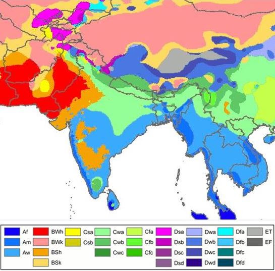
India and South Asia Köppen climate map with legend.jpg - 2know4power

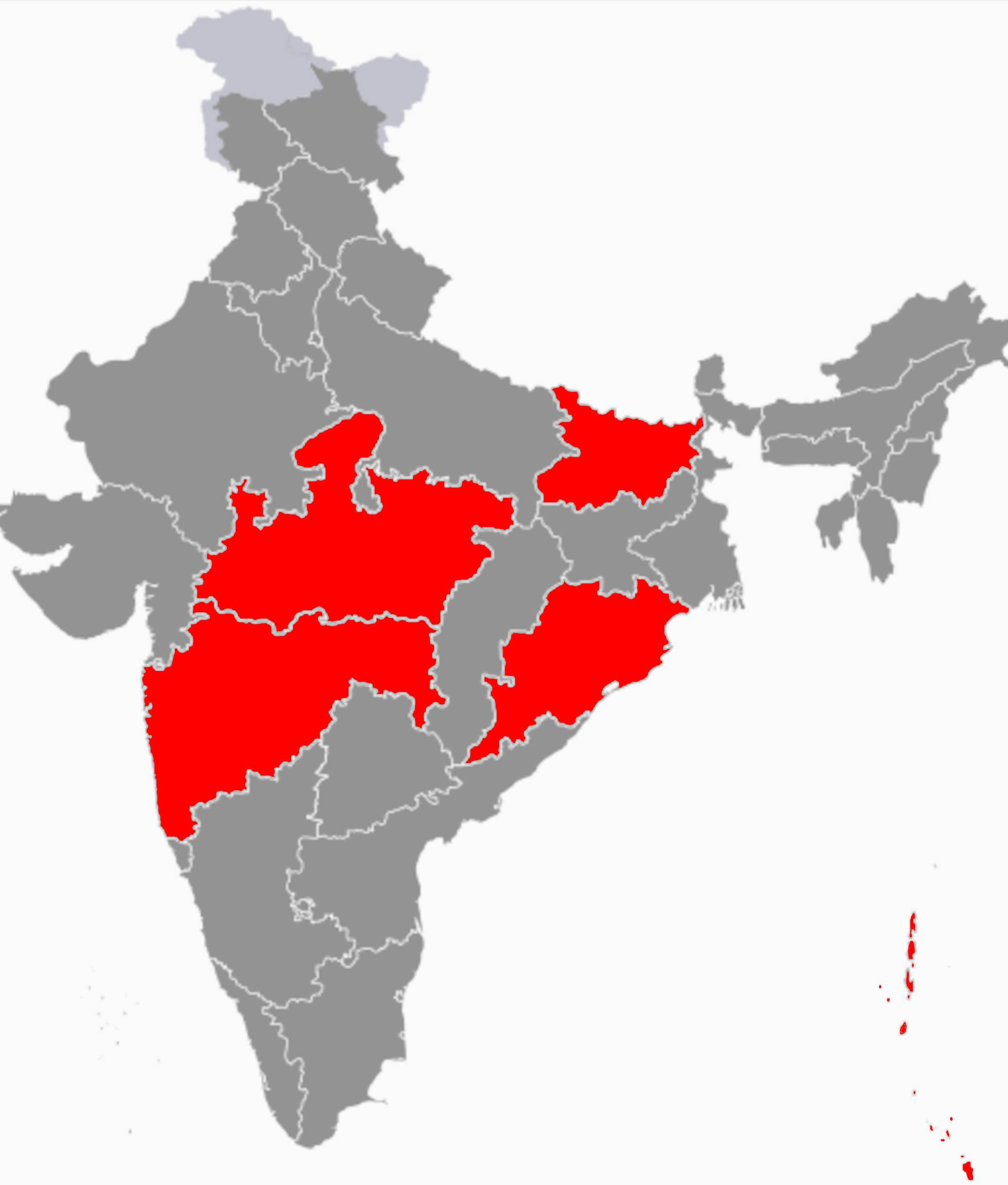
India's forest cover- by state (percentage of land area).png - Kaustavdibya

Kerala Threatened Bird Species (2021) vs Silver Line.png - Manojk

Kerala Bird Species (2021) vs Silver Line.png - Manojk

Minervarya pentali map.svg - Jebbles

Nasikabatrachus bhupathi map.svg - Jebbles
Kerala forest types.pdf - Nairpv
Kerala forest divisions.pdf - Nairpv

Map showing the type locality of Eurindicus bhugarbha.png - Arjunwild
Asanada agharkari range.png - Cremastra