Wikimedi'Òc
Modes d'emploi

Cet album fait partie des albums
Cet album photos contient les sous-albums suivants :


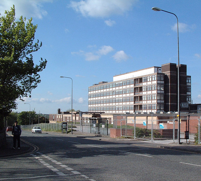
Billinge Maternity Hospital.jpg - BetacommandBot

Bispham Methodist Church - geograph.org.uk - 9622.jpg - GeographBot

Disused Brick Works - Smethurst Road, Billinge - geograph.org.uk - 11737.jpg - GeographBot

Farmland to the West of Bispham Hall - Billinge - geograph.org.uk - 11753.jpg - GeographBot

Farmland to the West of Bispham Hall - Billinge - geograph.org.uk - 11754.jpg - GeographBot

Farmland to the west of Bispham Hall - Billinge - geograph.org.uk - 11756.jpg - GeographBot

Farmland to the west of Bispham Hall - Billinge - geograph.org.uk - 11757.jpg - GeographBot

Fish Pond - geograph.org.uk - 11748.jpg - GeographBot

Gantley Avenue - geograph.org.uk - 11771.jpg - GeographBot

Gantley Road and Upholland Road - geograph.org.uk - 11765.jpg - GeographBot

Winstanley College - geograph.org.uk - 19340.jpg - GeographBot

Bispham Hall Scout Camp - geograph.org.uk - 52281.jpg - GeographBot

Footpath north west of Winstanley Hall - geograph.org.uk - 47832.jpg - GeographBot

Motorway underpass at Billinge Higher End and Winstanley, in Manchester, England.jpg - GeographBot

M6 junction 26 - geograph.org.uk - 47844.jpg - GeographBot

No More Patients - geograph.org.uk - 47811.jpg - GeographBot

Park Road - geograph.org.uk - 47806.jpg - GeographBot

Sunset from Billinge Hill - geograph.org.uk - 310146.jpg - GeographBot

The Meadow, Billinge - geograph.org.uk - 319807.jpg - GeographBot

Ambulance Station, Upholland Road Billinge - geograph.org.uk - 420353.jpg - GeographBot

Billinge Hospital Demolition - geograph.org.uk - 420344.jpg - GeographBot

Date Stone on Methodist Chapel, Billinge - geograph.org.uk - 420373.jpg - GeographBot

Billinge Hospital - geograph.org.uk - 702378.jpg - GeographBot

Billinge geology - Shale outcrop - geograph.org.uk - 877117.jpg - GeographBot

Rainbow over Billinge Plantation - geograph.org.uk - 878758.jpg - GeographBot

Crank Road from Billinge Plantation - geograph.org.uk - 889382.jpg - GeographBot

England and Sons - geograph.org.uk - 887946.jpg - GeographBot

The smallest field in England^ - geograph.org.uk - 887931.jpg - GeographBot

Billinge Plantation - geograph.org.uk - 902471.jpg - GeographBot

Stone terrace, UpHolland Road - geograph.org.uk - 902421.jpg - GeographBot

Wiswall's Farm - geograph.org.uk - 952715.jpg - GeographBot

Running Horses public house - geograph.org.uk - 1037540.jpg - GeographBot

The Unicorn public house - geograph.org.uk - 1037535.jpg - GeographBot

Billinge plantation - geograph.org.uk - 1053005.jpg - GeographBot

Signs that this was once the site of a quarry - geograph.org.uk - 1053016.jpg - GeographBot

Fishing at Island Dam - geograph.org.uk - 1064175.jpg - GeographBot

Farmland East of Billinge Plantation - geograph.org.uk - 1098176.jpg - GeographBot

Converted Barns off Upholland road, Billinge - geograph.org.uk - 1100999.jpg - GeographBot

From Billinge Hill - geograph.org.uk - 1100994.jpg - GeographBot

Billinge Hill from Chair Wood - geograph.org.uk - 1114571.jpg - GeographBot

Fallen Trees in Chair Wood - geograph.org.uk - 1114536.jpg - GeographBot

Island Dam Frozen Over - geograph.org.uk - 1114641.jpg - GeographBot

Billinge Lodge - geograph.org.uk - 1134206.jpg - GeographBot

Hunters Chase, Billinge - geograph.org.uk - 1230783.jpg - GeographBot

England and Sons - Established 1850 - geograph.org.uk - 1598088.jpg - GeographBot

Island Dam, Billinge - geograph.org.uk - 1633682.jpg - GeographBot

Velvet Shank fungus ( Flammulina velutipes ) - geograph.org.uk - 1631684.jpg - GeographBot

Crank Road Closed - geograph.org.uk - 1657178.jpg - GeographBot

Igloo in Billinge - geograph.org.uk - 1651606.jpg - GeographBot

Winstanley College (geograph 3540970).jpg - Voello

The path along the railway - geograph.org.uk - 1838007.jpg - GeographBot

The path by the site of the old brick works - geograph.org.uk - 2059974.jpg - GeographBot

Upholland Road Higher End - geograph.org.uk - 3659293.jpg - GeographBot

The Unicorn pub, Higher End - geograph.org.uk - 4017154.jpg - GeographBot

Trevelyan Drive, Billinge - geograph.org.uk - 4164390.jpg - GeographBot

Rear of old nurses home, Billinge Hospital - geograph.org.uk - 4211766.jpg - GeographBot

North end of the derelict Billinge Hospital building - geograph.org.uk - 4302489.jpg - GeographBot

The Views - geograph.org.uk - 4302510.jpg - GeographBot

Rear of Derelict Billinge Hospital buildings - geograph.org.uk - 4311615.jpg - GeographBot

End of the line - geograph.org.uk - 4320772.jpg - GeographBot

Sluice at Sand Brook, Billinge Higher End - geograph.org.uk - 4320780.jpg - GeographBot

Footpaths at Billinge Higher End - geograph.org.uk - 4320797.jpg - GeographBot

Sheep eating carrots at Brownlow, Billinge - geograph.org.uk - 4402213.jpg - GeographBot

The Views - geograph.org.uk - 4599818.jpg - GeographBot

Straw bales at Moss Vale Farm, Billinge - geograph.org.uk - 4660134.jpg - GeographBot

The Views - geograph.org.uk - 4714721.jpg - GeographBot

The Views - geograph.org.uk - 4780777.jpg - GeographBot

The Views - geograph.org.uk - 4951282.jpg - GeographBot

The Views, Smethurst Road, Billinge - geograph.org.uk - 4951284.jpg - GeographBot

New Substation at The Views - geograph.org.uk - 4951293.jpg - GeographBot

The Views, Smethurst Road, Billinge - geograph.org.uk - 4951297.jpg - GeographBot

New parking area for fishers near The Views - geograph.org.uk - 4951302.jpg - GeographBot

The red brick part of Billinge Hospital now demolished - geograph.org.uk - 5142291.jpg - GeographBot

The Billinge Hospital Site - geograph.org.uk - 5196267.jpg - GeographBot

The old Billinge Hospital Site - geograph.org.uk - 5196268.jpg - GeographBot

Construction beginning on the old Billinge Hospital Maternity Wing Site - geograph.org.uk - 5196270.jpg - GeographBot

Field drain West of Moss Wood, Billinge - geograph.org.uk - 5196275.jpg - GeographBot

The Views, Smethurst Road, Billinge - geograph.org.uk - 5196687.jpg - GeographBot

Shepherding at Brownlow, Billinge - geograph.org.uk - 5196689.jpg - GeographBot

Construction work on the former Billinge Hospital site - geograph.org.uk - 5202837.jpg - GeographBot

Outside Londis, Upholland Road, Billinge - geograph.org.uk - 5202839.jpg - GeographBot

Late autumn in Billinge Plantation - geograph.org.uk - 5211034.jpg - GeographBot

Housing Development at the former Billinge Hospital Site - geograph.org.uk - 5298959.jpg - GeographBot

Storm Doris Fells Trees in Billinge Plantation - geograph.org.uk - 5298963.jpg - GeographBot

Storm Doris Fells Three Trees in Billinge Plantation - geograph.org.uk - 5298967.jpg - GeographBot

Footpath to Greenslate Water Meadows - geograph.org.uk - 5376422.jpg - GeographBot

Old Barn at Plane Tree Farm, Billinge - geograph.org.uk - 5377782.jpg - GeographBot

Housing Development at the former Billinge Hospital Site - geograph.org.uk - 5429494.jpg - GeographBot

Entrance road for housing development at the old Billinge Hospital site - geograph.org.uk - 5429497.jpg - GeographBot

The Views, Billinge - geograph.org.uk - 5453540.jpg - GeographBot

Stocks at Windy Arbour (geograph 6310555).jpg - Sic19

Bales, East of Upholland Road, Billinge - geograph.org.uk - 5523125.jpg - GeographBot

The Bispham Lodge Pub - geograph.org.uk - 5537053.jpg - GeographBot

Trimming the hedgerows on Upholland Road - geograph.org.uk - 5541356.jpg - GeographBot

Building Higher End Close, Billinge - geograph.org.uk - 5541363.jpg - GeographBot

House building on Higher End Close, Billinge - geograph.org.uk - 5541373.jpg - GeographBot

Coffee Kitchen on Upholland Road, Billinge - geograph.org.uk - 5541375.jpg - GeographBot

Alleyway off Cross Lane, Billinge - geograph.org.uk - 5541394.jpg - GeographBot

Moss Road, Billinge - geograph.org.uk - 5541439.jpg - GeographBot

Flooding on Upholland Road, Billinge - geograph.org.uk - 5637542.jpg - GeographBot

House building on the former Billinge Hospital Site - geograph.org.uk - 5646923.jpg - GeographBot