Wikimedi'Òc
Modes d'emploi

Cet album fait partie des albums
Cet album photos contient les sous-albums suivants :


Gore Hill - geograph.org.uk - 40210.jpg - GeographBot

Bridlepath sign near telegraph hill - geograph.org.uk - 82173.jpg - GeographBot

Cross and Hand - geograph.org.uk - 81222.jpg - GeographBot

High Stoy - geograph.org.uk - 80748.jpg - GeographBot

Woodland track Highfield Hill Batcombe Dorset - geograph.org.uk - 158273.jpg - GeographBot

Batcombe Down - geograph.org.uk - 247645.jpg - GeographBot

Bridlepath Leading To Up Cerne - geograph.org.uk - 247642.jpg - GeographBot

Bridlepath To Up Sydling Farm - geograph.org.uk - 248516.jpg - GeographBot

Copse, Wether Hill - geograph.org.uk - 247613.jpg - GeographBot

Clay Pigeon Go-Kart Circuit, Wardon Hill - geograph.org.uk - 295700.jpg - GeographBot

Bridleway on East Hill - geograph.org.uk - 318850.jpg - GeographBot

Newlands Farm - geograph.org.uk - 489835.jpg - GeographBot

Cottage at Batcombe - geograph.org.uk - 554862.jpg - GeographBot

Haydon Lane - geograph.org.uk - 607062.jpg - GeographBot

Horchester Copse from Haydon Lane - geograph.org.uk - 607057.jpg - GeographBot

Avenue of trees, Wriggle River Lane - geograph.org.uk - 806921.jpg - GeographBot

Batcombe crossroads - geograph.org.uk - 806941.jpg - GeographBot

Cross-in -Hand stone. - geograph.org.uk - 808362.jpg - GeographBot

Entrance gate to Newlands Farm - geograph.org.uk - 806937.jpg - GeographBot

Batcombe Hill - geograph.org.uk - 912252.jpg - GeographBot

Batcombe Hill in the Snow - geograph.org.uk - 1148385.jpg - GeographBot

Row Hill Coppice - geograph.org.uk - 1148387.jpg - GeographBot

Snowy Gateway on Batcombe Down - geograph.org.uk - 1148388.jpg - GeographBot

Bull^ Keep Out^ - geograph.org.uk - 1318428.jpg - GeographBot

Countryside near Batcombe - geograph.org.uk - 1318429.jpg - GeographBot

Helpful Road Signs - geograph.org.uk - 1318430.jpg - GeographBot

Grazing Heifers - Batcombe Hill - geograph.org.uk - 1553895.jpg - GeographBot

Bridleway near Batcombe - geograph.org.uk - 1576292.jpg - GeographBot

Cattle on Batcombe Hill - geograph.org.uk - 1576279.jpg - GeographBot

Footpath near Batcombe - geograph.org.uk - 1576263.jpg - GeographBot

Pheasant on the bridleway, Hilfield - geograph.org.uk - 1576245.jpg - GeographBot

Batcombe Hill, View from Road - geograph.org.uk - 1733882.jpg - GeographBot

Church Farm Farmhouse. - geograph.org.uk - 1739684.jpg - GeographBot

Snowdrops, Galanthus nivalis - geograph.org.uk - 1735158.jpg - GeographBot

View towards Church Farm - geograph.org.uk - 1735145.jpg - GeographBot

Minternes Folly, Batcombe - geograph.org.uk - 1741887.jpg - GeographBot

View across fields to Batcombe - geograph.org.uk - 1741039.jpg - GeographBot

Hilfield, a carpet of bluebells on Gore Hill - geograph.org.uk - 1876074.jpg - GeographBot

Hilfield, gateway to bluebells - geograph.org.uk - 1876084.jpg - GeographBot

Hilfield, a bluebell in close-up - geograph.org.uk - 1876088.jpg - GeographBot

Batcombe, heading down into the village - geograph.org.uk - 1876111.jpg - GeographBot

Batcombe, postbox № DT2 28 and a horse - geograph.org.uk - 1876131.jpg - GeographBot

Batcombe, postbox and barn - geograph.org.uk - 1876135.jpg - GeographBot

Hilfield, the Friary of St. Francis - geograph.org.uk - 1876142.jpg - GeographBot

Hilfield, postbox № DT2 117, the Friary - geograph.org.uk - 1876148.jpg - GeographBot

Gore Hill, Cross and Hand - geograph.org.uk - 1913130.jpg - GeographBot

Crucifix beyond the Hidden Garden of Hilfield Friary - geograph.org.uk - 2469111.jpg - GeographBot

The Bell at Hilfield Friary - geograph.org.uk - 2469180.jpg - GeographBot

Hilfield, the Friary of Saint Francis - geograph.org.uk - 2469191.jpg - GeographBot

Inside the Chapel at the Friary of Saint Francis - geograph.org.uk - 2469204.jpg - GeographBot

Minor road near Hilfield - geograph.org.uk - 2476028.jpg - GeographBot

Batcombe, Panoramic View of the Down - geograph.org.uk - 2996649.jpg - GeographBot

Too close to be coincidence - geograph.org.uk - 3123601.jpg - GeographBot

Cross and Hand - geograph.org.uk - 4465503.jpg - GeographBot

Road passing Cross and Hand - geograph.org.uk - 4465517.jpg - GeographBot

Batcombe Hill - geograph.org.uk - 4465522.jpg - GeographBot

Mixen, Batcombe Hill - geograph.org.uk - 4465529.jpg - GeographBot

Road, Batcombe Hill - geograph.org.uk - 4465532.jpg - GeographBot

Batcombe Hill - geograph.org.uk - 4465538.jpg - GeographBot

Batcombe - geograph.org.uk - 4465542.jpg - GeographBot

East Hill, gate - geograph.org.uk - 4722726.jpg - GeographBot

East Hill, minor road - geograph.org.uk - 4723821.jpg - GeographBot

East Hill, gate - geograph.org.uk - 4723829.jpg - GeographBot

East Hill, farm road - geograph.org.uk - 4723835.jpg - GeographBot

Gore Hill, byway - geograph.org.uk - 4723842.jpg - GeographBot

Gore Hill, bridleway marker - geograph.org.uk - 4723875.jpg - GeographBot

Benchmark on barn at Church Farm, Batcombe - geograph.org.uk - 4791555.jpg - GeographBot

Barn, Church Farm, Batcombe - geograph.org.uk - 4791557.jpg - GeographBot

The hamlet of Batcombe from West Hill - geograph.org.uk - 4816024.jpg - GeographBot

West Hill trigpoint - geograph.org.uk - 4833919.jpg - GeographBot

Above Batcombe, near Hendover Coppice - geograph.org.uk - 5038059.jpg - GeographBot

Stile Way, near Batcombe - geograph.org.uk - 5038063.jpg - GeographBot
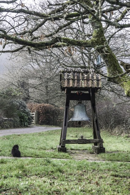
Bell and cat at the Friary of St Francis - geograph.org.uk - 5650936.jpg - GeographBot

Scotley Farm - geograph.org.uk - 5712215.jpg - GeographBot

The amazing Batcombe turn off on Gore Hill - geograph.org.uk - 5712221.jpg - GeographBot

Please drive peacefully, Approach road to Hilfield Friary - geograph.org.uk - 6880234.jpg - GeographBot

Cloister, Hilfield Friary - geograph.org.uk - 6880244.jpg - GeographBot

Church, Friary of St. Francis, Hilfield, Dorset - geograph.org.uk - 6880251.jpg - GeographBot

Bell, Hilfield Friary - geograph.org.uk - 6880266.jpg - GeographBot

Downland in summer - geograph.org.uk - 7032517.jpg - GeographBot

The Friary Hilfield - geograph.org.uk - 7173475.jpg - GeographBot

Field near Hilfield Friary - geograph.org.uk - 7329636.jpg - GeographBot

Flowers Farm Trout Lakes - geograph.org.uk - 7329638.jpg - GeographBot

Fingerpost, Wriggle River - geograph.org.uk - 7329641.jpg - GeographBot

A glimpse of chalk, Batcombe - geograph.org.uk - 7329643.jpg - GeographBot

Batcombe Down - geograph.org.uk - 7329646.jpg - GeographBot

St Mary Magdalene Church, Batcombe, Dorset - geograph.org.uk - 7846649.jpg - GeographBot