Wikimedi'Òc
Modes d'emploi

Cet album fait partie des albums
Cet album photos contient les sous-albums suivants :


Roman Road, Bartestree - geograph.org.uk - 146267.jpg - GeographBot

The Gateway Centre, Bartestree - geograph.org.uk - 143470.jpg - GeographBot

Apple Trees in Blossom, Pomona Farm - geograph.org.uk - 293333.jpg - GeographBot

Pomona Barns, Bartestree. - geograph.org.uk - 293084.jpg - GeographBot

Pomona Farm, Bartestree. - geograph.org.uk - 293082.jpg - GeographBot

Footpath at Bartestree - geograph.org.uk - 722676.jpg - GeographBot

Hagley Park, Bartestree - geograph.org.uk - 722687.jpg - GeographBot

Hairdressers, Bartestree - geograph.org.uk - 722698.jpg - GeographBot

Half-timbered cottage and outbuildings - geograph.org.uk - 722702.jpg - GeographBot

Phone box at the crossroads in Bartestree - geograph.org.uk - 722696.jpg - GeographBot

Timber outbuilding with corrugated roof - geograph.org.uk - 722693.jpg - GeographBot

Victorian postbox at Bartestree, dated 1893 - geograph.org.uk - 722673.jpg - GeographBot

View over farmland at Bartestree - geograph.org.uk - 722663.jpg - GeographBot

Village shop, Bartestree - geograph.org.uk - 722700.jpg - GeographBot

A converted barn at Longworth Bridge - geograph.org.uk - 1012522.jpg - GeographBot

Orchard at Bartestree - geograph.org.uk - 1293266.jpg - GeographBot

Lane And Cottage Near Hill End - geograph.org.uk - 1355851.jpg - GeographBot

Longworth Lane - geograph.org.uk - 1355920.jpg - GeographBot

Old Bridge Marker on the A438 - geograph.org.uk - 7486916.jpg - GeographBot
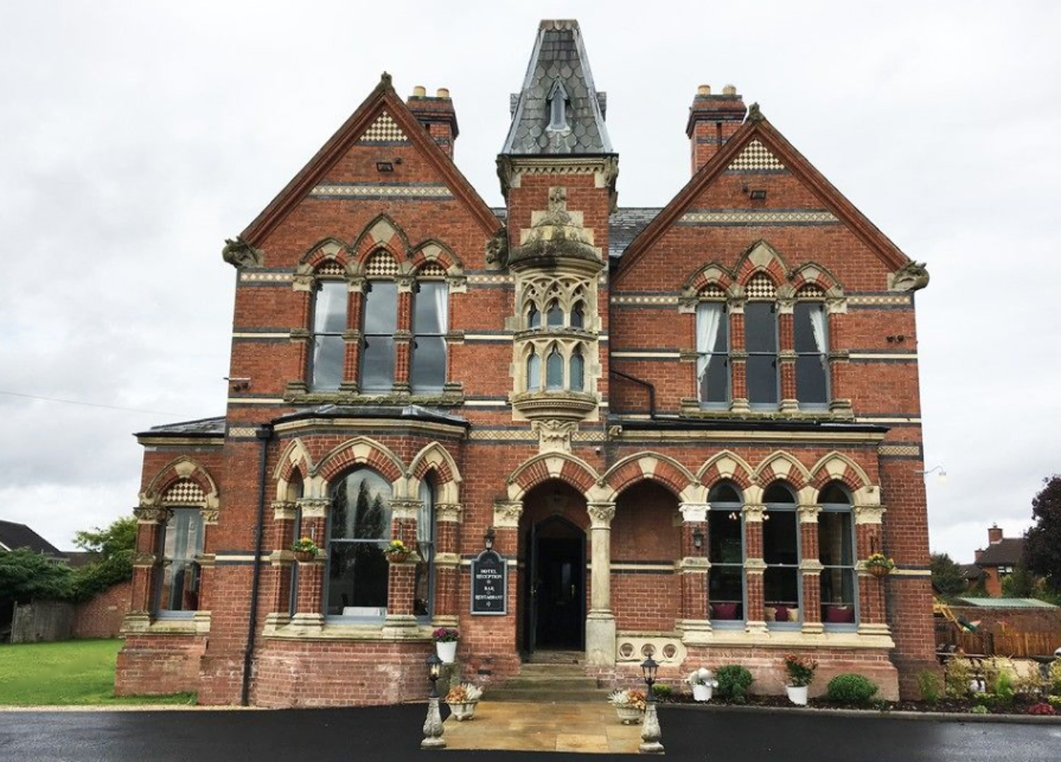
The Godwins Hotel Bartestree.jpg - Maypm

William Henry Godwin of Lugwardine.jpg - Maypm

Black Hole Lane - geograph.org.uk - 2200565.jpg - GeographBot

St Michael's Hospice, Bartestree - geograph.org.uk - 2335169.jpg - GeographBot

Former convent, Frome Park, Bartestree - geograph.org.uk - 2335178.jpg - GeographBot

Bartestree Convent and St. Michael's Hospice from Longworth Lane - geograph.org.uk - 2472872.jpg - GeographBot

Converted Oast House at Bartestree - geograph.org.uk - 2557484.jpg - GeographBot

The A438 between Dormington and Bartestree - geograph.org.uk - 3391265.jpg - GeographBot

Roman Road - geograph.org.uk - 4639974.jpg - GeographBot

Fruit boxes at Pomona Farm - geograph.org.uk - 4639977.jpg - GeographBot

Roman Road - geograph.org.uk - 4639979.jpg - GeographBot

Former Convent of our Lady of Charity and Refuge, Bartestree - geograph.org.uk - 5215203.jpg - GeographBot

Former Convent of our Lady of Charity and Refuge, Bartestree - geograph.org.uk - 5215222.jpg - GeographBot

Former Convent of our Lady of Charity and Refuge, Bartestree - geograph.org.uk - 5215286.jpg - GeographBot

Former Convent of our Lady of Charity and Refuge, Bartestree - geograph.org.uk - 5215351.jpg - GeographBot

Former Convent of our Lady of Charity and Refuge, Bartestree - geograph.org.uk - 5215385.jpg - GeographBot

Former Convent of our Lady of Charity and Refuge, Bartestree - geograph.org.uk - 5215427.jpg - GeographBot

Bartestree Convent - geograph.org.uk - 5357491.jpg - GeographBot

Bartestree Convent - geograph.org.uk - 5357494.jpg - GeographBot

Lodge near Bartestree - geograph.org.uk - 5462154.jpg - GeographBot

Ledbury 10 Miles - geograph.org.uk - 6943480.jpg - GeographBot

Gated farm track off the A438, Bartestree - geograph.org.uk - 6943482.jpg - GeographBot

A438, Bartestree - geograph.org.uk - 6943485.jpg - GeographBot

Hereford Road, Bartestree - geograph.org.uk - 7234934.jpg - GeographBot

A former orchard - geograph.org.uk - 7356130.jpg - GeographBot