Wikimedi'Òc
Modes d'emploi

Cet album fait partie des albums
Cet album photos contient les sous-albums suivants :


Barkisland Cricket Club - geograph.org.uk - 36735.jpg - GeographBot

Barkisland Hall - geograph.org.uk - 65551.jpg - GeographBot

Barkisland Vicarage - geograph.org.uk - 65567.jpg - GeographBot

Black Brook - geograph.org.uk - 52499.jpg - GeographBot

Farmland, Abbots Royd - geograph.org.uk - 36729.jpg - GeographBot

Footpath, Howroyd Lane - geograph.org.uk - 36736.jpg - GeographBot

Firth House Mills - geograph.org.uk - 52501.jpg - GeographBot

Stainland Road, Barkisland - geograph.org.uk - 65576.jpg - GeographBot

Stainland Dean - geograph.org.uk - 52537.jpg - GeographBot

View from Stainland Road towards Stainland - geograph.org.uk - 65583.jpg - GeographBot

Bottomley Clough, Barkisland - geograph.org.uk - 180053.jpg - GeographBot

Disused penstock next to the Black Brook, Stainland - geograph.org.uk - 182892.jpg - GeographBot

Foot of Steele Lane at Penny Hill, Barkisland, with base of mill chimney - geograph.org.uk - 180043.jpg - GeographBot

Footpath east of Calf Hey Farm, Barkisland - geograph.org.uk - 180084.jpg - GeographBot

Footpath from Penny Hill to Holme Bottom, Barkisland - geograph.org.uk - 180045.jpg - GeographBot

Gate with stile, Crow Wood Lane, Barkisland - geograph.org.uk - 180072.jpg - GeographBot

Holme Bottom Farm, Crow Wood Lane, Barkisland - geograph.org.uk - 180075.jpg - GeographBot

Ladder in place of ruined stile, Barkisland - geograph.org.uk - 182871.jpg - GeographBot

Outbuilding to Calf Hey Farm, Bottomley Lane, Barkisland - geograph.org.uk - 180051.jpg - GeographBot

Remains of walled footpath, Barkisland - geograph.org.uk - 182472.jpg - GeographBot

View of Barkisland Mill from the south - geograph.org.uk - 182458.jpg - GeographBot

View of Barkisland from the south-east - geograph.org.uk - 182461.jpg - GeographBot

View of Penny Hill from Intake, Steele Lane, Stainland - geograph.org.uk - 180116.jpg - GeographBot

View over Black Brook valley from above Intake, Steele Lane, Stainland - geograph.org.uk - 180124.jpg - GeographBot

View over the valley of the Black Brook from Crow Wood Lane, Barkisland - geograph.org.uk - 180066.jpg - GeographBot

View over the valley of the Black Brook from near Crow Wood Farm, Barkisland - geograph.org.uk - 180059.jpg - GeographBot

View towards Stainland from Pit Hill Lane, Barkisland - geograph.org.uk - 180077.jpg - GeographBot

Krumlin service reservoir - geograph.org.uk - 203256.jpg - GeographBot

Silver Street, Old Bank, Ripponden, Barkisland - geograph.org.uk - 224623.jpg - GeographBot

Wood near Pike Law Quarry, Saddleworth Road, Barkisland (2) - geograph.org.uk - 262260.jpg - GeographBot

Wood near Pike Law Quarry, Saddleworth Road, Barkisland - geograph.org.uk - 262254.jpg - GeographBot

Eastern earthwork, Meg Dike, Barkisland - geograph.org.uk - 288372.jpg - GeographBot

Meg Dike, Barkisland - geograph.org.uk - 288375.jpg - GeographBot

Dinosaur, Gallows Pole Hill - geograph.org.uk - 341818.jpg - GeographBot

Hey Croft Clough - geograph.org.uk - 374267.jpg - GeographBot

Hey Croft Clough - geograph.org.uk - 374271.jpg - GeographBot

Hey Lane - geograph.org.uk - 374275.jpg - GeographBot

Hollin Hey - geograph.org.uk - 373858.jpg - GeographBot

Hollin Hey Ruins - geograph.org.uk - 374251.jpg - GeographBot

Hollin Hey Ruins - geograph.org.uk - 374258.jpg - GeographBot

M62 Motorway, Hudson Croft - geograph.org.uk - 373817.jpg - GeographBot

Nab, Stainland Dean - geograph.org.uk - 374547.jpg - GeographBot

Spring Fields, Stainland Dean - geograph.org.uk - 374536.jpg - GeographBot

Highlee Knowl - geograph.org.uk - 604223.jpg - GeographBot

Barkisland Lower Hall - geograph.org.uk - 654179.jpg - GeographBot

Benchmark, Steele Lane, Barkisland - geograph.org.uk - 684961.jpg - GeographBot

Causeway, Barkisland - geograph.org.uk - 684759.jpg - GeographBot

Farm, Steele Lane, Barkisland - geograph.org.uk - 684899.jpg - GeographBot

Milestone on the B6114, Barkisland - geograph.org.uk - 684734.jpg - GeographBot

Ochre, Bank Royd Lane, Barkisland - geograph.org.uk - 684792.jpg - GeographBot

Spring and trough, Steele Lane, Barkisland - geograph.org.uk - 684860.jpg - GeographBot

Stile, Steele Lane, Barkisland - geograph.org.uk - 684833.jpg - GeographBot

Trough, Steele Lane, Barkisland - geograph.org.uk - 684914.jpg - GeographBot

Water pipes, Steele Lane, Barkisland - geograph.org.uk - 684928.jpg - GeographBot

Donkeys grazing in the Black Brook valley, Stainland - geograph.org.uk - 692345.jpg - GeographBot

Houses at Upper Firth House Mills, Stainland - geograph.org.uk - 692327.jpg - GeographBot

Scammonden Road, Krumlin, Barkisland - geograph.org.uk - 717415.jpg - GeographBot

Milestone at the quarry entrance, Saddleworth Road, Barkisland - geograph.org.uk - 731684.jpg - GeographBot

Path through the wood, Barkisland - geograph.org.uk - 731626.jpg - GeographBot

Pike Plain, Saddleworth Road, Barkisland - geograph.org.uk - 731640.jpg - GeographBot

Bank Hey Bottom Lane, Barkisland - geograph.org.uk - 803294.jpg - GeographBot

Bank Hey Bottom Lane, Barkisland - geograph.org.uk - 803300.jpg - GeographBot
Beacon Hill, Barkisland - geograph.org.uk - 803267.jpg - GeographBot

Bridleway above Fox Stones, Barkisland - geograph.org.uk - 803254.jpg - GeographBot

Bridleway near Fox Stones, Barkisland - geograph.org.uk - 801800.jpg - GeographBot

Cob Clough, Bank Hey Bottom Lane, Barkisland - geograph.org.uk - 803310.jpg - GeographBot

Foxstones Lane, Barkisland - geograph.org.uk - 803236.jpg - GeographBot

Gate on the bridleway leading to Gosling Lane, Barkisland - geograph.org.uk - 803276.jpg - GeographBot

Gosling Lane, Barkisland - geograph.org.uk - 803264.jpg - GeographBot

Gosling Lane, Barkisland - geograph.org.uk - 803286.jpg - GeographBot

Milestone, Ripponden New Bank B6113, Barkisland - geograph.org.uk - 803335.jpg - GeographBot

Track off Gosling Lane, Barkisland - geograph.org.uk - 803246.jpg - GeographBot

Trough, Bank Hey Bottom Lane, Barkisland - geograph.org.uk - 803316.jpg - GeographBot

Well, Bank Hey Bottom Lane, Barkisland - geograph.org.uk - 803321.jpg - GeographBot

ROC monitoring post in field off Garden Lane, Greetland - geograph.org.uk - 963007.jpg - GeographBot

Former Chapel, Greetland Road, Barkisland - geograph.org.uk - 992704.jpg - GeographBot

Green Lane , Barkisland - geograph.org.uk - 992712.jpg - GeographBot
Milestone, Greetland Road B6113, Barkisland - geograph.org.uk - 992752.jpg - GeographBot

Barkisland Cricket Club - geograph.org.uk - 1127015.jpg - GeographBot

Bridge, Holme House Lane, Barkisland - Rishworth - geograph.org.uk - 1122001.jpg - GeographBot

Bowers Mills, Barkisland - geograph.org.uk - 1237664.jpg - GeographBot

Bowers Mills Barkisland - geograph.org.uk - 1237659.jpg - GeographBot

Road junction north of Barkisland Mill - geograph.org.uk - 1350622.jpg - GeographBot

Butterfield End Lane - geograph.org.uk - 1447234.jpg - GeographBot

Bowers Mill - geograph.org.uk - 1451385.jpg - GeographBot

Barkisland Post Office - geograph.org.uk - 1478278.jpg - GeographBot

Branch Road - geograph.org.uk - 1478299.jpg - GeographBot

Stainland Road - geograph.org.uk - 1478285.jpg - GeographBot

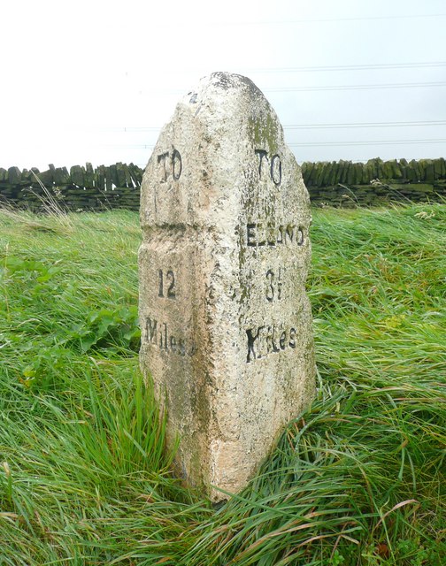
To Elland 3.5 miles (3218000459).jpg - INeverCry

Sign (3206691415).jpg - INeverCry

Chimney of Firth House Mill, Steel Lane, Barkisland (8290980127).jpg - INeverCry

View towards Stainland (8258064973).jpg - INeverCry

New Lane, Scammonden (4424297097).jpg - INeverCry

Scammonden Reservoir 4 (4425137969).jpg - INeverCry

The Griffin, Barkisland (5591815159).jpg - Sic19

Former Cross Base, Barkisland.jpg - Peter I. Vardy

Entering Barkisland on Staindale Road - geograph.org.uk - 2774101.jpg - GeographBot

The former New Rock Inn, Scammonden Road, Barkisland - geograph.org.uk - 3101886.jpg - GeographBot

High Royd Farm, Barkisland - geograph.org.uk - 3246901.jpg - GeographBot

Bowers Mill - geograph.org.uk - 3369671.jpg - GeographBot

Old Milestone by the B6113, Greetland Road, North Royd (geograph 6038938).jpg - Sic19

Old Milestone, B6114, Barkisland, nr housing at Field Hurst (geograph 6744854).jpg - Sic19

Old Milestone, on the B6114, Saddleworth Road (geograph 6745322).jpg - Sic19

Old Milestone, on the B6114, Saddleworth Road (geograph 6745327).jpg - Sic19

Old milestone (geograph 6739871).jpg - Sic19

Old Waymarker Stone by the B6113, Barkisland Cross, Ripponden parish (geograph 6055789).jpg - Sic19

Old milestone (geograph 6739859).jpg - Sic19

Lightcliffe Royd Lane, Barkisland - geograph.org.uk - 3408024.jpg - GeographBot

Lightcliffe Royd Lane, Barkisland - geograph.org.uk - 3408148.jpg - GeographBot

Blocked footpath off Barsey Green Lane - geograph.org.uk - 3408283.jpg - GeographBot

Elland Footpath 49, southern branch - geograph.org.uk - 3411305.jpg - GeographBot

Wood End Lane, Barkisland - geograph.org.uk - 3467762.jpg - GeographBot

Bowers Mills, Barkisland - water courses - geograph.org.uk - 3806965.jpg - GeographBot

Barkisland Mill - geograph.org.uk - 4005872.jpg - GeographBot

From Greetland to the three reservoirs, aerial 2014 - geograph.org.uk - 4100678.jpg - GeographBot

Barkisland Mill Bridge - Beestonley Lane - geograph.org.uk - 4280942.jpg - GeographBot

Stile at the parish boundary - geograph.org.uk - 4305481.jpg - GeographBot

Bus stop and shelter on Stainland Road, Barkisland - geograph.org.uk - 4389165.jpg - GeographBot

Stainland Road, Barkisland - geograph.org.uk - 4389167.jpg - GeographBot

Barkisland Post Office - geograph.org.uk - 4389168.jpg - GeographBot

Scammonden Road - viewed from Greetland Road - geograph.org.uk - 4389548.jpg - GeographBot

Scammonden Road - viewed from Greetland Road - geograph.org.uk - 4389550.jpg - GeographBot

Barkisland Cricket Ground - Scammonden Road - geograph.org.uk - 4389709.jpg - GeographBot

Barkisland Cricket Ground - viewed from Stainland Road - geograph.org.uk - 4390347.jpg - GeographBot

Footpath to Saddleworth Road at Stainland Road, Barkisland - geograph.org.uk - 4864688.jpg - GeographBot

Footpath 6700, Barkisland - geograph.org.uk - 4865417.jpg - GeographBot

Field Hurst and Footpath 6700 at Saddleworth Road, Barkisland - geograph.org.uk - 4865424.jpg - GeographBot

Footpath 6730 at Greetland Road, Barkisland - geograph.org.uk - 4865714.jpg - GeographBot

Large iron pipe crossing Sandyfoot Clough, Barkisland - geograph.org.uk - 4865956.jpg - GeographBot

Footpath to Sandyfoot Clough from Saddleworth Road, Barkisland - geograph.org.uk - 4865959.jpg - GeographBot

Footpath on driveway to Abbots Royd at Greetland Road, Barkisland - geograph.org.uk - 4866989.jpg - GeographBot

Greetland Road, Barkisland, at Heath Lea - geograph.org.uk - 4867360.jpg - GeographBot

Footpath on driveway to Heath Lea Farm, Barkisland - geograph.org.uk - 4867398.jpg - GeographBot

Footpath eastwards from heath Lea, Barkisland - geograph.org.uk - 4867422.jpg - GeographBot

Footpath eastwards from Heath Lea, Barkisland - geograph.org.uk - 4867432.jpg - GeographBot

Footpath to Heath Lea at Saddleworth Road, Barkisland - geograph.org.uk - 4867445.jpg - GeographBot

Gate and 'stile' on the footpath to Heath Lea, Barkisland - geograph.org.uk - 4867458.jpg - GeographBot

Greetland Road at Barsey Green Lane - geograph.org.uk - 5216837.jpg - GeographBot

Stainland Road, Barkisland - geograph.org.uk - 5299770.jpg - GeographBot

Barkisland Hall - geograph.org.uk - 5974934.jpg - GeographBot

Barkisland Mills - geograph.org.uk - 6629352.jpg - GeographBot

Barkisland Mills - geograph.org.uk - 6629356.jpg - GeographBot

Barkisland Mills - geograph.org.uk - 6629358.jpg - GeographBot

Barkisland Mills - geograph.org.uk - 6629360.jpg - GeographBot

Barkisland Mills - spoilt^ - geograph.org.uk - 6630083.jpg - GeographBot