×

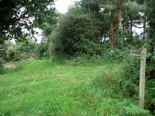
Heading south from Holt to Mannington on bridleway - geograph.org.uk - 515708.jpg - GeographBot

Y-junction heading south to Matlaske (left) or Baconsthorpe (right) - geograph.org.uk - 515688.jpg - GeographBot

A stack of square straw bales - geograph.org.uk - 545031.jpg - GeographBot

Approach to and road past Hole Farm from the east - geograph.org.uk - 544871.jpg - GeographBot

Bridleway near Hole Farm leading north to Church Lane - geograph.org.uk - 544875.jpg - GeographBot

Footpath leading northwest to Church Lane - geograph.org.uk - 545046.jpg - GeographBot

Northwest past Up Wood - geograph.org.uk - 545052.jpg - GeographBot

Silage bales in Barningham Park - geograph.org.uk - 544950.jpg - GeographBot

Track opposite entrance to Manor Farmhouse - geograph.org.uk - 545070.jpg - GeographBot

A misty day in mid January - geograph.org.uk - 1121068.jpg - GeographBot

A redundant postbox - geograph.org.uk - 1121048.jpg - GeographBot

Approaching The Belt - geograph.org.uk - 1121583.jpg - GeographBot

Brand-new gate and stile - geograph.org.uk - 1121075.jpg - GeographBot

Field by Hall Farm - geograph.org.uk - 1121135.jpg - GeographBot

Following a field's edge - geograph.org.uk - 1121598.jpg - GeographBot

Footbridge over drain - geograph.org.uk - 1121087.jpg - GeographBot

Footbridge with stile and a roof - geograph.org.uk - 1121100.jpg - GeographBot

Footpath marker in The Belt - geograph.org.uk - 1121586.jpg - GeographBot

Footpath to Baconsthorpe Castle - geograph.org.uk - 1121064.jpg - GeographBot

Hall Lane - geograph.org.uk - 1121582.jpg - GeographBot

Path across field - geograph.org.uk - 1121601.jpg - GeographBot

Path to The Street - geograph.org.uk - 1121592.jpg - GeographBot

Path to the ruined Baconsthorpe Castle - geograph.org.uk - 1121595.jpg - GeographBot

Sewage works - geograph.org.uk - 1121093.jpg - GeographBot

Skirting The Belt - geograph.org.uk - 1121590.jpg - GeographBot

Squeezing past holly bushes - geograph.org.uk - 1121593.jpg - GeographBot

Stile into cultivated field - geograph.org.uk - 1121599.jpg - GeographBot

Stile on footpath - geograph.org.uk - 1121596.jpg - GeographBot

The Street past Pitt Farm - geograph.org.uk - 1121602.jpg - GeographBot

View along Hall Lane - geograph.org.uk - 1121587.jpg - GeographBot

View east along The Street - geograph.org.uk - 1121603.jpg - GeographBot

View west along School Lane - geograph.org.uk - 1121605.jpg - GeographBot

To Baconsthorpe on Long Lane - geograph.org.uk - 3664072.jpg - GeographBot

View along the Holt - Mannington Walk - geograph.org.uk - 3664075.jpg - GeographBot

RAF West Beckham radar station (B Site) - geograph.org.uk - 3938021.jpg - GeographBot

Upland at Willow Glen - geograph.org.uk - 3938116.jpg - GeographBot

Baconsthorpe - geograph.org.uk - 4029735.jpg - GeographBot

Dead tree north of Baconsthorpe Castle, seen over the moat - geograph.org.uk - 4137204.jpg - GeographBot

School Lane, Baconsthorpe - geograph.org.uk - 4851042.jpg - GeographBot

Holt-Mannington Walk - geograph.org.uk - 4851131.jpg - GeographBot

Baconsthorpe Meadows camping fields - geograph.org.uk - 4851359.jpg - GeographBot

Sheep by Pitt Farm - geograph.org.uk - 4851365.jpg - GeographBot

Baconsthorpe - geograph.org.uk - 4871007.jpg - GeographBot

Field by Gresham Road - geograph.org.uk - 4871012.jpg - GeographBot

Gresham Road - geograph.org.uk - 4871020.jpg - GeographBot

Pond by Gresham Road - geograph.org.uk - 4871035.jpg - GeographBot

Gresham Road - geograph.org.uk - 4871037.jpg - GeographBot

Road near Upwood Cottage - geograph.org.uk - 4871074.jpg - GeographBot

Tree art - geograph.org.uk - 5135272.jpg - GeographBot

Path near Beckett's Farm - geograph.org.uk - 5633639.jpg - GeographBot

Drive and path to Breck Farm - geograph.org.uk - 5633642.jpg - GeographBot

Church Lane, Baconsthorpe - geograph.org.uk - 5974774.jpg - GeographBot

Access track from Baconsthorpe Castle to village - geograph.org.uk - 6146517.jpg - GeographBot

Arable field alongside access track to Breck Farm - geograph.org.uk - 6146525.jpg - GeographBot

The Street. Baconsfield toward Long Lane on the left - geograph.org.uk - 6146532.jpg - GeographBot

School Lane. Baconsfield toward Long Lane - geograph.org.uk - 6146540.jpg - GeographBot

School Lane. Baconsfield toward Long Lane (2) - geograph.org.uk - 6146551.jpg - GeographBot

The Street. Baconsthorpe heading west - geograph.org.uk - 6146607.jpg - GeographBot

Hall Lane at western end of Baconsthorpe - geograph.org.uk - 6146613.jpg - GeographBot

Baconsthorpe Castle - geograph.org.uk - 6442951.jpg - GeographBot

Baconsthorpe Castle Outer Gatehouse - geograph.org.uk - 7063413.jpg - GeographBot

Baconsthorpe Castle and Moat - geograph.org.uk - 7063421.jpg - GeographBot

Baconsthorpe Castle Inner Gatehouse and Moat - geograph.org.uk - 7063439.jpg - GeographBot

Field by School Lane - geograph.org.uk - 7236152.jpg - GeographBot

School Lane - geograph.org.uk - 7236153.jpg - GeographBot

Water tower in Baconsthorpe - geograph.org.uk - 7236189.jpg - GeographBot

Barley field by Baconsthorpe - geograph.org.uk - 7236191.jpg - GeographBot

Footpath through stubble field - geograph.org.uk - 7236194.jpg - GeographBot

Road to Baconsthorpe - geograph.org.uk - 7243160.jpg - GeographBot

Access track to Baconsthorpe Castle - geograph.org.uk - 7243161.jpg - GeographBot

Fields near Baconsthorpe Castle - geograph.org.uk - 7243166.jpg - GeographBot

Baconsthorpe Castle gatehouse fenced off - geograph.org.uk - 7243178.jpg - GeographBot

Baconsthorpe Castle fenced off - geograph.org.uk - 7243180.jpg - GeographBot

Barn at Hall Farm - geograph.org.uk - 7692875.jpg - GeographBot

Church of St Mary, Baconsthorpe - geograph.org.uk - 7692881.jpg - GeographBot

The White House, Baconsthorpe - geograph.org.uk - 7692884.jpg - GeographBot

Footpath leading between Baconsthorpe Castle and Village - geograph.org.uk - 7692888.jpg - GeographBot
❮
❯


