Wikimedi'Òc
Modes d'emploi

Cet album fait partie des albums
Cet album photos contient les sous-albums suivants :


Heptonstall, West Yorkshire bells removal in August 2012.jpg - Owen30

Footpath - Score Hill - geograph.org.uk - 3079998.jpg - GeographBot

Landemere Syke - Score Hill - geograph.org.uk - 3080000.jpg - GeographBot

Yarborough Croft - Northowram Green - geograph.org.uk - 3080006.jpg - GeographBot

Footpath - Wytehill Chase - geograph.org.uk - 3080011.jpg - GeographBot

Sinderhill Court - viewed from Wytehill Chase - geograph.org.uk - 3080015.jpg - GeographBot

Almond Court - Wytehill Chase - geograph.org.uk - 3080017.jpg - GeographBot

Rowan Way - viewed from Wytehill Chase - geograph.org.uk - 3080019.jpg - GeographBot

Rowan Way - viewed from Wytehill Chase - geograph.org.uk - 3080020.jpg - GeographBot

Electricity Substation No 46905 - Rowan Way - geograph.org.uk - 3080025.jpg - GeographBot

Spruce Drive - Rowan Way - geograph.org.uk - 3080029.jpg - GeographBot

Mulberry Way - viewed from Spruce Drive - geograph.org.uk - 3080031.jpg - GeographBot

Mulberry Way - viewed from Spruce Drive - geograph.org.uk - 3080034.jpg - GeographBot

Upper Hall View - Hall Lane - geograph.org.uk - 3080038.jpg - GeographBot

Hall Lane - viewed from Upper Hall View - geograph.org.uk - 3080041.jpg - GeographBot

Hall Close - Upper Hall view - geograph.org.uk - 3080223.jpg - GeographBot

Electricity Substation No 3509 - Upper Hall View - geograph.org.uk - 3080226.jpg - GeographBot

Greenfield Close - Daleson Close - geograph.org.uk - 3080229.jpg - GeographBot

Daleson Close - viewed from Greenfield Close - geograph.org.uk - 3080233.jpg - GeographBot

Coley View - off Town Gate - geograph.org.uk - 3080237.jpg - GeographBot

Coley View - off Town Gate - geograph.org.uk - 3080238.jpg - GeographBot

Hough - viewed from Heywood Close - geograph.org.uk - 3080240.jpg - GeographBot

Town Gate - viewed from Heywood Close - geograph.org.uk - 3080243.jpg - GeographBot

Footpath - Town Gate - geograph.org.uk - 3080245.jpg - GeographBot

Joseph Avenue - Back Clough - geograph.org.uk - 3080249.jpg - GeographBot

Back Clough - viewed from St Matthew's Church - geograph.org.uk - 3080250.jpg - GeographBot

Back Clough - viewed from St Matthew's church - geograph.org.uk - 3080252.jpg - GeographBot

Electricity Substation No 1048 - Westercroft Lane - geograph.org.uk - 3080255.jpg - GeographBot

Hedge Top Lane - looking towards Westercroft Lane - geograph.org.uk - 3080257.jpg - GeographBot

Greencroft Avenue - Westercroft Lane - geograph.org.uk - 3080277.jpg - GeographBot

Westercroft View - Westercroft Lane - geograph.org.uk - 3080281.jpg - GeographBot

Footpath - Westercroft Lane - geograph.org.uk - 3080283.jpg - GeographBot
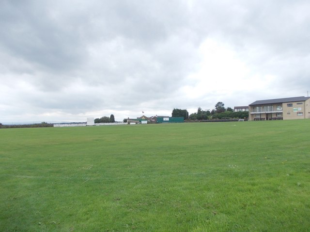
Northowram Fields Cricket Club - Westercroft Lane - geograph.org.uk - 3080288.jpg - GeographBot

Northowram Fields Cricket Pavilion - Westercroft Lane - geograph.org.uk - 3080292.jpg - GeographBot

Oaklands Avenue - looking towards Bradford Road - geograph.org.uk - 3080297.jpg - GeographBot

Victoria Drive - off Bradford Road - geograph.org.uk - 3080303.jpg - GeographBot

Cheeky Monkeys Day Nursery - Bradford Road - geograph.org.uk - 3080324.jpg - GeographBot

Queens Mead - Bradford Road - geograph.org.uk - 3080329.jpg - GeographBot

Cock Hill Lane - West Street - geograph.org.uk - 3083246.jpg - GeographBot

West Street - viewed from Cock Hill lane - geograph.org.uk - 3083247.jpg - GeographBot

Shelf Hall Lane - viewed from Belle Vue Road - geograph.org.uk - 3083251.jpg - GeographBot

Shelf Hall Lane - viewed from Belle Vue Road - geograph.org.uk - 3083253.jpg - GeographBot

Park Stone Rise - looking towards Broad Ings Way - geograph.org.uk - 3083255.jpg - GeographBot

Belle Vue Crescent - Belle Vue Road - geograph.org.uk - 3083258.jpg - GeographBot

Belle Vue Rise - Belle Vue Crescent - geograph.org.uk - 3083262.jpg - GeographBot

Belle Vue Crescent - Belle Vue Road - geograph.org.uk - 3083267.jpg - GeographBot

Highcliffe Court - Belle Vue Road - geograph.org.uk - 3083269.jpg - GeographBot

Belle Vue Rise - Belle Vue Road - geograph.org.uk - 3083273.jpg - GeographBot

Airedale Drive - Eskdale Avenue - geograph.org.uk - 3083276.jpg - GeographBot

Wharfedale Mount - Airedale Drive - geograph.org.uk - 3083278.jpg - GeographBot

Eskdale Avenue - viewed from near Airedale Drive - geograph.org.uk - 3083282.jpg - GeographBot

Dovedale Close - Eskdale Avenue - geograph.org.uk - 3083286.jpg - GeographBot

Electricity Pylon - Cock Hill Lane - geograph.org.uk - 3083609.jpg - GeographBot

Electricity Pylons - off Pepper Hill - geograph.org.uk - 3083613.jpg - GeographBot

Pepper Hill - viewed from Cock Hill - geograph.org.uk - 3083614.jpg - GeographBot

Cock Hill - viewed from Pepper Hill - geograph.org.uk - 3083617.jpg - GeographBot

Footpath - Pepper Hill - geograph.org.uk - 3083618.jpg - GeographBot

Cabin Farm Barn - Pepper Hill - geograph.org.uk - 3083623.jpg - GeographBot

Cross Lane - Pepper Hill - geograph.org.uk - 3083624.jpg - GeographBot

Pepper Hill - viewed from Cross Lane - geograph.org.uk - 3083625.jpg - GeographBot

High Cross Lane - viewed from Pepper Hill - geograph.org.uk - 3083627.jpg - GeographBot

Bridge Lane - High Cross Lane - geograph.org.uk - 3083629.jpg - GeographBot

Pepper Hill Unitarian Chapel - Cross Lane - geograph.org.uk - 3083634.jpg - GeographBot
Footpath - Brighouse Road - geograph.org.uk - 3083636.jpg - GeographBot

Diverted Footpath - Brighouse Road - geograph.org.uk - 3083674.jpg - GeographBot

Whinney Royd Lane - Brighouse ^ Denholme Gate Road - geograph.org.uk - 3083680.jpg - GeographBot

Brighouse ^ Denholme Gate Road - viewed from Whinney Royd Lane - geograph.org.uk - 3083684.jpg - GeographBot

Brighouse ^ Denholme Gate Road - viewed from Whinney Royd Lane - geograph.org.uk - 3083688.jpg - GeographBot

Footpath - Whinney Royd Lane - geograph.org.uk - 3083695.jpg - GeographBot

Lower Bowl Shaw - Whinney Royd Lane - geograph.org.uk - 3083698.jpg - GeographBot

Track - Whinney Royd Lane - geograph.org.uk - 3083702.jpg - GeographBot

Footpath - Whinney Royd Lane - geograph.org.uk - 3083707.jpg - GeographBot

Footpath (- cows^) - Brighouse ^ Denholme Gate Road - geograph.org.uk - 3083710.jpg - GeographBot

Electricity Pylon - Brighouse ^ Denholme Gate Road - geograph.org.uk - 3083714.jpg - GeographBot

Track to The Coach House - Brighouse ^ Denholme Gate Road - geograph.org.uk - 3083716.jpg - GeographBot
Score Hill - Brighouse ^ Denholme Gate Road - geograph.org.uk - 3083719.jpg - GeographBot

Bridge over the old railway near Dodge Royd Wood - geograph.org.uk - 3104590.jpg - GeographBot

Crow Hill End Farm, Sowerby - geograph.org.uk - 3116370.jpg - GeographBot

Crow Hill Road - geograph.org.uk - 3116431.jpg - GeographBot

Crow Hill Road - geograph.org.uk - 3116447.jpg - GeographBot

Crow Hill Road - geograph.org.uk - 3116467.jpg - GeographBot