Wikimedi'Òc
Modes d'emploi

Cet album fait partie des albums
Cet album photos contient les sous-albums suivants :


Aston Clinton - The Old School - geograph.org.uk - 148461.jpg - File Upload Bot (Magnus Manske)
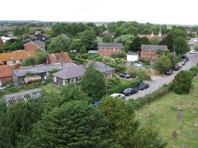
Aston Clinton from the church tower - geograph.org.uk - 199351.jpg - File Upload Bot (Magnus Manske)

New development with Pharmacy - geograph.org.uk - 26652.jpg - GeographBot

Chivery Reservoir - geograph.org.uk - 139505.jpg - GeographBot

Green Park, from A4011 - geograph.org.uk - 135458.jpg - GeographBot

High Meadow Farm (Beware of the Dogs ^) - geograph.org.uk - 139550.jpg - GeographBot

High Meadow Farm - through the hedge - geograph.org.uk - 139555.jpg - GeographBot

House with a view - geograph.org.uk - 139542.jpg - GeographBot

Looking northwest towards Aylesbury - geograph.org.uk - 135451.jpg - GeographBot

Aston Clinton, Aylesbury Road - geograph.org.uk - 148452.jpg - GeographBot

Aston Clinton, The Baptist Church - geograph.org.uk - 148672.jpg - GeographBot
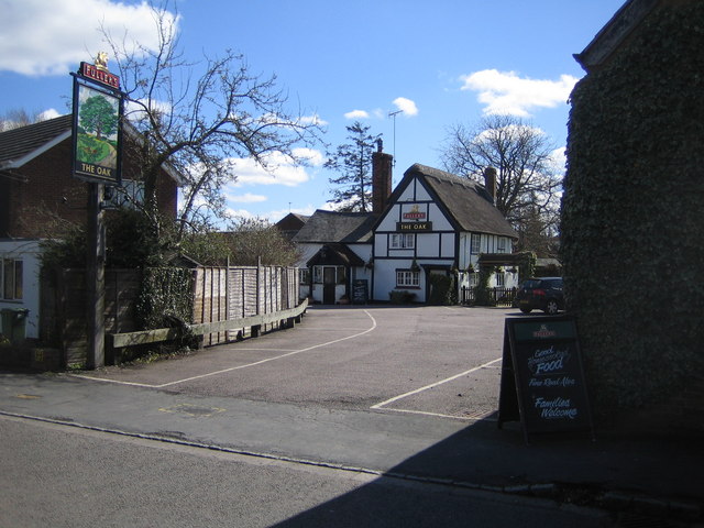
Aston Clinton, The Oak - geograph.org.uk - 148845.jpg - GeographBot

Angelic Niche - geograph.org.uk - 199365.jpg - GeographBot

Aston Clinton cricket ground, Buckinghamshire, England.jpg - GeographBot

Turning hole and weir, Merrymead Farm - geograph.org.uk - 243201.jpg - GeographBot

Near Lodge Farm - geograph.org.uk - 256963.jpg - GeographBot

Footpath and marker - geograph.org.uk - 429061.jpg - GeographBot

Hawthorn hedge in pasture - geograph.org.uk - 428722.jpg - GeographBot

Pasture with sheep beyond - geograph.org.uk - 429071.jpg - GeographBot

Grand Union Canal (Wendover Arm) in Aston Clinton - geograph.org.uk - 516391.jpg - GeographBot

Grand Union Canal (Wendover Arm) in Aston Clinton - geograph.org.uk - 517403.jpg - GeographBot
Aston Clinton Football Club - geograph.org.uk - 571668.jpg - GeographBot

Field near Chivery - geograph.org.uk - 576934.jpg - GeographBot

Old A41 at Buckland Wharf - geograph.org.uk - 571639.jpg - GeographBot

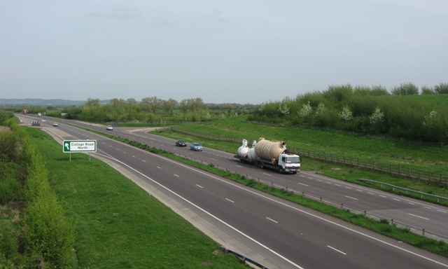
College Lane North - View South - geograph.org.uk - 607615.jpg - GeographBot

Klargester HQ - geograph.org.uk - 606138.jpg - GeographBot

Tall Crane, College Lane, Aston Clinton - geograph.org.uk - 606141.jpg - GeographBot

Telephone Exchange, Aston Clinton - geograph.org.uk - 894052.jpg - GeographBot

Aston Clinton Veterinery Centre - geograph.org.uk - 989700.jpg - GeographBot

Service station in Aston Clinton - geograph.org.uk - 988954.jpg - GeographBot

Shop and cottages on Aston Clinton High Street - geograph.org.uk - 989704.jpg - GeographBot

Footpath past High Meadow Farm - geograph.org.uk - 1201979.jpg - GeographBot

High Meadow Farm, Aston Hill, Chivery - geograph.org.uk - 1201919.jpg - GeographBot
Ivy-covered trees by the Road - geograph.org.uk - 1201940.jpg - GeographBot

Sheep on High Meadow Farm - geograph.org.uk - 1201924.jpg - GeographBot

Snowdrops in Tatnall's Wood, near Chivery - geograph.org.uk - 1201933.jpg - GeographBot

Start of footpath past High Meadow Farm - geograph.org.uk - 1201976.jpg - GeographBot

Canalside Bungalow at Merrymead Farm - geograph.org.uk - 1227507.jpg - GeographBot

Unit No 5 on Harebridge Lane, Halton - geograph.org.uk - 1258789.jpg - GeographBot

Unit No 7 on Harebridge Lane, Halton - geograph.org.uk - 1258786.jpg - GeographBot

Aston Hill Lodge, Aston Hill, Halton - geograph.org.uk - 1263091.jpg - GeographBot

Mallard duck with ducklings on the Wendover Arm - geograph.org.uk - 1260627.jpg - GeographBot

Merrymead Farm from College Road North - geograph.org.uk - 1269983.jpg - GeographBot

The First Flush of Bluebells in Tatnall's Wood - geograph.org.uk - 1263156.jpg - GeographBot

Wendover Arm, Houses line the North Bank of the Canal at Aston Clinton - geograph.org.uk - 1260659.jpg - GeographBot

Bridleway going East from End of College Road N - geograph.org.uk - 1270048.jpg - GeographBot

Klargester Factory, College Road North - geograph.org.uk - 1270027.jpg - GeographBot

Looking South along College Road N - geograph.org.uk - 1270037.jpg - GeographBot
The Aston Clinton Bypass (A41) looking East - geograph.org.uk - 1270110.jpg - GeographBot

The Aston Clinton Bypass (A41) looking West - geograph.org.uk - 1270117.jpg - GeographBot

Corner of Large Field to South of the Canal - geograph.org.uk - 1283037.jpg - GeographBot

A Fallen Giant in Cobblers Pits - geograph.org.uk - 1311636.jpg - GeographBot

A Mowed Strip across a Giant Lawn - geograph.org.uk - 1310475.jpg - GeographBot

A stand of young ash trees in Cobblers Pits, Aston Clinton - geograph.org.uk - 1311622.jpg - GeographBot

Box trees line the old track in Cobbler's Pits, Aston Clinton - geograph.org.uk - 1311616.jpg - GeographBot
Cobblers Pits - A Yew Woodland in Disused Quarries - geograph.org.uk - 1310392.jpg - GeographBot

Cobblers Pits - The ancient track looking towards the disused canal - geograph.org.uk - 1310396.jpg - GeographBot

Coot chicks leaving their nest and swimming off - geograph.org.uk - 1310500.jpg - GeographBot

Entrance to Cobblers Pits from the Canal Towpath - geograph.org.uk - 1310385.jpg - GeographBot

Leaving the yew grove by the main track in Cobblers Pits - geograph.org.uk - 1311607.jpg - GeographBot

Part of the main yew grove, to the west of the old track in Cobblers Pits - geograph.org.uk - 1311598.jpg - GeographBot

Russian Comfrey in hedgerow beside the footpath to the Wendover Arm - geograph.org.uk - 1310529.jpg - GeographBot
The Hedge along the Canal Towpath on the Wendover Arm - geograph.org.uk - 1310374.jpg - GeographBot

The old track becomes a holloway - geograph.org.uk - 1311661.jpg - GeographBot

The quarry in Cobblers Pits - geograph.org.uk - 1311666.jpg - GeographBot

The trunk of an old yew tree in Cobblers Pits, Aston Clinton - geograph.org.uk - 1311588.jpg - GeographBot

Under the spreading chestnut tree ... there are no reeds - geograph.org.uk - 1311809.jpg - GeographBot

Wendover Arm, Fewer trees mean more reeds - geograph.org.uk - 1311794.jpg - GeographBot

Wendover Arm, The canal overshadowed by trees - geograph.org.uk - 1311789.jpg - GeographBot

Wendover Arm, The reeds continue - geograph.org.uk - 1311800.jpg - GeographBot

Wendover Arm, The towpath approaches Harelane Bridge - geograph.org.uk - 1311786.jpg - GeographBot

Wendover Arm, The trees return - geograph.org.uk - 1311804.jpg - GeographBot

A flint wall hides Hengrove Cottage beside the Ridgeway, Chivery - geograph.org.uk - 1320672.jpg - GeographBot

A kissing gate with limited headroom on the Ridgeway - geograph.org.uk - 1320546.jpg - GeographBot
Barn by the Ridgeway at Chivery - geograph.org.uk - 1320670.jpg - GeographBot

Entrance to a modern building adjoining the Ridgeway at Chivery - geograph.org.uk - 1320655.jpg - GeographBot

The Ridgeway emerges through a hole in a hedge at Chivery - geograph.org.uk - 1320531.jpg - GeographBot

The Ridgeway goes west from Chivery - geograph.org.uk - 1320516.jpg - GeographBot

Driveway, to High Meadow Farm - geograph.org.uk - 1440522.jpg - GeographBot

Canal Farm, Buckland - geograph.org.uk - 1462106.jpg - GeographBot

Entrance to Aston Hill Farm - geograph.org.uk - 1542661.jpg - GeographBot

Long Meadow Farm - geograph.org.uk - 1542706.jpg - GeographBot

Mountain Bike Area Sign, Aston Hill - geograph.org.uk - 1542665.jpg - GeographBot

Rear of Aston Court, Aston Hill - geograph.org.uk - 1542656.jpg - GeographBot

The Long Fence beside the footpath through Buckland Hoo wood - geograph.org.uk - 1542698.jpg - GeographBot
The Wood behind the Fence at Buckland Hoo - geograph.org.uk - 1542703.jpg - GeographBot

Track through the Mountain Bike Area, Aston Hill Coppice - geograph.org.uk - 1542669.jpg - GeographBot

Trees hide the view over Aylesbury Vale from Aston Hill - geograph.org.uk - 1542688.jpg - GeographBot
Lane heading to St Leonards - geograph.org.uk - 1566195.jpg - GeographBot

Aston Clinton sunrise.JPG - File Upload Bot (Magnus Manske)

College Business Park, Gate 3 - geograph.org.uk - 7474703.jpg - GeographBot

Red House Lock - geograph.org.uk - 7475824.jpg - GeographBot

Alderfly (Sialis lutaria) (34402497043).jpg - Rudolphous

GOC Tring & Wendover Woods 087 Wellonhead Bridge, Wendover Arm, Aston Clinton (34841785025).jpg - Matlin

GOC Tring & Wendover Woods 080 Wendover Arm, Aston Clinton (34841784065).jpg - Matlin

Cow and calf (34124586000).jpg - Matlin

Cow and calf (34124582650).jpg - Matlin

Cow (34098276720).jpg - Matlin

Cow (33641101684).jpg - Matlin

An arable field on Aston Hill - geograph.org.uk - 1882737.jpg - GeographBot

Arable field on Aston Hill - geograph.org.uk - 1882743.jpg - GeographBot
The B4009 on Aston Hill - geograph.org.uk - 1882745.jpg - GeographBot

The road through Wendover Woods - geograph.org.uk - 1884754.jpg - GeographBot

Wendover Woods in Spring - geograph.org.uk - 1884760.jpg - GeographBot

The road from Wendover - geograph.org.uk - 1884765.jpg - GeographBot

Looking over Wendover Woods - geograph.org.uk - 1884767.jpg - GeographBot

Looking along the slope - geograph.org.uk - 1884771.jpg - GeographBot

Wendover Woods - geograph.org.uk - 1884773.jpg - GeographBot

Footpath in Wendover Woods - geograph.org.uk - 1884787.jpg - GeographBot

Wendover Woods - geograph.org.uk - 1884788.jpg - GeographBot
Grand Union Canal - geograph.org.uk - 2166952.jpg - GeographBot

Field north of Wendover Woods - geograph.org.uk - 2343515.jpg - GeographBot

RAF Halton from the air - geograph.org.uk - 2356016.jpg - GeographBot

Ridgeway long distance path - geograph.org.uk - 2403512.jpg - GeographBot

Cattle near Chivery - geograph.org.uk - 2403519.jpg - GeographBot

The Bell, Aston Clinton - geograph.org.uk - 2598914.jpg - GeographBot

Bridleway to Puttenham - geograph.org.uk - 2679969.jpg - GeographBot

Aston Clinton cricket ground - geograph.org.uk - 2680104.jpg - GeographBot

War Memorial Aston Clinton - geograph.org.uk - 2680108.jpg - GeographBot

Aylesbury Road - geograph.org.uk - 2680110.jpg - GeographBot

A41 looking east from Weston Turville roundabout - geograph.org.uk - 2865089.jpg - GeographBot

Fly Tipping near Aston Clinton - geograph.org.uk - 2903918.jpg - GeographBot

Industrial buildings on College Road Industrial Estate - geograph.org.uk - 2903924.jpg - GeographBot

Work starts on New Recycling Centre near Aston Clinton - geograph.org.uk - 2903926.jpg - GeographBot

Piled Skips on industrial site near Aston Clinton - geograph.org.uk - 2903929.jpg - GeographBot

A41 near Dropshort Farm - geograph.org.uk - 3010309.jpg - GeographBot

College Road bridge, A41 - geograph.org.uk - 3010310.jpg - GeographBot

A41 west of College Road bridge - geograph.org.uk - 3010311.jpg - GeographBot

A41 at The Vatches - geograph.org.uk - 3010312.jpg - GeographBot

Reduce Speed Now - geograph.org.uk - 3010315.jpg - GeographBot

Path in Black Wood - geograph.org.uk - 3183894.jpg - GeographBot

Chivery Cottage from Black Wood - geograph.org.uk - 3183910.jpg - GeographBot

Arla panorama (under construction) - geograph.org.uk - 3288451.jpg - GeographBot

Arla under construction - geograph.org.uk - 3288453.jpg - GeographBot

Arla grows - view from College Road - geograph.org.uk - 3288454.jpg - GeographBot

Harelane Bridge - geograph.org.uk - 3547003.jpg - GeographBot

Wellonhead Bridge - geograph.org.uk - 4014111.jpg - GeographBot
Memorial flight fly-past, Aston Clinton - geograph.org.uk - 4077289.jpg - GeographBot

Track to the Dancersend Nature Reserve - geograph.org.uk - 4095315.jpg - GeographBot

West Entrance to Dancersend Nature Reserve - geograph.org.uk - 4095341.jpg - GeographBot

End of Entrance Track, Dancersend Nature Reserve - geograph.org.uk - 4095366.jpg - GeographBot

The Sun shining through the trees at Dancersend Reserve - geograph.org.uk - 4095381.jpg - GeographBot

The Meadow Plots - Dancersend Reserve - geograph.org.uk - 4095408.jpg - GeographBot

Looking over the Meadow Plots at Dancersend Reserve - geograph.org.uk - 4095430.jpg - GeographBot

The West Gate into the Meadow Plots, Dancersend Reserve - geograph.org.uk - 4095448.jpg - GeographBot

Rotting Wood Pile for Wildlife at Dancersend Reserve - geograph.org.uk - 4095498.jpg - GeographBot

The Cross Paths Junction in Dancers End Reserve - geograph.org.uk - 4095535.jpg - GeographBot

Cyclists on the Upper Icknield way - geograph.org.uk - 4299530.jpg - GeographBot

Looking north west from Aston Hill - geograph.org.uk - 4299547.jpg - GeographBot

Aylesbury seen from Aston Hill - geograph.org.uk - 4299563.jpg - GeographBot

Aston Hill - geograph.org.uk - 4483494.jpg - GeographBot

Aston Hill - geograph.org.uk - 4483496.jpg - GeographBot

Aston Hill - geograph.org.uk - 4484542.jpg - GeographBot
Chivery village - geograph.org.uk - 4484564.jpg - GeographBot

Chivery village - geograph.org.uk - 4484616.jpg - GeographBot

St Leonards, Chivery - geograph.org.uk - 4484650.jpg - GeographBot
A clear bit of canal - geograph.org.uk - 4688477.jpg - GeographBot

Longcroft, Aston Clinton - geograph.org.uk - 4715644.jpg - GeographBot

Rosebery Road, Aston Clinton - geograph.org.uk - 4715649.jpg - GeographBot

The Ridgeway - geograph.org.uk - 4730185.jpg - GeographBot

Outer Aylesbury Ring - geograph.org.uk - 4781670.jpg - GeographBot

Outer Aylesbury Ring - geograph.org.uk - 4781706.jpg - GeographBot

Outer Aylesbury Ring - geograph.org.uk - 4781714.jpg - GeographBot

Fields near Chivery - geograph.org.uk - 4802206.jpg - GeographBot

A41 passes under exit slip overbridge - geograph.org.uk - 4871757.jpg - GeographBot

Red House next to College Road North - geograph.org.uk - 4890865.jpg - GeographBot

College Road Winding Hole - geograph.org.uk - 4960306.jpg - GeographBot

Garden furniture near Red House lock - geograph.org.uk - 5212945.jpg - GeographBot

Bridge 9, College Road - geograph.org.uk - 5212951.jpg - GeographBot

Aylesbury arm - geograph.org.uk - 5212981.jpg - GeographBot

West Lodge - geograph.org.uk - 5390006.jpg - GeographBot

Park Farm - geograph.org.uk - 5392189.jpg - GeographBot

Old school building on London Road - geograph.org.uk - 5392206.jpg - GeographBot

Acar2go on London Road, Aston Clinton - geograph.org.uk - 5639876.jpg - GeographBot

Terrace of houses on Aylesbury Road, Aston Clinton - geograph.org.uk - 5640597.jpg - GeographBot

Aylesbury Road, Aston Clinton - geograph.org.uk - 5640604.jpg - GeographBot
Aylesbury Road, Aston Clinton - geograph.org.uk - 5640608.jpg - GeographBot

London Road, Aston Clinton - geograph.org.uk - 5640619.jpg - GeographBot

London Road, Buckland - geograph.org.uk - 5640634.jpg - GeographBot

Aylesbury Road, Aston Clinton - geograph.org.uk - 5643352.jpg - GeographBot

House on Aylesbury Road, Aston Clinton - geograph.org.uk - 5643353.jpg - GeographBot

The Bottle Making Plant in the Arla Factory at Aston Clinton - geograph.org.uk - 5832059.jpg - GeographBot
The final corner on the tarmac road through Wendover Woods - geograph.org.uk - 5974323.jpg - GeographBot

Path coming down to Tatnall's Wood - geograph.org.uk - 6029105.jpg - GeographBot

Path in Bittam's Wood - geograph.org.uk - 6029109.jpg - GeographBot

Field Hedge Line - geograph.org.uk - 6029172.jpg - GeographBot

Old Milepost by London Road, Aston Clinton - geograph.org.uk - 6060906.jpg - GeographBot

The A41, Aston Clinton - geograph.org.uk - 6179565.jpg - GeographBot

Footpath on Aston Hill - geograph.org.uk - 6292044.jpg - GeographBot

Footpath on Aston Hill - geograph.org.uk - 6292047.jpg - GeographBot

Footpath on Aston Hill heading for the woodland of Haddington Hill - geograph.org.uk - 6292048.jpg - GeographBot

The harvest is in but the straw awaits collection - geograph.org.uk - 6292049.jpg - GeographBot

Stablebridge Road crosses Wellonhead Bridge - geograph.org.uk - 6586821.jpg - GeographBot

Stablebridge Road heading towards Halton - geograph.org.uk - 6586823.jpg - GeographBot

Stablebridge Road approaching Upper Icknield Way - geograph.org.uk - 6586825.jpg - GeographBot

Lay-by on A41 - geograph.org.uk - 6853135.jpg - GeographBot

Triangulation Pillar at Aston Hill - geograph.org.uk - 6942334.jpg - GeographBot

Closer look at Triangulation Pillar at Aston Hill - geograph.org.uk - 6942338.jpg - GeographBot

Flush Bracket Bench Mark on Triangulation Pillar at Aston Hill - geograph.org.uk - 6942342.jpg - GeographBot

Bluebells in Tatnalls Wood - geograph.org.uk - 6952303.jpg - GeographBot

The Rothschild Arms, Aston Clinton - geograph.org.uk - 6987659.jpg - GeographBot

A41 towards Aylesbury - geograph.org.uk - 7037292.jpg - GeographBot

A41 towards Aylesbury - geograph.org.uk - 7037295.jpg - GeographBot

Weston Road, Aston Clinton - geograph.org.uk - 7037361.jpg - GeographBot

London Road, Aston Clinton - geograph.org.uk - 7037376.jpg - GeographBot

The side of China Water Restaurant, Aston Clinton - geograph.org.uk - 7364534.jpg - GeographBot

Petrol station on London Road, Aston Clinton - geograph.org.uk - 7364535.jpg - GeographBot

Hammond Street, Aston Clinton - geograph.org.uk - 7364537.jpg - GeographBot

The Bell, Aston Clinton - geograph.org.uk - 7365168.jpg - GeographBot

London Road, Aston Clinton - geograph.org.uk - 7365169.jpg - GeographBot

Weston Road, Aston Clinton - geograph.org.uk - 7365170.jpg - GeographBot

Rosebery Road, Aston Clinton - geograph.org.uk - 7366339.jpg - GeographBot

Houses on London Road, Aston Clinton - geograph.org.uk - 7366340.jpg - GeographBot

House on London Road, Aston Clinton - geograph.org.uk - 7366949.jpg - GeographBot

The Forest is Closed - geograph.org.uk - 7636323.jpg - GeographBot

No Access to the Forest - geograph.org.uk - 7636336.jpg - GeographBot

The Forbidden Forest - geograph.org.uk - 7636344.jpg - GeographBot

Dancers End Nature Reserve - geograph.org.uk - 7636455.jpg - GeographBot

One Way Road, Wendover Woods - geograph.org.uk - 7636528.jpg - GeographBot

Chiltern Edge View - geograph.org.uk - 7636529.jpg - GeographBot

Track to Bittam's Wood - geograph.org.uk - 7636902.jpg - GeographBot

Rugby Posts in a Field - geograph.org.uk - 7636904.jpg - GeographBot

Footpath to Bittam's Wood - geograph.org.uk - 7636908.jpg - GeographBot

Lower Icknield Way, Aston Clinton - geograph.org.uk - 7695109.jpg - GeographBot

Dean Way, Aston Clinton - geograph.org.uk - 7695114.jpg - GeographBot

Built in 2019 - geograph.org.uk - 7695149.jpg - GeographBot

Old Mill Place, Aston Clinton - geograph.org.uk - 7695154.jpg - GeographBot

Mast on Church Lane - geograph.org.uk - 7695159.jpg - GeographBot

College Road South (end of) - geograph.org.uk - 7695688.jpg - GeographBot

Play Area, Green End Street - geograph.org.uk - 7695690.jpg - GeographBot

Factory in the distance - geograph.org.uk - 7695696.jpg - GeographBot

The End Of The World - geograph.org.uk - 7695702.jpg - GeographBot

Akeman Street, Aston Clinton - geograph.org.uk - 7695710.jpg - GeographBot

A41 Approaching Aston Clinton - geograph.org.uk - 7722474.jpg - GeographBot

The Grand Union Canal - geograph.org.uk - 7738435.jpg - GeographBot

The Grand Union Canal - geograph.org.uk - 7738438.jpg - GeographBot

Red House Lock - geograph.org.uk - 7738442.jpg - GeographBot

The Grand Union Canal - geograph.org.uk - 7738443.jpg - GeographBot

Arla, Aylesbury - geograph.org.uk - 7738447.jpg - GeographBot

Road approaching Arla Dairy - geograph.org.uk - 7738449.jpg - GeographBot

Farmland near Aston Clinton - geograph.org.uk - 7738450.jpg - GeographBot