×

Castle Cary Station - geograph.org.uk - 7726231.jpg - GeographBot

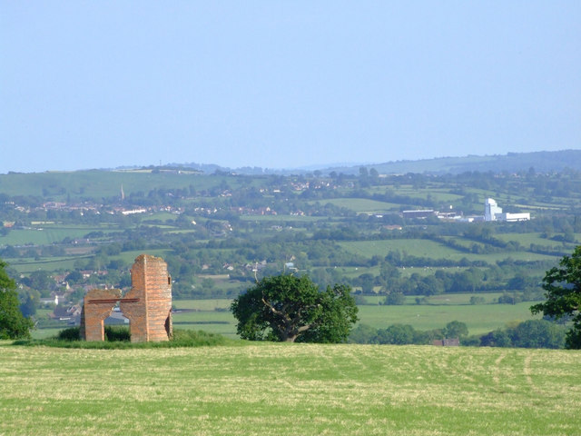
Ansford from Ditcheat Hill - geograph.org.uk - 454856.jpg - File Upload Bot (Magnus Manske)

Flytipped sofas - geograph.org.uk - 460323.jpg - GeographBot

Former railway bridge - geograph.org.uk - 460316.jpg - GeographBot

Two railway bridges - geograph.org.uk - 460335.jpg - GeographBot

A pleasant farmhouse - geograph.org.uk - 515942.jpg - GeographBot

A track in farmland - geograph.org.uk - 515943.jpg - GeographBot

Hanging place - geograph.org.uk - 515938.jpg - GeographBot

Entrance to Redlands Farm - geograph.org.uk - 562494.jpg - GeographBot

South Somerset , Field and Countryside - geograph.org.uk - 1347310.jpg - GeographBot

South Somerset , Field and Tree - geograph.org.uk - 1347306.jpg - GeographBot

South Somerset , Field and Trees - geograph.org.uk - 1347283.jpg - GeographBot

South Somerset , Field and Trees - geograph.org.uk - 1347294.jpg - GeographBot

South Somerset , Grassy Field and Countryside - geograph.org.uk - 1347280.jpg - GeographBot

South Somerset , Grassy Field and Tree - geograph.org.uk - 1347273.jpg - GeographBot

South Somerset , Grassy Field and Trees - geograph.org.uk - 1347262.jpg - GeographBot

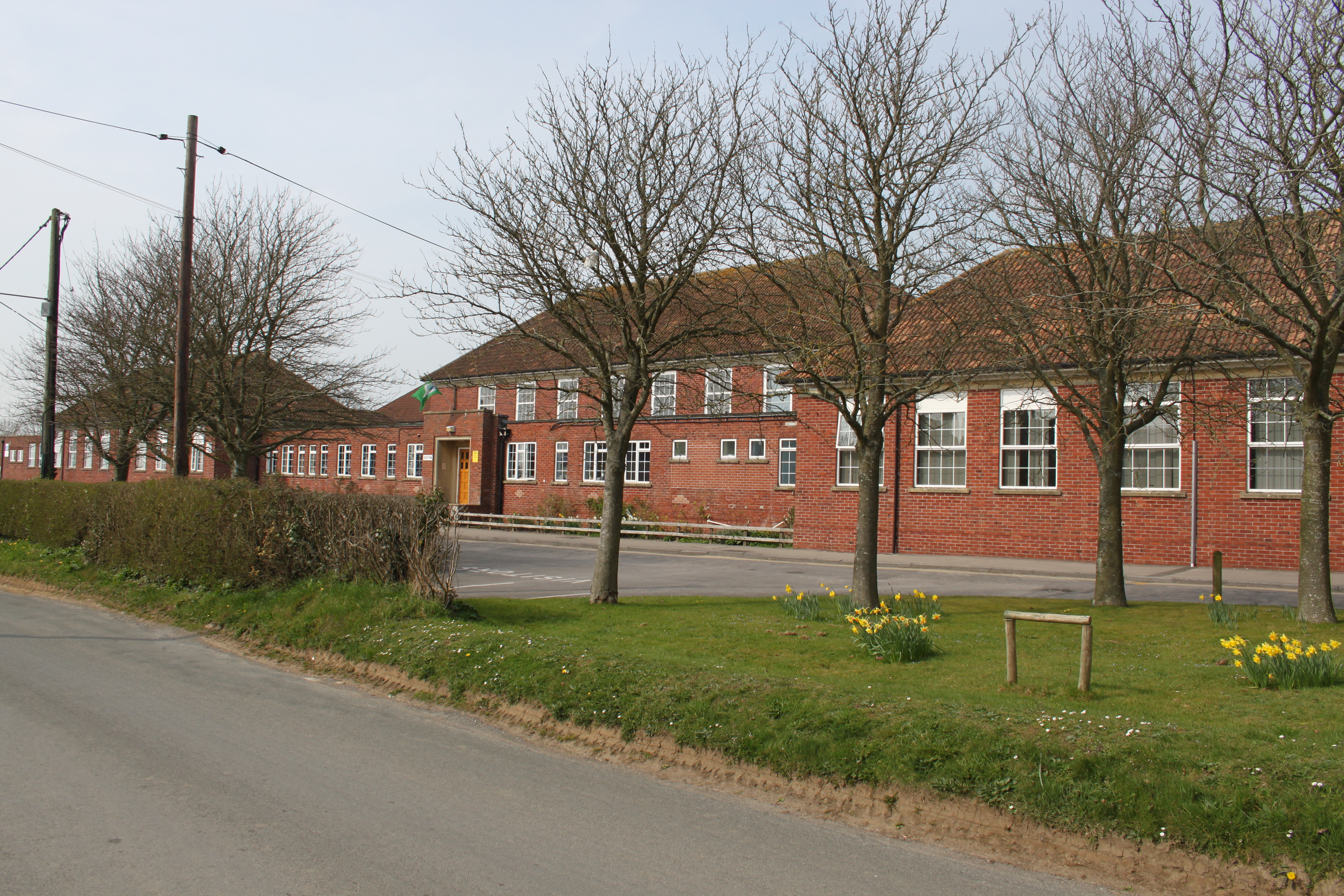
Ansford School.JPG - Rodw

Ansford Lodge, Higher Ansford (geograph 4509995).jpg - Plucas58

Hillcrest Farm - geograph.org.uk - 2363054.jpg - GeographBot

Ansford Park Farm - geograph.org.uk - 2363060.jpg - GeographBot

Countryside near Ansford - geograph.org.uk - 2364633.jpg - GeographBot

Pasture near Wyke - geograph.org.uk - 2521831.jpg - GeographBot

South Somerset , Grassy Field ^ Bushes - geograph.org.uk - 2588967.jpg - GeographBot

South Somerset , Cows Grazing - geograph.org.uk - 2588995.jpg - GeographBot

South Somerset , Grassy Field - geograph.org.uk - 2589003.jpg - GeographBot

Field near Ansford - geograph.org.uk - 2868707.jpg - GeographBot

Tree in field, Clanville - geograph.org.uk - 2868730.jpg - GeographBot

The Monarch's Way leading to Castle Cary Station - geograph.org.uk - 3903420.jpg - GeographBot

View from Wyke Road - geograph.org.uk - 4191844.jpg - GeographBot

Churchfield Drive, Ansford - geograph.org.uk - 4509025.jpg - GeographBot

Zebra crossing, Ansford Hill, Ansford - geograph.org.uk - 4509042.jpg - GeographBot

Ansford Silver Jubilee Gardens - geograph.org.uk - 4509058.jpg - GeographBot

Mullins Way, Ansford - geograph.org.uk - 4509068.jpg - GeographBot

Hallett Road, Ansford - geograph.org.uk - 4509074.jpg - GeographBot

Parsons Gate, Ansford - geograph.org.uk - 4509086.jpg - GeographBot

Tuckers Lane bungalows, Ansford - geograph.org.uk - 4509132.jpg - GeographBot

Down Tuckers Lane, Ansford - geograph.org.uk - 4509149.jpg - GeographBot

Grade II listed former barn in Higher Ansford - geograph.org.uk - 4509952.jpg - GeographBot

Grade II listed Ansford House, Higher Ansford - geograph.org.uk - 4509965.jpg - GeographBot

Top of Ansford Hill, Higher Ansford - geograph.org.uk - 4509971.jpg - GeographBot

Former Hillcrest School, Higher Ansford - geograph.org.uk - 4509980.jpg - GeographBot

Station Road bridge over the Taunton line, Castle Cary - geograph.org.uk - 4510106.jpg - GeographBot

Station Road bridge over the Taunton railway line, Castle Cary - geograph.org.uk - 4510126.jpg - GeographBot

Castle Cary ^ Ansford northern boundary sign - geograph.org.uk - 4510247.jpg - GeographBot

Ansford boundary sign, Lower Ansford - geograph.org.uk - 4510368.jpg - GeographBot

June 2015 Glastonbury Festival delays sign alongside Ansford Hill, Castle Cary - geograph.org.uk - 4510402.jpg - GeographBot

Left here for Castle Cary railway station - geograph.org.uk - 4510431.jpg - GeographBot

Wychwood Cottage, Ansford - geograph.org.uk - 4514610.jpg - GeographBot

Skid risk sign, Ansford Hill, Ansford - geograph.org.uk - 4514614.jpg - GeographBot

Ansford Hill, Ansford - geograph.org.uk - 4514621.jpg - GeographBot

Lower Ansford, Ansford - geograph.org.uk - 4514622.jpg - GeographBot

Main building on Castle Cary railway station - geograph.org.uk - 4521296.jpg - GeographBot

Path towards Castle Cary railway station - geograph.org.uk - 4539697.jpg - GeographBot

Joining the Reading to Taunton line - geograph.org.uk - 4612021.jpg - GeographBot

Reading to Taunton line - geograph.org.uk - 4612026.jpg - GeographBot

Farm building by the railway - geograph.org.uk - 4612031.jpg - GeographBot

House on the B3153 - geograph.org.uk - 4612035.jpg - GeographBot

Saw Mill - geograph.org.uk - 4612036.jpg - GeographBot

Tree in a field - geograph.org.uk - 4612125.jpg - GeographBot

Somerset farmland - geograph.org.uk - 4612127.jpg - GeographBot

Tree in a field - geograph.org.uk - 4612131.jpg - GeographBot

The Brue Valley - geograph.org.uk - 4612137.jpg - GeographBot

Tree in a field - geograph.org.uk - 4612140.jpg - GeographBot

Grazing land in the Brue Valley - geograph.org.uk - 4617396.jpg - GeographBot

Farm building - geograph.org.uk - 4617397.jpg - GeographBot

Farmland near Ansford - geograph.org.uk - 4617399.jpg - GeographBot

Isolated tree - geograph.org.uk - 4862453.jpg - GeographBot

Farmland in the Brue Valley - geograph.org.uk - 4862456.jpg - GeographBot

Somerset farmland - geograph.org.uk - 4862468.jpg - GeographBot

Farmland, Brue Valley - geograph.org.uk - 4862469.jpg - GeographBot

Farmland, Brue Valley - geograph.org.uk - 4863038.jpg - GeographBot

Hedge coming down the hill - geograph.org.uk - 5114334.jpg - GeographBot

Ansford Park Farm - geograph.org.uk - 5114336.jpg - GeographBot

Farmland below Ridge Hill - geograph.org.uk - 5114337.jpg - GeographBot

Single Tree - geograph.org.uk - 5114339.jpg - GeographBot

Isolated tree - geograph.org.uk - 5188638.jpg - GeographBot

Single tree - geograph.org.uk - 5188645.jpg - GeographBot

Farmland in the Brue Valley - geograph.org.uk - 5188646.jpg - GeographBot

Combe Bottom - geograph.org.uk - 5391897.jpg - GeographBot

Ansford Park Farm - geograph.org.uk - 5391901.jpg - GeographBot

Woodland, Ansford Park Farm - geograph.org.uk - 5391907.jpg - GeographBot

Slope near Ansford - geograph.org.uk - 5391909.jpg - GeographBot

Hedge - geograph.org.uk - 5391918.jpg - GeographBot

Industrial Estate - geograph.org.uk - 5391923.jpg - GeographBot

Brue Valley - geograph.org.uk - 5437036.jpg - GeographBot

Single tree - geograph.org.uk - 5437039.jpg - GeographBot

A tree - geograph.org.uk - 5452748.jpg - GeographBot

A single tree - geograph.org.uk - 5510128.jpg - GeographBot

Houses at junction of Cumnock Road and Ansford Road - geograph.org.uk - 5529953.jpg - GeographBot

Maggs Lane junction with A371 - geograph.org.uk - 5529956.jpg - GeographBot

B3153 junction with Station Road - geograph.org.uk - 5529965.jpg - GeographBot

Tuckers Lane junction with A371 - geograph.org.uk - 5530460.jpg - GeographBot

Entrance to Lower Ansford from A371 - geograph.org.uk - 5530463.jpg - GeographBot

Somerset field - geograph.org.uk - 5558431.jpg - GeographBot

Single tree - geograph.org.uk - 5558434.jpg - GeographBot

Somerset farmland - geograph.org.uk - 5558435.jpg - GeographBot

Isolated tree - geograph.org.uk - 5558436.jpg - GeographBot

Single tree - geograph.org.uk - 5558438.jpg - GeographBot

Tree in a red field - geograph.org.uk - 5558440.jpg - GeographBot

Somerset Pasture - geograph.org.uk - 5558444.jpg - GeographBot

Brue Valley farmland - geograph.org.uk - 5668238.jpg - GeographBot

Tree in field - geograph.org.uk - 5668242.jpg - GeographBot

On its own - geograph.org.uk - 5668243.jpg - GeographBot

Oak tree - geograph.org.uk - 5668244.jpg - GeographBot

Sign, Castle Cary Station - geograph.org.uk - 5668246.jpg - GeographBot

Farmland - geograph.org.uk - 5696475.jpg - GeographBot

In the Brue Valley - geograph.org.uk - 5696479.jpg - GeographBot

Isolated tree - geograph.org.uk - 5696481.jpg - GeographBot

Wiltshire farmland - geograph.org.uk - 5696486.jpg - GeographBot

A tree - geograph.org.uk - 5696488.jpg - GeographBot

Rather derelict looking - geograph.org.uk - 5696501.jpg - GeographBot

Distinctive tree - geograph.org.uk - 5777805.jpg - GeographBot

Lonesome tree - geograph.org.uk - 5777831.jpg - GeographBot

Isolated tree - geograph.org.uk - 5777832.jpg - GeographBot

View north from Wyke Road - geograph.org.uk - 5806237.jpg - GeographBot

Ansford Park Farm - geograph.org.uk - 5806241.jpg - GeographBot

Wyke Road - geograph.org.uk - 5806244.jpg - GeographBot

Factory on Torbay Road Industrial Estate - geograph.org.uk - 5822506.jpg - GeographBot

Slope near Ansford Park Farm - geograph.org.uk - 5822521.jpg - GeographBot

Ansford Park Farm - geograph.org.uk - 5822522.jpg - GeographBot

Near Ansford Park Farm - geograph.org.uk - 5822524.jpg - GeographBot

Single tree in field - geograph.org.uk - 5822525.jpg - GeographBot

Tree in field - geograph.org.uk - 5853375.jpg - GeographBot

Two trees - geograph.org.uk - 5853378.jpg - GeographBot

Slopes, Castle Cary - geograph.org.uk - 5853382.jpg - GeographBot

Lonesome tree - geograph.org.uk - 5909098.jpg - GeographBot

Single tree - geograph.org.uk - 5909101.jpg - GeographBot

Isolated tree - geograph.org.uk - 5909104.jpg - GeographBot

Single tree - geograph.org.uk - 5951011.jpg - GeographBot

Tramlines in field - geograph.org.uk - 5951015.jpg - GeographBot

Combe Bottom - geograph.org.uk - 5951016.jpg - GeographBot

Wooded slope - geograph.org.uk - 5951021.jpg - GeographBot

Ansford - geograph.org.uk - 5951022.jpg - GeographBot

Railway Line to Yeovil - geograph.org.uk - 6027336.jpg - GeographBot

Isolated tree - geograph.org.uk - 6054874.jpg - GeographBot

Ploughed field - geograph.org.uk - 6054876.jpg - GeographBot

Ansford Park Farm - geograph.org.uk - 6423338.jpg - GeographBot

Woodland near Ansford - geograph.org.uk - 6423340.jpg - GeographBot

Factory, Torbay Road Industrial Estate - geograph.org.uk - 6446627.jpg - GeographBot

Ansford Park Farm - geograph.org.uk - 6446686.jpg - GeographBot

Two trees - geograph.org.uk - 6446687.jpg - GeographBot

Cattle grazing - geograph.org.uk - 6446688.jpg - GeographBot

Isolated tree - geograph.org.uk - 6660282.jpg - GeographBot

Isolated tree - geograph.org.uk - 6660285.jpg - GeographBot

Isolated tree - geograph.org.uk - 6660287.jpg - GeographBot

Single tree - geograph.org.uk - 6829759.jpg - GeographBot

Ansford Park Farm - geograph.org.uk - 6829762.jpg - GeographBot

Woodland, Ansford - geograph.org.uk - 6829769.jpg - GeographBot

Cattle grazing - geograph.org.uk - 6829771.jpg - GeographBot

Row of cottages, Ansford Hill - geograph.org.uk - 6829773.jpg - GeographBot

Former goods shed - geograph.org.uk - 6871060.jpg - GeographBot

Railway building - geograph.org.uk - 6871065.jpg - GeographBot

Fields at Hillcrest Farm - geograph.org.uk - 6871965.jpg - GeographBot

Ansford Academy - geograph.org.uk - 6977581.jpg - GeographBot

'Wagon and Horses', Ansford - geograph.org.uk - 6977629.jpg - GeographBot

Wyke Road on Honeywick Hill - geograph.org.uk - 7097673.jpg - GeographBot

Solomon's Lane - geograph.org.uk - 7097686.jpg - GeographBot

Bridleway junction on Solomon's Lane - geograph.org.uk - 7102073.jpg - GeographBot
❮
❯


