Wikimedi'Òc
Modes d'emploi

Cet album fait partie des albums
Cet album photos contient les sous-albums suivants :


Walton Breck Road - geograph.org.uk - 81524.jpg - GeographBot

Oakfield Road toward LFC - geograph.org.uk - 122379.jpg - GeographBot

The real Anfield - geograph.org.uk - 122378.jpg - GeographBot
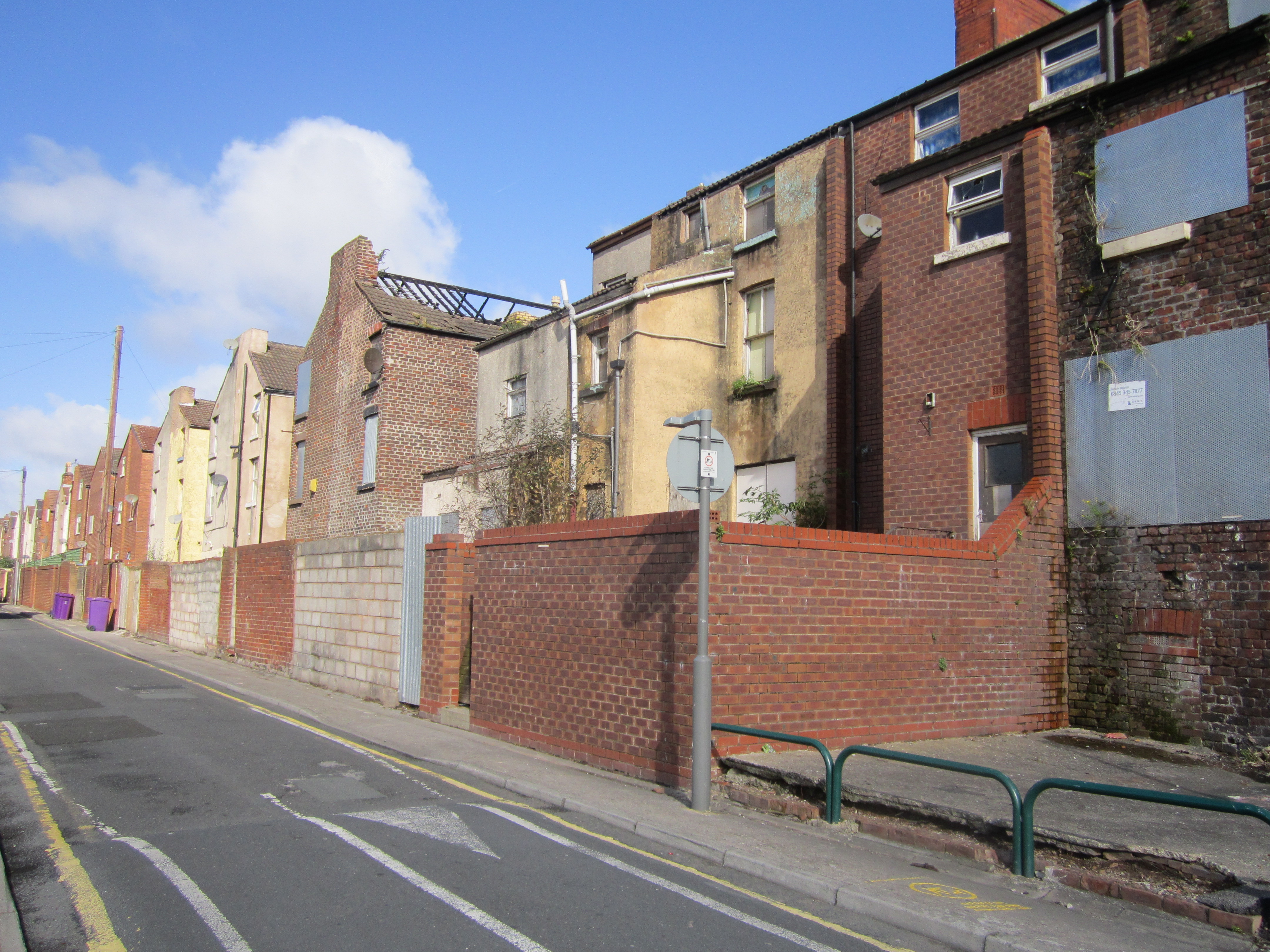
Empty houses in Herschell Street, Anfield - geograph.org.uk - 208685.jpg - GeographBot

Goldie Street, Anfield - geograph.org.uk - 206667.jpg - GeographBot

House on Anfield Road - geograph.org.uk - 208669.jpg - GeographBot

Oakfield Road, Anfield - geograph.org.uk - 208689.jpg - GeographBot

Glaisher Street, Liverpool - DSC00696.JPG - Green Lane

Rockfield Road, Liverpool - DSC00702.JPG - Green Lane

Tinsley Street Liverpool - geograph.org.uk - 674852.jpg - GeographBot

Anfield Road meets Sleepers Hill, Walton Lane, and Fountains Close - geograph.org.uk - 1047033.jpg - GeographBot

Anfield Road variety - geograph.org.uk - 1047040.jpg - GeographBot

Bodley Street- Sleepers Hill junction - geograph.org.uk - 1047090.jpg - GeographBot

Butterfield Street - geograph.org.uk - 1047097.jpg - GeographBot

Saker Street- Sleepers Hill junction - geograph.org.uk - 1047105.jpg - GeographBot

Hillsborough Justice Campaign office, Liverpool.jpg - Rept0n1x

Venmore Street, Anfield (1).JPG - Rept0n1x

Venmore Street, Anfield (2).JPG - Rept0n1x

Venmore Street, Anfield (3).JPG - Rept0n1x

Venmore Street, Anfield (4).JPG - Rept0n1x

Venmore Street, Anfield (5).JPG - Rept0n1x

Richmond Park, Anfield.jpg - Rept0n1x
Back Rockfield Road, Anfield (1).jpg - Rept0n1x

Back Rockfield Road, Anfield (2).jpg - Rept0n1x

Pets Bazzaar, Anfield.jpg - Rept0n1x

Breck Road, Anfield (1).jpg - Rept0n1x

Anfield - 2012-09-29 (9).JPG - Rept0n1x

Flats on Cherry Lane, Liverpool L4.JPG - Rept0n1x

Green Space on Utting Avenue, Liverpool L4.JPG - Rept0n1x

Boarded-up houses on Anfield Road, Liverpool (2).JPG - Rept0n1x

Boarded-up houses on Anfield Road, Liverpool (3).JPG - Rept0n1x

Boarded-up houses on Anfield Road, Liverpool (1).JPG - Rept0n1x

Shops on Stanley Park Avenue South, Liverpool L4.JPG - Rept0n1x

Pinehurst Primary School, Pinehurst Avenue, Liverpool L4.JPG - Rept0n1x

Shops on the corner of Cherry Lane and Lindsay Road, Liverpool L4.JPG - Rept0n1x

Shops on the corner of Cherry Lane and Utting Avenue, Liverpool L4.JPG - Rept0n1x

Anfield Village - Rockfield Project Office.jpg - Rept0n1x

Bagnall Street, Liverpool L4.jpg - Rept0n1x

Partially demolished house, Bagnall Street, Liverpool L4.jpg - Rept0n1x

Baltic Street, Liverpool L4.jpg - Rept0n1x

Gilman Street, Liverpool L4.jpg - Rept0n1x

Oakfield Road, Liverpool L4.jpg - Rept0n1x

Oakfield Road, Liverpool L4 (2) (2).jpg - Rept0n1x

Alroy Road, Liverpool L4.jpg - Rept0n1x

Rockfield Road, Liverpool L4.jpg - Rept0n1x

Gardening woman statue, Rockfield Road, Liverpool L4.jpg - Rept0n1x

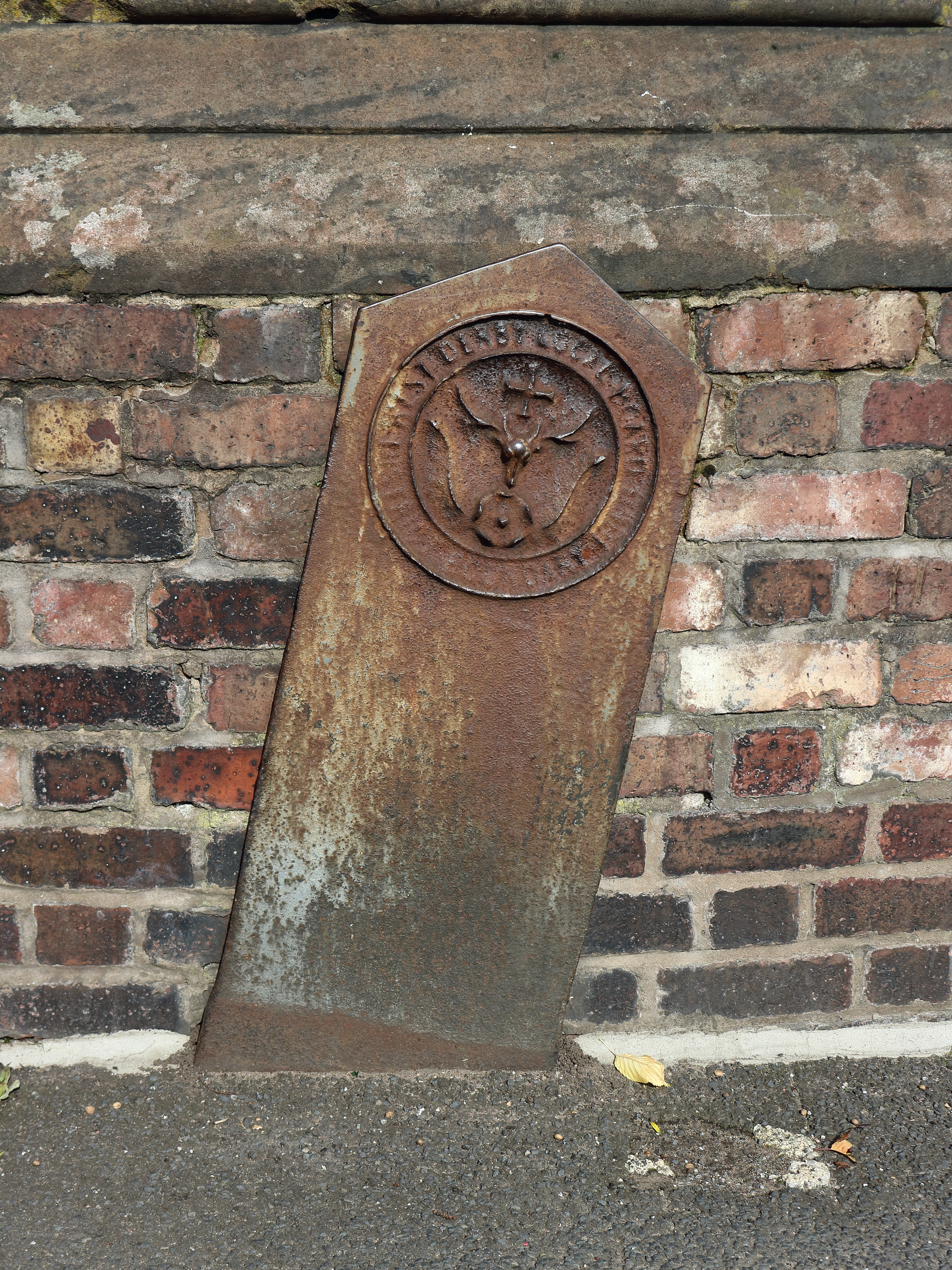
Boundary marker, Townsend Lane-Priory Road, Anfield.jpg - Rodhullandemu

Office of Dan Carden MP.jpg - Rodhullandemu

Derelict building, Priory Road-Dewsbury Road, Anfield.jpg - Rodhullandemu

Oak Hall Building, Anfield.jpg - Rodhullandemu
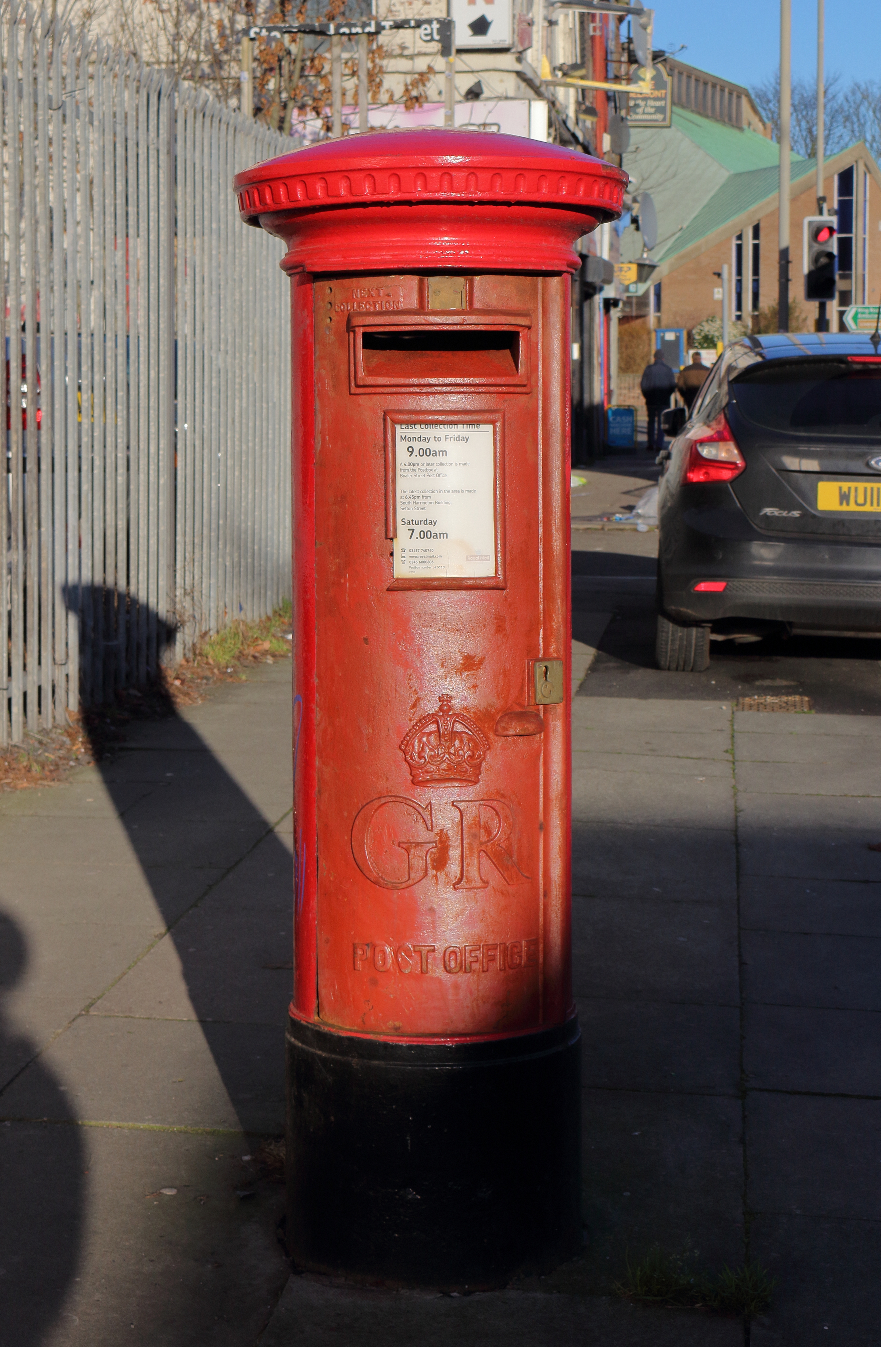
Post box on West Derby Road.jpg - Rodhullandemu
West Derby boundary marker, Rocky Lane.jpg - Rodhullandemu

Amazon Locker (49375614141).jpg - TaurusEmerald

Glaisher Street, Anfield - geograph.org.uk - 3363842.jpg - GeographBot

Salisbury Road, Anfield - geograph.org.uk - 3410308.jpg - GeographBot

Venmore Street, Anfield, ready for demolition - geograph.org.uk - 3816039.jpg - GeographBot

Liverbus Volvo Countrybus.jpg - Murgatroyd49