Wikimedi'Òc
Modes d'emploi

Cet album fait partie des albums
Cet album photos contient les sous-albums suivants :


Valkyrie State School, 2025.jpg - Kerry Raymond

Caloundra State School (left) aerial view of red-roofed school buildings and oval with the Coral Sea in the background, 2025.jpg - Kerry Raymond

Caloundra State High School, aerial view with Coral Sea in the distance, 2025.jpg - Kerry Raymond

Heron Island, Australia - View of Island from helicopter.JPG - Nickj

Part of Great Barrier Reef from Helicopter.jpg - Nickj

Freshwater Bay in September 1999.jpg - Kges1901

Peak-of-Brampton-Island-72-degree-2-image-panorama.jpg - Nickj

Toowoomba.png - Aliasd

Roma Overhead.jpg - BrisbanePom

Birdsville Overhead.jpg - BrisbanePom

Mount Lindesay Queensland.jpg - RedWolf

Henning Island.jpg - Flickr upload bot

Conway National Park 01.jpg - Flickr upload bot

Conway National Park 02.jpg - Flickr upload bot

Sweers Island 02.jpg - Flickr upload bot

SS Maheno shipwreck flyover.jpg - Flickr upload bot
Home view.jpg - Gearster
Texas, Qld - aerial.jpg - File Upload Bot (Magnus Manske)

Yuleba, Queensland.jpg - File Upload Bot (Magnus Manske)

Jackson, Queensland.jpg - File Upload Bot (Magnus Manske)

Westmoreland uranium.jpg - Geomartin

Lady Elliot Island.jpg - Telim tor

Bowenville.jpg - File Upload Bot (Magnus Manske)

StateLibQld 1 104948 Cooma (ship).jpg - SLQbot

StateLibQld 1 111444 Murgon from the air, 1938.jpg - SLQbot

StateLibQld 1 116120 Cotton ginnery at Eagle Farm, ca. 1925.jpg - SLQbot

StateLibQld 1 121540 Charters Towers from the air, ca. 1922.jpg - SLQbot

StateLibQld 1 121564 Aerial view of Warwick, 1932.jpg - SLQbot

StateLibQld 1 128687 Aerial view of Carmila, ca. 1920s.jpg - SLQbot
StateLibQld 1 150419 Aerial view of Beenleigh, 1954.jpg - Kerry Raymond

StateLibQld 1 150927 Aerial view of Allora, Queensland, 1951.jpg - SLQbot

StateLibQld 1 164503 Aerial view of Goomeri, ca. 1945.jpg - SLQbot

StateLibQld 1 188475 View of the town of Hughenden, ca. 1925.jpg - SLQbot

StateLibQld 1 198719 Aerial view of Charleville, 1947.jpg - SLQbot

StateLibQld 1 208041 Town of Kingaroy from the air, 1951.jpg - SLQbot

StateLibQld 1 212292 Aerial view of Kingaroy, 1939.jpg - SLQbot

StateLibQld 1 253538 Aerial view of Burleigh Heads, ca. 1952.jpg - SLQbot

StateLibQld 1 259012 Aerial view of Dalby, ca. 1930.jpg - SLQbot

StateLibQld 1 270237 Aerial view of Cleveland, ca. 1920.jpg - SLQbot

StateLibQld 1 393761 Burdekin River at Sellheim, ca. 1925.jpg - SLQbot

StateLibQld 1 394173 Aerial view of Bunya Mountains, ca. 1910.jpg - SLQbot

StateLibQld 1 40007 Aerial view of Springsure district, 1930.jpg - SLQbot

StateLibQld 1 152519 General view of Mount Morgan, ca. 1923.jpg - SLQbot

StateLibQld 1 270789 Elevated view of Irvinebank, ca. 1912.jpg - SLQbot

StateLibQld 1 153511 Aerial view of Bowen, North Queensland, 1954.jpg - SLQbot

StateLibQld 1 190575 Somerset Dam during construction, July 1938.jpg - SLQbot

StateLibQld 1 196283 Panorama of Port Douglas, Queensland, ca. 1927.jpg - SLQbot

StateLibQld 1 233092 Aerial photograph of Warwick, Queensland, 1929.jpg - SLQbot

StateLibQld 1 297447 View of the wharves at Townsville, ca. 1916.jpg - SLQbot

StateLibQld 1 297823 View of the beach at Yeppoon, Queensland ca. 1936.jpg - SLQbot

Goods Island Aerial, 1999.jpg - Cropbot
Goods Island Aerial, 1999 cropped.jpg - Muhandes

Mount Mitchell1.jpg - File Upload Bot (Magnus Manske)

StateLibQld 1 116604 Pilots, planes and spectators at the Stanthorpe Aerial Pageant in 1930.jpg - SLQbot

StateLibQld Aerial view of Woody Point, Queensland, 1950.jpg - SLQbot

StateLibQld 1 111976 Brynhyfryd mansion at Blackstone, Ipswich, ca. 1930.jpg - SLQbot

StateLibQld 1 112956 Aerial view of Gordonvale in 1937.jpg - SLQbot

StateLibQld 1 116284 Ranelagh (ship).jpg - SLQbot

Dent Island Lightstation, 2007.jpg - Muhandes

StateLibQld 1 110172 Maheno (ship).jpg - SLQbot

StateLibQld 1 120540 Maheno (ship).jpg - SLQbot

Mount Lindesay Aerial 2.jpg - Shiftchange

StateLibQld 1 295103 Aerial photograph of Ularunda Station, ca. 1933.jpg - SLQbot

Aerial View of Miles Historical VIllage.jpg - Jneil29

StateLibQld 1 242358 Looking down towards the Townsville harbour, ca. 1895.jpg - SLQbot

StateLibQld 1 293239 Aerial view of Townsville including Molton Hill, ca. 1920.jpg - SLQbot

StateLibQld 1 89720 Aerial view of the Charters Towers showgrounds, ca. 1905.jpg - SLQbot

StateLibQld 1 157085 Bowen Hills, Brisbane, photographed from the hospital, ca. 1891.jpg - SLQbot

StateLibQld 1 89692 Aerial view of Bowen, ca. 1926.jpg - SLQbot

StateLibQld 1 89708 Aerial photograph of part of Bowen taken by an early airforce plane, ca. 1927.jpg - SLQbot

StateLibQld 1 294031 Tweed Heads, New South Wales, ca. 1930.jpg - SLQbot
StateLibQld 1 294395 Tweed Heads, ca. 1929.jpg - SLQbot
StateLibQld 1 296271 Aerial view of Boyd's Bay Ferry from Razorback, Tweed Heads, ca. 1932.jpg - SLQbot

StateLibQld 1 298327 View of Tweed Heads, ca. 1930.jpg - SLQbot

StateLibQld 1 298371 Aerial view of Tweed Heads, ca. 1925.jpg - SLQbot

StateLibQld 1 298563 View of Tweed Heads, ca. 1940.jpg - SLQbot

StateLibQld 1 298663 View of Tweed Heads from Razorback, ca. 1924.jpg - SLQbot

StateLibQld 1 116356 Aerial view over the shipping wharves and Newstead Terrace, Newstead, Brisbane, ca.1928.jpg - SLQbot

StateLibQld 1 120304 Aerial view of a display at the Exhibition Ground for Queen Elizabeth II, Brisbane, 1954.jpg - SLQbot

StateLibQld 1 136434 Holts Hill water treatment plant, Mount Crosby, 1950.jpg - SLQbot

Dauan Island (Landsat).png - Wurfzoll

Charters Towers Airport overview Vabre.jpg - Russavia

Barcaldine Airport overview Vabre.jpg - Russavia

StateLibQld 1 176259 Crowds gather to see Queen Elizabeth II near St. John's Cathedral, Brisbane in 1954.jpg - SLQbot

Australia lady elliot arial.jpg - MGA73bot2

Australia lei lagoon.jpg - MGA73bot2

Australia lei lighthouse.jpg - MGA73bot2

Queensland State Archives 2955 Aerial photograph of Ipswich Grammar School c 1970.png - File Upload Bot (99of9)

Queensland State Archives 5298 Aerial view of Cunnamulla January 1955.png - File Upload Bot (99of9)

StateLibQld 2 117380 Aerial photograph of the Darling Downs district showing rivers and farmlands, 1946.jpg - SLQbot

StateLibQld 2 136466 Low Level Reservoir viewed from the air, part of the Mount Crosby pumping station, Brisbane, Queensland, 1948.jpg - SLQbot

StateLibQld 2 153507 Aerial view of the work site at the Mount Morgan mine, 1936.jpg - SLQbot

StateLibQld 2 154123 Aerial view of the southern end of Moreton Island, 1953.jpg - SLQbot

StateLibQld 2 159018 View over the central business district of Brisbane, 1895.jpg - SLQbot

StateLibQld 2 166027 Aerial view of cars and pedestrians on the Hornibrook Highway Bridge, Redcliffe, 1935.jpg - SLQbot

StateLibQld 2 206761 Fuel supplies at Charleville Airport, Queensland, 1934.jpg - SLQbot

StateLibQld 2 207309 Aerial view of the Brisbane City Botanic Gardens at Gardens Point, 1937.jpg - SLQbot

StateLibQld 2 207345 Aerial view of community housing in the Mount Isa township, Queensland, 1947.jpg - SLQbot

StateLibQld 2 242633 Tents used as accommodation seen from an elevated position at Mount Isa Mines, 1935.jpg - SLQbot

StateLibQld 2 245707 Aerial view of Roma Street towards Milton, ca. 1889.jpg - SLQbot

StateLibQld 2 292983 Aerial view of the beach at Yeppoon, Queensland, 1933.jpg - SLQbot

StateLibQld 2 254017 Aerial photograph of Maroochydore looking north towards Noosa, ca. 1950.jpg - SLQbot

StateLibQld 2 53204 Aerial view of the air raid system at the Ford motor works Eagle Farm, Brisbane, 1942.jpg - SLQbot

Bell, Queensland.jpg - File Upload Bot (Magnus Manske)

ProserpineAerial.jpg - Greditdesu

CSIRO ScienceImage 1336 Rainforest Canopy.jpg - File Upload Bot (99of9)

CSIRO ScienceImage 1337 Rainforest Canopy.jpg - File Upload Bot (99of9)

CSIRO ScienceImage 1371 Rainforest Canopy.jpg - File Upload Bot (99of9)

CSIRO ScienceImage 1593 Rainforest Canopy.jpg - File Upload Bot (99of9)

CSIRO ScienceImage 1594 Rainforest Canopy.jpg - File Upload Bot (99of9)

CSIRO ScienceImage 1595 Rainforest Canopy.jpg - File Upload Bot (99of9)

CSIRO ScienceImage 4193 Aerial view of tropical rainforest adjoining the Barron River near Cairns northern Queensland 2000.jpg - File Upload Bot (99of9)

Albert River Queensland.jpg - Rcbutcher

Southport State High School Aerial Photograph.jpg - Kateeshepherd

Meandro - panoramio.jpg - Panoramio upload bot

Burdekin River (13)-01(1).jpg - Bauple58

Iron Pot Mountain, Yeppoon.jpg - Bauple58

Fantome Island - aerial 1 (2012).jpg - Kerry Raymond

Fantome Island - aerial 2 (2012).jpg - Kerry Raymond

Ipswich-QLD-Australia-City-Skyline-Aerial-Shot-CBD-and-surrounds.jpg - Kpravin2
Woolooga aerial.jpg - Bauple58

Australia - Brisbane Wivenhoe Dam From the air - panoramio.jpg - Panoramio upload bot

Moreton Bay, ca. 1933 (7877942052).jpg - Fæ

Lady Elliot Island - Flickr - GregTheBusker.jpg - Josve05a

Lady Eliot Island - Flickr - GregTheBusker.jpg - Josve05a

Charters Towers Aerial View - panoramio.jpg - Panoramio upload bot

Aerial Geography (9561221537).jpg - Ser Amantio di Nicolao

Injune, Queensland.jpg - Bauple58
Rolleston, Queensland.jpg - Bauple58

Vergemont QLD 4730, Australia - panoramio.jpg - Panoramio upload bot

Aerial view of Norley Station, June 1946.jpg - Kerry Raymond

Aerial photograph of Hervey Bay looking north, 12 July 1967.jpg - Kerry Raymond
Moreton Bay.jpg - LBM1948

Abrevadero Queensland.jpg - LBM1948

Incendio Queensland.jpg - LBM1948

Costa Queensland.jpg - LBM1948

Rosslyn Bay 1.jpg - LBM1948

Rosslyn Bay 2.jpg - LBM1948

Keppel Bay 1.jpg - LBM1948

Keppel Bay 2.jpg - LBM1948

Keppel Bay 5.jpg - LBM1948

Keppel Bay 4.jpg - LBM1948

Keppel Bay 6.jpg - LBM1948

Keppel Bay 7.jpg - LBM1948

Keppel Bay 8.jpg - LBM1948

Keppel Bay 3.jpg - LBM1948

Médanos Isla Curtis 3.jpg - LBM1948

Médanos Isla Curtis 1.jpg - LBM1948

Médanos Isla Curtis 2.jpg - LBM1948

Médanos Isla Curtis 5.jpg - LBM1948

Médanos Isla Curtis 4.jpg - LBM1948

Médanos Isla Curtis 6.jpg - LBM1948

Médanos Isla Curtis 8.jpg - LBM1948

Médanos Isla Curtis 7.jpg - LBM1948
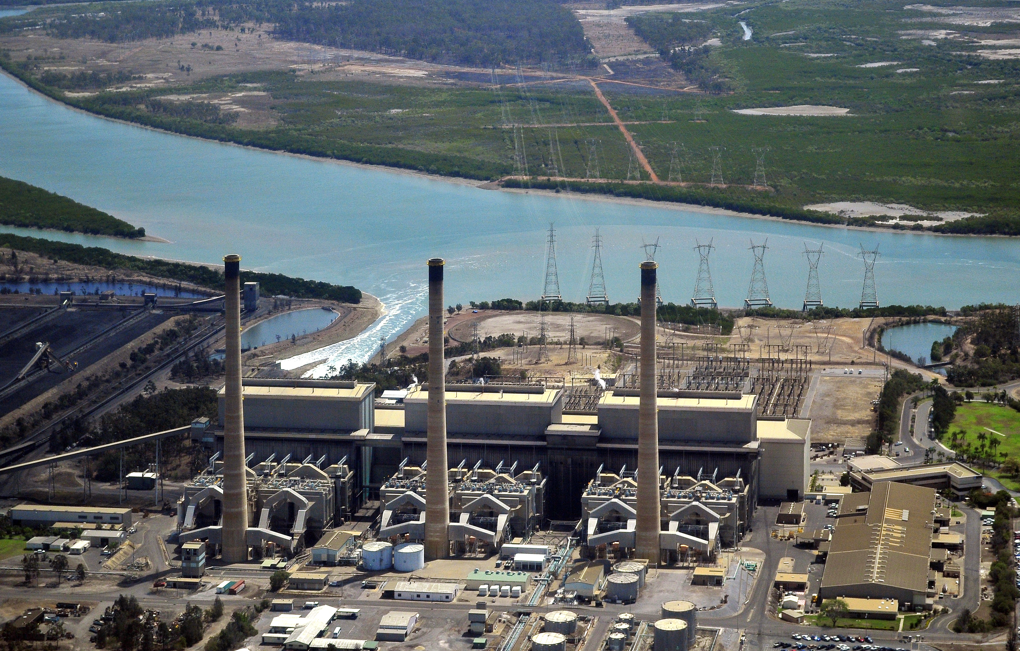
Gladstone Power Station 2.jpg - LBM1948

Gladstone Power Station 1.jpg - LBM1948

Gladstone Power Station 3.jpg - LBM1948
Heron Island Aérea.jpg - LBM1948

Flight from Sydney to Cairns. Over Queensland (483670) (9443427948).jpg - OceanAtoll

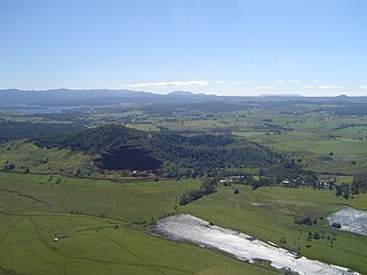
Mt Quincan aerial view.jpg - Glpww

Green Island and Saint Helena Island, Queensland, Australia.jpg - Kgbo

Springfield Central - Bird's Eye View.jpg - Wikiforgood

Bushfire near Lake Cootharaba, Queensland, Australia - November 6th, 2019 (49025918793).jpg - Eyes Roger

Bushfire near Lake Cootharaba, Queensland, Australia - November 6th, 2019 (49026641657).jpg - Eyes Roger

Aerostock coolum beach aerial photo.jpg - Aerutopian

A view from the heavens (29872415050).jpg - Sentinel user

Aerial Photo of Noosa Spit Recreation Reserve.jpg - Aerutopian

Aerial view of Highfields State School, 2021.jpg - Kerry Raymond

Aerial view of Yarrabah Mission Station, circa 1972.jpg - Kerry Raymond

Aerial perspective of Mooloolaba's network of waterways.jpg - BobTanGo

Aerial panorama of Mooloolaba.jpg - BobTanGo

Aerial panorama of Lake Baroon. June 2023.jpg - BobTanGo

Lake Baroon top down. June 2023.jpg - BobTanGo

Aerial panorama of Maleny facing the hinterland. 2023.jpg - BobTanGo

Aerial panorama of Maleny facing Lake Baroon. 2023.jpg - BobTanGo

Aerial panorama of the Australia Zoo. 2023.jpg - BobTanGo

Aerial panorama of the Australia Zoo along Steve Irwin Way. 2023.jpg - BobTanGo
Aerial vista of Sunshine Coast University and its surrounds. 2023.jpg - BobTanGo

View from a helicopter over Southport across the Broadwater to Main Beach and the Pacific Ocean beyond, 2006 - 289362902.jpg - Kerry Raymond

Aerial panorama from Mount Mee lookout. June 2023.jpg - BobTanGo

Dayboro and surrounds from above. June 2023.jpg - BobTanGo

Dayboro aerial panorama. June 2023.jpg - BobTanGo

Palmview State Secondary College, site view taken by drone, late October 2022 01.jpg - Kerry Raymond

Aerial view, Sandgate State School, 2011.jpg - Kerry Raymond
Aerial view of Scarborough State School with Moreton Bay in the distance, 2023.jpg - Kerry Raymond
Normanton State School, 2023 02.jpg - Kerry Raymond
Normanton State School, 2023 01.jpg - Kerry Raymond
Normanton State School, 2023 03.jpg - Kerry Raymond
Aerial view, Freshwater State School, 2019.jpg - Kerry Raymond
Noosa District State High School, aerial view, 2013.jpg - Kerry Raymond
Back Plains State School, 2023 01.jpg - Kerry Raymond

Back Plains State School, 2023 02.jpg - Kerry Raymond

Mourilyan Harbour port facilities, 2023.jpg - Kerry Raymond

Pajinka including Utingu photographed by Ian Cochrane.jpg - MatthewDalhousie
Aerial panorama of Maleny facing Lake Baroon. 2023 (cropped).jpg - Leftregister

Aerial panorama of Mooloolaba (cropped).jpg - Leftregister

Aerial view over Mackay, 2009.jpg - Kerry Raymond

Aerial photograph, Kawana Waters State College, 2024.jpg - Kerry Raymond

Aerial photograph of Mudgeeraba State School, 2023 01.jpg - Kerry Raymond
Aerial photograph of Mudgeeraba State School, 2023 02.jpg - Kerry Raymond

Aerial photograph of Mudgeeraba State School, 2023 03.jpg - Kerry Raymond

Looking towards Surfers Paradise from Mudgeeraba, 2023.jpg - Kerry Raymond

Aerial view of Flagstone State School, 2024.jpg - Kerry Raymond

Bentley Park College campus, 2007.jpg - Kerry Raymond

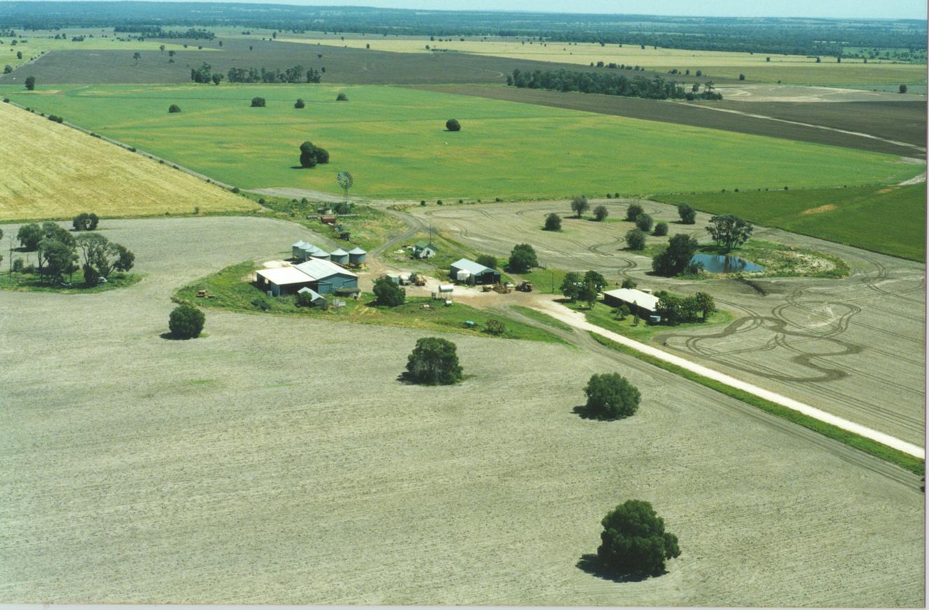
Rosedale State School, 2023.jpg - Kerry Raymond
Aerial photograph of Gympie East State School, 2020.jpg - Kerry Raymond

Aerial photograph of Bell State School, 2024.jpg - Kerry Raymond
Aerial view of Tully State High School, 2024.jpg - Kerry Raymond
Tully State High School, aerial view, 2023.jpg - Kerry Raymond

Cairns from the air, circa 1966.jpg - Kerry Raymond

Mackay from the air, 1966.jpg - Kerry Raymond

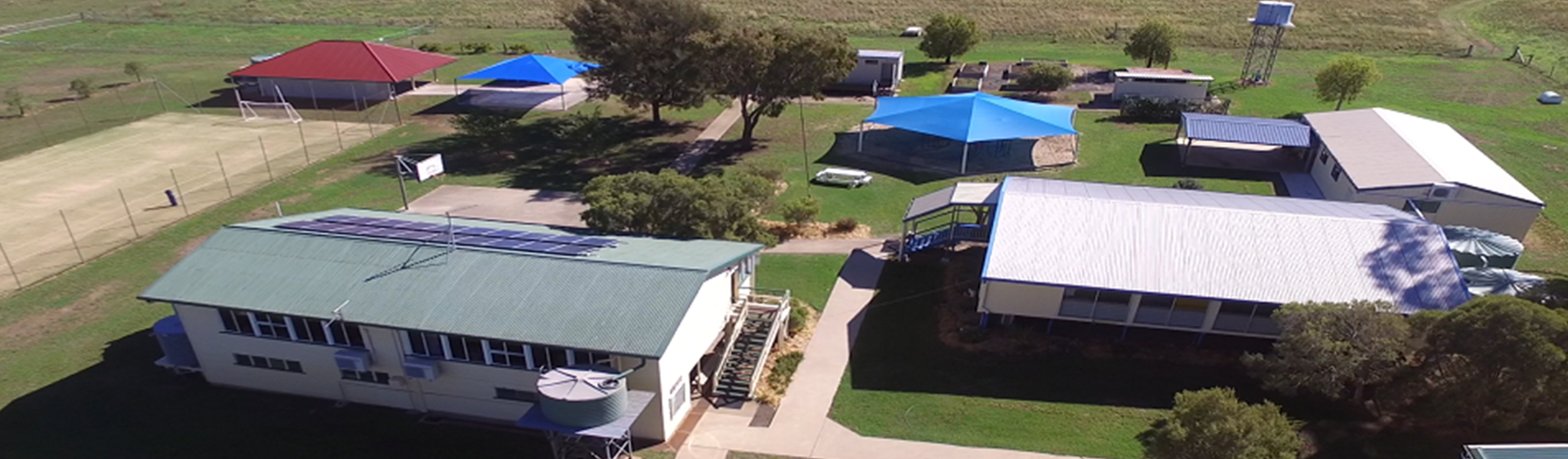
Lochington State School aerial, 2025.jpg - Kerry Raymond

Doomadgee, aerial view, 2025.jpg - Kerry Raymond

Irvinebank State School, 2025.jpg - Kerry Raymond

Babinda State School, 2025.jpg - Kerry Raymond
Aerial view of Babinda State School, 2025.jpg - Kerry Raymond

Port Douglas State School, 2025.jpg - Kerry Raymond

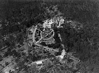
Aerial view of the BoysTown site, 1993.jpg - Kerry Raymond

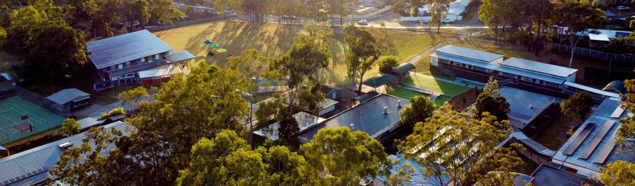
White Rock State School, aerial photo, 2024.jpg - Kerry Raymond

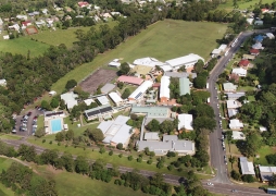
Northern Beaches State High School, 2023.jpg - Kerry Raymond