Wikimedi'Òc
Modes d'emploi

Cet album fait partie des albums
Cet album photos contient les sous-albums suivants :


UK road A32.svg - Fredddie

UK road A32.PNG - BotMultichill

Junction of A27 and A32 Fareham. - geograph.org.uk - 2396.jpg - GeographBot

Looking North along the A32 passing through farmland. - geograph.org.uk - 27160.jpg - GeographBot

West Meon - geograph.org.uk - 1573.jpg - GeographBot

Wickham - geograph.org.uk - 1577.jpg - GeographBot

Crossroad A32 and Cott Street - geograph.org.uk - 81921.jpg - GeographBot

George and Falcon public house, Warnford - geograph.org.uk - 239490.jpg - GeographBot

Junction of A32 and yellow road going towards Winchester - geograph.org.uk - 239514.jpg - GeographBot

King's Way crossing the A32 west of Soberton - geograph.org.uk - 237788.jpg - GeographBot

King's Way looking across A32 towards Soberton - geograph.org.uk - 237802.jpg - GeographBot

Warnford - geograph.org.uk - 375415.jpg - GeographBot

Forton Road, Gosport - geograph.org.uk - 388478.jpg - GeographBot

Entering Meonstoke from the A32, showing Bucks Head pub - geograph.org.uk - 423778.jpg - GeographBot

Roundabout joining B3035 to A32 at Corhampton - geograph.org.uk - 423804.jpg - GeographBot

Turning off A32 into Meonstoke - geograph.org.uk - 423816.jpg - GeographBot

Albany Business Centre on the A32 - geograph.org.uk - 458299.jpg - GeographBot

Roundabout on A32 and dedicated access road to Knowle Village - geograph.org.uk - 458301.jpg - GeographBot

Gosport, former Britannia Inn - geograph.org.uk - 542937.jpg - GeographBot

A32 road approaching Droxford from the south - geograph.org.uk - 594745.jpg - GeographBot

High Street, Droxford - geograph.org.uk - 592548.jpg - GeographBot

High Street, Droxford - geograph.org.uk - 594724.jpg - GeographBot

Meringtons Store and Fuel Station, nr Droxford - geograph.org.uk - 590769.jpg - GeographBot

Meringtons crossroads, Droxford - geograph.org.uk - 592520.jpg - GeographBot

Murco service station, Droxford - geograph.org.uk - 592392.jpg - GeographBot

Police Station Lane, Droxford - geograph.org.uk - 592567.jpg - GeographBot

A32 going through West Meon - geograph.org.uk - 619958.jpg - GeographBot

High Street, West Meon - geograph.org.uk - 619938.jpg - GeographBot

Looking southwards towards A32 from car park by Fareham Police Station - geograph.org.uk - 616651.jpg - GeographBot

The Cross, West Meon - geograph.org.uk - 619976.jpg - GeographBot

Footpath from the church emerges onto the A32, West Meon - geograph.org.uk - 620123.jpg - GeographBot

The A32 snakes through West Meon - geograph.org.uk - 620131.jpg - GeographBot

Warnford Corner, West Meon - geograph.org.uk - 620004.jpg - GeographBot

Caravan site west of Brocklands Farm - geograph.org.uk - 631448.jpg - GeographBot

Take your chance^ - geograph.org.uk - 736748.jpg - GeographBot

Wallington Way-Fareham - geograph.org.uk - 748005.jpg - GeographBot

Milepost - geograph.org.uk - 830685.jpg - GeographBot

Junction of Allens Lane with the A32 - geograph.org.uk - 1114731.jpg - GeographBot

Looking along the A32 towards Exton - geograph.org.uk - 1114967.jpg - GeographBot

The A32 at Corhampton - geograph.org.uk - 1114961.jpg - GeographBot

Gravestones by the A32 - geograph.org.uk - 1124714.jpg - GeographBot

Junction of the B2177 and the A32 at Wickham - geograph.org.uk - 1124670.jpg - GeographBot

Welcome to Fareham - geograph.org.uk - 1153956.jpg - GeographBot

Welcome to Gosport - geograph.org.uk - 1153974.jpg - GeographBot

Gosport Road - Lower Farringdon - geograph.org.uk - 1161734.jpg - GeographBot

Bus shelter on the A32 at East Tisted - geograph.org.uk - 1182792.jpg - GeographBot

A32 south of Wickham - geograph.org.uk - 1273216.jpg - GeographBot

Castle Farm Lane - geograph.org.uk - 1273229.jpg - GeographBot

Entering Wickham from the south on the A32 - geograph.org.uk - 1273670.jpg - GeographBot

A32 Wickham Road about to pass beneath the M27 - geograph.org.uk - 1286450.jpg - GeographBot

Entrance to The Dean Estate - geograph.org.uk - 1286455.jpg - GeographBot

Mid section of Forton Road - geograph.org.uk - 1327402.jpg - GeographBot

Mumby Road - geograph.org.uk - 1327021.jpg - GeographBot

Traffic lights in Forton Road - geograph.org.uk - 1327666.jpg - GeographBot

Traffic lights in Mumby Road - geograph.org.uk - 1327292.jpg - GeographBot

Postbox, Lower Farringdon - geograph.org.uk - 1343521.jpg - GeographBot

Telephone box, Lower Farringdon - geograph.org.uk - 1343504.jpg - GeographBot

Small roundabout on the A32 - geograph.org.uk - 1364064.jpg - GeographBot

Brockhurst Road - geograph.org.uk - 1379211.jpg - GeographBot

Traffic lights in Forton Road - geograph.org.uk - 1377640.jpg - GeographBot

BP garage in Brockhurst Road - geograph.org.uk - 1380528.jpg - GeographBot

Mid section of Brockhurst Road - geograph.org.uk - 1380487.jpg - GeographBot
Lower Farringdon, Hampshire - geograph.org.uk - 1416600.jpg - GeographBot

Mumby Road - geograph.org.uk - 1424085.jpg - GeographBot

Commemorative tree, Warnford - geograph.org.uk - 1430793.jpg - GeographBot

The A32 heading towards Corhampton - geograph.org.uk - 1582189.jpg - GeographBot

The A32 heading towards Warnford - geograph.org.uk - 1582178.jpg - GeographBot

Fareham Road near its junction with Cunningham Drive (1982) - geograph.org.uk - 1741348.jpg - GeographBot

Fareham Road near its junction with Cunningham Drive (2010) - geograph.org.uk - 1741386.jpg - GeographBot

Texaco garage in Fareham Road - geograph.org.uk - 1763219.jpg - Geograph Update Bot

Wickham Bridge Street corner geograph-4070803-by-Ben-Brooksbank.jpg - Chevin

A32 crossroads with Brightstone Lane - geograph.org.uk - 3248866.jpg - GeographBot

Old Milepost by the A32, Fareham Road, Gosport parish (geograph 6049472).jpg - Sic19

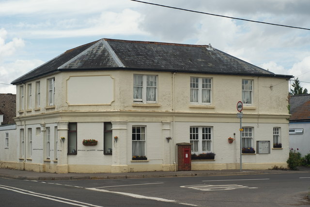
I bet this was once a public house - geograph.org.uk - 4123135.jpg - GeographBot

Looking north on the A32 at the junction with Brightstone Lane - geograph.org.uk - 4123137.jpg - GeographBot

Looking north in Lower Farringdon from footpath junction - geograph.org.uk - 4123140.jpg - GeographBot

Public House in Lower Farringdon - geograph.org.uk - 4123236.jpg - GeographBot

Telephone box and junction with the A32, Lower Farringdon - geograph.org.uk - 4610769.jpg - GeographBot

Former shop, Farringdon - geograph.org.uk - 4842077.jpg - GeographBot

Former shop, by the crossroads at Farringdon - geograph.org.uk - 4901969.jpg - GeographBot

Red Lion - geograph.org.uk - 2985144.jpg - GeographBot

The Red Lion - West Meon - geograph.org.uk - 1627117.jpg - GeographBot

The Red Lion pub, West Meon - geograph.org.uk - 2510112.jpg - GeographBot

Sadly a pub no more - geograph.org.uk - 3704105.jpg - GeographBot

The A32 through West Meon - geograph.org.uk - 4619515.jpg - GeographBot

Gosport Road at the junction of Brightstone Lane - geograph.org.uk - 5020225.jpg - GeographBot

Gosport Road, Lower Farringdon - geograph.org.uk - 5020226.jpg - GeographBot

Gosport Road, Lower Farringdon - geograph.org.uk - 5020243.jpg - GeographBot

Street House Farm, Lower Farringdon - geograph.org.uk - 5028728.jpg - GeographBot