Wikimedi'Òc
Modes d'emploi

Cet album fait partie des albums
Cet album photos contient les sous-albums suivants :


Cloud Over Butser Hill, Queen Elizabeth Country Park.jpg - TimSC

Visitors Centre and The Meadow, Queen Elizabeth Country Park.jpg - TimSC

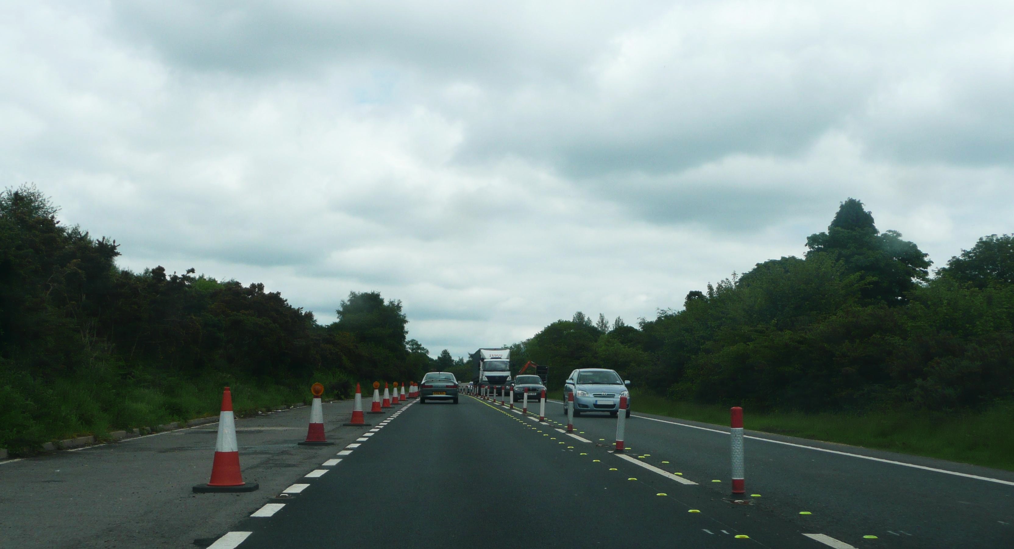
A3 near Liphook.jpg - Loganberry~commonswiki

A3 Portsdown Hill Junction 5.jpg - Unisouth~commonswiki

A3 North - approaching the Wisley Interchange.jpg - BetacommandBot

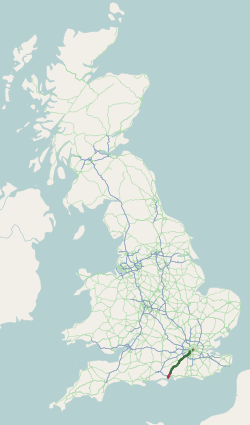
UK road A3.svg - Fredddie

Petrol station at Lower Eashing on A3 - geograph.org.uk - 1263450.jpg - File Upload Bot (Magnus Manske)

Hindhead A3 Portsmouth Road contraflow.JPG - Arriva436
Hindhead A3 Portsmouth Road contraflow 2.JPG - Arriva436

Hindhead A3 Portsmouth Road contraflow 3.JPG - Arriva436

Hindhead A3 Portsmouth Road contraflow and roadworks.JPG - Arriva436

Hindhead A3 Portsmouth Road contraflow and roadworks 2.JPG - Arriva436

Hindhead A3 Portsmouth Road roadworks.JPG - Arriva436

Hindhead A3 Portsmouth Road roadworks 2.JPG - Arriva436

Hindhead A3 Portsmouth Road roadworks 3.JPG - Arriva436

Hindhead A3 Portsmouth Road roadworks 4.JPG - Arriva436

Hindhead A3 Portsmouth Road.JPG - Arriva436

Stagecoach Hants & Surrey 32628 P628 PGP.JPG - Arriva436

Hindhead Traffic Lights A3 Portsmouth Road.JPG - Arriva436

Hindhead Traffic Lights A3 Portsmouth Road 2.JPG - Arriva436

Hindhead A3 London Road.JPG - Arriva436

Devil's Punch Bowl A3 Portsmouth Road.JPG - Arriva436

Devil's Punch Bowl A3 Portsmouth Road 2.JPG - Arriva436

Devil's Punch Bowl A3 Portsmouth Road 3.JPG - Arriva436

Devil's Punch Bowl A3 Portsmouth Road 4.JPG - Arriva436

Devil's Punch Bowl from A3 Portsmouth Road.JPG - Arriva436

Devil's Punch Bowl A3 Portsmouth Road 5.JPG - Arriva436

Devil's Punch Bowl A3 Portsmouth Road 6.JPG - Arriva436

Devil's Punch Bowl A3 Portsmouth Road roadworks.JPG - Arriva436

Devil's Punch Bowl A3 Portsmouth Road roadworks 2.JPG - Arriva436

Devil's Punch Bowl A3 Portsmouth Road roadworks 3.JPG - Arriva436

Devil's Punch Bowl A3 Portsmouth Road roadworks 4.JPG - Arriva436

A3, Devil's Punch Bowl - geograph.org.uk - 3751.jpg - GeographBot

A3, Thursley junction - geograph.org.uk - 2790.jpg - GeographBot

A3 and B3006 Roundabout - geograph.org.uk - 3792.jpg - GeographBot
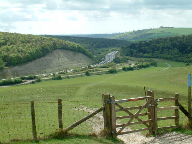
Butser Hill and Hillhampton Bottom - geograph.org.uk - 8088.jpg - GeographBot

A3 Petersfield bypass and farmland. - geograph.org.uk - 10876.jpg - GeographBot

A3, Bramshott - geograph.org.uk - 21557.jpg - GeographBot

Looking North on the A3 Petersfield Bypass - geograph.org.uk - 10745.jpg - GeographBot

The Spaniard, Bramshott Chase - geograph.org.uk - 17161.jpg - GeographBot

A3 at Hook looking east. - geograph.org.uk - 39477.jpg - GeographBot

A3 at the Hook underpass - geograph.org.uk - 39474.jpg - GeographBot

A3(T) from bridge near Hook - geograph.org.uk - 48802.jpg - GeographBot

A3(T) from the bridleway bridge near Barwell Farm - geograph.org.uk - 45394.jpg - GeographBot

A3 near Hook - geograph.org.uk - 42280.jpg - GeographBot

A3 near the American Community School, Cobham - geograph.org.uk - 89101.jpg - GeographBot

A3 from Bell Hill, Petersfield - geograph.org.uk - 95352.jpg - GeographBot

Butser Hill and Hilhampton Bottom - geograph.org.uk - 206626.jpg - GeographBot

The A3, looking north - geograph.org.uk - 251669.jpg - GeographBot

Petersfield bypass - geograph.org.uk - 357284.jpg - GeographBot

Climbing Butser Hill winter - geograph.org.uk - 417762.jpg - GeographBot

A3 London Road north of Burpham - geograph.org.uk - 696508.jpg - GeographBot

Number 21 at Cathedral Junction - geograph.org.uk - 698686.jpg - GeographBot

A31 road bridge over the A3 - geograph.org.uk - 705606.jpg - GeographBot

A3 - A31 interchange at the Hog's Back - geograph.org.uk - 704305.jpg - GeographBot

Twyford Avenue, Stamshaw - geograph.org.uk - 723095.jpg - GeographBot

Bank holiday motorbikes in London Road - geograph.org.uk - 732559.jpg - GeographBot

Bend in the road at Plant Farm - geograph.org.uk - 732552.jpg - GeographBot

Bike and bus lane on London Road - geograph.org.uk - 732624.jpg - GeographBot

Bus stop on the old Light Railway Route - geograph.org.uk - 732601.jpg - GeographBot

Bus stops by Christchurch Gardens - geograph.org.uk - 732036.jpg - GeographBot

London Road, Purbrook - geograph.org.uk - 732072.jpg - GeographBot

London Road between Purbrook and Waterlooville - geograph.org.uk - 732576.jpg - GeographBot

Postbox in London Road - geograph.org.uk - 732598.jpg - GeographBot

Shops in London Road, Widley - geograph.org.uk - 732060.jpg - GeographBot

These are not just lampposts.... - geograph.org.uk - 732545.jpg - GeographBot

Looking from junction of Widley and Chalkridge Roads towards the old A3 - geograph.org.uk - 746044.jpg - GeographBot

Junction of Park Road with the A3 - geograph.org.uk - 757197.jpg - GeographBot
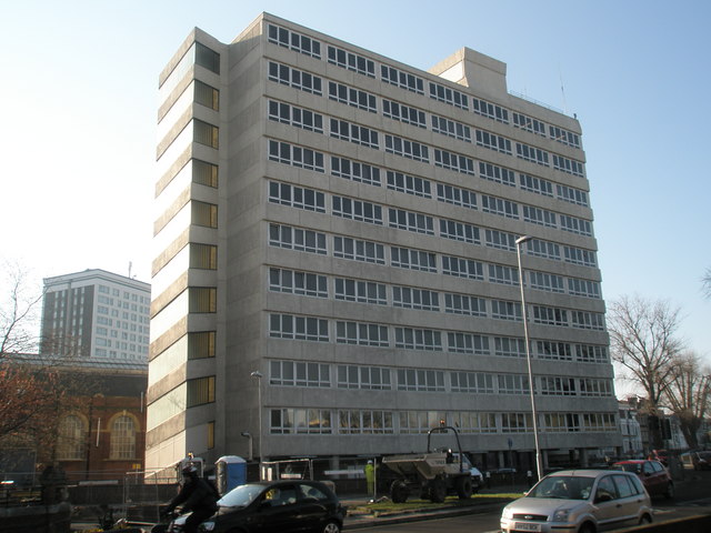
Tower block on the A3 - geograph.org.uk - 757213.jpg - GeographBot

Commercial building between A3 and Rampart Gate - geograph.org.uk - 774283.jpg - GeographBot

The A3 from half way up Butser Hill - geograph.org.uk - 808798.jpg - GeographBot

Junction of Tower road with the A3 at Hindhead - geograph.org.uk - 819241.jpg - GeographBot

Portsmouth Road towards the Haslemere Road - geograph.org.uk - 819203.jpg - GeographBot

The A3 approaching Hindhead - geograph.org.uk - 818748.jpg - GeographBot

Former A3 north of Hindhead - geograph.org.uk - 818744.jpg - GeographBot

A3 London-bound - geograph.org.uk - 1001887.jpg - GeographBot

Ripley By-Pass - geograph.org.uk - 1001379.jpg - GeographBot

A3 southbound near Horndean - geograph.org.uk - 1098960.jpg - GeographBot

A3, Looking East From Clay Lane - geograph.org.uk - 1144286.jpg - GeographBot

A3 From Clay Lane - geograph.org.uk - 1144273.jpg - GeographBot

Snowplough on the A3 - geograph.org.uk - 1144219.jpg - GeographBot

The A3 - geograph.org.uk - 1253844.jpg - GeographBot

Looking south-west down London Road - geograph.org.uk - 1286257.jpg - GeographBot

Twyford Avenue - geograph.org.uk - 1294465.jpg - GeographBot

Ace cars in London Road - geograph.org.uk - 1308018.jpg - GeographBot

Car in London Road - geograph.org.uk - 1308040.jpg - GeographBot

Looking north-east up London Road - geograph.org.uk - 1308078.jpg - GeographBot

Shops in London Road - geograph.org.uk - 1308024.jpg - GeographBot

Looking eastwards on the A3 from the Hangers Way Footbridge - geograph.org.uk - 1325156.jpg - GeographBot

Looking westwards on the A3 from the Hangers Way Footbridge - geograph.org.uk - 1325143.jpg - GeographBot

A wet and windy London Road - geograph.org.uk - 1582831.jpg - GeographBot

Bus stops in London Road - geograph.org.uk - 1584071.jpg - GeographBot

Chalet bungalows in London Road - geograph.org.uk - 1584058.jpg - GeographBot

Lampposts in London Road - geograph.org.uk - 1583982.jpg - GeographBot

Looking across London Road towards an alleyway leading to Granada Close - geograph.org.uk - 1583973.jpg - GeographBot

Mid section of London Road - geograph.org.uk - 1583971.jpg - GeographBot

A3 flyover - geograph.org.uk - 1659077.jpg - GeographBot

A really hideous roundabout - geograph.org.uk - 1702200.jpg - GeographBot

A3 eastbound, Esher - geograph.org.uk - 1743114.jpg - GeographBot

A3 near Thursley - geograph.org.uk - 1802306.jpg - GeographBot

Crossing on the A3 - geograph.org.uk - 1802271.jpg - GeographBot
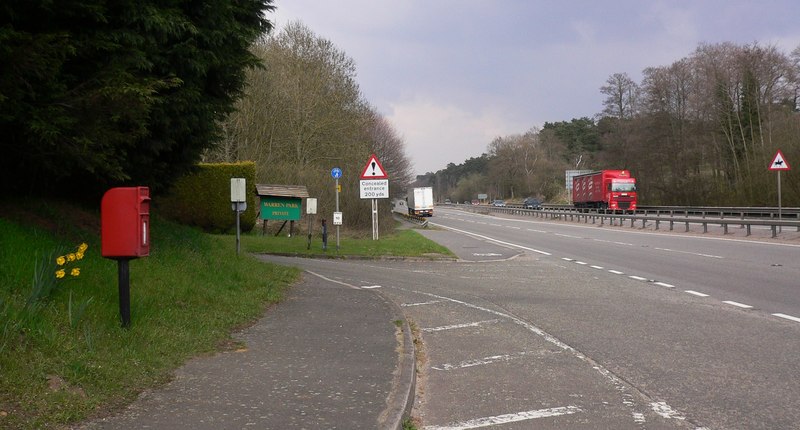
The A3 at Warren Park - geograph.org.uk - 1802209.jpg - GeographBot

Hindhead Tunnel Vision Day - geograph.org.uk - 2407995.jpg - File Upload Bot (Magnus Manske)
Devil's Punch Bowl, old A3 closed to traffic 1.jpg - Simon Burchell

Devil's Punch Bowl, old A3 closed to traffic 2.jpg - Simon Burchell

Devil's Punch Bowl, old A3 closed to traffic 3.jpg - Simon Burchell

Devil's Punch Bowl, old A3 closed to traffic 4.jpg - Simon Burchell

Devil's Punch Bowl, old A3 closed to traffic 5.jpg - Simon Burchell
A3M.PNG - Cloudbound

41 bus in London Road about to pass Wallis Road - geograph.org.uk - 1827593.jpg - File Upload Bot (Magnus Manske)

Old A3 Hindhead.JPG - Martinvl
A3 road map.png - Rcsprinter123

The old A3 at Hindhead (aerial).jpg - Flickr upload bot

Queen Elizabeth Country Park - panoramio - Alistair Cunningham (1).jpg - Panoramio upload bot

A3 - panoramio.jpg - Panoramio upload bot

Former Evangelical Mission Hall, London Road, Cowplain (May 2019).JPG - Hassocks5489

Milestone beside A3, Bramshott Common, Hampshire 05.jpg - Simon Burchell

Milestone beside A3, Bramshott Common, Hampshire 08.jpg - Simon Burchell

Milestone beside A3, Bramshott Common, Hampshire 09.jpg - Simon Burchell

Milestone beside A3, Bramshott Common, Hampshire 07.jpg - Simon Burchell

Milestone beside A3, Bramshott Common, Hampshire 10.jpg - Simon Burchell

Milestone beside A3, Bramshott Common, Hampshire 11.jpg - Simon Burchell

Hindhead Tunnel Vision - geograph.org.uk - 2407997.jpg - GeographBot

Hindhead Tunnel Vision - geograph.org.uk - 2408082.jpg - GeographBot

A3 - 1-2 mile to Burpham interchange - geograph.org.uk - 2686972.jpg - GeographBot

A3, Approaching junction 2 - geograph.org.uk - 2794364.jpg - GeographBot

Dockyard Building, Albert Road - geograph.org.uk - 2930147.jpg - GeographBot

A3 at Waterlooville boundary - geograph.org.uk - 3113476.jpg - GeographBot

A3 at Wisley, Surrey - geograph.org.uk - 3352458.jpg - GeographBot

The A3 trunk road - geograph.org.uk - 3588692.jpg - GeographBot

The A3 out of Portsmouth - geograph.org.uk - 3621935.jpg - GeographBot

Portsdown Hill Road Bridge opening commemoration stone (20221022 092955 687).jpg - Djm-leighpark

Portsbridge Roundabout from the South.jpg - TimSC

Gymnasium, HMS Nelson.jpg - TimSC

Subway under the A3 at Black Hanger, Thursley 01.jpg - Simon Burchell

Subway under the A3 at Black Hanger, Thursley 02.jpg - Simon Burchell

Subway under the A3 at Black Hanger, Thursley 03.jpg - Simon Burchell

Subway under the A3 at Black Hanger, Thursley 05.jpg - Simon Burchell

Subway under the A3 at Black Hanger, Thursley 04.jpg - Simon Burchell

Abutment of former Portsmouth & Horndean Light Railway bridge 4.jpg - TimSC

Abutment of former Portsmouth & Horndean Light Railway bridge 3 - 53024209089.jpg - TimSC

Just Stop Oil, Portsmouth, 9th Sept 2023.jpg - TimSC

Just Stop Oil, Portsmouth, 9th Sept 2023 2.jpg - TimSC

Mile End Roundabout Junction.jpg - TimSC

Footbridge Between FirstSolent Bus Depot and Southdown View.jpg - TimSC

Area Around Former Sainsburys, Commercial Road.jpg - TimSC

Gymnasium, Eastney, Jervis.jpg - TimSC

A3 - geograph.org.uk - 6545513.jpg - GeographBot

A3 - geograph.org.uk - 6573615.jpg - GeographBot

A3 at night - geograph.org.uk - 6574021.jpg - GeographBot

Texaco Filling Station, A3 - geograph.org.uk - 6574026.jpg - GeographBot

A3 looking south - geograph.org.uk - 6580310.jpg - GeographBot

Severed End of London Road, Hindhead (June 2015) (1).jpg - Hassocks5489

Severed End of London Road, Hindhead (June 2015) (2).jpg - Hassocks5489

Severed End of London Road, Hindhead (June 2015) (3).jpg - Hassocks5489

Severed End of London Road, Hindhead (June 2015) (4).jpg - Hassocks5489

Northeastward view along A3 (Portsmouth Road), Thursley (June 2015) (1).jpg - Hassocks5489

Northeastward view along A3 (Portsmouth Road), Thursley (June 2015) (2).jpg - Hassocks5489

Northeastward view along Portsmouth Road, Hindhead (June 2015).jpg - Hassocks5489

Southwestward view along A3 (Portsmouth Road), Thursley (June 2015).jpg - Hassocks5489

A3 - geograph.org.uk - 6720253.jpg - GeographBot

A3 - geograph.org.uk - 6754651.jpg - GeographBot

Compass Roundabout, Cosham.jpg - TimSC