Wikimedi'Òc
Modes d'emploi

Cet album fait partie des albums
Cet album photos contient les sous-albums suivants :


1873 Stieler's Map of Ibiza and Spanish and African Coasts - Geographicus - Ibiza-s-73.jpg - BotMultichill

Carte des îles Baléares Iphigénie.jpg - Rotatebot

O'SHEAS (1895) p486 BALEARIC ISLANDS.jpg - Metilsteiner

Map of part of the Mediterranean Sea from Malaga to the Island of Minorca (1803).png - CzarJobKhaya

La face de la terre (Das Antlitz der Erde). Traduit de l'allemand, avec l'autorisation de l'auteur et annotée sous la direction de Emm. de Margerie. Avec une préf. par Marcel Bertrand (1897) (14591529100).jpg - SteinsplitterBot

Brockhaus' Konversations-Lexikon (1892) (14597917697).jpg - Fæ

Part 2 of Roman Hispania 218-215 aC.jpg - MagentaGreen

Image taken from page 486 of 'O'Shea's Guide to Spain and Portugal. Edited by John Lomas. Tenth edition. (With a loose map and plans.)' (11230695924).jpg - Artix Kreiger 2

Image taken from page 494 of '(Guide to Spain and Portugal including the Balearic Islands. ... Third edition.)' (11215862806).jpg - Artix Kreiger 2

Admiralty Chart No 1187 Alicante to Palamos with the Islas Baleares, Published 1882.jpg - Kognos

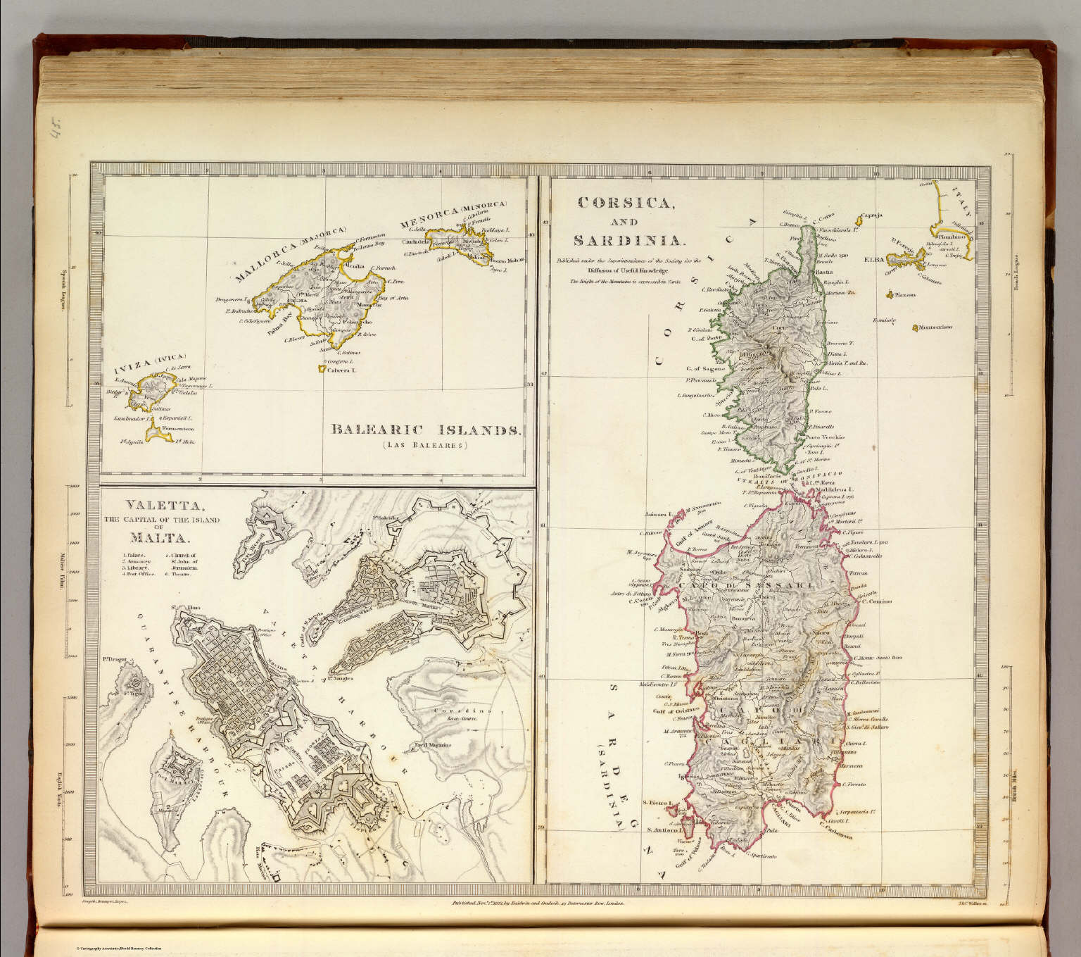
Corsica and Sardinia. Balearic Islands. Valetta, the Capital of the Island of Malta (1865).jpg - Dans
Corsica and Sardinia. Balearic Islands. Valetta, the Capital of the Island of Malta (1831).jpg - Dans

Plano de los Canales entre la islas Dragonera y Mallorca - Islas Baleares - D. José Gómez Ímaz ; J. Galvon lo grabó - btv1b53163309j.jpg - Gzen92Bot

Iles Baleares. btv1b8439359b (cropped).jpg - Geagea