Wikimedi'Òc
Modes d'emploi

Cet album fait partie des albums
Cet album photos contient les sous-albums suivants :


Kaart en sleutels vestingwerken.jpg - Kleon3

2025 Maastricht Museum, detail plattegrond 1841-1843.jpg - Kleon3

Von Geusau & anonymus, plattegrond Maastricht 3a (cropped).jpg - Kleon3

P.263-ing. F.W. van Gendt, 1872-Schetsmatig plan voor de aanleg van straten na de afbraak van de vestingwerken.jpg - Romaine

Netherlands, Ambij (Amby, Maastricht), map of 1866.jpg - Kleon3

Plattegrond "Plan van de stad Maastricht" - Maastricht - 20145277 - RCE.jpg - Mr.Nostalgic

Plattegrond van de stad met aanduiding van openbare gebouwen - Maastricht - 20145278 - RCE.jpg - Kleon3

Plattegrond 8 augustus 1867 - Maastricht - 20145279 - RCE.jpg - Mr.Nostalgic

Plattegrond waarop de uitbreiding van het gemeentelijk grondgebied - Maastricht - 20145280 - RCE.jpg - Kleon3

Plattegrond Wijck - Maastricht - 20145281 - RCE.jpg - Kleon3

Plan van Maastricht plattegrond (ingekleurd bouwkavels van de voormalige vestingwerken) - Maastricht - 20145282 - RCE.jpg - Mr.Nostalgic

"Kaart der Domeingronden te Maastricht" - Maastricht - 20145283 - RCE.jpg - Mr.Nostalgic

Plattegrond ontmanteling van Maastricht - Maastricht - 20145284 - RCE.jpg - Mr.Nostalgic

Plattegrond ontmanteling van Maastricht - Maastricht - 20145285 - RCE.jpg - Kleon3

Plattegrond uit 1867 - Maastricht - 20145288 - RCE.jpg - Mr.Nostalgic

Plattegrond uitbreidingsplan ten behoeve van te verkopen percelen - Maastricht - 20145289 - RCE.jpg - Mr.Nostalgic

Plattegrond verbreding Wijcker Brugstraat en percelen behorend bij onteigeningsbesluit - Maastricht - 20145290 - RCE.jpg - Kleon3

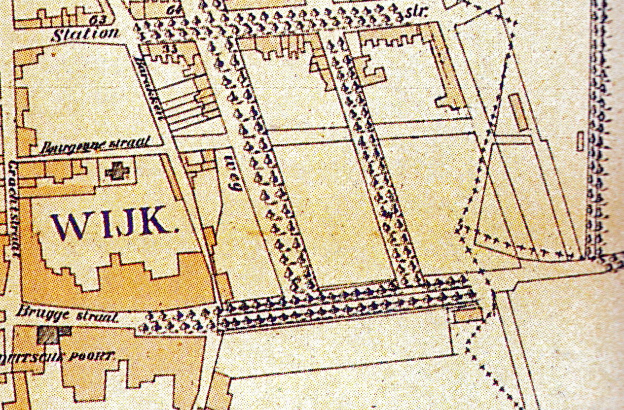
Plattegrond Wijck zuidelijk deel - Maastricht - 20145291 - RCE.jpg - Kleon3

Borgharen.jpg - Treehill

Itteren ca. 1870.jpg - Treehill

Limmel-Nazareth ca. 1850.JPG - Treehill

Borghaeren ca. 1842.jpg - Treehill

Maastricht, noordelijke vestingwerken.jpg - Kleon3

Tranchotkaart. Maastricht-Vroenhoven.jpg - Kleon3

Maastricht, ca 1860, omgeving Boschpoort, Bassin, Zuidwillemsvaart.jpg - Kleon3

Belgium and Holland. Handbook for travellers (1891) (14782628895).jpg - Fæ

Von Geusau & anonymus, plattegrond Maastricht 3.jpg - Kleon3

Von Geusau & anonymus, plattegrond Maastricht 1.jpg - Kleon3

Von Geusau & anonymus, plattegrond Maastricht 2.jpg - Kleon3

Von Geusau & anonymus, plattegrond Maastricht 4.jpg - Kleon3

Von Geusau & anonymus, plattegrond Maastricht 4 (cropped).jpg - Kleon3
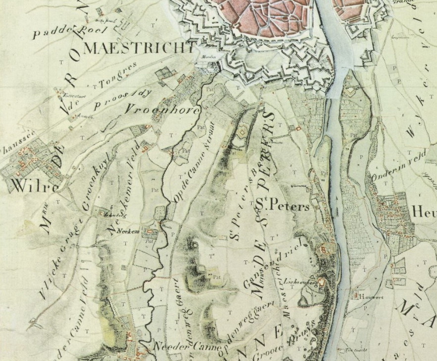
Tranchotkaart. Maastricht-Vroenhoven (cropped).jpg - Kleon3

Plattegrond "Plan van de stad Maastricht" - Maastricht - 20145277 - RCE (cropped1).jpg - Kleon3

Plattegrond "Plan van de stad Maastricht" - Maastricht - 20145277 - RCE (cropped2).jpg - Kleon3

Tranchotkaart. Maastricht-De Kommen.jpg - Kleon3

Maastricht, verkaveling Stationsbuurt, 1886.jpg - Kleon3

Maastricht, verkaveling Stationsbuurt, 1882.jpg - Kleon3

Maastricht, verkaveling Stationsbuurt, 1886a.jpg - Kleon3

Maastricht (Nederland - Provincie Limburg) — Kaart van de gids "Baedeker België en Holland", Franse editie van 1897.jpg - Jpcuvelier

Villapark Maastricht, 1886.jpg - Kleon3

Plattegrond "Plan van de stad Maastricht" - Maastricht - 20145277 - RCE (Quartier Amélie).jpg - Kleon3

Historische plattegrond van Maastricht (RAL K 159).jpg - Kleon3

Plattegrond Maastricht, ca 1830 (RAL K 165).jpg - Kleon3
Plattegrond Maastricht, ca 1860-1865 (RAL K 167).jpg - Kleon3

Plattegrond Maastricht, ca 1830 (RAL K 165) (detail1).jpg - Kleon3

Maastricht, Plan tot aanleg van straten op de vestingterreinen te Wyk, 1882.jpg - Kleon3

Maastricht, Plan tot aanleg van straten op de vestingterreinen te Wyk, 1882 (cropped).jpg - Kleon3

Maastricht, Plan tot aanleg van straten op de vestingterreinen te Wyk, 1882 (crop2).jpg - Kleon3
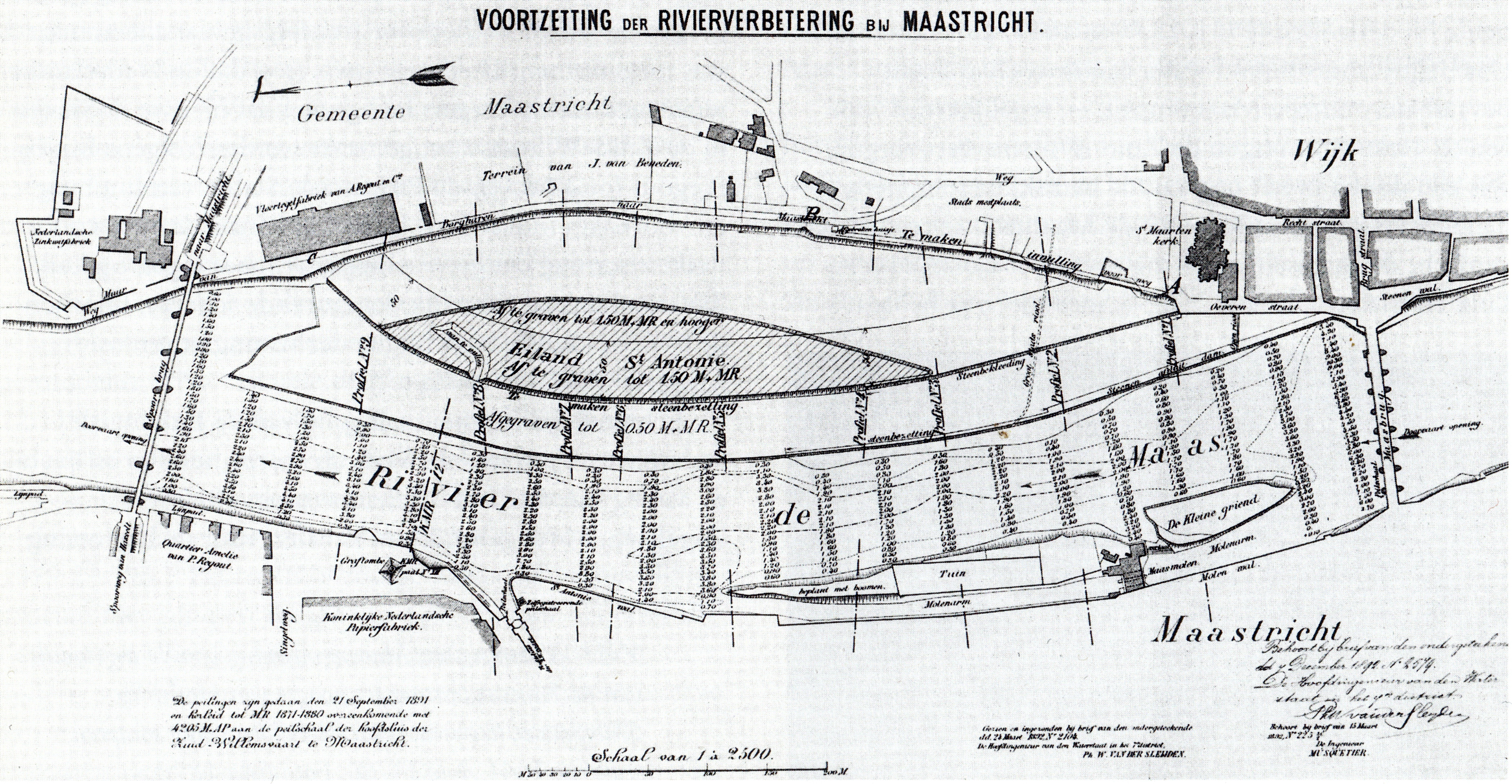
Rivierverbetering bij Maastricht, bestek 1892.jpg - Kleon3

Plattegrond van de vesting Maastricht (Wyck), 1868.jpg - Kleon3

Plattegrond "Plan van de stad Maastricht" (in kleur).jpg - Kleon3

Plattegrond Maastricht, ca 1860-1865 (RAL K 167) (crop1).jpg - Kleon3

Plattegrond van de vesting Maastricht (Wyck), 1868 (crop1).jpg - Kleon3

Plattegrond "Plan van de stad Maastricht", Wyck (in kleur).jpg - Kleon3

Plattegrond "Plan van de stad Maastricht" (Quartier Amélie).jpg - Kleon3

Plattegrond Maastricht, ca 1850.jpg - Kleon3

Plattegrond Maastricht, ca 1855.jpg - Kleon3

Plattegrond Maastricht-Wyck en omgeving, 1889.jpg - Kleon3

Plattegrond Maastricht en omgeving, 1889.jpg - Kleon3

Plattegrond Maastricht en omgeving, 1889 (detail Heugemerweg).jpg - Kleon3

Plattegrond Maastricht, 1823 (GAM1120).jpg - Kleon3
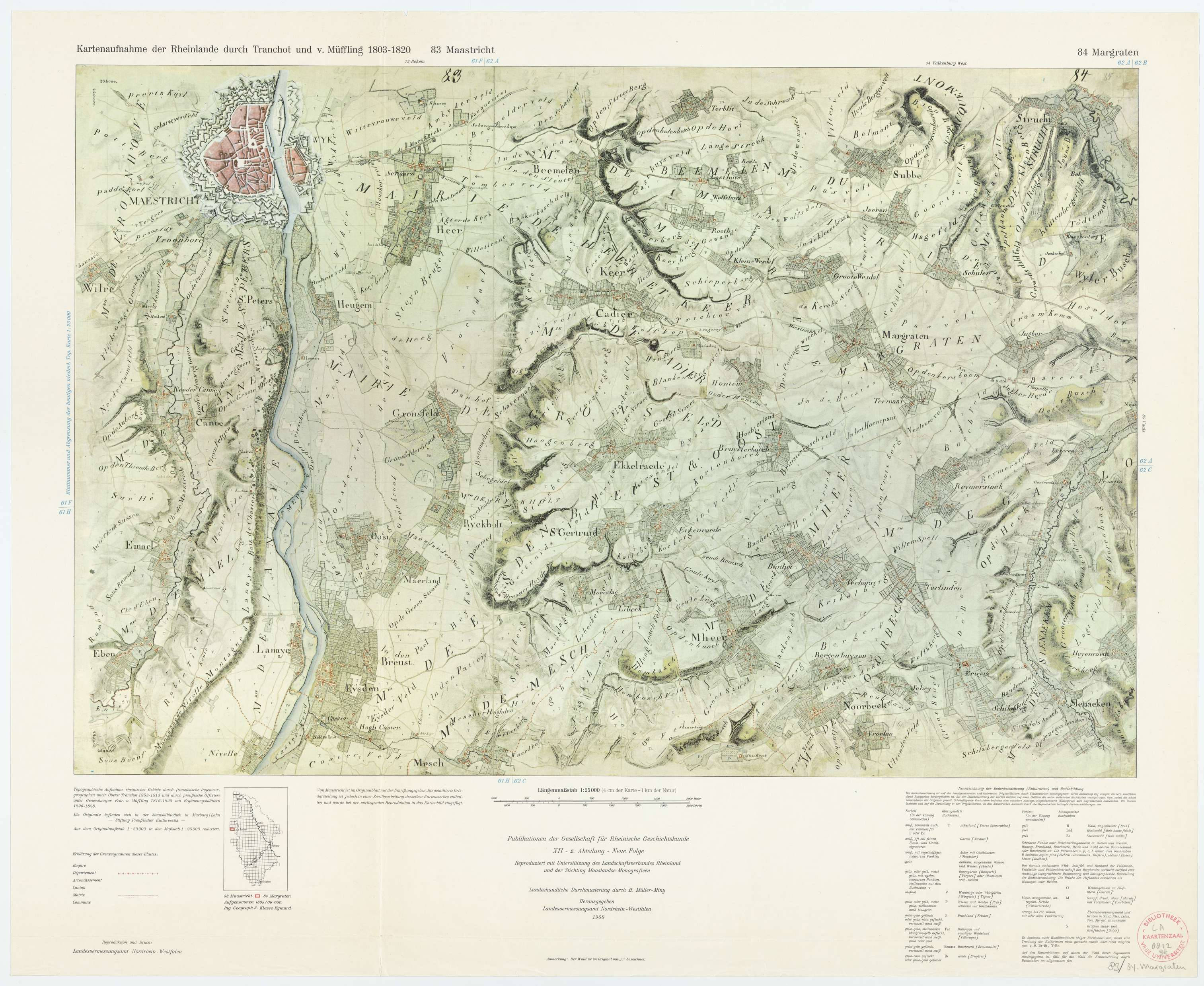
TrK83 Maastricht - 84 Margraten.jpg - Romaine
Plattegrond "Plan van de stad Maastricht" (Wyck).jpg - Kleon3

Plattegrond van de vesting Maastricht (Wyck), 1868 (crop2).jpg - Kleon3

Plattegrond Maastricht, ca 1830 (RAL K 165) (crop1).jpg - Kleon3

Plattegrond van de vesting Maastricht (Wyck), 1868 (crop3).jpg - Kleon3

TrK83 Maastricht - 84 Margraten (cropped).jpg - Kleon3

Goossens, opgraving Stokstraat.jpg - Kleon3

Tranchotkaart. Maastricht-Vroenhoven (Tongerseweg).jpg - Kleon3

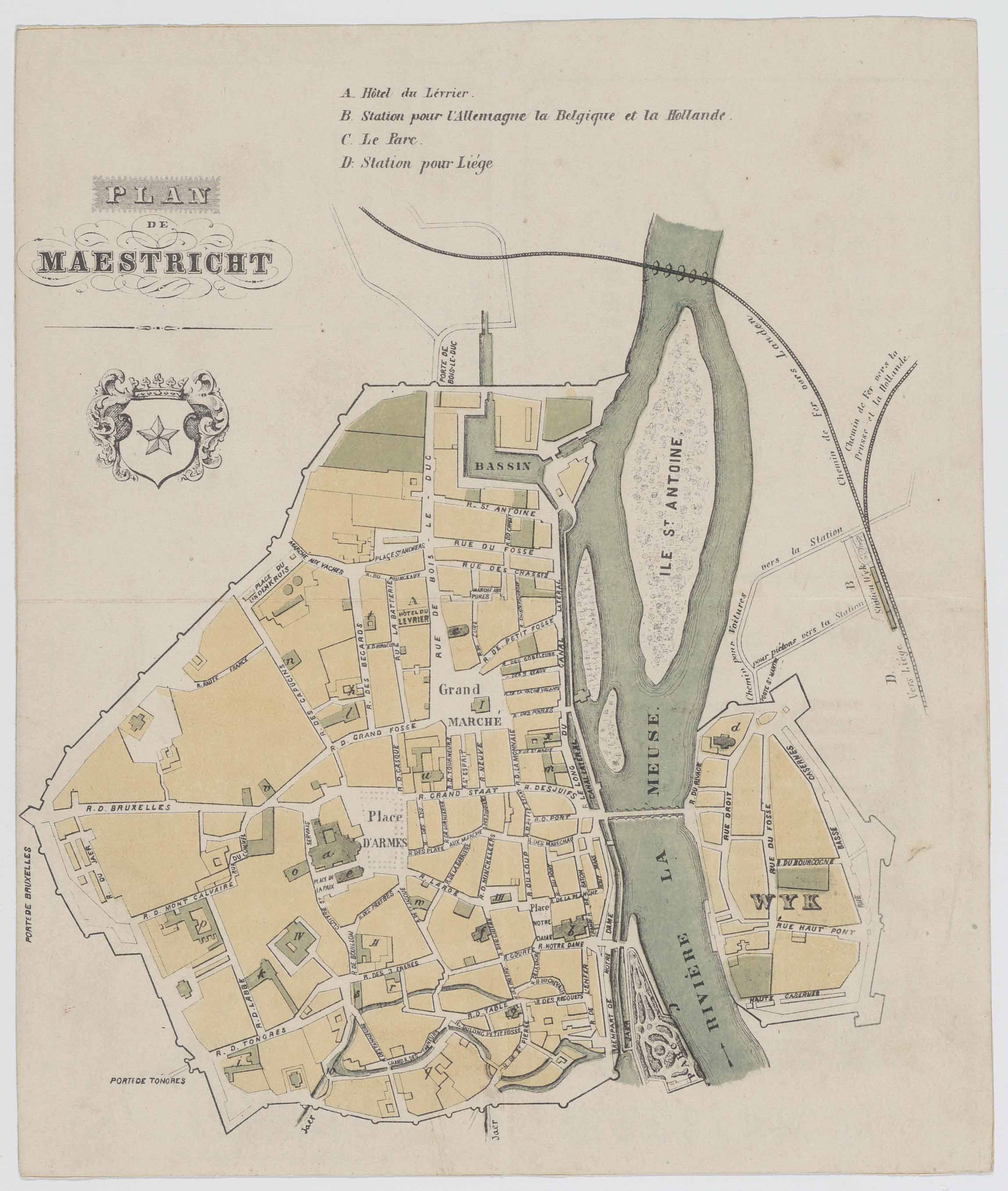
Maestricht. - Maestricht. M. Janssen fecit - btv1b8438994j.jpg - Gzen92Bot

Plan de la Ville de Maestricht. Echelle, 500 Metres (= Om. 067 ; 1 - 7 400 environ). Collon - del - btv1b84923822.jpg - Gzen92Bot

Maestricht. - Maestricht. M. Janssen fecit - btv1b8439840z.jpg - Gzen92Bot

Maastricht, kavels Herbenusstraat-Statensingel.jpg - Kleon3

Maastricht, kavels Herbenusstraat-Statensingel (detail).jpg - Kleon3
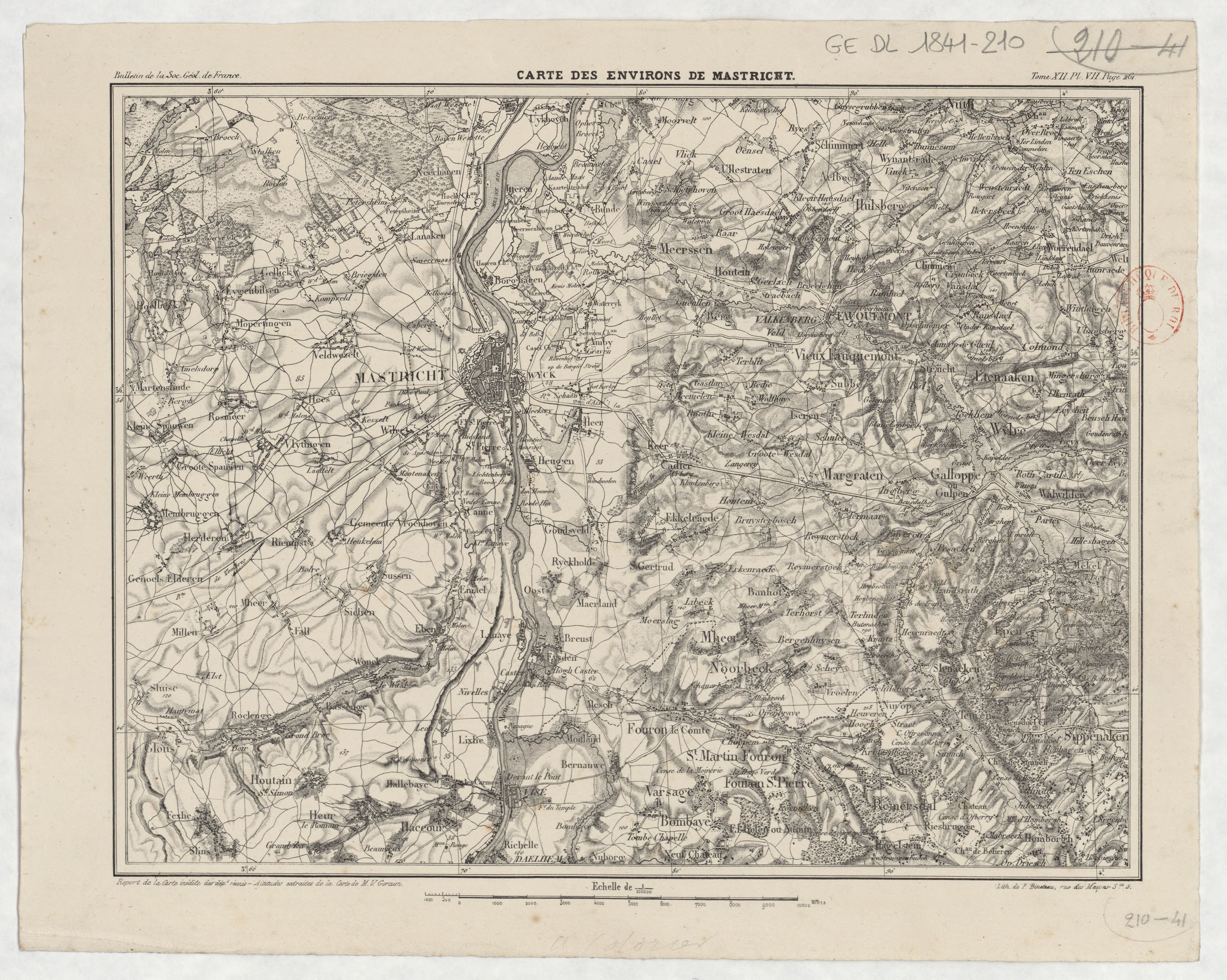
Carte des environs de Mastricht - lith. de P. Bineteau - btv1b53087666j.jpg - Gzen92Bot

Plattegrond Maastricht, ca 1830 (RAL K 165) (crop2 St Pieter-Blekerij).jpg - Kleon3

Plattegrond Maastricht, ca 1830 (RAL K 165) (crop2).jpg - Kleon3

Von Geusau & anonymus, plattegrond Maastricht 2a (cropped).jpg - Kleon3

TrK83 Maastricht - 84 Margraten (Scharn).jpg - Kleon3

Plattegrond van de vesting Maastricht (Wyck), 1868 (crop4).jpg - Kleon3

Plattegrond van de vesting Maastricht (Wyck), 1868 (crop5).jpg - Kleon3