Wikimedi'Òc
Modes d'emploi

Cet album fait partie des albums


1940 Census Enumeration District Maps - Rhode Island - Bristol County - Barrington - ED 1-1, ED 1-2, ED 1-3, ED 1-4, ED 1-5 - NARA - 5838829.jpg - US National Archives bot

1940 Census Enumeration District Maps - Rhode Island - Bristol County - Bristol - ED 1-6 - ED 1-18 - NARA - 5838830 (page 1).jpg - US National Archives bot

1940 Census Enumeration District Maps - Rhode Island - Bristol County - Bristol - ED 1-6 - ED 1-18 - NARA - 5838830 (page 2).jpg - US National Archives bot

1940 Census Enumeration District Maps - Rhode Island - Bristol County - Bristol - ED 1-6 - ED 1-18 - NARA - 5838830 (page 3).jpg - US National Archives bot

1940 Census Enumeration District Maps - Rhode Island - Bristol County - Bristol - ED 1-6 - ED 1-18 - NARA - 5838830 (page 4).jpg - US National Archives bot

1940 Census Enumeration District Maps - Rhode Island - Bristol County - ED 1-1 - ED 1-26 - NARA - 5838832 (page 1).jpg - US National Archives bot

1940 Census Enumeration District Maps - Rhode Island - Bristol County - ED 1-1 - ED 1-26 - NARA - 5838832 (page 2).jpg - US National Archives bot

1940 Census Enumeration District Maps - Rhode Island - Bristol County - ED 1-1 - ED 1-26 - NARA - 5838832 (page 3).jpg - US National Archives bot

1940 Census Enumeration District Maps - Rhode Island - Bristol County - ED 1-1 - ED 1-26 - NARA - 5838832 (page 4).jpg - US National Archives bot

1940 Census Enumeration District Maps - Rhode Island - Bristol County - Warren - ED 1-19, ED 1-20, ED 1-21, ED 1-22, ED 1-23, ED 1-24, ED 1-25, ED 1-26 - NARA - 5838831.jpg - US National Archives bot

1940 Census Enumeration District Maps - Rhode Island - Kent County - Coventry - ED 2-1, ED 2-2, ED 2-3, ED 2-4, ED 2-5, ED 2-6 - NARA - 5838834 (page 1).jpg - US National Archives bot

1940 Census Enumeration District Maps - Rhode Island - Kent County - Coventry - ED 2-1, ED 2-2, ED 2-3, ED 2-4, ED 2-5, ED 2-6 - NARA - 5838834 (page 2).jpg - US National Archives bot

1940 Census Enumeration District Maps - Rhode Island - Kent County - East Greenwich - ED 2-7, ED 2-8, ED 2-9, ED 2-10 - NARA - 5838835 (page 1).jpg - US National Archives bot

1940 Census Enumeration District Maps - Rhode Island - Kent County - East Greenwich - ED 2-7, ED 2-8, ED 2-9, ED 2-10 - NARA - 5838835 (page 2).jpg - US National Archives bot

1940 Census Enumeration District Maps - Rhode Island - Kent County - ED 2-1 - ED 2-57 - NARA - 5838838 (page 1).jpg - US National Archives bot

1940 Census Enumeration District Maps - Rhode Island - Kent County - ED 2-1 - ED 2-57 - NARA - 5838838 (page 2).jpg - US National Archives bot

1940 Census Enumeration District Maps - Rhode Island - Kent County - Warwick - ED 2-11 - ED 2-38 - NARA - 5838836 (page 1).jpg - US National Archives bot

1940 Census Enumeration District Maps - Rhode Island - Kent County - Warwick - ED 2-11 - ED 2-38 - NARA - 5838836 (page 2).jpg - US National Archives bot

1940 Census Enumeration District Maps - Rhode Island - Kent County - Warwick - ED 2-11 - ED 2-38 - NARA - 5838836 (page 3).jpg - US National Archives bot

1940 Census Enumeration District Maps - Rhode Island - Kent County - Warwick - ED 2-11 - ED 2-38 - NARA - 5838836 (page 4).jpg - US National Archives bot

1940 Census Enumeration District Maps - Rhode Island - Kent County - West Warwick - ED 2-40 - ED 2-57 - NARA - 5838837 (page 1).jpg - US National Archives bot

1940 Census Enumeration District Maps - Rhode Island - Kent County - West Warwick - ED 2-40 - ED 2-57 - NARA - 5838837 (page 2).jpg - US National Archives bot

1940 Census Enumeration District Maps - Rhode Island - Kent County - West Warwick - ED 2-40 - ED 2-57 - NARA - 5838837 (page 3).jpg - US National Archives bot

1940 Census Enumeration District Maps - Rhode Island - Kent County - West Warwick - ED 2-40 - ED 2-57 - NARA - 5838837 (page 4).jpg - US National Archives bot

1940 Census Enumeration District Maps - Rhode Island - Kent County - West Warwick - ED 2-40 - ED 2-57 - NARA - 5838837 (page 5).jpg - US National Archives bot

1940 Census Enumeration District Maps - Rhode Island - Kent County - West Warwick - ED 2-40 - ED 2-57 - NARA - 5838837 (page 6).jpg - US National Archives bot

1940 Census Enumeration District Maps - Rhode Island - Newport County - ED 3-1 - ED 3-71 - NARA - 5838843 (page 1).jpg - US National Archives bot

1940 Census Enumeration District Maps - Rhode Island - Newport County - ED 3-1 - ED 3-71 - NARA - 5838843 (page 2).jpg - US National Archives bot

1940 Census Enumeration District Maps - Rhode Island - Newport County - ED 3-1 - ED 3-71 - NARA - 5838843 (page 3).jpg - US National Archives bot

1940 Census Enumeration District Maps - Rhode Island - Newport County - ED 3-1 - ED 3-71 - NARA - 5838843 (page 4).jpg - US National Archives bot

1940 Census Enumeration District Maps - Rhode Island - Newport County - Newport - ED 3-15 - ED 3-52 - NARA - 5838840 (page 1).jpg - US National Archives bot

1940 Census Enumeration District Maps - Rhode Island - Newport County - Newport - ED 3-15 - ED 3-52 - NARA - 5838840 (page 2).jpg - US National Archives bot

1940 Census Enumeration District Maps - Rhode Island - Newport County - Newport - ED 3-15 - ED 3-52 - NARA - 5838840 (page 3).jpg - US National Archives bot

1940 Census Enumeration District Maps - Rhode Island - Newport County - Newport - ED 3-15 - ED 3-52 - NARA - 5838840 (page 4).jpg - US National Archives bot

1940 Census Enumeration District Maps - Rhode Island - Newport County - Newport - ED 3-15 - ED 3-52 - NARA - 5838840 (page 5).jpg - US National Archives bot

1940 Census Enumeration District Maps - Rhode Island - Newport County - Newport - ED 3-15 - ED 3-52 - NARA - 5838840 (page 6).jpg - US National Archives bot

1940 Census Enumeration District Maps - Rhode Island - Newport County - Portsmouth - ED 3-60, ED 3-63, ED 3-64, ED 3-65, ED 3-66 - NARA - 5838841.jpg - US National Archives bot

1940 Census Enumeration District Maps - Rhode Island - Newport County - Tiverton - ED 3-67, ED 3-68, ED 3-69, ED 3-70, ED 3-71 - NARA - 5838842.jpg - US National Archives bot

1940 Census Enumeration District Maps - Rhode Island - Providence County - Burrillville - ED 4-1 - ED 4-10 - NARA - 5838845 (page 1).jpg - US National Archives bot

1940 Census Enumeration District Maps - Rhode Island - Providence County - Burrillville - ED 4-1 - ED 4-10 - NARA - 5838845 (page 2).jpg - US National Archives bot
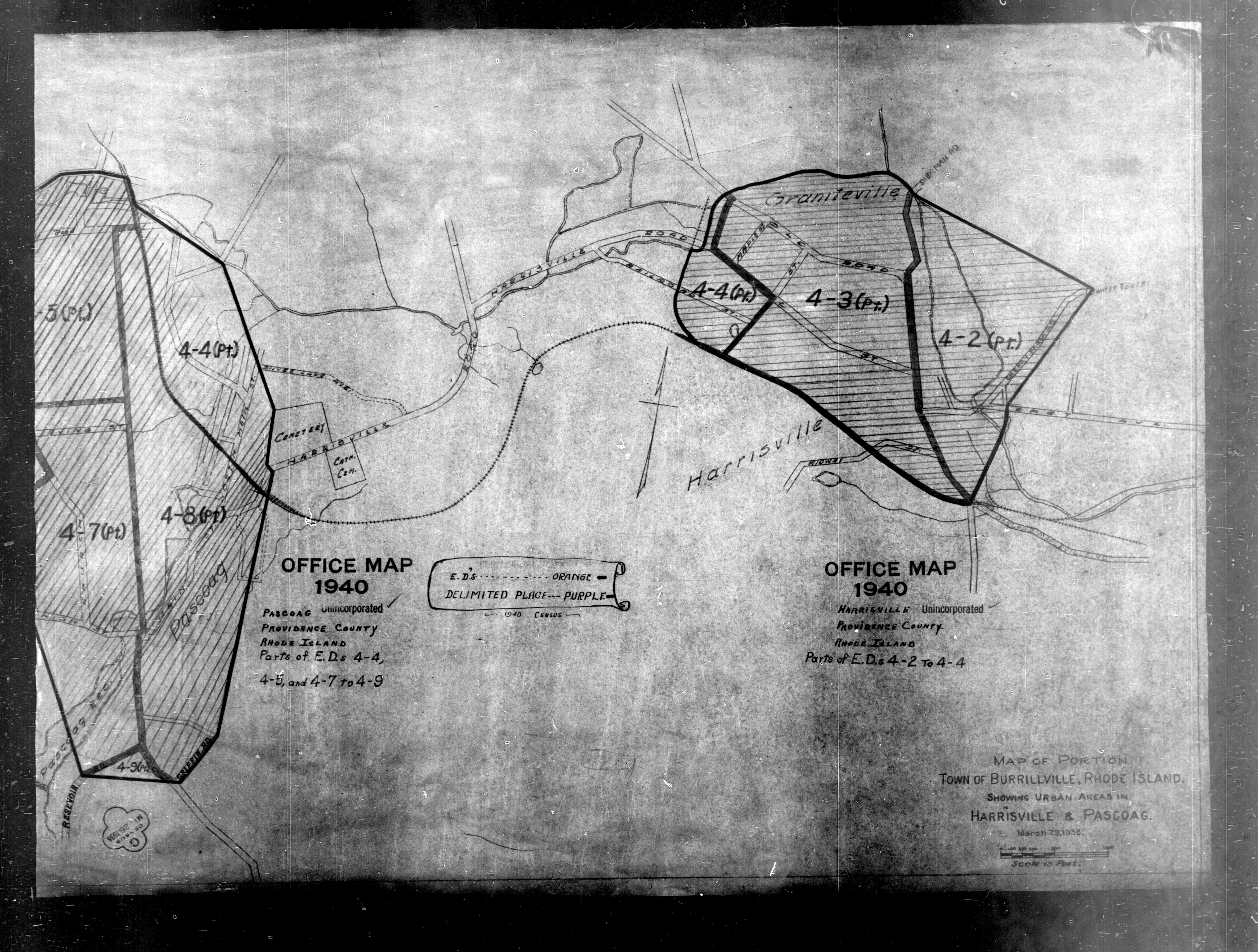
1940 Census Enumeration District Maps - Rhode Island - Providence County - Burrillville - ED 4-1 - ED 4-10 - NARA - 5838845 (page 3).jpg - US National Archives bot

1940 Census Enumeration District Maps - Rhode Island - Providence County - Central Falls - ED 4-11 - ED 4-37 - NARA - 5838846.jpg - US National Archives bot

1940 Census Enumeration District Maps - Rhode Island - Providence County - Cranston - ED 4-38 - ED 4-83 - NARA - 5838847 (page 1).jpg - US National Archives bot

1940 Census Enumeration District Maps - Rhode Island - Providence County - Cranston - ED 4-38 - ED 4-83 - NARA - 5838847 (page 2).jpg - US National Archives bot

1940 Census Enumeration District Maps - Rhode Island - Providence County - Cranston - ED 4-38 - ED 4-83 - NARA - 5838847 (page 3).jpg - US National Archives bot

1940 Census Enumeration District Maps - Rhode Island - Providence County - Cranston - ED 4-38 - ED 4-83 - NARA - 5838847 (page 4).jpg - US National Archives bot

1940 Census Enumeration District Maps - Rhode Island - Providence County - Cumberland - ED 4-84 - ED 4-94 - NARA - 5838848 (page 1).jpg - US National Archives bot

1940 Census Enumeration District Maps - Rhode Island - Providence County - Cumberland - ED 4-84 - ED 4-94 - NARA - 5838848 (page 2).jpg - US National Archives bot

1940 Census Enumeration District Maps - Rhode Island - Providence County - Cumberland - ED 4-84 - ED 4-94 - NARA - 5838848 (page 3).jpg - US National Archives bot

1940 Census Enumeration District Maps - Rhode Island - Providence County - East Providence - ED 4-95 - ED 4-127 - NARA - 5838849 (page 1).jpg - US National Archives bot

1940 Census Enumeration District Maps - Rhode Island - Providence County - East Providence - ED 4-95 - ED 4-127 - NARA - 5838849 (page 2).jpg - US National Archives bot

1940 Census Enumeration District Maps - Rhode Island - Providence County - East Providence - ED 4-95 - ED 4-127 - NARA - 5838849 (page 3).jpg - US National Archives bot

1940 Census Enumeration District Maps - Rhode Island - Providence County - East Providence - ED 4-95 - ED 4-127 - NARA - 5838849 (page 4).jpg - US National Archives bot

1940 Census Enumeration District Maps - Rhode Island - Providence County - East Providence - ED 4-95 - ED 4-127 - NARA - 5838849 (page 5).jpg - US National Archives bot

1940 Census Enumeration District Maps - Rhode Island - Providence County - East Providence - ED 4-95 - ED 4-127 - NARA - 5838849 (page 6).jpg - US National Archives bot

1940 Census Enumeration District Maps - Rhode Island - Providence County - ED 4-1 - ED 4-303 - NARA - 5838857 (page 1).jpg - US National Archives bot

1940 Census Enumeration District Maps - Rhode Island - Providence County - ED 4-1 - ED 4-303 - NARA - 5838857 (page 2).jpg - US National Archives bot

1940 Census Enumeration District Maps - Rhode Island - Providence County - ED 4-1 - ED 4-303 - NARA - 5838857 (page 3).jpg - US National Archives bot

1940 Census Enumeration District Maps - Rhode Island - Providence County - ED 4-1 - ED 4-303 - NARA - 5838857 (page 4).jpg - US National Archives bot

1940 Census Enumeration District Maps - Rhode Island - Providence County - Johnston - ED 4-133 - ED 4-141 - NARA - 5838850 (page 1).jpg - US National Archives bot

1940 Census Enumeration District Maps - Rhode Island - Providence County - Johnston - ED 4-133 - ED 4-141 - NARA - 5838850 (page 2).jpg - US National Archives bot

1940 Census Enumeration District Maps - Rhode Island - Providence County - Johnston - ED 4-133 - ED 4-141 - NARA - 5838850 (page 3).jpg - US National Archives bot

1940 Census Enumeration District Maps - Rhode Island - Providence County - Johnston - ED 4-133 - ED 4-141 - NARA - 5838850 (page 4).jpg - US National Archives bot

1940 Census Enumeration District Maps - Rhode Island - Providence County - Lincoln - ED 4-142 - ED 4-151 - NARA - 5838851 (page 1).jpg - US National Archives bot

1940 Census Enumeration District Maps - Rhode Island - Providence County - Lincoln - ED 4-142 - ED 4-151 - NARA - 5838851 (page 2).jpg - US National Archives bot

1940 Census Enumeration District Maps - Rhode Island - Providence County - Lincoln - ED 4-142 - ED 4-151 - NARA - 5838851 (page 3).jpg - US National Archives bot

1940 Census Enumeration District Maps - Rhode Island - Providence County - Lincoln - ED 4-142 - ED 4-151 - NARA - 5838851 (page 4).jpg - US National Archives bot

1940 Census Enumeration District Maps - Rhode Island - Providence County - North Providence - ED 4-152 - ED 4-163 - NARA - 5838852.jpg - US National Archives bot

1940 Census Enumeration District Maps - Rhode Island - Providence County - North Smithfield - ED 4-164, ED 4-166, ED 4-167 - NARA - 5838853.jpg - US National Archives bot

1940 Census Enumeration District Maps - Rhode Island - Providence County - Pawtucket - ED 4-168 - ED 4-243 - NARA - 5838854 (page 1).jpg - US National Archives bot

1940 Census Enumeration District Maps - Rhode Island - Providence County - Pawtucket - ED 4-168 - ED 4-243 - NARA - 5838854 (page 2).jpg - US National Archives bot

1940 Census Enumeration District Maps - Rhode Island - Providence County - Providence - ED 6-1 - ED 6-270 - NARA - 5838855 (page 1).jpg - US National Archives bot

1940 Census Enumeration District Maps - Rhode Island - Providence County - Providence - ED 6-1 - ED 6-270 - NARA - 5838855 (page 2).jpg - US National Archives bot

1940 Census Enumeration District Maps - Rhode Island - Providence County - Providence - ED 6-1 - ED 6-270 - NARA - 5838855 (page 3).jpg - US National Archives bot

1940 Census Enumeration District Maps - Rhode Island - Providence County - Providence - ED 6-1 - ED 6-270 - NARA - 5838855 (page 4).jpg - US National Archives bot

1940 Census Enumeration District Maps - Rhode Island - Providence County - Providence - ED 6-1 - ED 6-270 - NARA - 5838855 (page 5).jpg - US National Archives bot

1940 Census Enumeration District Maps - Rhode Island - Providence County - Providence - ED 6-1 - ED 6-270 - NARA - 5838855 (page 6).jpg - US National Archives bot

1940 Census Enumeration District Maps - Rhode Island - Providence County - Providence - ED 6-1 - ED 6-270 - NARA - 5838855 (page 7).jpg - US National Archives bot

1940 Census Enumeration District Maps - Rhode Island - Providence County - Providence - ED 6-1 - ED 6-270 - NARA - 5838855 (page 8).jpg - US National Archives bot

1940 Census Enumeration District Maps - Rhode Island - Providence County - Providence - ED 6-1 - ED 6-270 - NARA - 5838855 (page 9).jpg - US National Archives bot

1940 Census Enumeration District Maps - Rhode Island - Providence County - Providence - ED 6-1 - ED 6-270 - NARA - 5838855 (page 10).jpg - US National Archives bot

1940 Census Enumeration District Maps - Rhode Island - Providence County - Providence - ED 6-1 - ED 6-270 - NARA - 5838855 (page 11).jpg - US National Archives bot

1940 Census Enumeration District Maps - Rhode Island - Providence County - Providence - ED 6-1 - ED 6-270 - NARA - 5838855 (page 12).jpg - US National Archives bot

1940 Census Enumeration District Maps - Rhode Island - Providence County - Woonsocket - ED 4-250 - ED 4-303 - NARA - 5838856 (page 1).jpg - US National Archives bot

1940 Census Enumeration District Maps - Rhode Island - Providence County - Woonsocket - ED 4-250 - ED 4-303 - NARA - 5838856 (page 2).jpg - US National Archives bot

1940 Census Enumeration District Maps - Rhode Island - Providence County - Woonsocket - ED 4-250 - ED 4-303 - NARA - 5838856 (page 3).jpg - US National Archives bot

1940 Census Enumeration District Maps - Rhode Island - Providence County - Woonsocket - ED 4-250 - ED 4-303 - NARA - 5838856 (page 4).jpg - US National Archives bot

1940 Census Enumeration District Maps - Rhode Island - Washington County - ED 5-1 - ED 5-43 - NARA - 5838863 (page 1).jpg - US National Archives bot

1940 Census Enumeration District Maps - Rhode Island - Washington County - ED 5-1 - ED 5-43 - NARA - 5838863 (page 2).jpg - US National Archives bot

1940 Census Enumeration District Maps - Rhode Island - Washington County - ED 5-1 - ED 5-43 - NARA - 5838863 (page 3).jpg - US National Archives bot

1940 Census Enumeration District Maps - Rhode Island - Washington County - ED 5-1 - ED 5-43 - NARA - 5838863 (page 4).jpg - US National Archives bot

1940 Census Enumeration District Maps - Rhode Island - Washington County - North Kingstown - ED 5-17, ED 5-18, ED 5-19, ED 5-20, ED 5-21 - NARA - 5838859 (page 1).jpg - US National Archives bot

1940 Census Enumeration District Maps - Rhode Island - Washington County - North Kingstown - ED 5-17, ED 5-18, ED 5-19, ED 5-20, ED 5-21 - NARA - 5838859 (page 2).jpg - US National Archives bot

1940 Census Enumeration District Maps - Rhode Island - Washington County - South Kingstown - ED 5-24, ED 5-25, ED 5-26, ED 5-27, ED 5-29, ED 5-30 - NARA - 5838860.jpg - US National Archives bot

1940 Census Enumeration District Maps - Rhode Island - Washington County - Wakefield-Peacedale - ED 5-24, ED 5-25, ED 5-26, ED 5-27, ED 5-29, ED 5-30 - NARA - 5838861.jpg - US National Archives bot

1940 Census Enumeration District Maps - Rhode Island - Washington County - Westerly - ED 5-31 - ED 5-43 - NARA - 5838862 (page 1).jpg - US National Archives bot

1940 Census Enumeration District Maps - Rhode Island - Washington County - Westerly - ED 5-31 - ED 5-43 - NARA - 5838862 (page 2).jpg - US National Archives bot