Wikimedi'Òc
Modes d'emploi

Cet album fait partie des albums
Cet album photos contient les sous-albums suivants :


China old map.jpg - Shizhao

中東路事件.jpg - 邯鄲午
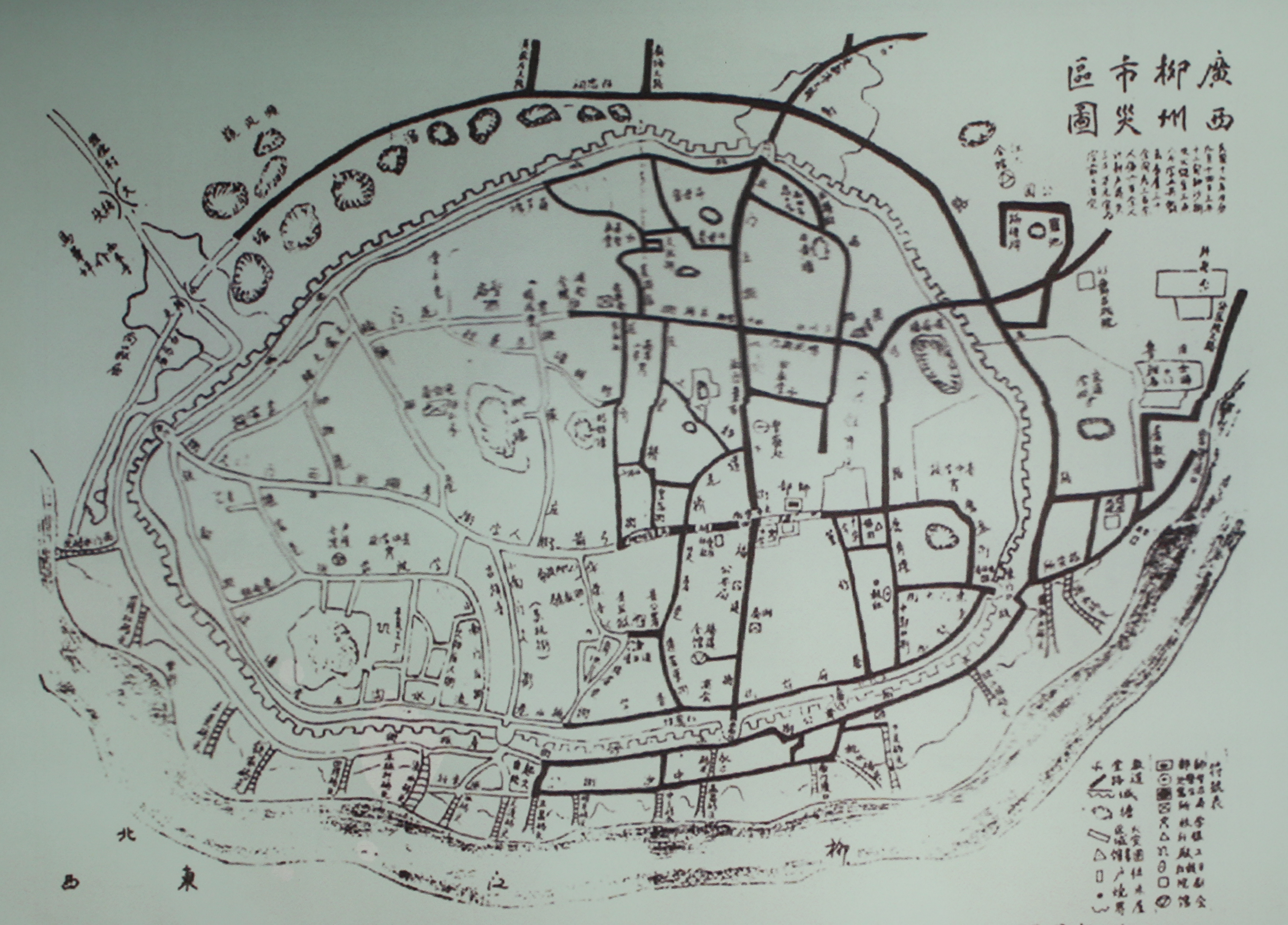
1928年“火烧半边城”灾情之后柳州城区图.png - 李海斌

Shanghai 1927 AMS-WO.jpg - Rosemania

Admiralty Chart No 3280 Hongkong Waters West . . . From Surveys by Captain W.U. Moore, R.N., and the Officers of H.M. Surveying Ships Rambler & Penguin 1886 & 1893, Published 1903, Corrections to 1920.jpg - Balkanique

Admiralty Chart No 3429 Hong Kong Island -- East Lamma Channel. Surveyed by Captain Morris H. Smyth, R.N. . . . H.M. Surveying Ship 'Rambler,' 1901-2, Published 1904, Corrections to 1928.jpg - Balkanique

1920 map of the Chinese Republic & Japan.jpg - Balkanique

1925 Air Routes of China.jpg - Zoozaz1

China - political (1922).jpg - Zoozaz1

Kokuji1922.png - Masamax11333

1926, Kinhori Tetsudo Route Plan.jpg - Jake900903

Postal map of China - btv1b53209800w.jpg - Gzen92Bot

Chine, carte économique - btv1b84585865.jpg - Gzen92Bot

Map of Mongolia, Sinkiang, Tibet and China from within Compton's Pictured Encyclopedia (1922).jpg - Ooligan

May 7, 1923 NYT map of the Lincheng Incident.png - Abzeronow
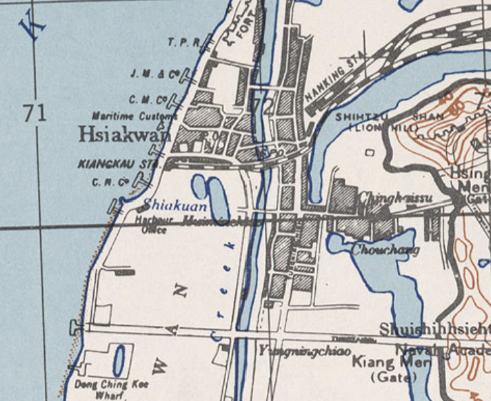
Kiangkau STA 1927.png - Njzjz

廣東省明細全圖-上海商務印書館-1924.jpg - Kcx36

Map to 1929 Photo- Four Koreans, Sino-Soviet War.jpg - Who-knows-nose

Map of Tientsin Controlled Territory - NARA - 76028919.jpg - US National Archives bot

Map of Tientsin and Vicinity - NARA - 76028925.jpg - US National Archives bot

Map of Taku to Peking - NARA - 76028923.jpg - US National Archives bot