Wikimedi'Òc
Modes d'emploi

Cet album fait partie des albums
Cet album photos contient les sous-albums suivants :


1913ridingmap.png - Cloveious

LeasideRoadMap1913.jpg - WilyD
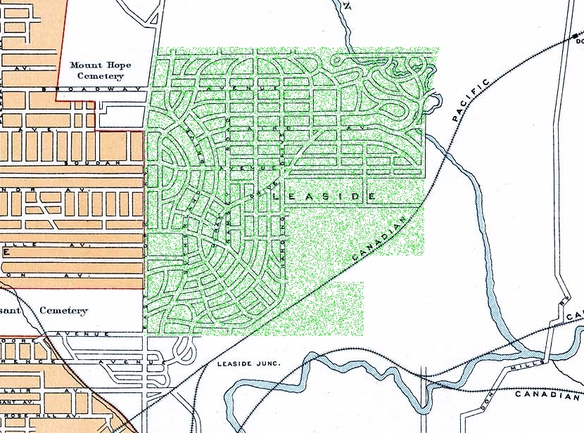
LeasideRoadMap1913HighlightedInGreen.jpg - WilyD

Oldtrin1913map.JPG - Wachowich~commonswiki
Scenic map of Columbia and Kootenay valley 1913.jpg - Mtsmallwood

Southampton Island 1913.jpg - Telim tor

The Dominion of Canada from the latest surveys and data (7557601306).jpg - File Upload Bot (Magnus Manske)

British Columbia (7557418174).jpg - File Upload Bot (Magnus Manske)

The empire of India (1913) (14757639016).jpg - Fæ

Canada and its provinces - a history of the Canadian people and their institutions by one hundred associates (1913) (14802094893).jpg - Fæ

An atlas of commercial geography (1913) (14781467525).jpg - SteinsplitterBot

The American Museum journal (c1900-(1918)) (17537375864).jpg - Fæ

Southern Saskatchewan Detail from Canadian Northern Railway Schedule System Map June 14, 1913.jpg - PrairieHist

Fort Saskatchewan Fire Insurance Map.png - CplKlinger

Canada. Department of Mines... Geological Map of the Dominion of Canada & Newfoundland. Scale 1 - 6 336 000 - C.O. Senécal, geographer and Chief Draughtsman ; Geology compiled by G.A. Young - btv1b53070204x.jpg - Gzen92Bot

British Columbia railway belt Port Moody and Yale sheet west of sixth and seventh meridians - map showing disposition of lands - prepared under the direction of F.F.C. Lynch - btv1b53081175j.jpg - Gzen92Bot