Wikimedi'Òc
Modes d'emploi

Cet album fait partie des albums
Cet album photos contient les sous-albums suivants :


PSM V86 D526 The fiji islands group.jpg - Ineuw

East Asia and Oceania 1914 german.png - Chrischerf
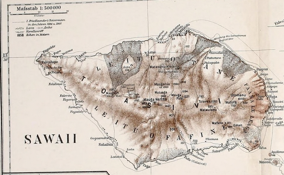
PEIP(1910) Map of Sawaii Island, Samoa.jpg - Metilsteiner

FMIB 36466 Profondeurs du Pacifique en Polynesie Occidentale.jpeg - BMacZeroBot

FMIB 36758 Profondeurs du Pacifique au Sud du Japon.jpeg - BMacZeroBot

FMIB 36788 Point ou a ete relevez l'une des plus grandes Profondeurs Oceaniques trouvees.jpeg - BMacZeroBot

East Asia and Oceania 1914-no text.svg - Skimel

Kayangel old map.jpg - Ratzer

Oc,G.T.1534, Mana Expedition to Easter Island, British Museum.jpg - KAVEBEAR

Иллюстрация к статье «Австралия». Военная энциклопедия Сытина. Том 1 (СПб., 1911—1915).jpg - Schekinov Alexey Victorovich

Lelu - plan du site archéologique.jpg - Hiro-Heremoana

Catalogue of Admiralty Charts 1914 Index Sheet 15 Western Pacific Islands and New Guinea.png - Kognos

Catalogue of Admiralty Charts 1914 Index Sheet 16 Central Pacific Islands.png - Kognos
Map, page 8, Island of Guam (1917).pdf - Featous

Ministère des colonies. Service géographique. Carte de l'archipel des Nouvelles-Hébrides - dressée par A. Meunier... - btv1b53064483m.jpg - Gzen92Bot

Oceania - btv1b8446123c.jpg - Gzen92Bot

Ministère des colonies. Service géographique. Carte de l'archipel des Nouvelles-Hébrides - dressée par A. Meunier... - btv1b530665755.jpg - Gzen92Bot

Ocean depths around australasia - cyclopedia of western australia.jpg - Evad37