Wikimedi'Òc
Modes d'emploi

Cet album fait partie des albums
Cet album photos contient les sous-albums suivants :


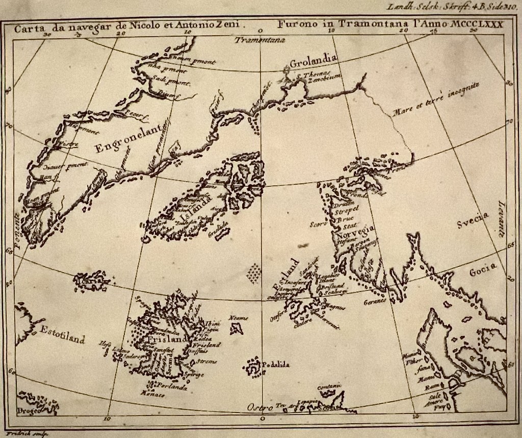
Map by nicolo zeno 1558.jpg - Hohum

Map of Greenland in 1791 by Reilly 077.jpg - Ratzer
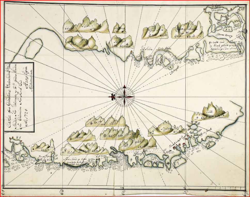
Carta-ofver-grønlands vesterside-hans-egede-1724.JPG - Lena Dyrdal Andersen

Grønlandiæ-antiqva-hans-egede-1723.JPG - Lena Dyrdal Andersen

Håbets-ø-hans-egede-1722.JPG - Lena Dyrdal Andersen

1747 Bowen Map of the North Atlantic Islands, Greenland, Iceland, Faroe Islands (Maelstrom) - Geographicus - OldGreenland-bowen-1747.jpg - BotMultichillT

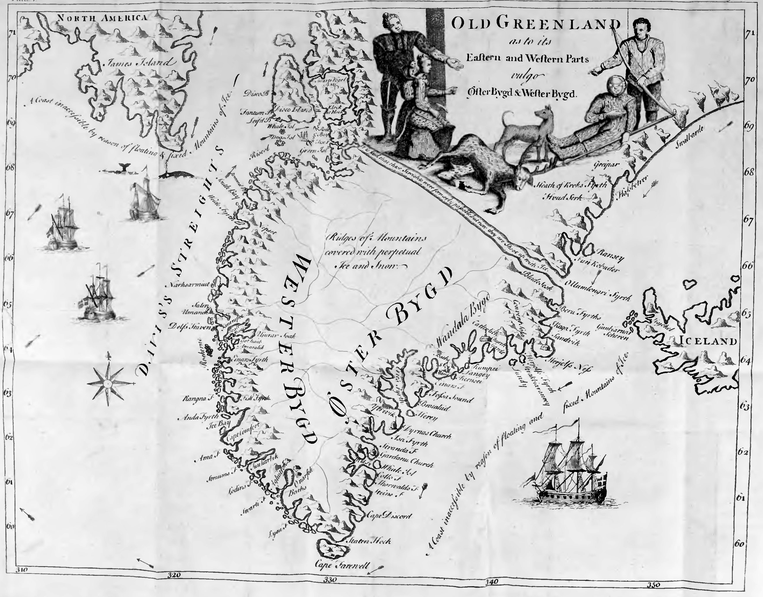
Old Greenland 1747.jpg - LlywelynII

Carte reduite de la mer du nord Zusammengezogene Karte des Nordmeeres Bellin 1772.jpg - Kallewirsch

Map of Greenland and Iceland from 1746 book by Johann Anderson.JPG - Cachalot1746

Beschryving van Ysland, Groenland en de Straat Davis (microform) - bevattende so wel ene bestipte bepaling van de ligging en grote van die eilanden, als en volledige ontvouwing van hunne inwendige (20430822518).jpg - Fæ

The history of England, from the accession of James the Second (1914) (14596492008).jpg - Fæ

Bellin map 1767 Carte reduite de l Islande et des Mers qui en sont voisines.jpg - Kallewirsch

Carte sud du Groenland, 1765.jpg - SteinsplitterBot
Series of ten small engravings of whale, walrus, and bear hunting, with map of Greenland LCCN2006683463.tif - Fæ

Carte Reduite de l'Ocean Septentrional contenant les Costes d'Europe depuis le 48 Degré de Lat. septentrionale jusqu'au 75 Degré et celles de l'Amérique qui leur sont opposées. Pour servir aux Vaisseaux du Roy.... - btv1b5973364g.jpg - Gzen92Bot

Map of Greenland.jpg - Baddu676
Map of Greenland; 1745 (p. 1, A Description of Greenland, Hans Egede).png - SpikeShroom

M. Frobichers scheeps togt, gedaan om de noord, ter ontdekking van een straat na Cataya en China - btv1b8595872k.jpg - Gzen92Bot