Wikimedi'Òc
Modes d'emploi

Cet album fait partie des albums
Cet album photos contient les sous-albums suivants :


Homann - Planiglobii Terrestris Cumutroq Hemisphaerio Caelesti.png - Frank Schulenburg

1763-1418ChineseMap.jpg - World Imaging

Potosi Real.jpg - Nagualdesign
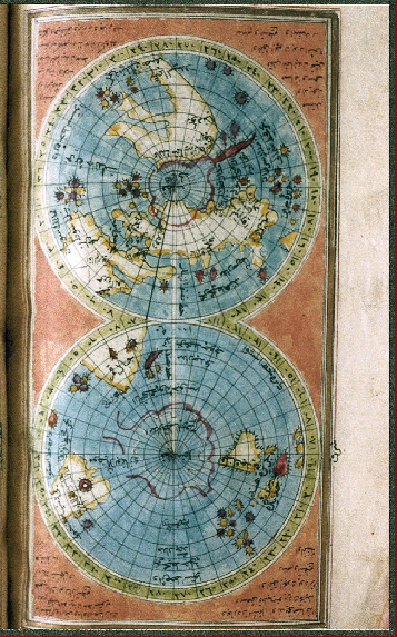
World-Map-Ismail-Hakki-Erzurumi-1756.png - Pngbot
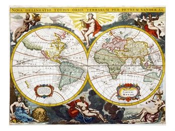
Aa-pieter-van-der-world-map-early-18th-century.jpg - JuTa
Caserta-reggia-15-4-05 093-ritoc.JPG - Hohum
World Map by Vasily Kiprianov.jpg - Niklitov

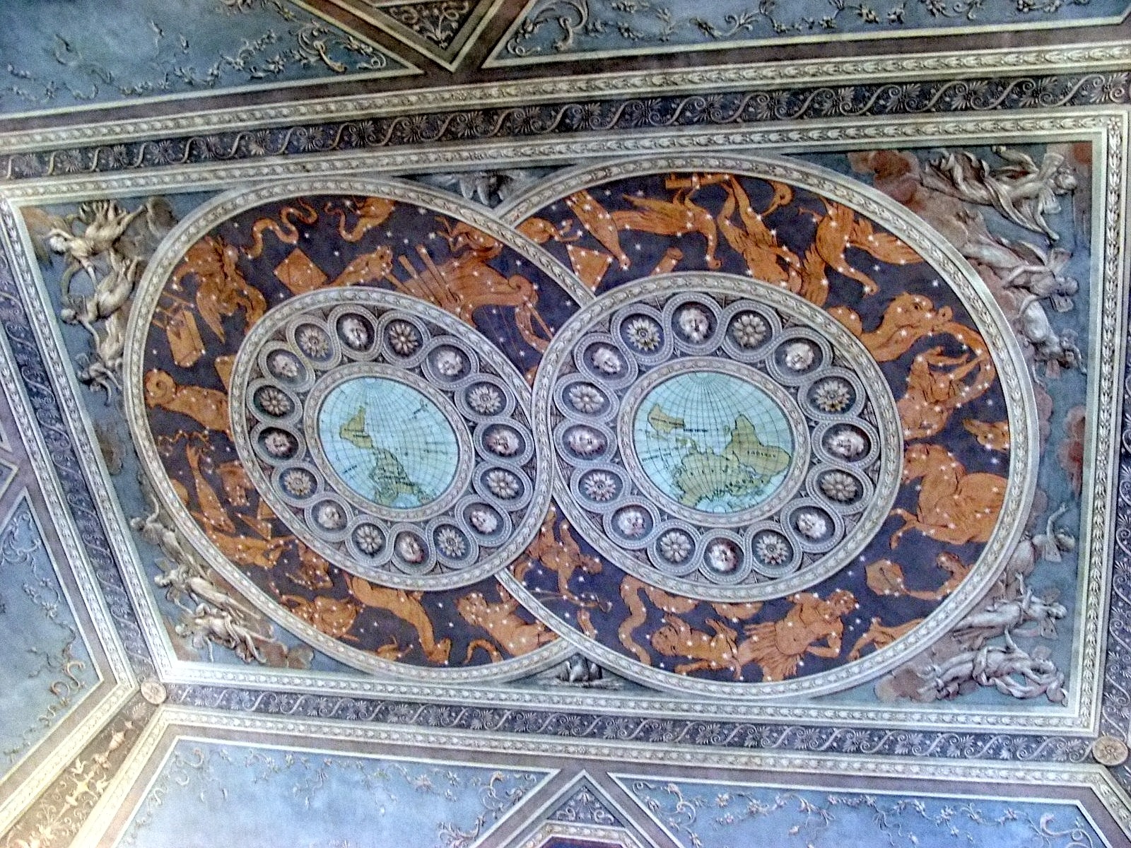
Caserta-reggia-fresco.jpg - Marcok

1700 Orbis Terrarum Visscher mr.jpg - Joopr

Potosì 8 reales 1768 131206.jpg - Carlomorino

EAMC 132 - a new and correct map of the world.png - Alexander.stohr
EAMC 056 - mappe monde carte universelle de la terre.png - Alexander.stohr

Leonhard Euler World Map AD1760.jpg - Ray007

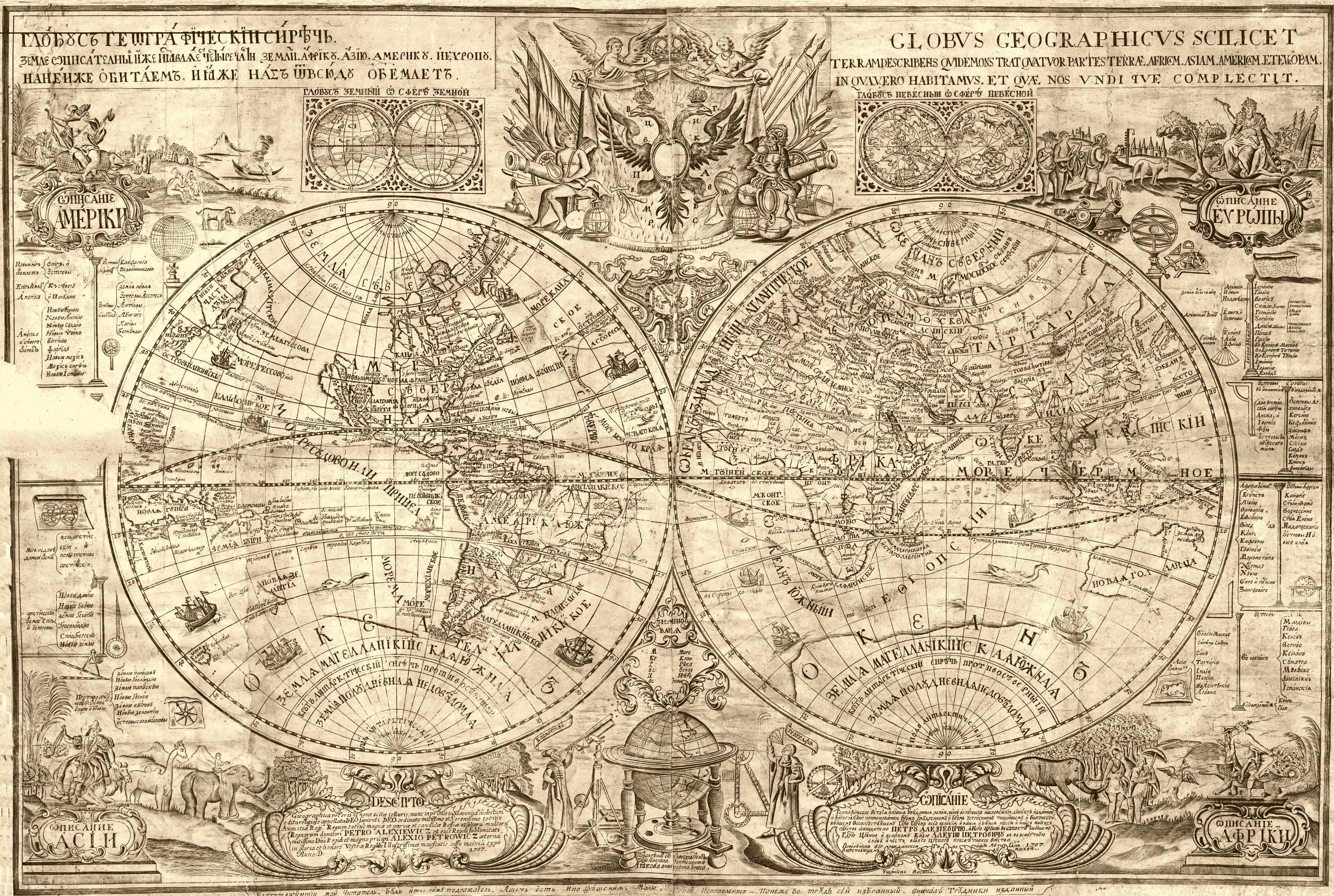
Peter karta1707.jpg - Rubinbot

Картаполушарий (1745).jpg - Schekinov Alexey Victorovich
The Earth's hemispheres in 1791 by Reilly 0002.jpg - Ephraim33

1798 Payne Map of the World (pre 1800 American Map) - Geographicus - World-payne-1798.jpg - BotMultichill

1775 Lotter Map of the World on a Hemisphere Projection - Geographicus - TotiusMundi-lotter-1775.jpg - BotMultichill
1775 Lattre and Janvier Map of the World on a Hemisphere Projection - Geographicus - World-lattre-1775.jpg - BotMultichillT

1794 Samuel Dunn Wall Map of the World in Hemispheres - Geographicus - World2-dunn-1794.jpg - Brandmeister~commonswiki

1728 Calmet Map of the Ancient World Showing the Creation of the Universe - Geographicus - AncientWorld-calmet-1728.jpg - BotMultichillT

1780 Raynal and Bonne Map of the Two Hemispheres - Geographicus - Hemispheres-bonne-1780.jpg - BotMultichillT

1799 Cruttwell Map of the World in Hemispheres - Geographicus - WorldHemisphere-cruttwell-1799.jpg - BotMultichillT

1706 de La Feuille Map of the World on Hemisphere Projection - Geographicus - Mapemonde-lafeuille-1706.jpg - BotMultichillT

1744 Bowen Map of the World in Hemispheres - Geographicus - World-bowen-1744.jpg - LlywelynII

1779 Pallas and Mentelle Map of the Physical World - Geographicus - World-mentelle-1779.jpg - BotMultichillT
1730 Stoopendaal Map of the World in two Hemispheres - Geographicus - WereltCaert-stoopendaal-1730.jpg - BotMultichillT

1782 Baldwyn Map of the World.jpg - Onkel X

2ndBritworld.JPG - DigbyDalton

Digital map of the world in hemispheres by thomas kitchin (1777).jpg - Sridhar1000

Chodowiecki Basedow Tafel 44.jpg - A. Wagner

A map of the world from the best authorities - Norman B. Leventhal Map Center at the BPL.jpg - Dzlinker

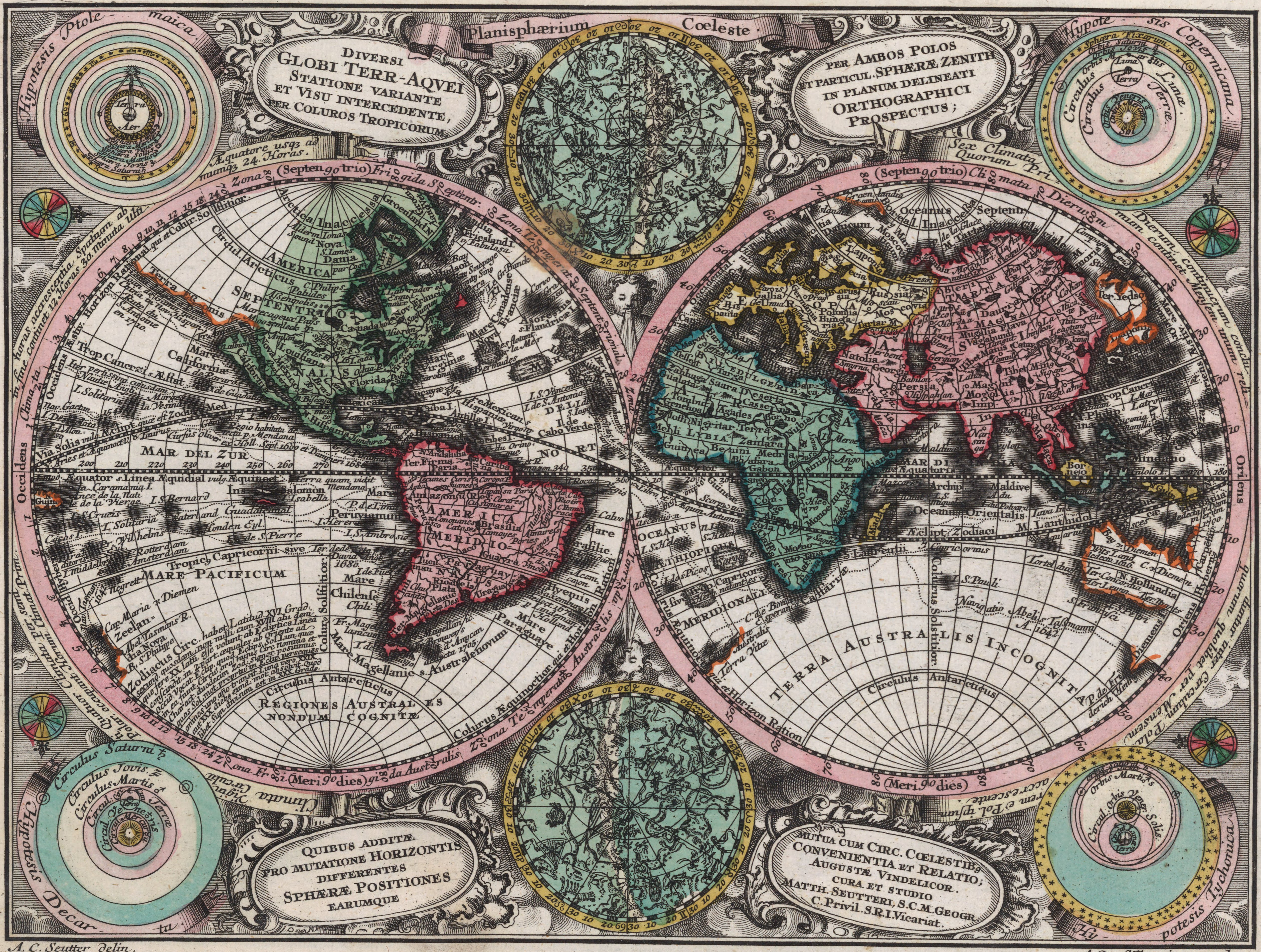
Diversi globi terr-aquei statione variante et visu intercedente(...) - Norman B. Leventhal Map Center at the BPL.jpg - Dzlinker

A map of the world - Norman B. Leventhal Map Center at the BPL.jpg - Dzlinker
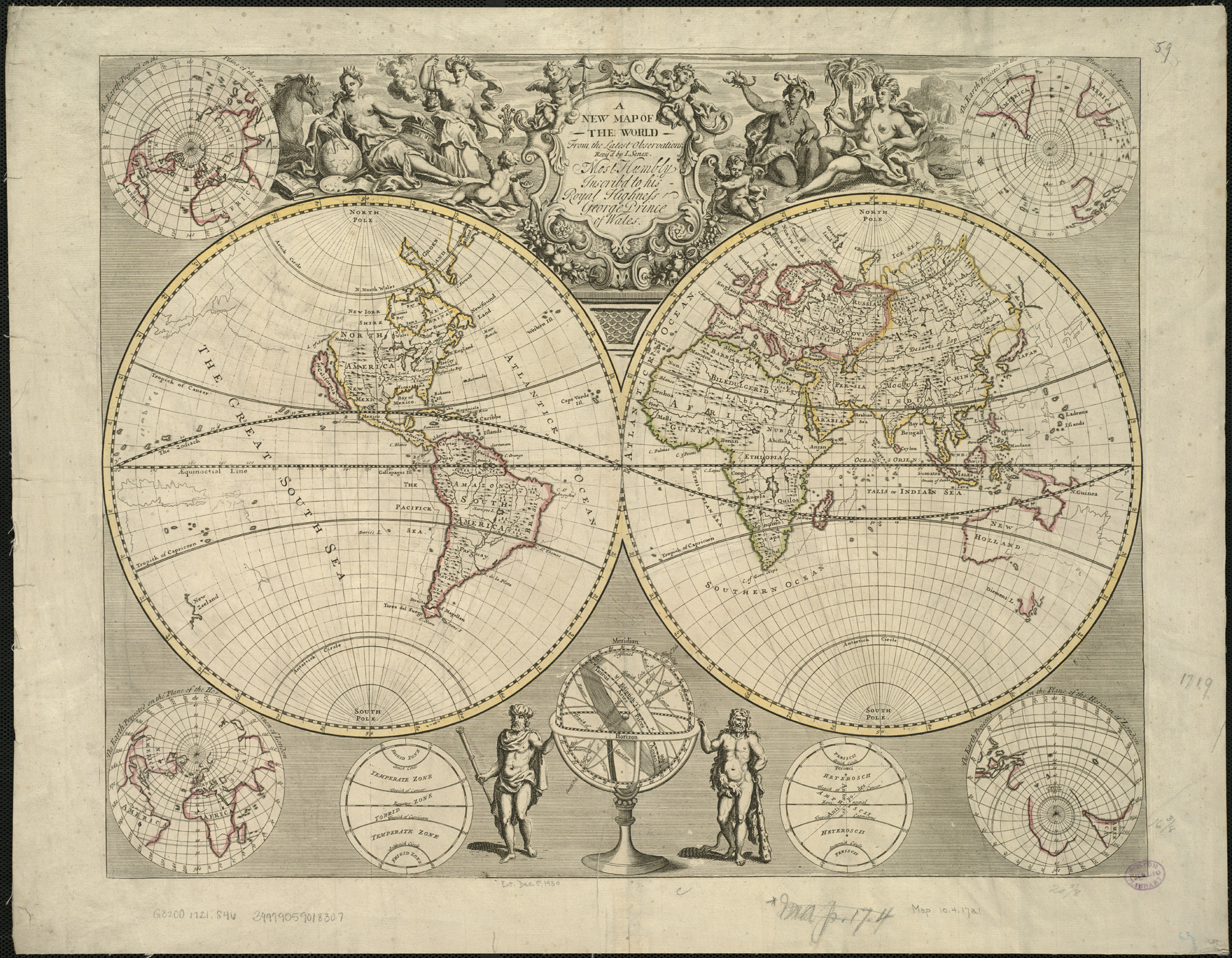
A new map of the world from the latest observations - Norman B. Leventhal Map Center at the BPL.jpg - Dzlinker

Mappmonde ou description generale du globe terrestre - Norman B. Leventhal Map Center at the BPL.jpg - Dzlinker

Mappe-monde - Norman B. Leventhal Map Center at the BPL.jpg - Dzlinker

Mappa totius mundi - Norman B. Leventhal Map Center at the BPL.jpg - Dzlinker

Weltkarte aus Weber Kurtzgefaßte Geographie 1760.jpg - FA2010

Piri Reis - World Map in a Double Hemisphere - Google Art Project.jpg - Rotatebot

World map from the book "Kort begrip der waereld-historie voor de jeugd" by J.F. Martinet".jpg - OlafJanssen

Mappemonde ou Description du globe terrestre (4072626326).jpg - File Upload Bot (Magnus Manske)

A map of the world from the best authorities (4072626080).jpg - File Upload Bot (Magnus Manske)

A new map of the terraqueous globe according to the ancient discoveries and most general divisions of it into continents and oceans (4072622916).jpg - File Upload Bot (Magnus Manske)

A new map of the terraqueous globe according to the latest discoveries and most general divisions of it into continents and oceans (4071859313).jpg - File Upload Bot (Magnus Manske)

A map of the world on a globular projection (2710771418).jpg - File Upload Bot (Magnus Manske)

Map of the World WDL7.png - Fæ
A map of the world, with the latest discoveries - by Samuel Dunn, mathematician. NYPL478202.tiff - Pratyeka
A new and correct map of the world, laid down according to the newest discoveries, and from the most exact observations. NYPL1630429.tiff - Fæ
A new map of ye world - by Robt. Morden. NYPL1261075.tiff - Enyavar
A new mapp of the world. NYPL1640711.tiff - Fæ

Antique World Map of Continents and Oceans 1700.png - Mattes
Orbis terrarum cognitus hodiernis Europaeis. NYPL464975.tiff - Enyavar
Orbis terrarum cognitus veteribus Graecis et Latinis. NYPL464974.tiff - Enyavar
Rigobert-Bonne-Atlas-de-toutes-les-parties-connues-du-globe-terrestre MG 9981.tif - Hansmuller

A map of the world Wellcome V0049922.jpg - Fæ

Géographie Buffier-mappe-monde.jpg - François GOGLINS

Der gantze Welt Kreis in seinen zwey grossen Begriffen als 1 dem Neueren und 2 dem Alteren (14166737348).jpg - Fæ
A map of the whole world (12619471764).jpg - Fæ

An historical and chronological deduction of the origin of commerce - from the earliest accounts to the present time. Containing, an history of the great commercial interests of the British empire. To (14804767343).jpg - Fæ

Armenian map of 1747.jpg - Taron Saharyan

A collection of voyages and travels- consisting of authentic writers in our own tongue, which have not before been collected in English, or have only been abridged in other collections. And continued (14770643704).jpg - SteinsplitterBot

Crusoe's Island; a bird-hunter's story (1898) (14727839796).jpg - SteinsplitterBot

"Mappe-Monde Physique," by l'Abbé Mongez (Mentelle, Paris, 1779).jpg - Baddu676

Bodleian Libraries, Map of the World in two hemispheres.jpg - User-duck
Planisphaerium coeleste. A.C. Seutter delin. Andr. Silbereisen Sculps (world map 1744).jpg - HerrAdams

Vaugondy, Gilles Robert De — Orbis Vetus in utraque continente juxta mentem Sansonianam distinctus, nec non observationibus astonimicis redactus 1752.jpg - Mattes

Bourgoin, Pierre — Mappe Monde Carte Universelle 1766.jpg - Mattes
A new map of the terraqueous globe according to the latest discoveries and most general divisions of it into continents and oceans (NYPL b15114268-1630698).tiff - Fæ

A new map of the terraqueous globe according to the ancient discoveries and most general divisions of it into continents and oceans (NYPL b15114268-1630697).jpg - Fæ

A new map of the terraqueous globe according to the latest discoveries and most general divisions of it into continents and oceans (NYPL b15114268-1630698).jpg - Fæ
A new and correct map of the world, laid down according to the newest discoveries, and from the most exact observations (NYPL b15369994-1630429).tiff - Fæ
Map of the world (NYPL b15373374-1505120).tiff - Fæ

A new map of ye world (NYPL b15366051-1261075).jpg - Enyavar

A new and correct map of the world, laid down according to the newest discoveries, and from the most exact observations (NYPL b15369994-1630429).jpg - Fæ

Map of the world (NYPL b15373374-1505120).jpg - Fæ
A new mapp of the world (NYPL b13909432-1640711).tiff - Fæ
Map of the world drawn and engraved from D'Anville's two sheet map with improvements for Harrison, Newgate Street as the act directs, Dec. 1, 1788 (NYPL b13967285-2020698).tiff - Fæ

A new mapp of the world (NYPL b13909432-1640711).jpg - Fæ

View of different planispheres, 1719.jpg - Baddu676
Planiglobii Terrestris Mappa Universalis... MET DP832557.jpg - Pharos

Planiglobii terrestris mappa universalis utrumq hemisphærium orient. et occidentale repræsentans ex IV mappis generalibus = Mappe-monde qui represente les deux hemispheres savoir celui de l'orient et (4072626766).jpg - Fæ
A new and correct map of the world, laid down according to the newest discoveries, and from the most exact observations, by Herman Moll, Geographer. RMG F0475.tiff - Fæ

83 of 'Terra incognita. Eine kurzgefasste Darstellung der stufenweisen Entwickelung der Erdkenntnis von Ausgange des Mittelalters bis zur Gegenwart ... Mit fünf Kartentafeln' (11209100223).jpg - Artix Kreiger 2

Planiglobii terrestris cum utroq. hemisphaerio caelesti generalis exhibitio quam ex novissimis... - CBT 5870875.jpg - Francesco Serra (BIBCOMTN)

Diversa orbis Terrae visu incedente per coluros Tropicorum ambos ejus polos... - CBT 5870902.jpg - Francesco Serra (BIBCOMTN)

Haemisphaeriorum tabula Carthesiana - CBT 5870962.jpg - Francesco Serra (BIBCOMTN)
Worldmap with two hemispheres – 1702 – Print - Special Collections University of Amsterdam - HB-KZL 31.01.24.tif - DeJong2332
Map - Special Collections University of Amsterdam - OTM- HB-KZL 31-01-13.tif - DeJong2332
Map - Special Collections University of Amsterdam - OTM- HB-KZL 31-01-30.tif - DeJong2332
Map - Special Collections University of Amsterdam - OTM- HB-KZL 31-02-41.tif - DeJong2332

A map of the world with ships DUKE & DUTCHESS' tract round it from 1708 to 1711, by Herman Moll, geographer LCCN2007677057.jpg - Fæ
A map of the world with ships DUKE & DUTCHESS' tract round it from 1708 to 1711, by Herman Moll, geographer LCCN2007677057.tif - Fæ

Mappemonde. LOC 2017585639.jpg - Fæ
Mappa totius mundi - adornata juxta observationes dnn. academiae regalis scientiarum et nonnullorum aliorum secundum annotationes recentissimas LOC 2006627254.tif - Fæ

Mappa totius mundi - adornata juxta observationes dnn. academiae regalis scientiarum et nonnullorum aliorum secundum annotationes recentissimas LOC 2006627254.jpg - Fæ
Bowles's new pocket map of the world, laid down from the latest observations and comprehending the new discoveries to the present time, particularly those lately made in the southern seas, by Byron, LOC 77694186.tif - Fæ

Bowles's new pocket map of the world, laid down from the latest observations and comprehending the new discoveries to the present time, particularly those lately made in the southern seas, by Byron, LOC 77694186.jpg - Fæ
Mappe-monde, dressé sur les observations de mrs. de l'Academie royale des sciences et quelques autres et sur les memoires les plus recens LOC 2017585808.tif - Fæ

Large-scale-old-map-of-the-world-1702.jpg - Thesupermat

Mappe monde, ou description du globe terrestre - drojettée e assujettie au ciel LOC 2017585638.jpg - Fæ
Zee-atlas LOC 2011586011-1.tif - Fæ

Zee-atlas LOC 2011586011-1.jpg - Fæ
Neue Welt-Karte.jpg - Higgenhorscht

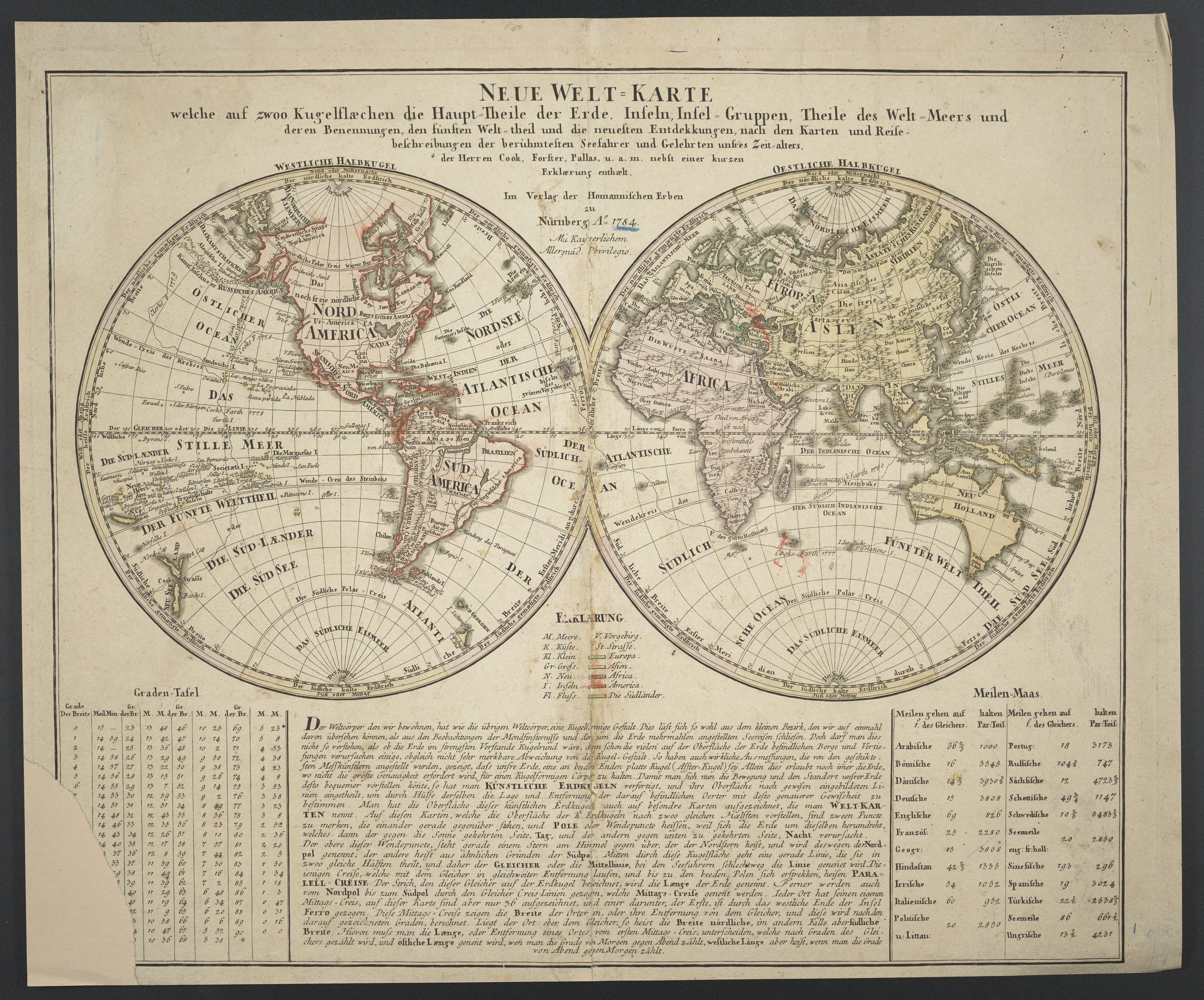
Neue Welt-Karte 1784.jpg - Higgenhorscht

Il mappamondo - Venezia - Antonio Zatta - 1774.jpg - Argonitros

1757 – G. R. Vaugondy – Orbis Vetus.jpg - Poli.Pav

Lib doppelmayr 1742 33.jpg - Poli.Pav

Atlas Coelestis n der Bibliothek der Nikolaus-Kopernikus-Universität in der polnischen Stadt Torun 06.jpg - Poli.Pav

Basis geographiae recentioris astronomica.jpg - Poli.Pav

Atlas coelestis. Ioh. Gabriele Doppelmaiero 18.jpg - Poli.Pav

Wereldkaart Waereld-Kaart (titel op object), RP-P-1935-796.jpg - Mr.Nostalgic

Wereldkaart, 1726 Mappe-Monde, Suivant les Nouvelles Observations (titel op object) Les Forces de l'Europe, Asie, Afrique et Amerique Comme aussi les Cartes des Côtes de France et d'Espagne (serieti, RP-P-OB-83.035-14.jpg - Mr.Nostalgic

Histoire des deux Indes-Atlas-d18-C01-Mappemonde.png - Vieux têtard

Ca. 1750 Japanes world map - Chiku Bankoku Ichizan no Zu - Comprehensive Image of the World's Myriad Countries.jpg - Balkanique

1787 world map - Mappe-Monde Celeste Terrestre et Historique.jpg - Balkanique

1782 map of the world.jpg - Balkanique
Ca. 1765 map of the world by Isaak Tirion.tif - Balkanique

1730 double hemisphere map of the world by Matthaus Seutter.jpg - Balkanique

1730 Stoopendaal Map of the World in two Hemispheres - Geographicus - WereltCaert-stoopendaal-1730FXD.jpg - Pixel8tor

1794 map of the world by Samuel Dunn.jpg - Balkanique

Jeu des cartes géographiques - S. L. Hegrad (28) - Globe terrestre.jpg - SteinsplitterBot

Drawing, print study, map (BM 1988,1105.32).jpg - Copyfraud

Atlas Novus Coelestis by Johann Gabriel Doppelmayr (1742) 018.jpg - Balkanique

Notions Elementaires De Cosmographie.jpg - Balkanique

A New Map of the Terraqueous Globe according to the latest Discoveries and most general Divisions of it into Continents and Oceans.jpg - Balkanique

Mappa Totius Mundi Adornata juxta Observationes Dnn Academiae Regalis Scientarum.jpg - Balkanique

Mapmonde ou Description Generale Du Globe Terrestre.jpg - Balkanique
A new map of the world -cartographic material- from the latest observations (1720) by John Senex. Original from The Beinecke Rare Book & Manuscript Library. Digitally enhanced by rawpixel. (50622864728).jpg - Eyes Roger
A Map of the World from the best Authorities (1795) from Carey's American Edition of Guthrie's Geography Improved. Original from The Beinecke Rare Book & Manuscript Library. Digitally enhanced by rawpixel. (50623708292).jpg - Eyes Roger
A new map of the world according to the new observations (1732) by Herman Moll. Original from The Beinecke Rare Book & Manuscript Library. Digitally enhanced by rawpixel. (50623604851).jpg - Eyes Roger

Le Globe Terrestre Represente En Deux Plans-Hemispheres Dresse Sur la Projection de Mr. de la Hure de l'Academie Royale des Sciences.jpg - Balkanique

Homann Planiglobii Terrestris Cumutroq Hemisphaerio Caelesti Generalis Exhibitio 1707 UTA.jpg - Michael Barera

Atlas nouveau portatif a l'usage des militaires, colleges et du voyageur. Tome 1 1756 (106348177).jpg - Enyavar

Mappa Mondo, Nuovo Atlante Geografico Universale.jpg - Taterian

Basis geographiae recentioris astronomica - a Iohanne Gabriele Doppelmaiero (...) opera Ih. Bapt. Homanni - btv1b53052960b.jpg - Gzen92Bot

Orbis Vetus in utrâque continente juxta mentem Sansonianam distinctus, nec non observationibus astronomicis redactus accurante Robert de Vaugondy... - btv1b5962753g.jpg - Gzen92Bot

Atlas géographique des quatre parties du Monde - faits pour les géographies élémentaires de Mrs Buache et de l'Abbé Nicolle de la Croix - par Guillaume de l'Isle et Philippe Buache ; rév. et augm.... - btv1b52000143b (009 of 128).jpg - Gzen92Bot

Mapamundi ò descripcion de todo el mundo, y en particular del globo terrestre... - por D. Tomàs Lopez... - btv1b53092951m.jpg - Gzen92Bot

Mappe monde nouvelle dédiée à Mgr le comte de Maurepas... - par... Le Rouge... - btv1b53093340t.jpg - Gzen92Bot

Mappe-monde - Dressée suivant les nouvelles relations et assujettie aux observations astronomiques par le S. Robert de Vaugondy Geogr. ; Corrigée et augmentée des Nouvelles Découvertes du Capitaine Cook par... - btv1b53176414f.jpg - Gzen92Bot

Atlas portatif, universel et militaire, composé d'après les meilleures cartes, tant gravées que manuscrites, des plus célébres géographes et ingénieurs. Tome 2 - . Par M. Robert, geographe... - bpt6k1510920h (022 of 409).jpg - Gzen92Bot

Figure du passage de Venus sur le disque du Soleil qu'on observera le 3 juin 1769... - par M. de la Lande - btv1b53179329r (1 of 2).jpg - Gzen92Bot

Mappemonde dressée suivant les nouvelles relations et assujettie aux observations astronomiques - par le Sr Robert... - btv1b53093290h.jpg - Gzen92Bot

Les révolutions de l'univers représentées en trente cartes composées chacune de deux feuilles, avec des remarques et observations sur chacune d'elles, ouvrage destiné à faciliter la lecture à l'étude de... - btv1b59636558.jpg - Gzen92Bot

Mappe monde nouvelle dédiée à Mgr le comte de Maurepas... - par... Le Rouge... - btv1b53092971f.jpg - Gzen92Bot

1e (-2e) Mappemonde - btv1b84440398 (1 of 2).jpg - Gzen92Bot

1e (-2e) Mappemonde - btv1b84440398 (2 of 2).jpg - Gzen92Bot
Mappe-monde par le Sr Robert de Vaugondy - btv1b84909279.jpg - Gzen92Bot
Le Globe terrestre representé en deux plans - hemispheres dressé sur les observations de M.rs de l'Académie Royale des sciences . Par Antoine Menard - btv1b53179358j (1 of 2).jpg - Gzen92Bot

Nouvel atlas portatif destiné principalement pour l'instruction de la Jeunesse, d'après la Géographie Moderne de feu l'abbé Delacroix - Par Le S(ieur) Robert de Vaugondy Géographe ord(inaire) du... - btv1b550137444 (016 of 183).jpg - Gzen92Bot

Orbis vetus in utraque continente juxta mentem Sansonianam... - accurante Robert de Vaugondy... - btv1b53093791v.jpg - Gzen92Bot

Mappe-Monde dressée suivant les nouvelles relations et assujettie aux observations astronomiques - par le Sr Robert de Vaugondy Geog? - btv1b53119358p.jpg - Gzen92Bot

Nouvelle Mappe-Monde 1750 (nla.obj-232406580).jpg - Mike Krüger

Mapamundi Murillo Velarde.jpg - David Montermoso

Mapumundi Murillo Velarde.jpg - David Montermoso

Double hemispherical map of the world (1705).jpg - Austiger

A new map of the World from the latest observations.png - Austiger

Mappe-monde ou carte generale du globe terrestre - representee en deux plan-hemispheres.png - Austiger

A new and correct map of the world laid down according to the newest discoveries and from the most exact observations.png - Austiger

A map of the world, corrected from the observations communicated to the royal Societys of London and Paris.png - Austiger

De werelt caart.png - Austiger

Atlas Novus Coelestis by Johann Gabriel Doppelmayr (1742 worldmap croppout).jpg - Enyavar

EB1 Plate LXXXVII Fig. 2 World.png - LlywelynII

EB1 Plate LXXXVII.png - LlywelynII

Dury Atlas Maps 1 and 2 The World.jpg - LlywelynII

Map of the World by Augustae Vindelicor and Matthaeus Seutter.jpg - Yann

A New and correct map of the world, laid down according to the latest discoveries.jpg - Librarydew

Institutions géographiques, ou Description générale du globe terrestre... suivi d'un Atlas élémentaire composé de 31 cartes, lequel comprend la carte générale de la France Ancienne & de la... - btv1b532488301 (126 of 221).jpg - Gzen92Bot

Mappemonde ou description du globe terrestre... par le Sr Janvier... - btv1b84911911.jpg - Gzen92Bot

Mappemonde contenant des parties connues du globe terrestre... - gravée par Chambon - btv1b532240033.jpg - Gzen92Bot

Le Globe terrestre divisé en ses deux hémisphères... - par le Sr Moithey... - btv1b53093372z.jpg - Gzen92Bot

1ère mappemonde ou représentation du globe terrestre... avec l'indication des principaux termes de la géographie physique ou naturelle... - btv1b8492070t.jpg - Gzen92Bot
A new universal history of arts and sciences Fleuron T061270-54.png - Fæ

Mappemonde sur laquelle on a marqué tous les lieux qui doivent voir le passage de Mercure sur le soleil le 6 mars 1753... - par Mr Guillaume de l'Isle... - btv1b84440754 (01 of 10).jpg - Gzen92Bot

Mappemonde, ou, Description du globe terrestre (cartographic material) - dres??e fur les memoires les plus nouveaux, et assujettie aux observations astronomiques - par Robert de Vau - DPLA - e810b2f4447b9bb8ca86786559b67d68.jpg - DPLA bot

Orbis vetus in utrâque continente juxtà mentem Sansonianam distinctus, nec non observationibus astronomicis - Norman B. Leventhal Map Center at the BPL.jpg - Dzlinker

Nieuwe en beknopte hand-atlas - 1754 - UB Radboud Uni Nijmegen - 209718609 001 Wereld-Kaart.jpeg - Spinster

Mappe-monde ou description du globe terrestre vu en concave ou en creux en deux hémisphères où l'on trouve. -le rapport que toutes ses parties ont avec les cieux... - par M. Moullart-Sanson... - btv1b53093266z.jpg - Gzen92Bot

Le Globe terrestre divisé en ses deux hémisphères... - par le Sr Moithey... - btv1b53062146g.jpg - Gzen92Bot

Atlas methodique et elementaire de geographie 1793 (137818496).jpg - Polona Upload

Atlas methodique et elementaire de geographie 1793 (137819085).jpg - Polona Upload

Atlas methodique et elementaire de geographie 1793 (137819425).jpg - Polona Upload

Atlas methodique et elementaire de geographie 1793 (137820560).jpg - Polona Upload

Mappe-monde, ou carte générale de la terre, divisée en deux hémisphères suivant la projection la plus commune - par N. de Fer ; H. van Loon - btv1b53052620j.jpg - Gzen92Bot

Atlas ou recüeil de cartes geographiques, dressées sur les nouvelles observations de M(essieu)rs de l'Academie Royale des Sciences, par N. de Fer geographe de sa Majesté Catolique et Monseigneur le... - btv1b53247486x (019 of 328).jpg - Gzen92Bot

Atlas ou recüeil de cartes geographiques, dressées sur les nouvelles observations de M(essieu)rs de l'Academie Royale des Sciences, par N. de Fer geographe de sa Majesté Catolique et Monseigneur le... - btv1b53247486x (022 of 328).jpg - Gzen92Bot