Wikimedi'Òc
Modes d'emploi

Cet album fait partie des albums
Cet album photos contient les sous-albums suivants :


La Grande-Bretagne et l'Irlande - par Bauerkeller - Victor Ribot - btv1b532474752 (1 of 2).jpg - Enyavar

La Grande-Bretagne et l'Irlande - par Bauerkeller - Victor Ribot - btv1b532474500 (1 of 2).jpg - Gzen92Bot

La Grande-Bretagne et l'Irlande - par Bauerkeller ((Reproduction photographique)) - btv1b53247442g.jpg - Enyavar

Johnson, A.J. Europe. 1864.K.jpg - Geagea

1862 Stieler Map of the British Isles ( England, Ireland, Scotland ) - Geographicus - Britischen-perthes-1862.jpg - BotMultichill

1865 Spruner Map of the British Isles (England, Scotland, Ireland) - Geographicus - Britannia-spruner-1865.jpg - BotMultichillT

British Isles and Ireland (6094188024).jpg - File Upload Bot (Magnus Manske)
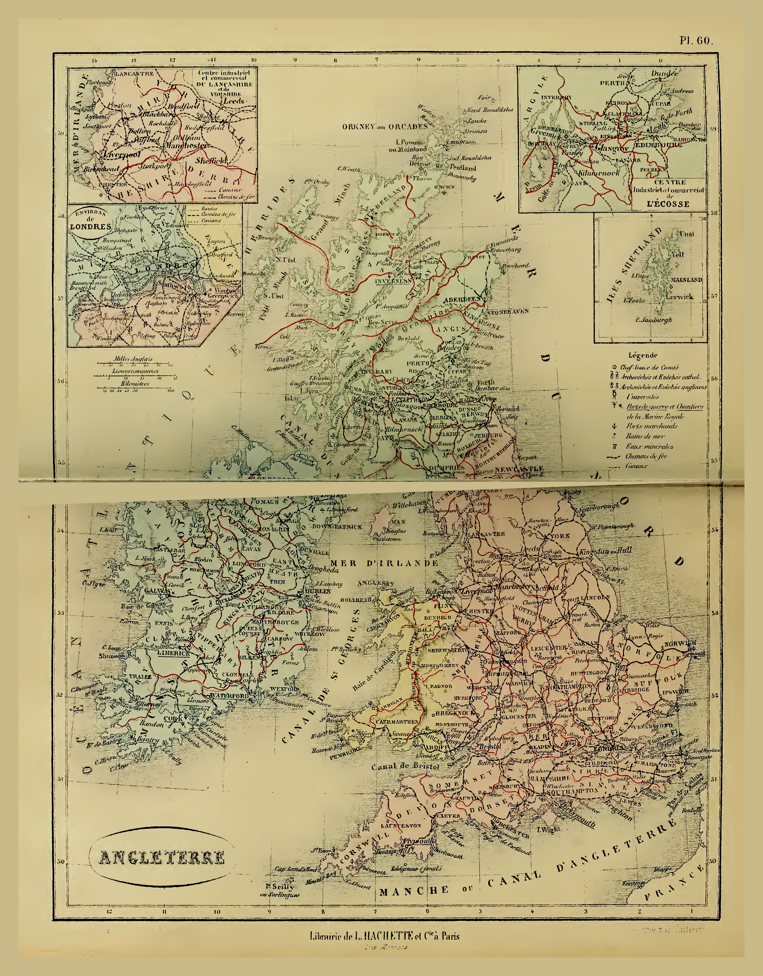
Bouillet - Atlas universel, Carte 60.png - Pibewiki

Bouillet - Atlas universel, Carte 30.png - Pibewiki

New reference atlas for the use of colleges, libraries, families, and counting houses (1865) (14764009432).jpg - Fæ

92 of 'The Student's Manual of Modern Geography. Mathematical, physical, and descriptive' (11244156284).jpg - Artix Kreiger 2

417 of 'The National Gazetteer of Great Britain and Ireland. (Edited by N. E. S. A. H.)' (11087053584).jpg - FlickreviewR 2
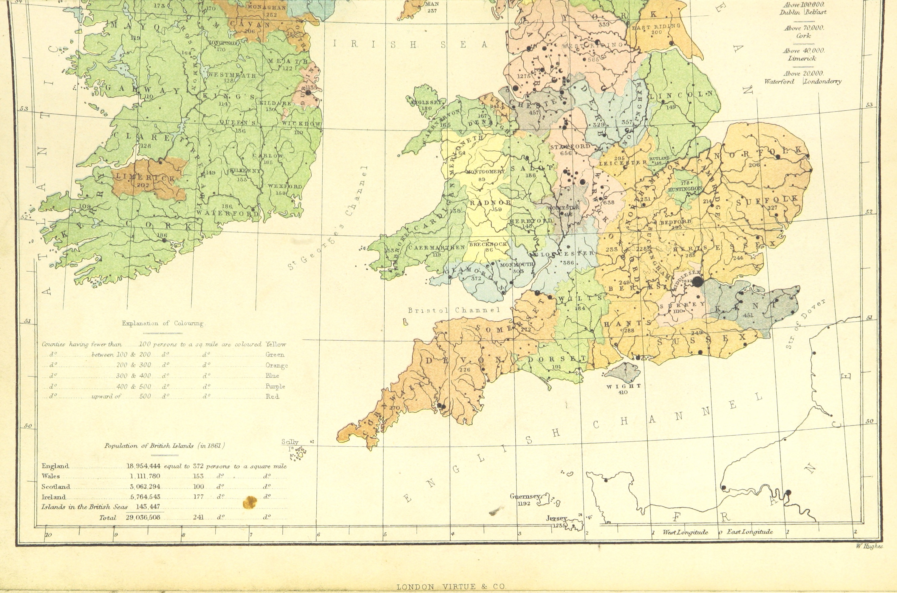
421 of 'The National Gazetteer of Great Britain and Ireland. (Edited by N. E. S. A. H.)' (11087162753).jpg - FlickreviewR 2

Die Britischen Inseln Und Das Umliegende Meer.jpg - Higgenhorscht

Admiralty Chart No 2 British Islands, Published 1867.jpg - Kognos

Britannia et Hibernia - Roman Britain and Ireland (Spruner-Menke, Atlas Atiquus, 1865).jpg - FDRMRZUSA
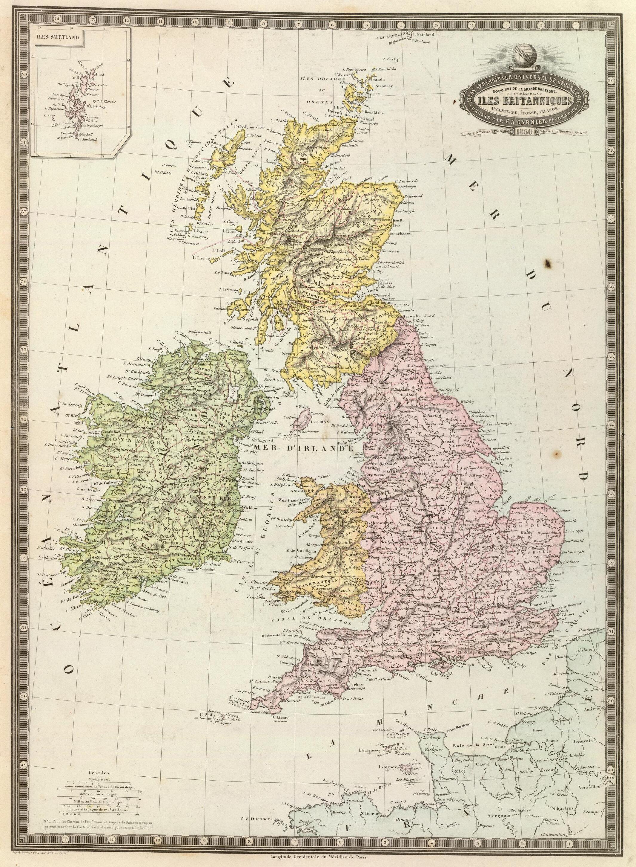
Iles Britanniques 1862.jpg - Enyavar