Wikimedi'Òc
Modes d'emploi

Cet album fait partie des albums


1864 Johnson Map of California, Nevada, Utah, Arizona, New Mexico and Colorado - Geographicus - Southwest2-johnson-1864.jpg - SDudley

Map of Parts of California, Nevada, Oregon, and Idaho Territory Showing the Routes to the Humboldt and Reese River Mines, Surprise Valley Owyhee Mines, Idaho (2) - NARA - 86455718.jpg - US National Archives bot

Map of Parts of California, Nevada, Oregon, and Idaho Territory, Showing the Routes to the Humboldt and Reese River Mines, Surprise Valley Owyhee Mines, Idaho (1) - NARA - 86455716.jpg - US National Archives bot

Map of the State of Nevada - to accompany the Annual report of the Commr. Genl. Land Office LOC 2014589395.jpg - Fæ

DeGroot's Map of Nevada Territory.jpg - Tristan Surtel

DeGroot's Map of Nevada Territory crop.jpg - Tristan Surtel

Map of the Boundary Line between California and Nevada Territory - NARA - 93193135.jpg - US National Archives bot

1866 Mitchell Map of Utah and Nevada - Geographicus - UtahNevada-mitchell-1866.jpg - BotMultichillT

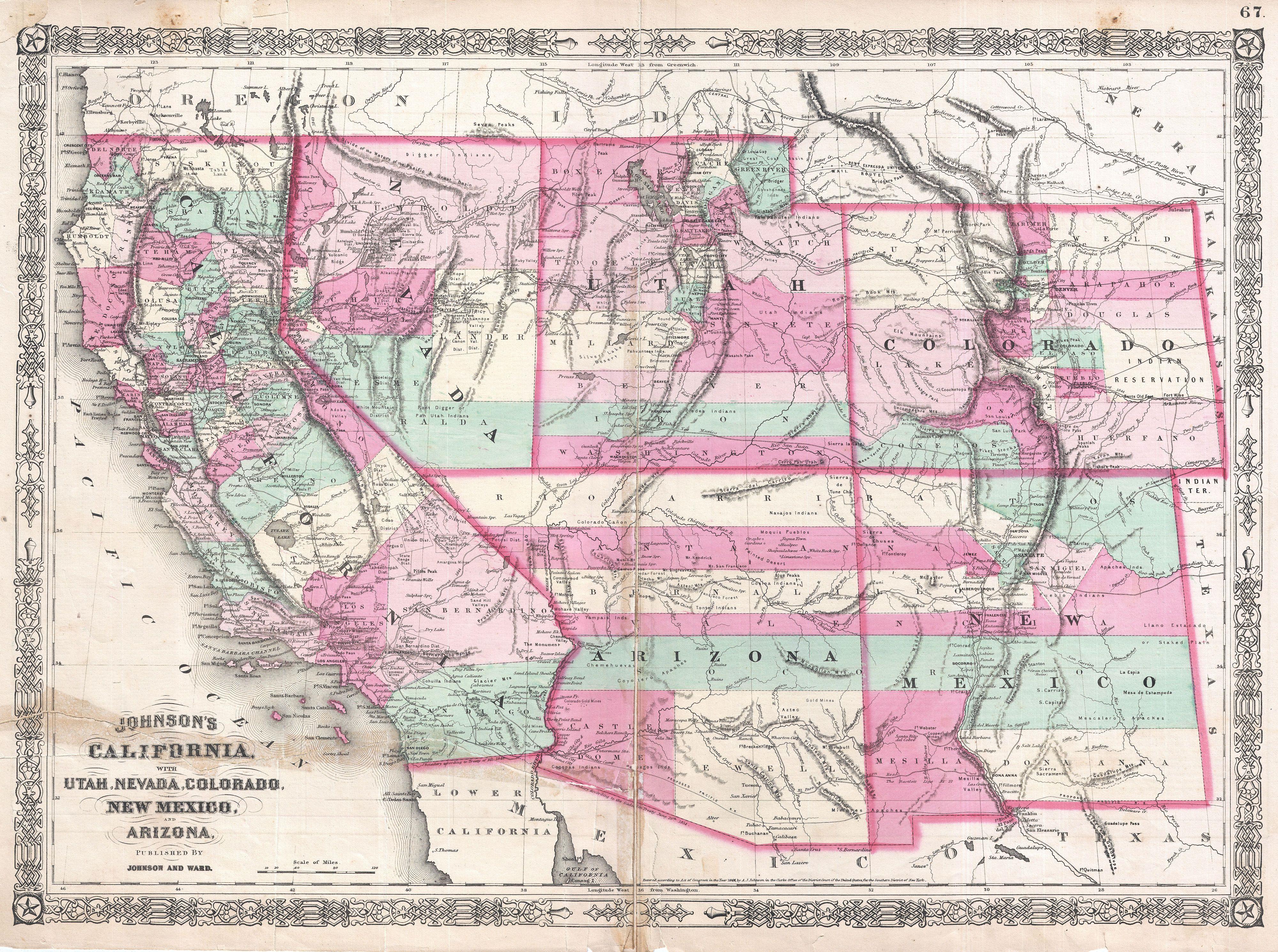
1862 Johnson Map of California, Nevada, Utah, Colorado, New Mexico and Arizona - Geographicus - CANMUT-johnson-1862.jpg - BotMultichillT

1866 Johnson Map of California, Colorado, Arizona, New Mexico, Nevada and Utah - Geographicus - Southwest-johnson-1866.jpg - BotMultichillT

California State and New Mexico, Arizona, Nevada, Colorado and Utah Territories Map, 1862.jpg - Yann

Territory and military department of Utah LOC 2015591071.jpg - Fæ

Wayside at St. Thomas (e73aa032-d7e2-4079-9d7f-63e8c179d693).jpg - BMacZeroBot