Wikimedi'Òc
Modes d'emploi

Cet album fait partie des albums
Cet album photos contient les sous-albums suivants :


1857 Map of Albany.jpeg - MattWade
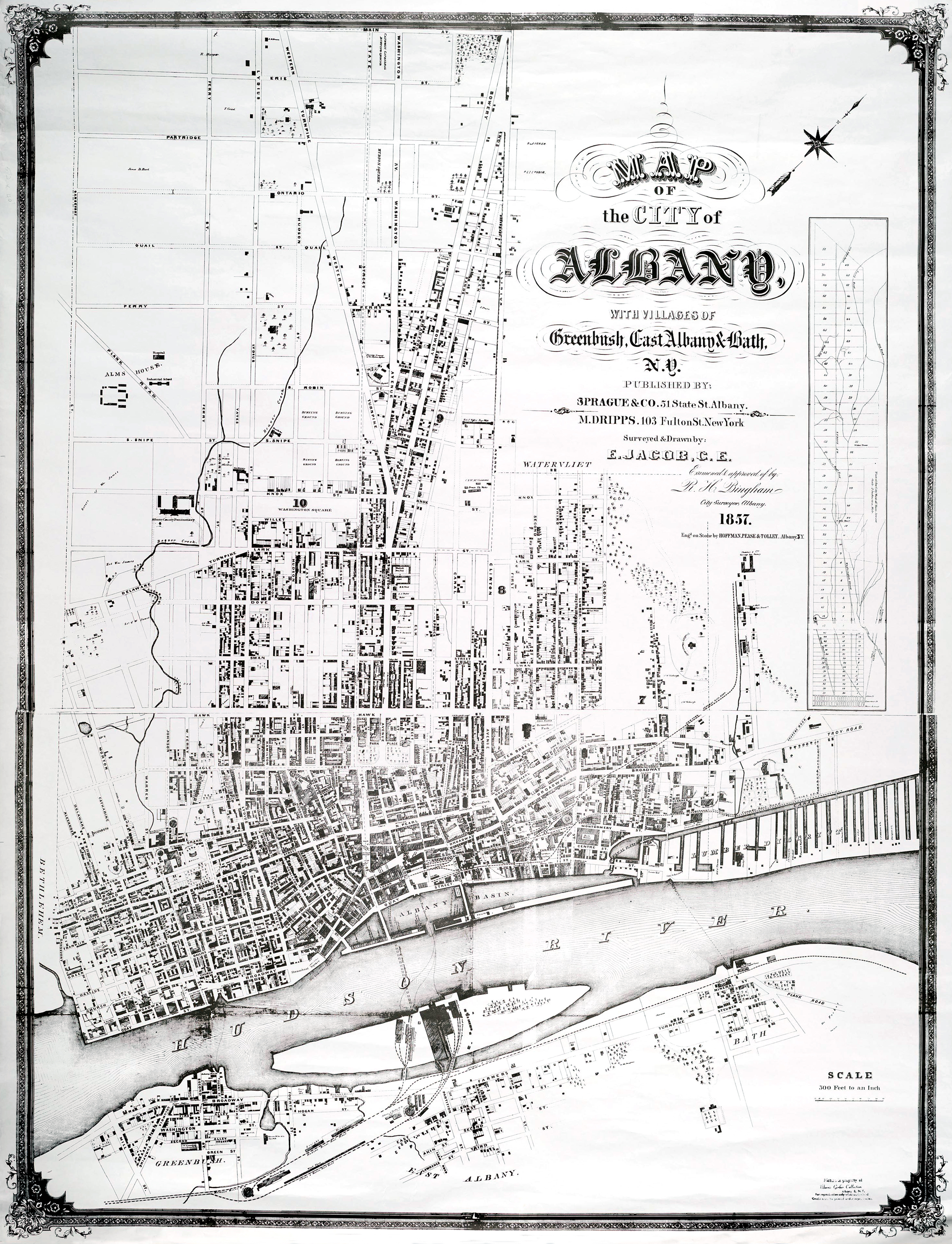
1857 Map of Albany Edit.jpeg - MattWade

1857 Map of Albany Edit Crop.jpeg - MattWade

Albany Basin 1857.jpeg - MattWade

1857 U.S. Coast Survey Map of Eastern Long Island (Hamptons, Amagansett) - Geographicus - SouthernLongIslandMP-uscs-1857.jpg - BotMultichillT

1857 U.S. Coast Survey Map of New York City and Harbor - Geographicus - NewYorkCity-uscs-1857.jpg - BotMultichillT
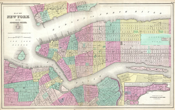
1857 Colton Map of New York City, New York - Geographicus - NewYorkCity-colton-1857.jpg - Multichill

Seneca Village-Central Park-Nyc.gif - 7mike5000

Town of Kirkland, Oneida Co., New York LOC 2010593272.jpg - Fæ
City & county map of New-York - Brooklyn, Williamsburgh, Jersey City & the adjacent waters LOC 2015591060.tif - Fæ

City & county map of New-York - Brooklyn, Williamsburgh, Jersey City & the adjacent waters LOC 2015591060.jpg - Fæ
A topographical map of Lewis Co., New York - from actual surveys LOC 2013593274.tif - Fæ

A topographical map of Lewis Co., New York - from actual surveys LOC 2013593274.jpg - Fæ

Travellers map of Long Island. LOC 2005625366.jpg - Fæ
Map of the rail-roads of the state of New York prepared under the direction of Silas Seymour, state engineer surveyor. LOC 98688522.tif - Fæ

Map of the rail-roads of the state of New York prepared under the direction of Silas Seymour, state engineer surveyor. LOC 98688522.jpg - Fæ
Village of Albion, Orleans Co., New York LOC 2010593266.tif - Fæ

Village of Albion, Orleans Co., New York LOC 2010593266.jpg - Fæ

Map of Canajoharie, Montgomery Co., New York LOC 2009575122.jpg - Fæ