Wikimedi'Òc
Modes d'emploi

Cet album fait partie des albums
Cet album photos contient les sous-albums suivants :


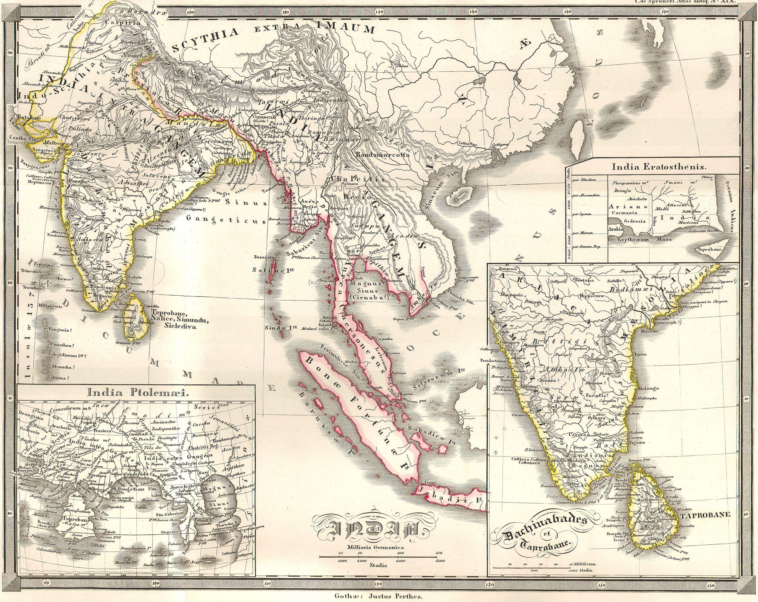
1855 Spruneri Map of India and Southeast Asia in Ancient Times - Geographicus - India-spruneri-1855.jpg - BotMultichill

1855 Spruner Map of Asia in the 9th and 10th Centuries - Geographicus - AsienIXX-spruneri-1855.jpg - BotMultichill

1855 Spruneri Map of Persia ( Iran, Iraq, Kuwait ) - Geographicus - Persis-spruneri-1855.jpg - BotMultichill

1855 Spruner Map of Asia in the 11th and 12th Centuries ( Seljuk Empire, Song China ) - Geographicus - AsienXIXII-spruner-1855.jpg - BotMultichill

1855 Spruner Map of Asia 200 B.C.E ( Han China, Seleucid Empire ) - Geographicus - AsiaChristus-spruner-1855.jpg - BotMultichill

1855 Spruner Map of Asia at the end of the 2nd Century ( Han China ) - Geographicus - AsienZweiten-spruneri-1855.jpg - BotMultichill

1855 Spruner Map of Asia During Chang Dynasty China ( Tufan Tibet ) - Geographicus - AsienVIXI-spruneri-1855.jpg - BotMultichill

1855 Spruner Map of Asia under the Mongol Empire - Geographicus - AsiaXIIIXIV-spruneri-1855.jpg - BotMultichill
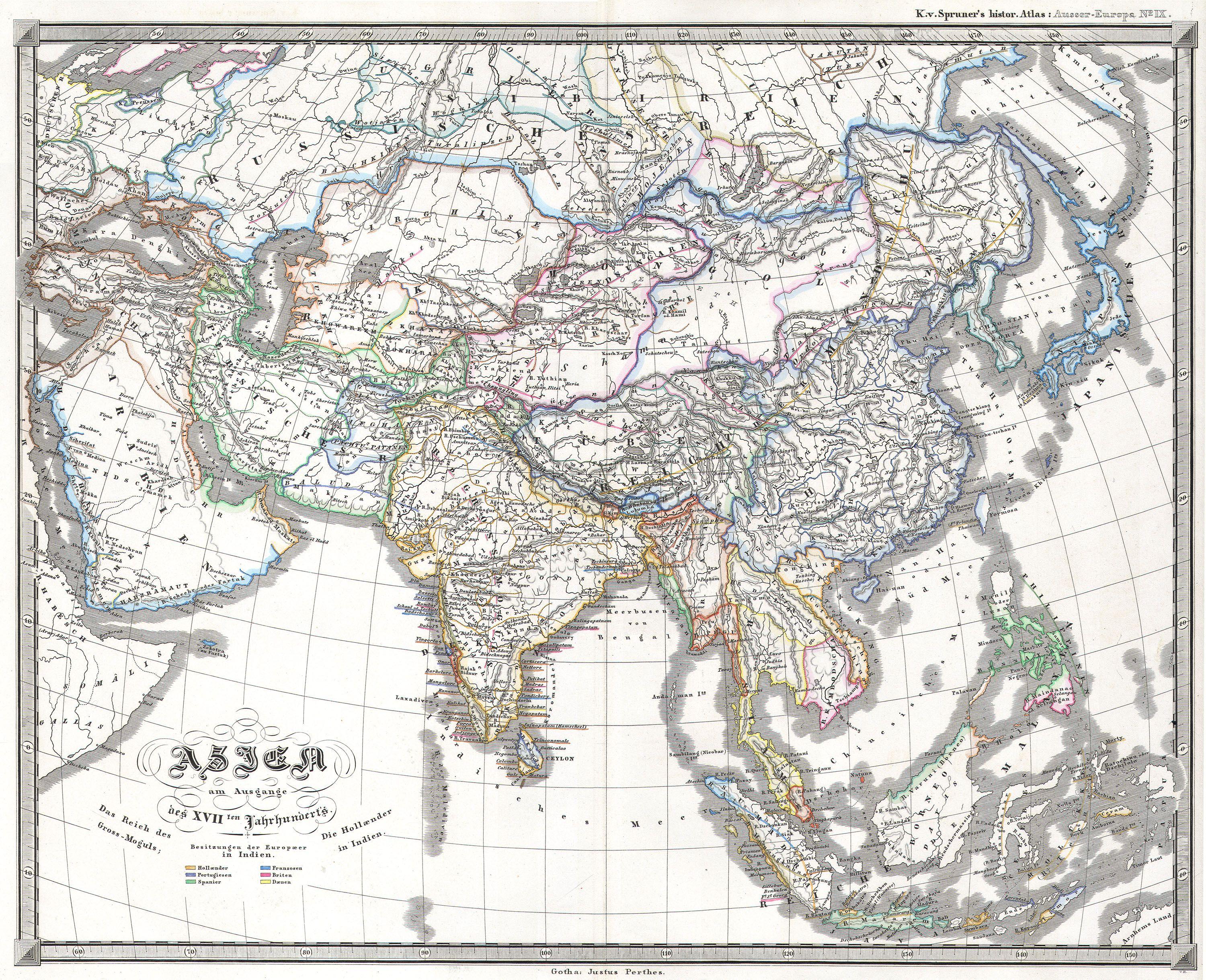
1855 Perthes Map of Asia at the end of the 17th Century - Geographicus - Asia17th-perthes-1855.jpg - BotMultichill

1855 Colton Map of Asia - Geographicus - Asia-colton-1855.jpg - BotMultichillT

Asia Map 1855.jpg - INeverCry

Tōkaidō and the sea route from Ōsaka to Edo (15322852942).jpg - Fæ

Plan of places destroyed by the earthquake and fires in Edo (15022268970).jpg - Fæ

"Imperio de los Mogoles" (4114213297).jpg - Tm
Asia LOC 2018588021.tif - Fæ

Asia LOC 2018588021.jpg - Fæ
Vorder-Asien. LOC 2013593006.tif - Fæ

Vorder-Asien. LOC 2013593006.jpg - Fæ

Map of the Countries Between England & India, 3902002.jpg - Yann

Life-expectancy,Asia,1855.svg - Doc James