Wikimedi'Òc
Modes d'emploi

Cet album fait partie des albums
Cet album photos contient les sous-albums suivants :


Malovanka COSK 1840.jpg - Gampe
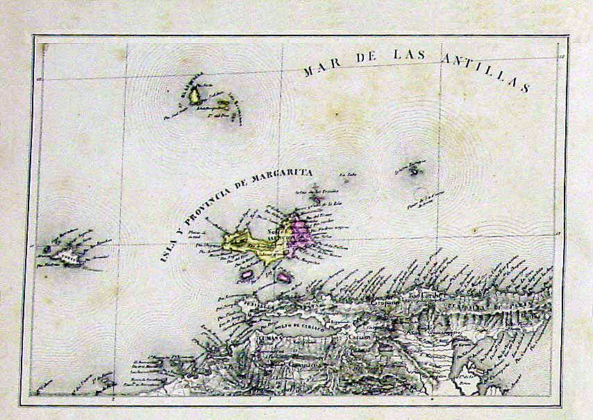
Isla-de-Margarita-map-1840-Codazzi.jpg - Bejnar

Chart of Cocos Keeling Islands.png - Goyston

Provincia de Guayana Cantón Piacoa.JPG - Milenioscuro

Plan zur Stadterweiterung von Heilbronn von Louis de Millas von 1840.jpg - Messina
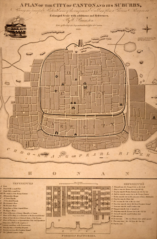
British map of Canton, 1840.jpg - Spellcast

Erie-canal 1840 map.jpg - Nconwaymicelli

Landgoed Aalbeek1840.jpg - Tannhome

1840 Lizars Map of Scandinavia ( Norway, Sweden, Finland, Denmark, Iceland ) - Geographicus - Scandinavia-lizar-1840.jpg - BotMultichillT

KoppinscheKarte.jpg - File Upload Bot (Magnus Manske)

Аккуратная карта Финского залива.jpg - Пётр Иванов

Topographischer Atlas des Königreichs Württemberg (Ausschnitt aus Blatt 16, Jahr 1840).png - Pilettes

Brisbane Town 1840.jpg - Lankiveil
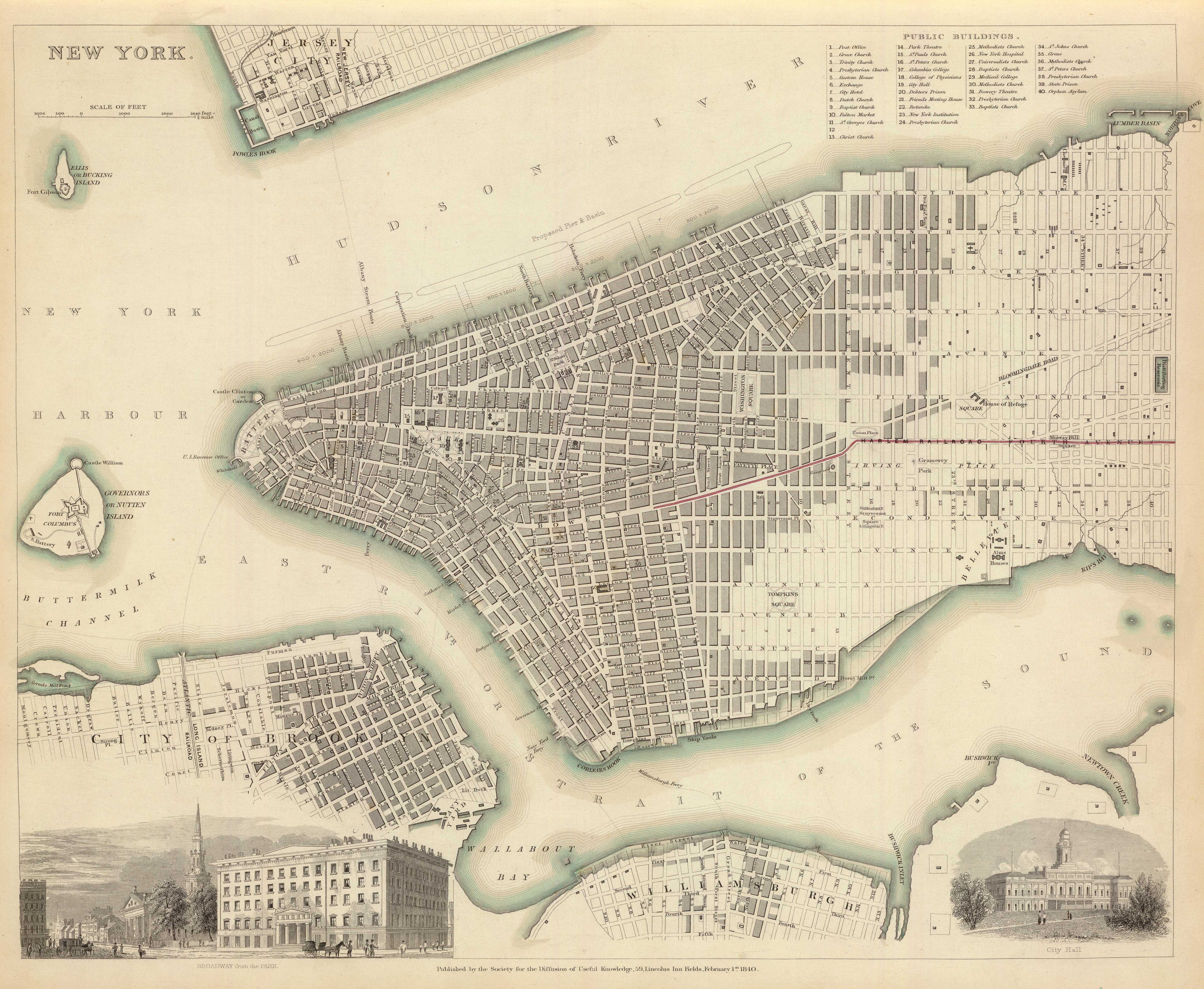
New york 1840.jpg - National Public Domain Archive
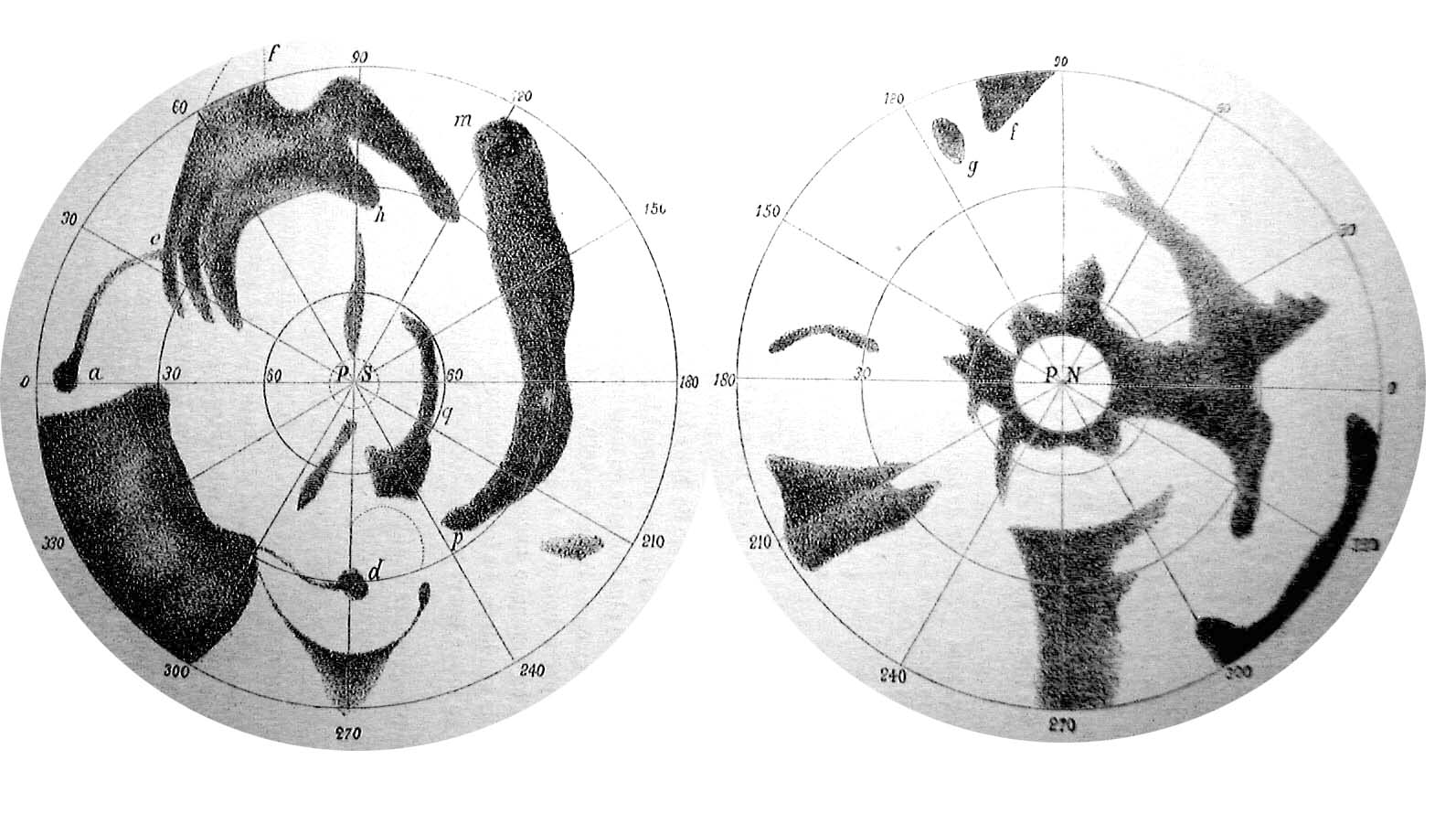
Madler-Beer Map of Mars.jpg - Slamhound

Plan of William Jacksons farm, Newton (3720087447).jpg - File Upload Bot (Magnus Manske)

Spezial Karte des Marburger Kreises im Herzogthum Steyermark 1840.jpg - Sporti
City of New-York - by David H. Burr. NYPL434685.tiff - Fæ
Distance map of the state of New York - containing all the towns in the state. NYPL434737.tiff - Fæ
State of New York - by D.H. Burr; engraved and printed by S. Stiles and Co. NYPL434733.tiff - Fæ

(1840) Island of CUBA, Island of PORTO RICO.jpg - Metilsteiner

Borodyno Danylevsky.jpg - Well-Informed Optimist

Département du Calvados - 1840.jpg - Gz260

Large atlas map of the Pacific, 1840, engraved by Pikao.jpg - KAVEBEAR

Mapa de Venezuela 1840.jpg - Acontista

Sordavala 1840.jpg - Well-Informed Optimist

Comune di Mesola 1840.jpg - Chiara Consonni (BEIC)
City of jiangyin in 1840.jpg - 猫猫的日记本

WP Stadtplan Lübeck 1840.jpg - Wdwdbot

Map of a woman's heart (11858147624).jpg - Fæ

20 of 'Cæsarea. The Island of Jersey; its history, constitution, ... commerce, and other statistics ... To which is added, its antiquities, and the biography of eminent men, natives of the Island' (11017630176).jpg - Artix Kreiger 2

Map of Lago di Bientina and surrounding area before drainage.jpg - Ganesha811
Joslin's six inch celestial globe from the best authorities LOC 2003625133.tif - Fæ

Joslin's six inch celestial globe from the best authorities LOC 2003625133.jpg - Fæ
Fort Edward to Putnam's Creek, incidents of the French War. LOC 73691809.tif - Fæ

Fort Edward to Putnam's Creek, incidents of the French War. LOC 73691809.jpg - Fæ
Copy, square 533 - (Washington D.C.) LOC 88693125.tif - Fæ

Copy, square 533 - (Washington D.C.) LOC 88693125.jpg - Fæ
Geological map of Maryland on which are also shewn the chief topographical features to aid in the triangulation. LOC 77693816.tif - Fæ

Geological map of Maryland on which are also shewn the chief topographical features to aid in the triangulation. LOC 77693816.jpg - Fæ
Map of the city of Washington LOC 88694055.tif - Fæ

Map of the city of Washington LOC 88694055.jpg - Fæ

Záchlumí SK 1840.jpg - Gampe
World. LOC 85694390.tif - Fæ

World. LOC 85694390.jpg - Fæ
Map of the projected railway from Harrisburg to Pittsburg (sic) with proposed extensions to Cleveland, Cincinnati and St. Louis, in connexion (sic) with the public works of Pennsylvania, Ohio, Indiana LOC 98688348.tif - Fæ
(General-content map of several townships in the southern part of Burlington County, N.J.) LOC 2012592357.tif - Fæ

(General-content map of several townships in the southern part of Burlington County, N.J.) LOC 2012592357.jpg - Fæ
Joslin's six inch terrestrial globe, containing the latest discoveries LOC 2003625132.tif - Fæ

Joslin's six inch terrestrial globe, containing the latest discoveries LOC 2003625132.jpg - Fæ

(Map of New York Island and vicinity. LOC gm71000923.jpg - Fæ
He mau palapala aina, a me na niele e pili ana. Hookahi ke pai ana. LOC 98687131.tif - Fæ

He mau palapala aina, a me na niele e pili ana. Hookahi ke pai ana. LOC 98687131.jpg - Fæ
(Cadastral survey map of land tracts in Washington D.C. near the Anacostia River LOC 87694331.tif - Fæ

(Cadastral survey map of land tracts in Washington D.C. near the Anacostia River LOC 87694331.jpg - Fæ
(Maps of Nova Scotia and Halifax harbor and view of lighthouse). LOC 2017585984.tif - Fæ

(Maps of Nova Scotia and Halifax harbor and view of lighthouse). LOC 2017585984.jpg - Fæ
Das südöstliche Asien, oder China, Japan und hinter-Indien mit dem indischen Archipelagus LOC 2006635528.tif - Fæ

Map of the River Sabine from its mouth on the Gulf of Mexico in the sea to Logan's Ferry in latitude 31°58ʹ24ʺ north - shewing the boundary between the United States and the Republic of Texas between LOC 98685985.jpg - Fæ

A sketch of a survey made for Col. W'm Hickey, under a warrant from the United States, to take up vacant land - made to lay before his lawyers to determine some legal points - (part of Washington D.C. LOC 87694330.jpg - Fæ
No. 1. County land from N.E. mile stone & John C. Rives' farm - (Washington D.C. and Prince Georges County, Md.) ; No. 2. Part of "Long Meadows" - (Washington D.C.). LOC 88690901.tif - Fæ

No. 1. County land from N.E. mile stone & John C. Rives' farm - (Washington D.C. and Prince Georges County, Md.) ; No. 2. Part of "Long Meadows" - (Washington D.C.). LOC 88690901.jpg - Fæ

Land taken for the Rideau Canal.jpg - Jeangagnon

Carte topographique statistique et historique (...)Lavenére-Lahont J btv1b530874944 1.jpg - TCY

1840 pictorial map - A new and easy Map of Matter-of-Money comprising all the late Discoveries made, and Observations Taken A.D. 1840.png - Balkanique

1840 celestial map of the Northern Hemisphere by Adolf Stieler.jpg - Balkanique

Beneschau COSK 1840.jpg - Gampe
Beneschau COSK 1840 detail.jpg - Gampe

New Map of Ireland 1840 by Pigot & Co (cropped).jpg - Jacobfrid

Map of a woman's heart, by Joseph Husson, Jr., 1840-1860, from the Digital Commanwealth - commonwealth cj82kr20j.jpg - Daderot

Heinrich Kiepert, Karte der Sinai-Halbinsel und des Petraeischen Arabiens (FL170208107 2370024).jpg - Geagea

Plan de la ville de Nazareth (FL199995557 2370222).jpg - Geagea

Antoine-Remy Frémin, Plan de l'Ancienne Jerusalem (FL6882052 2370262).jpg - Geagea

Louis-François Cassas, Plan général de la ville et des environs de Spalatro (FL147457684 2464170).jpg - Geagea

Terra Filiorum Israelis. antequam in duo regna dispertita fuit (FL37119266 3896542).jpg - Geagea

Judaea et Regiones Finitimae, Aerae Christianae (FL37119269 3896546).jpg - Geagea

Sidney Hall, Palestine (FL37119344 3897342).jpg - Geagea

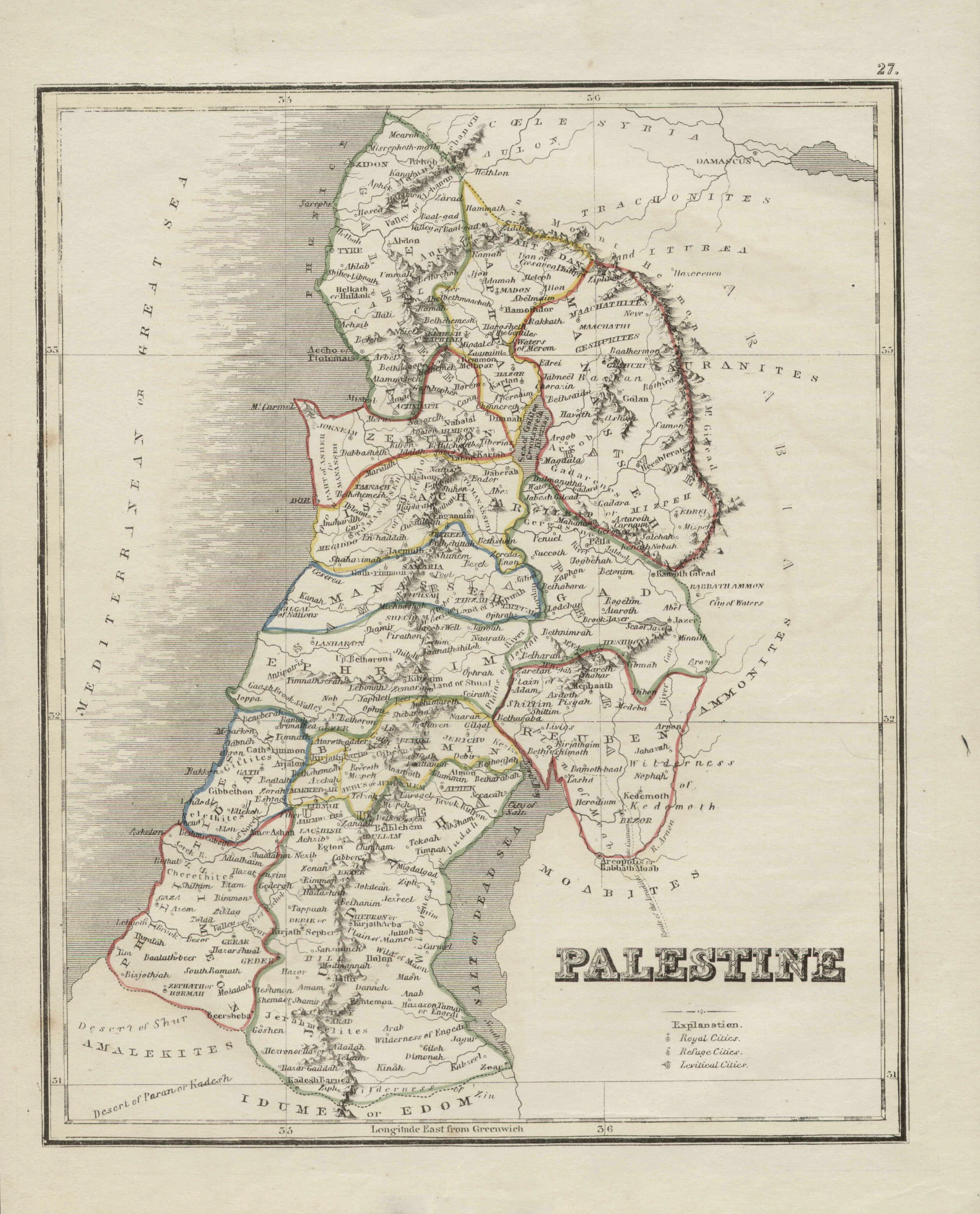
Palestine (FL37119356 3897442).jpg - Geagea

P. Bineteau, Carte de l'Afrique (FL13728513 2510792).jpg - Geagea

Middle East (FL13729692 2516196).jpg - Geagea

Francesco Amati, Plan de Jérusalem (FL13735715 3607386).jpg - Geagea

Western hemisphere (FL147409338 2726895).jpg - Geagea

Eastern hemisphere (FL147409341 2726893).jpg - Geagea

Frédéric-Guillaume Laguillermie, Océanie (FL27963667 2518796).jpg - Geagea

Asia minor (FL27964783 2559876).jpg - Geagea

Karte vom heiligen lande (FL32713915 3877876).jpg - Geagea

Petrus Plancius, Carte Routière de l'Europe divisée en ses principaux états (FL33132706 2524202).jpg - Geagea
Christoph Fembo, Gallia, Germania et Italia medii aevi (FL33133677 2583663).jpg - Geagea

George Peacock, Reisen seiner des Königs Ludwig I. von Bayern Mayestaet in den Jahren 1835 und 1836, auf der Koeniglich Großbrittanischen Kriegs-Dampf-Fregatte Medea (FL35071971 2532482).jpg - Geagea

Terra Sancta (FL35098505 3892340).jpg - Geagea
Sketch of the bombardment of Acre by the English fleet Novr. 3d. 1840 (FL35098716 3892381).jpg - Geagea

Syria and lower Egypt (FL35098742 3892206).jpg - Geagea

John Dower, Turkey in Asia (FL35868087 2714928).jpg - Geagea

W. Warwick, Palestine or the Holy Land.exhibiting the principal places mentioned in the Old & New Testaments (FL37103007 3803120).jpg - Geagea

Carl Ritter, Karte von Palaestina. nach den neuesten ouellen vorzüglich nach den Robinson'schen Untersuchungen (FL37105251 3886368).jpg - Geagea

Alexander Findlay, Palæstina (FL37119226 3896468).jpg - Geagea
Palestine (FL37119257 3896489).jpg - Geagea

Palestine avec la Phénicie et la coele - Syrie depuis établissement des Israélites jusqu 'au schisme des Dix Tribus (FL37122013 3898267).jpg - Geagea

Antoine-Remy Frémin, Carte de la Monarchie des Hebreux sous Salomon ou le Royaume d'Israel divise en douze Gouvernemens (FL37122018 3898276).jpg - Geagea

Louis-Magloire Cottard, Carte de la Palestine selon le partage des Douze Tribus (FL45612704 3960462).jpg - Geagea

Bataille du Mt. Tabor (FL4542154 3015785).jpg - Geagea

Střeschowitz COSK 1840 (Kassnička).jpg - Gampe

Střeschowitz COSK 1840.jpg - Gampe

Brzewnow COSK 1840.jpg - Gampe