Wikimedi'Òc
Modes d'emploi

Cet album fait partie des albums
Cet album photos contient les sous-albums suivants :


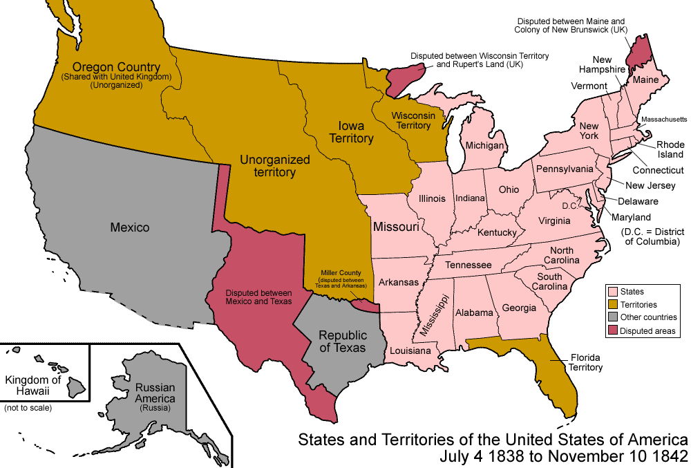
United States 1838-1842.png - Golbez
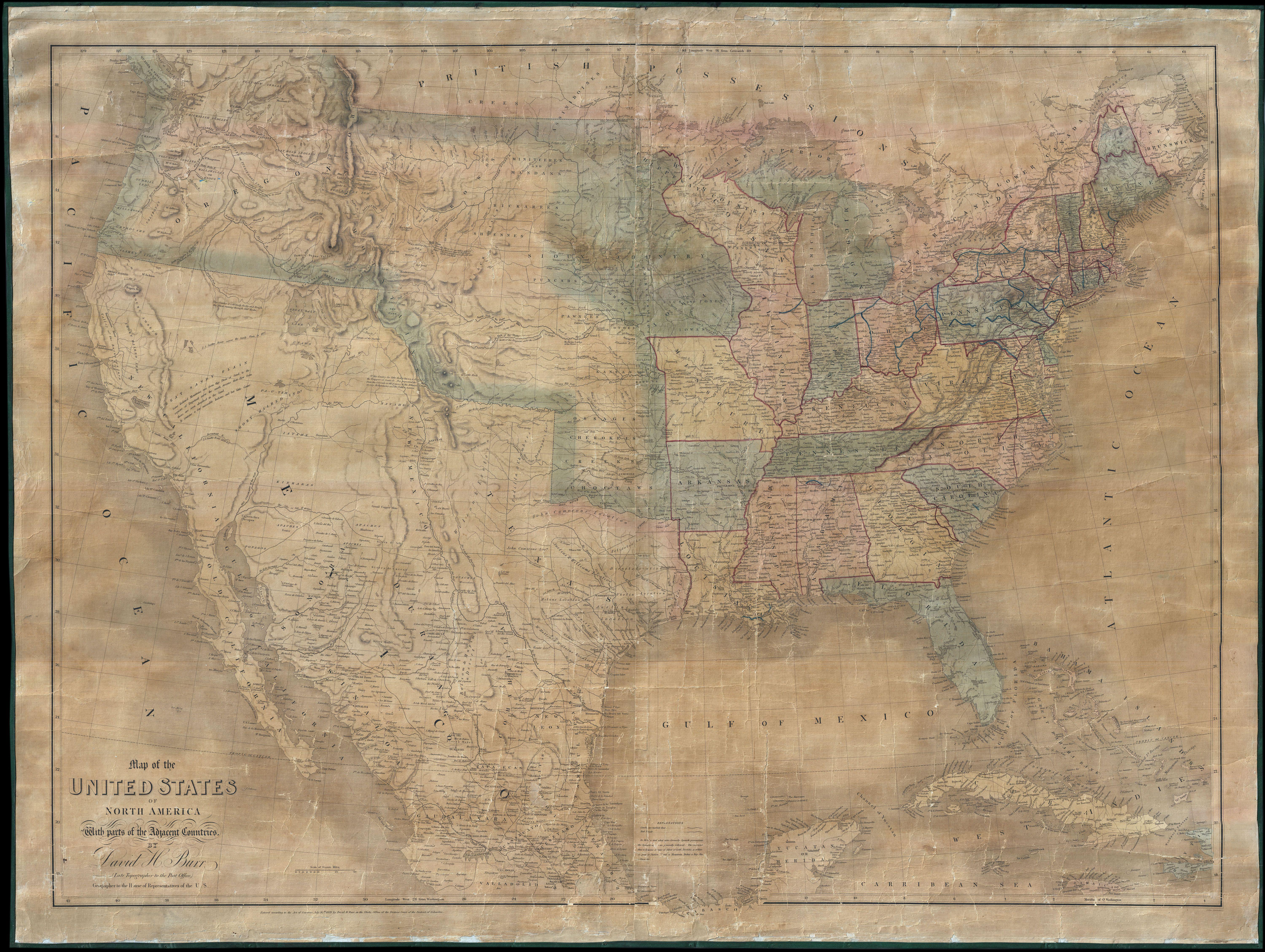
1839 Burr Wall Map of the United States (only example of Jedediah Smith's map) - Geographicus - UnitedStates-burr-1839.jpg - BotMultichillT

Map of the United States of North America with Parts of the Adjacent Countries.png - SarahStierch
The American Atlas WDL9562.pdf - Fæ

Section of 1839 Army Corps of Engineers Map Showing King's Road.JPG - Carlstak
Map of the United States of North America - with parts of the adjacent countries (NYPL b15485846-1951046).tiff - Fæ
Mitchell's map of the United States - showing the principal travelling turnpike and common roads, on which are given the distances in miles from one place to another, also the courses of the (NYPL b15108647-434852).tiff - SteinsplitterBot

A map of the Georgia Rail Road and the several lines of railroad connecting with it, Febr. 1839. LOC 98688667.jpg - Fæ
Map of North and South Carolina exhibiting the post offices post roads, canals, rail roads etc. By David H. Burr; (Late topographer to the Post Office.) Geographer to the House of Representatives of LOC 98688532.tif - Fæ

Map of North and South Carolina exhibiting the post offices post roads, canals, rail roads etc. By David H. Burr; (Late topographer to the Post Office.) Geographer to the House of Representatives of LOC 98688532.jpg - Fæ

The American atlas, exhibiting the post offices, post roads, rail roads, canals, and the physical & political divisions of the United States of North America LOC 2009582191-3.jpg - Fæ

Map Exhibiting the position of the Lands occupied by Indian Tribes in Amity with the United States- and also The Lands Ceded to the United States, by Treaty with various Indian Tribes. - United States o(...) - NARA - 102278691 (page 3).jpg - US National Archives bot

Ornamental map of the United States, 1839 - DPLA - 2bf7fe091e6676ba611645cef17c3ea6.jpg - DPLA bot

Edinburgh cabinet atlas (14296050).jpg - YannBot