Wikimedi'Òc
Modes d'emploi

Cet album fait partie des albums
Cet album photos contient les sous-albums suivants :


Mitchell's school atlas LOC 2007633727-13.tif - Fæ
Mitchell's school atlas LOC 2007633727-13.jpg - Fæ

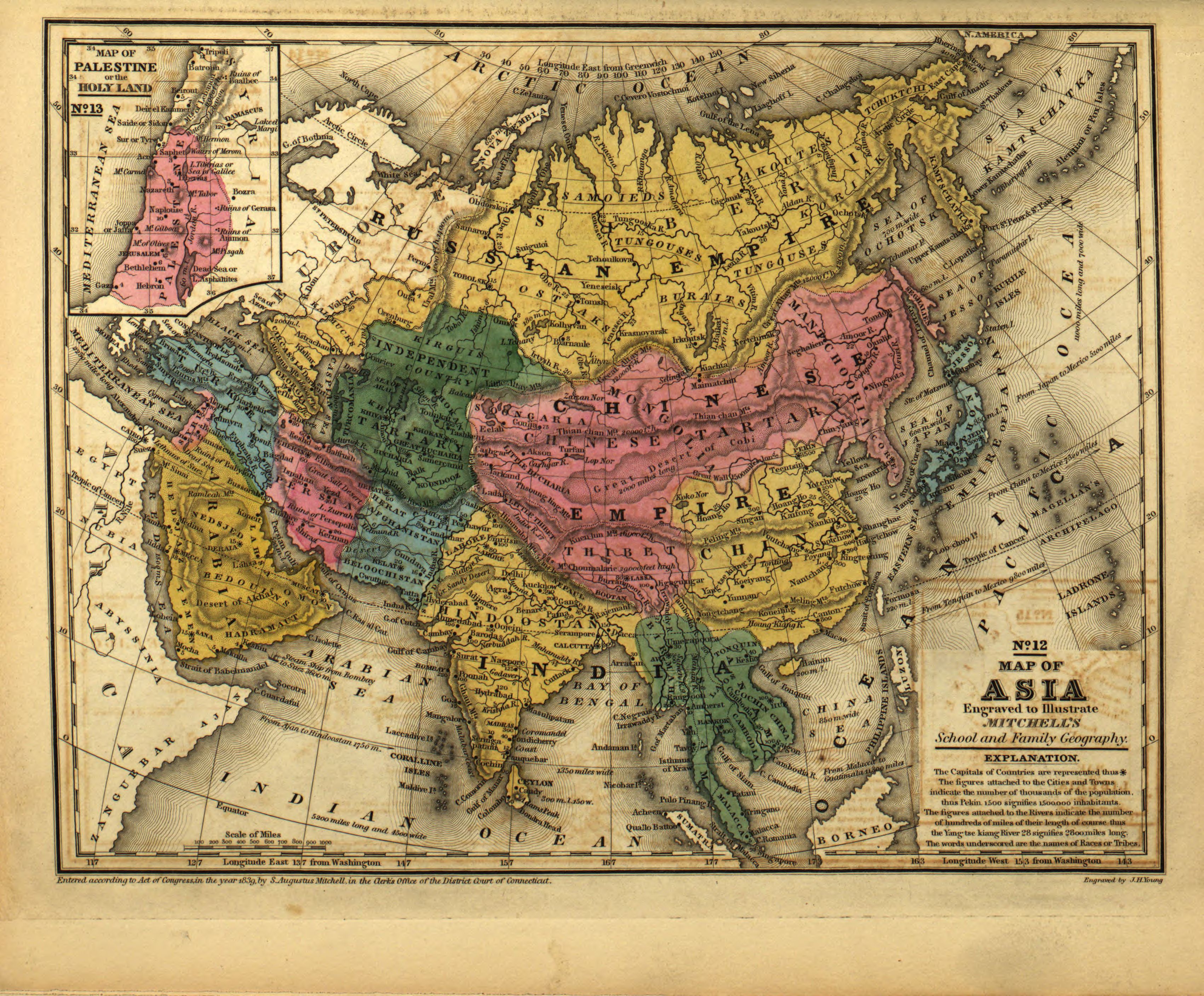
Map of (Thibet) with Lhasa (Lassa) capitol and India (Hindoostan) with Calcutta capitol in 1839 from Mitchell's School Atlas LOC 2007633727-13 (cropped).jpg - Tibet Nation

Maps of Tibet (Thibet) and Lhasa (Lassa) in 1839, equatorial projection, from Mitchell's School Atlas LOC 2007633727-4 (cropped).jpg - Tibet Nation

Map of Tibet (Thibet) and Lhasa (Lassa) in 1839, Polar projection, from Mitchell's School Atlas LOC 2007633727-4 (cropped).jpg - Tibet Nation
1839 map of the countries lying between Turkey & Birmah by James Wyld.tif - Balkanique

Life-expectancy,Asia,1839.svg - Doc James