Wikimedi'Òc
Modes d'emploi

Cet album fait partie des albums
Cet album photos contient les sous-albums suivants :


Arrowsmith's map of the world (1812).jpg - Tarawneh

Cádiz en 1812.jpg - GabrielZafra

Plan du port de Cadix.jpg - Furmeyer
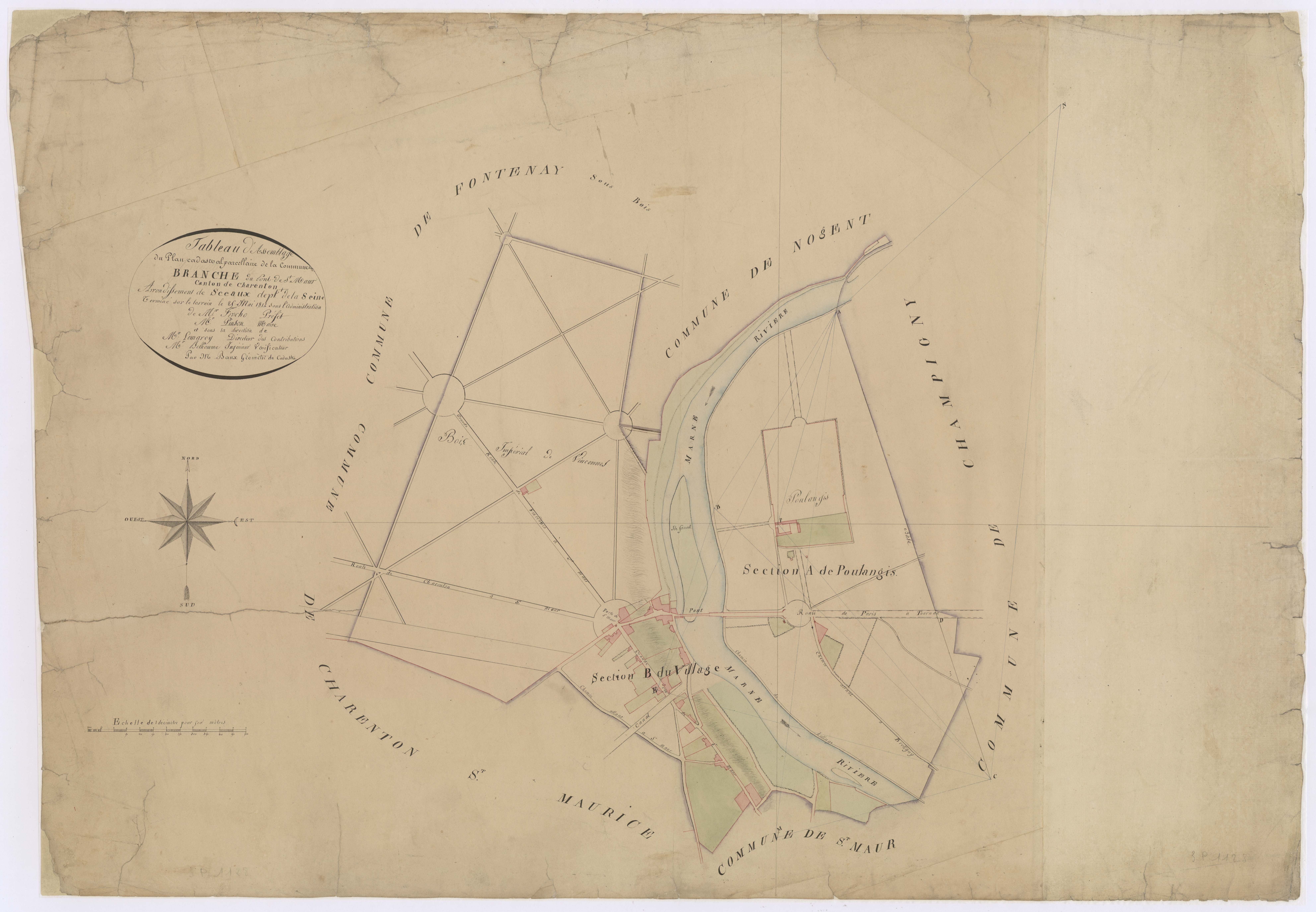
Branche Pont St Maur cadastre 1812.jpg - Benoit Willot

Plan étangs et rigoles de Versailles (1812).jpg - Tachymètre

MeredithGoldküste1812 300dpi.jpg - Katharinaiv

Erlangen Gegend um Erlang 1812 001.jpg - Janericloebe
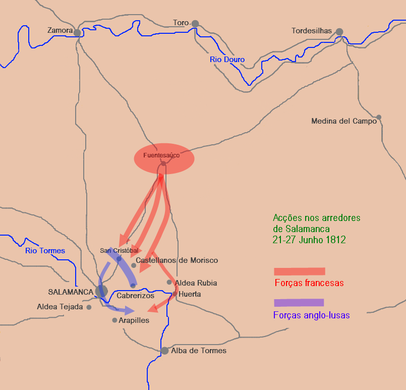
Acções na região de Salamanca 21-27Jun1812.png - Manuel F. V. G. Mourão

Chart of the Philippine Islands, from the Spanish chart 1808, the adjacent islands are added from the latest surveys (8249863961).jpg - File Upload Bot (Magnus Manske)
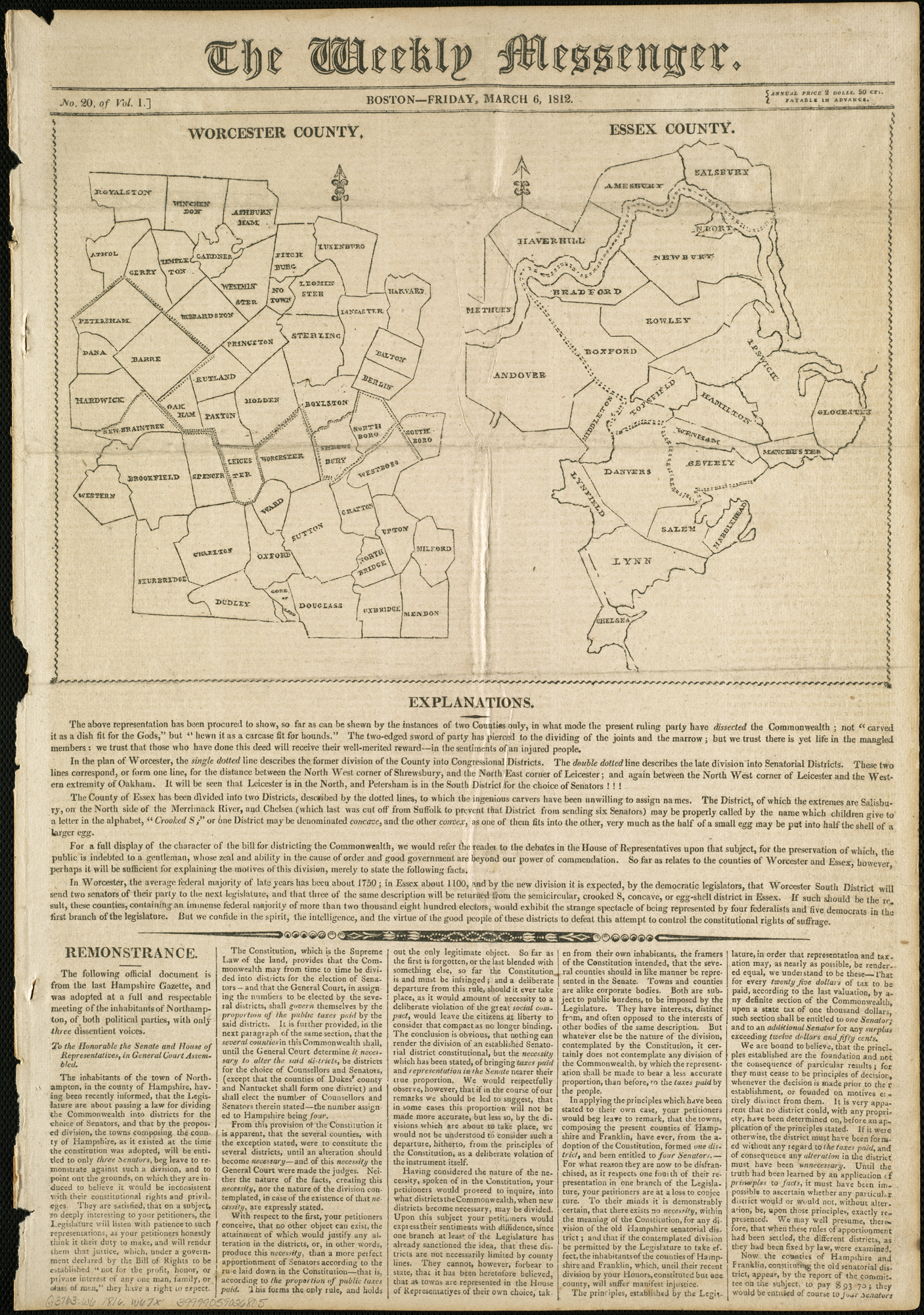
Worcester County ; Essex County (4583424679).jpg - File Upload Bot (Magnus Manske)

Kentucky (4578769839).jpg - File Upload Bot (Magnus Manske)

A new map of the world, with Captain Cooks tracks, his discoveries and those of the other circumnavigators (4071861969).jpg - File Upload Bot (Magnus Manske)

A chart of the coast of New England from the south shoal to Cape Sable including Georges Bank (3046378834).jpg - File Upload Bot (Magnus Manske)

Provinces Illyriennes Servie et Bosnie 1812.jpg - Sporti
New York - drawn by S. Lewis; Tanner, sc. NYPL435010.tiff - Fæ

CURRIE(1812) Guide at the Giant's Causeway, Map.jpg - Metilsteiner
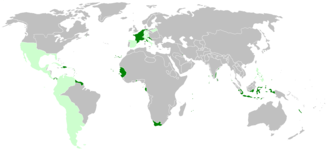
French Empire on World 1812.png - M.Bitton

(1812) MAP OF THE STRAIT OF MADURA, SUNDA ISLANDS.jpg - Metilsteiner

Carte des routes royales et départementales du Nord - 1812.jpg - Gz260

Grevskapsmålinger 9D1 19, Vestfold, 1812.jpg - Artturimatias

Grevskapsmålinger 9D1 21a, Vestfold, 1812.jpg - Artturimatias

Grevskapsmålinger 9D1 23b, Vestfold, 1812.jpg - Artturimatias

Plano de madrid 1812.jpg - Enrique Cordero

Siege of Cuidad Rodrigo RMG K1078.jpg - Fæ
Adventures of Johnny Newcome RMG F3069.tiff - Fæ
A survey of the Kings lordship or manor of East Greenwich - the park and desmesn-lands there with the remains of his Majesty's palaces and mansion houses situate either within or without the limits of the ground RMG F0460.tiff - Fæ

Plan de l'île de Caprée (33710771484).jpg - Junior Jumper
Wallis's New dissected map of world - engraved from the latest authorities for the use of young students in geography ; Neele, sculpt., Strand. LOC 85694395.tif - Fæ

Wallis's New dissected map of world - engraved from the latest authorities for the use of young students in geography ; Neele, sculpt., Strand. LOC 85694395.jpg - Fæ
Jiang hai quan tu. LOC gm71005059.tif - Fæ

Jiang hai quan tu. LOC gm71005059.jpg - Fæ
Sketch of the country between the Coa & Sierra de Gata LOC 2010589570.tif - Fæ

Sketch of the country between the Coa & Sierra de Gata LOC 2010589570.jpg - Fæ
Plan of the entrance of Barataria, with a projected battery proposed by Col. G.T. Ross. LOC 2007627048.tif - Fæ

Plan of the entrance of Barataria, with a projected battery proposed by Col. G.T. Ross. LOC 2007627048.jpg - Fæ
Wallis's new dissected map of America, engraved from the latest authorities for use of young students in geography LOC 85697801.tif - Fæ

Wallis's new dissected map of America, engraved from the latest authorities for use of young students in geography LOC 85697801.jpg - Fæ
Tableau des opérations de la Grande Armée depuis l'ouverture de la campagne jusqu'au 21 aout 1812 - (Eastern Europe). LOC 2018588067.tif - Fæ

Tableau des opérations de la Grande Armée depuis l'ouverture de la campagne jusqu'au 21 aout 1812 - (Eastern Europe). LOC 2018588067.jpg - Fæ
General Outline of the Authors Route, as adapted to The First Section of Part of the Second of These Travels from D'Anvilles Troisienne Parte de la Carte D'Europe. (IA bp 21836).pdf - Fæ

Mappemonde dressée suivant les nouvelles relations et assujettie aux observations astronomiques - par le Sr Robert... - btv1b53093292d.jpg - Gzen92Bot

1812 Kartierung Lambach.jpg - Xenophon

1812 Kartierung Lambach 2.jpg - Xenophon
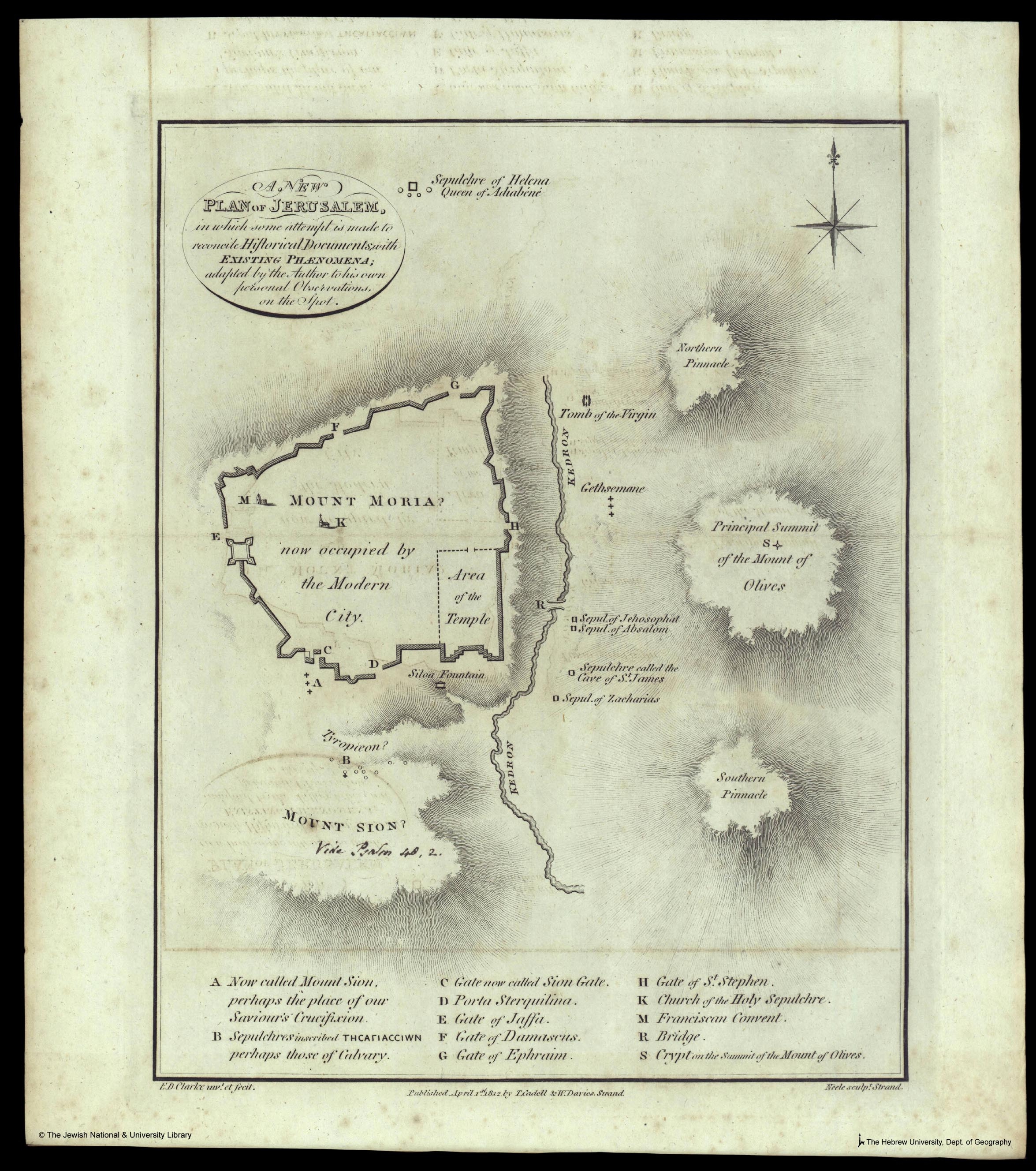
Edward Daniel Clarke, A new plan of Jerusalem in which some attempt is made to reconcile historical documents with existing phaenomena (FL6878354 2368011).jpg - Geagea

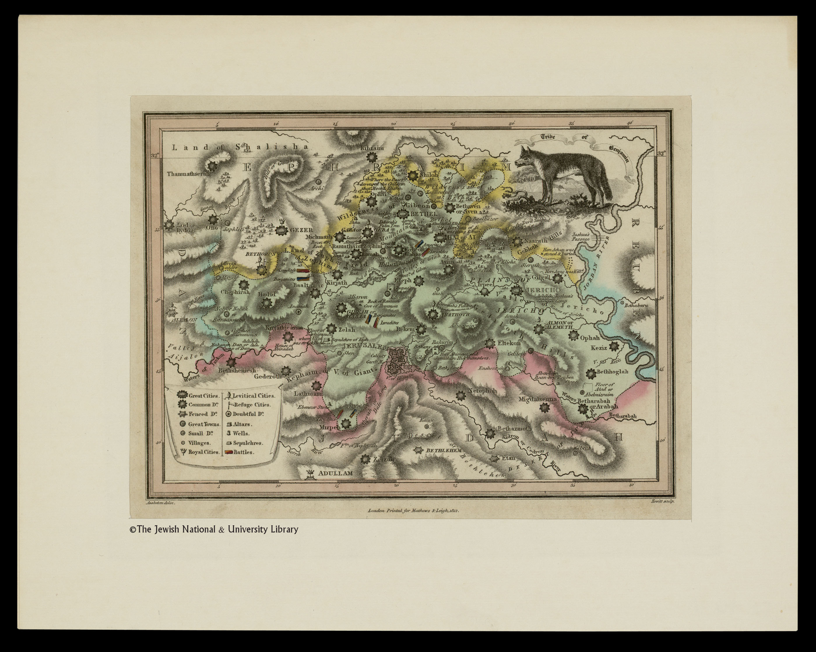
Assheton delin. Hewitt Sc, Plan of the city of Jerusalem (FL6878512 2368129).jpg - Geagea
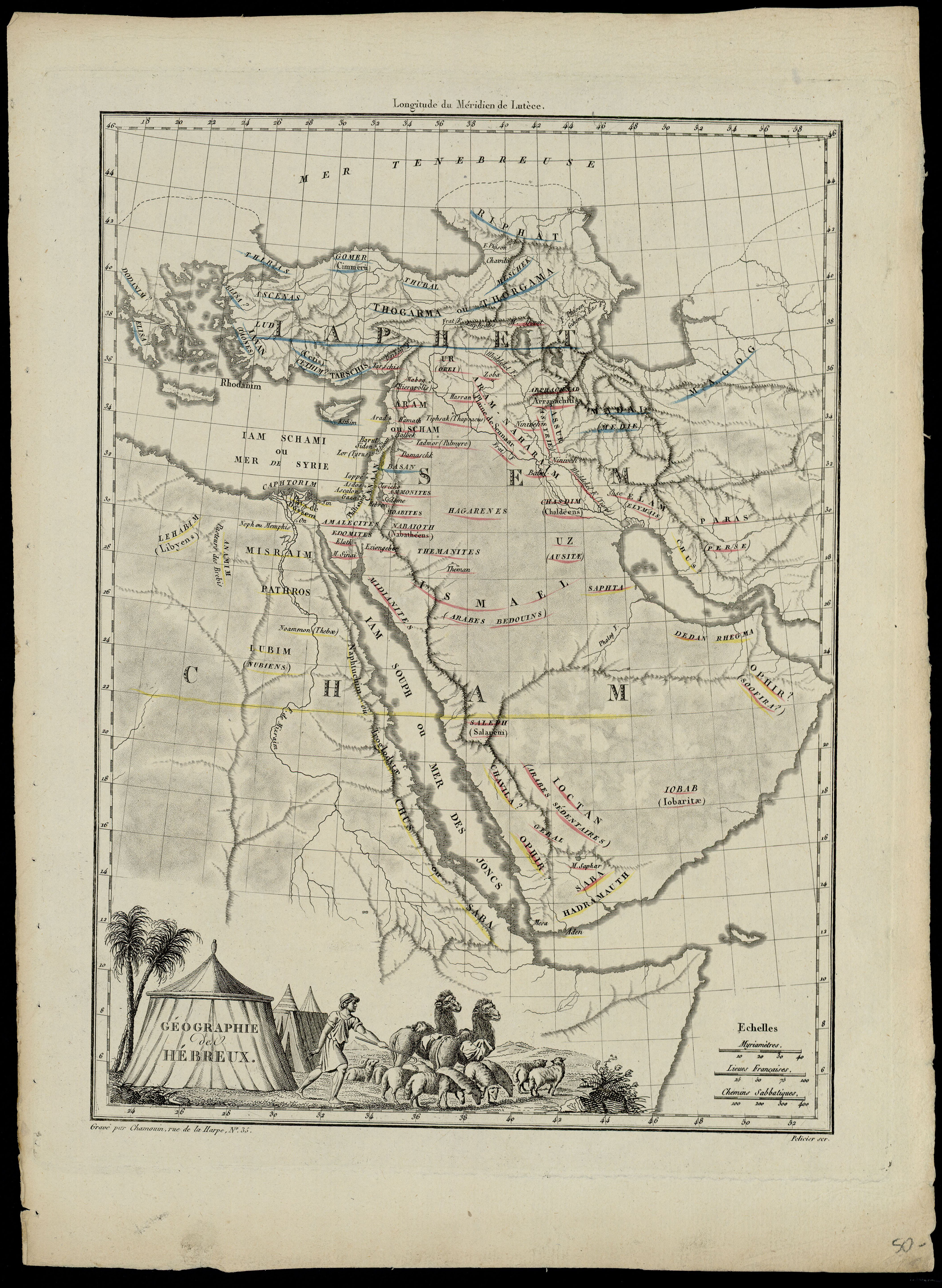
Conrad Malte-Brun, Geographie des Hebreux (FL199398294 2368751).jpg - Geagea

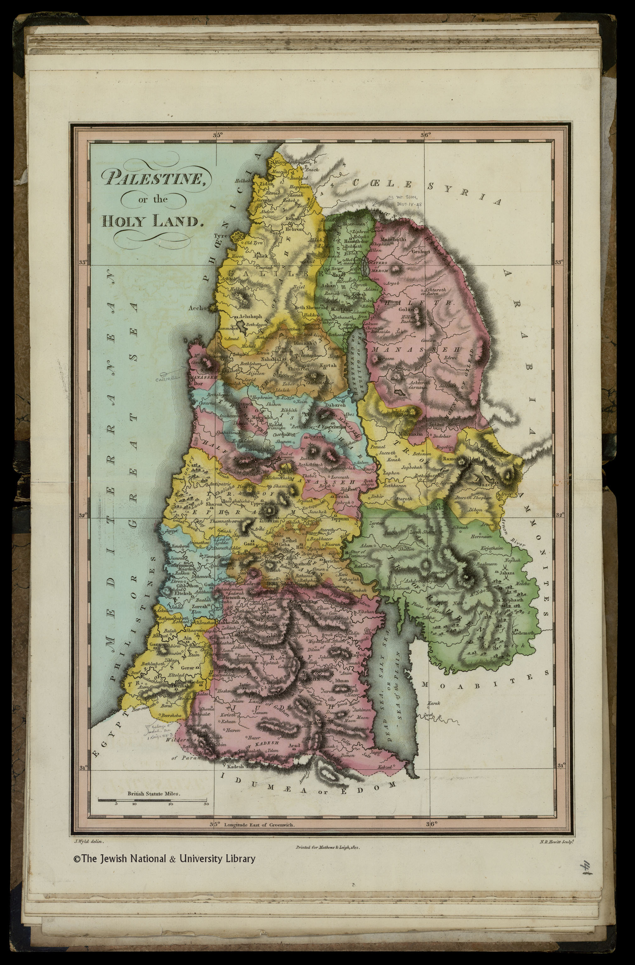
Conrad Malte-Brun, Palestine (FL199398036 2368752).jpg - Geagea

The Scripture atlas or a series of maps to illustrate the Old and New Testament (FL7330817 2368756).jpg - Geagea

The Scripture atlas or a series of maps to illustrate the Old and New Testament (FL7330819 2368756).jpg - Geagea

The Scripture atlas or a series of maps to illustrate the Old and New Testament (FL7330820 2368756).jpg - Geagea

The Scripture atlas or a series of maps to illustrate the Old and New Testament (FL7330823 2368756).jpg - Geagea

The Scripture atlas or a series of maps to illustrate the Old and New Testament (FL7330824 2368756).jpg - Geagea

The Scripture atlas or a series of maps to illustrate the Old and New Testament (FL7330825 2368756).jpg - Geagea

The Scripture atlas or a series of maps to illustrate the Old and New Testament (FL7330828 2368756).jpg - Geagea

The Scripture atlas or a series of maps to illustrate the Old and New Testament (FL7330830 2368756).jpg - Geagea

The Scripture atlas or a series of maps to illustrate the Old and New Testament (FL7330831 2368756).jpg - Geagea
The Scripture atlas or a series of maps to illustrate the Old and New Testament (FL7330832 2368756).jpg - Geagea

The Scripture atlas or a series of maps to illustrate the Old and New Testament (FL7330834 2368756).jpg - Geagea

The Scripture atlas or a series of maps to illustrate the Old and New Testament (FL7330837 2368756).jpg - Geagea

The Scripture atlas or a series of maps to illustrate the Old and New Testament (FL7330839 2368756).jpg - Geagea
The Scripture atlas or a series of maps to illustrate the Old and New Testament (FL7330840 2368756).jpg - Geagea

The Scripture atlas or a series of maps to illustrate the Old and New Testament (FL7330842 2368756).jpg - Geagea

The Scripture atlas or a series of maps to illustrate the Old and New Testament (FL7330843 2368756).jpg - Geagea
The Scripture atlas or a series of maps to illustrate the Old and New Testament (FL7330846 2368756).jpg - Geagea

The Scripture atlas or a series of maps to illustrate the Old and New Testament (FL7330847 2368756).jpg - Geagea

James Wyld, the elder, Map of the journeyings of the Israelites from Egypt to the Land of Canaan 01-copy1 (FL39695593 2369438).jpg - Geagea

James Wyld, the elder, Map of the journeyings of the Israelites from Egypt to the Land of Canaan 02-copy2 (FL39695596 2369438).jpg - Geagea
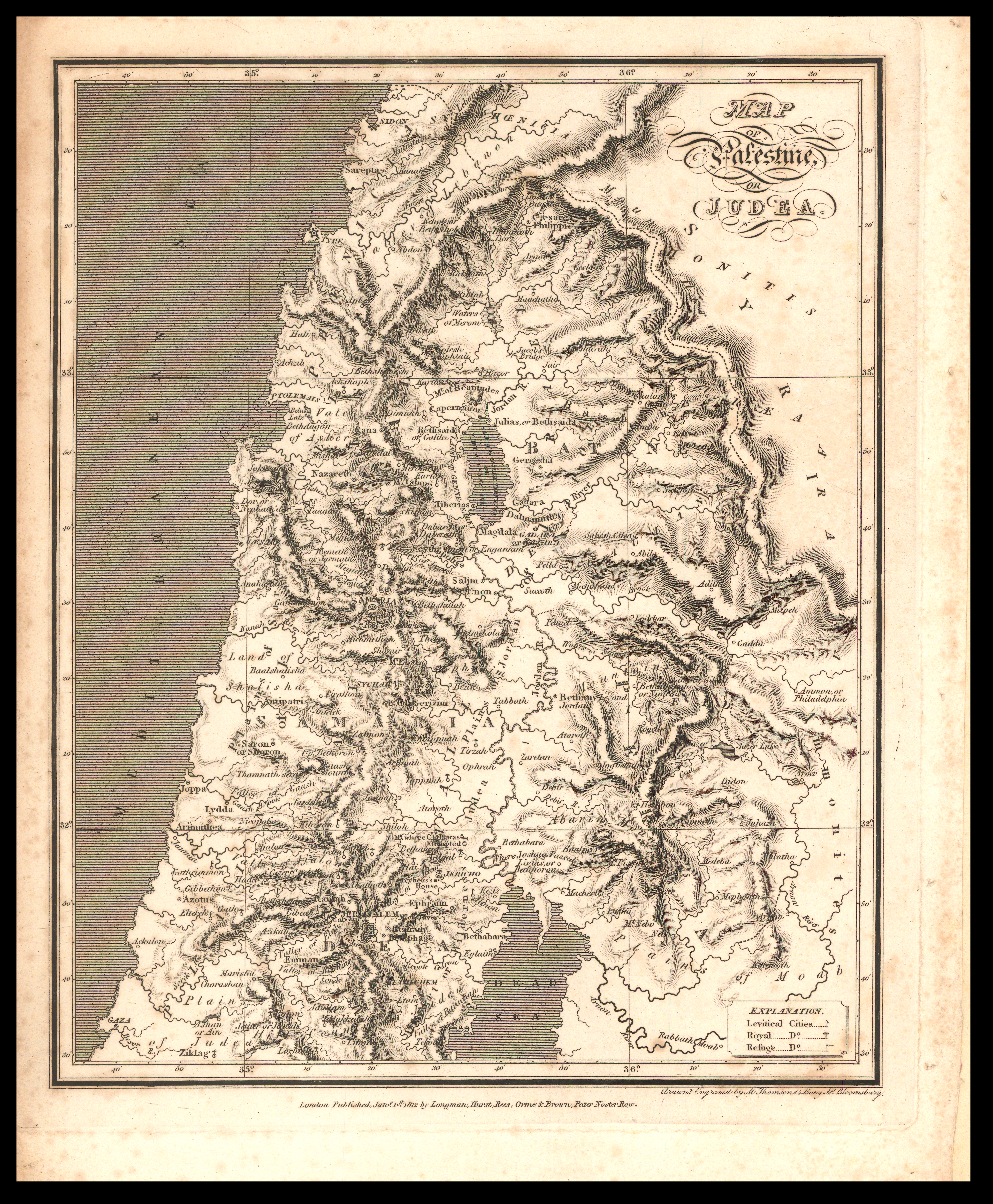
Mark Thomson, Map of Palestine or Judea (FL27935978 2370058).jpg - Geagea

John Pinkerton, La Plata (FL13729749 2534860).jpg - Geagea

De l'Allemagne politique en 1812 (FL189885417 2563491).jpg - Geagea

Mappe-Mondes sur Diverses Projections.jpg - Universalis
Atlas classique et universel de géographie ancienne et moderne par P. Lapie, 1812.pdf - Happyseeu