Wikimedi'Òc
Modes d'emploi

Cet album fait partie des albums
Cet album photos contient les sous-albums suivants :


Concarneau 025 Plan cadastral de la commune 1808.JPG - Moreau.henri

The West Indies (4587177590).jpg - File Upload Bot (Magnus Manske)
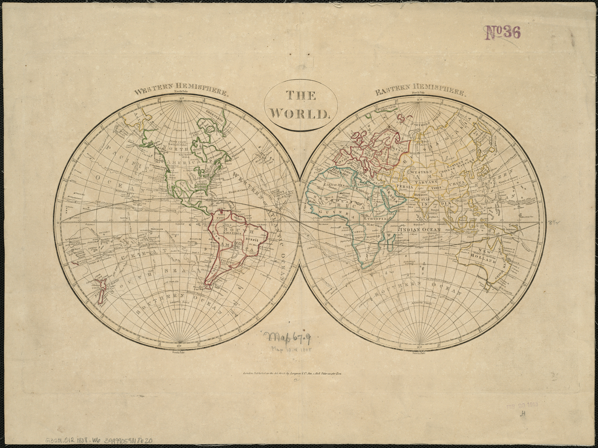
The World (4072625446).jpg - File Upload Bot (Magnus Manske)

A map of the countries thirty degrees round the north pole (4071860125).jpg - File Upload Bot (Magnus Manske)

Tortoreto in 1808.PNG - CorradoM83

France location map-Departements 1808.svg - Flappiefh
Karta-Världskarta från 1808. 1808 - Sjöhistoriska museet - OK 260.tif - SMMUploader

Güssefeld Plan des herzoglichen Parks bey Weimar 1808.jpg - Anvilaquarius
Admiralty Chart No 15 St.Helen's Road Spithead Portsmouth and Langstone harbours. Surveyed in 1783 by Lieut. Murdoch Mackenzie Junr. RMG F0090, Published 1808.tiff - Fæ

Karta-Världskarta från 1808. 1808 - Sjöhistoriska museet - OK 260 cropped.png - Felis domestica
Planta da cidade de S. Sebastião do Rio de Janeiro LOC 2003682766.tif - Fæ

Planta da cidade de S. Sebastião do Rio de Janeiro LOC 2003682766.jpg - Fæ
Carte générale de la Nouvelle Hollande. LOC 98687106.tif - Fæ

Carte générale de la Nouvelle Hollande. LOC 98687106.jpg - Fæ
A new and elegant imperial sheet atlas, comprehending general and particular maps of every part of the world - principally compiled from the great French atlas, and others of the most distinguished LOC 2005625623.tif - Fæ

A new and elegant imperial sheet atlas, comprehending general and particular maps of every part of the world - principally compiled from the great French atlas, and others of the most distinguished LOC 2005625623.jpg - Fæ
Sketch given by George Drewyer, 5th August 1808 - (Bighorn River, Wyoming and Montana). LOC 2004622579.tif - Fæ

Sketch given by George Drewyer, 5th August 1808 - (Bighorn River, Wyoming and Montana). LOC 2004622579.jpg - Fæ

Large-scale-old-map-of-australia-1808.jpg - Thesupermat
Carta militar das principaes estradas de Portugal LOC 2018593260.tif - Fæ

Carta militar das principaes estradas de Portugal LOC 2018593260.jpg - Fæ

Carta militar das principaes estradas de Portugal LOC 2010589541.jpg - Fæ

South America, 1808 - Laurie & Whittle.jpg - Janitoalevic

Travels of Israel, in the wilderness (FL200036762 2368463).jpg - Geagea

A map of Canaan, adapted to the books of Samuel (FL200036882 2368467).jpg - Geagea

Plan von Moskwa (FL33122226 2369996).jpg - Geagea

G. Alexander, Present appearance of mount Sinai & mount Horeb (FL155947896 2504179).jpg - Geagea

G. Alexander, Europe (FL33132598 2522674).jpg - Geagea

John Wilkes (publisher), Helvetia (FL35076513 2548862).jpg - Geagea

Jean Baptiste Bourguignon d'Anville, Retreat of the ten thousand.Drawn for Rollin's Antient History (FL37124102 3899300).jpg - Geagea

Spain and Portugal (FL37476929 2589050).jpg - Geagea
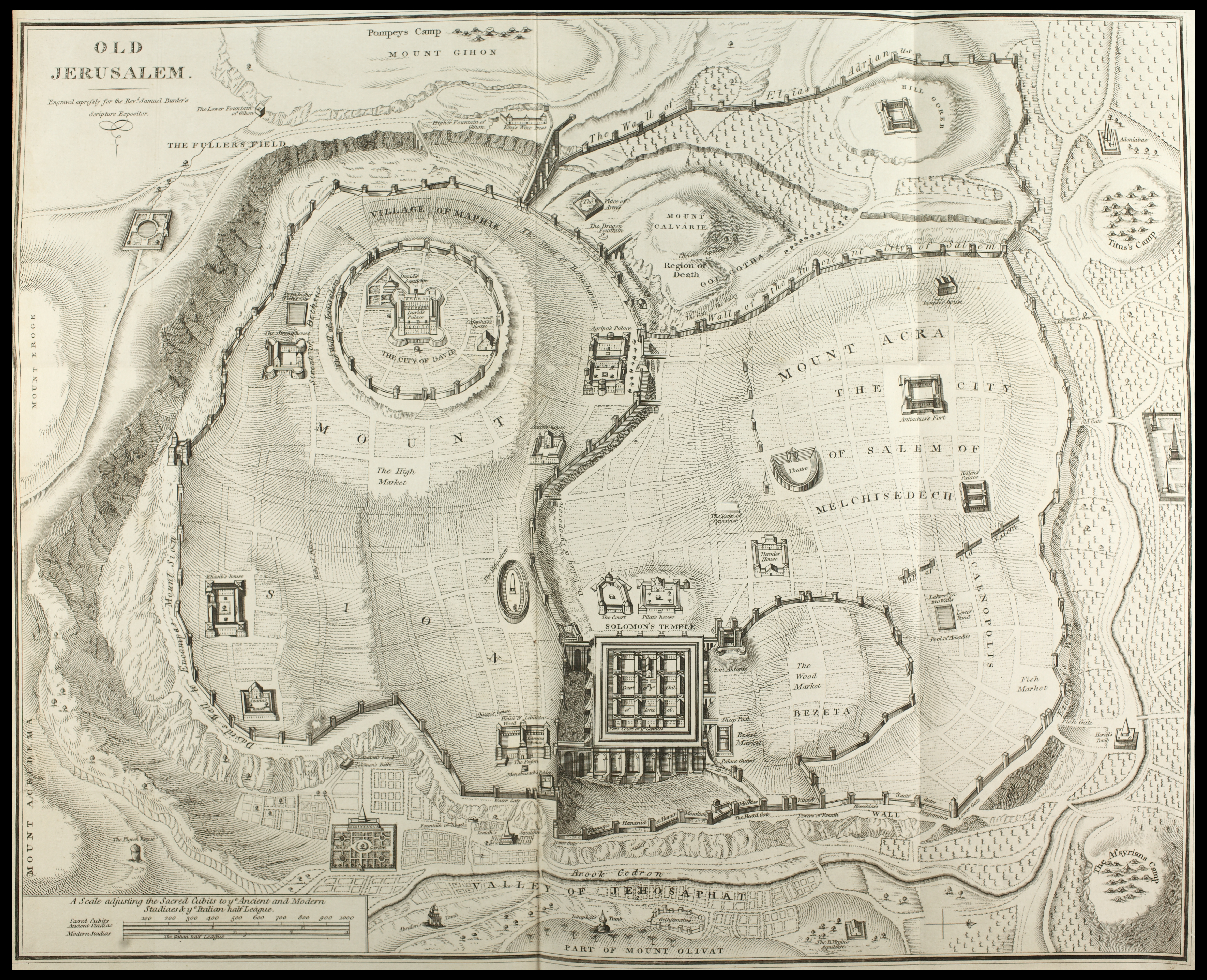
Old Jerusalem (FL48326103 3939722).jpg - Geagea

G. Alexander, The empire of Solomon (FL6881363 2553428).jpg - Geagea
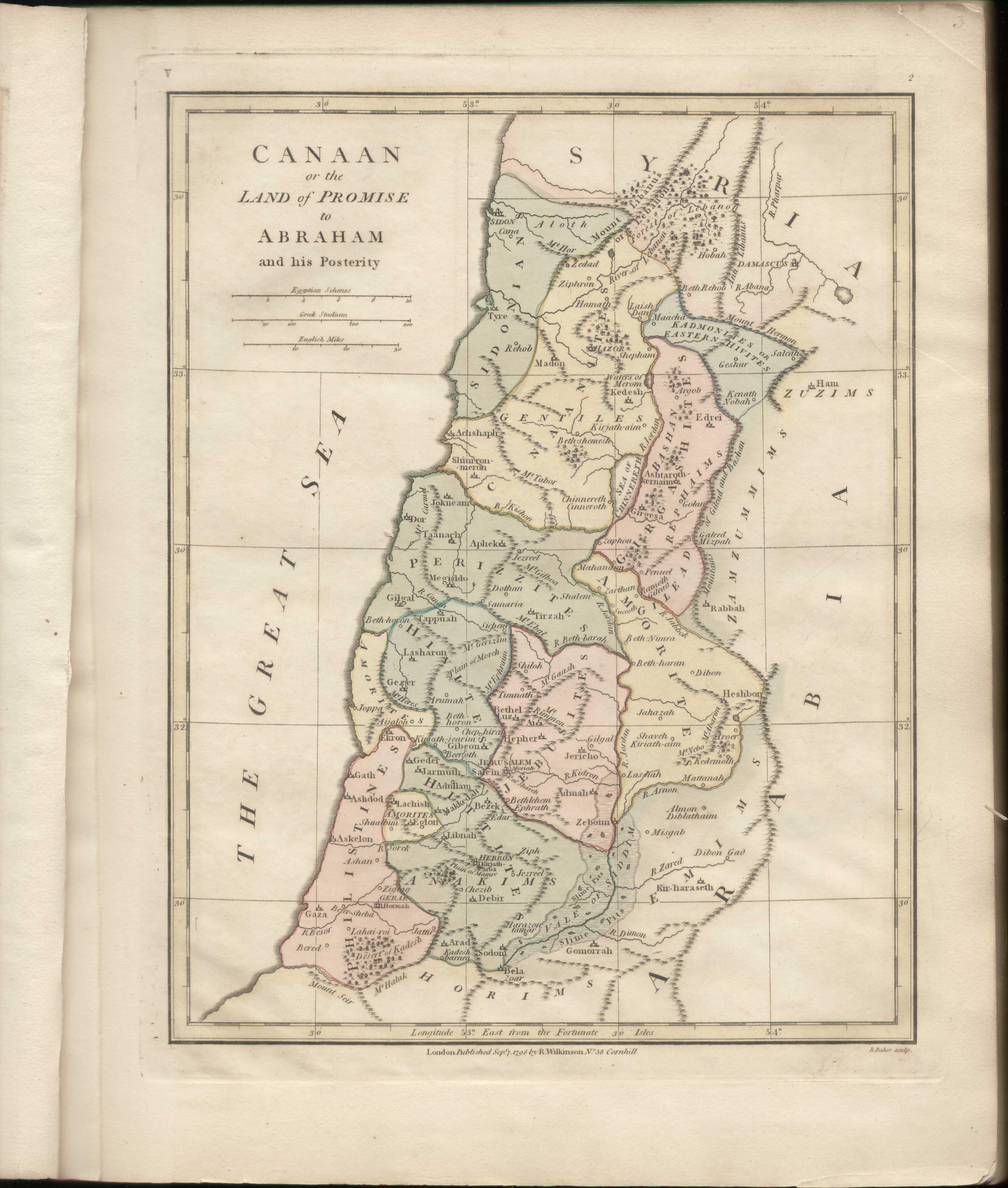
Robert Wilkinson, Canaan or Land of promise to Abraham and his Posterity (FL45582546 3918714).jpg - Geagea

A New Map of The World, with Captain Cook's Tracks.jpg - Universalis