Wikimedi'Òc
Modes d'emploi

Cet album fait partie des albums
Cet album photos contient les sous-albums suivants :


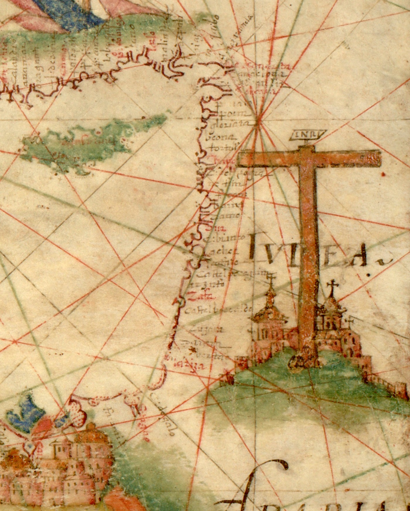
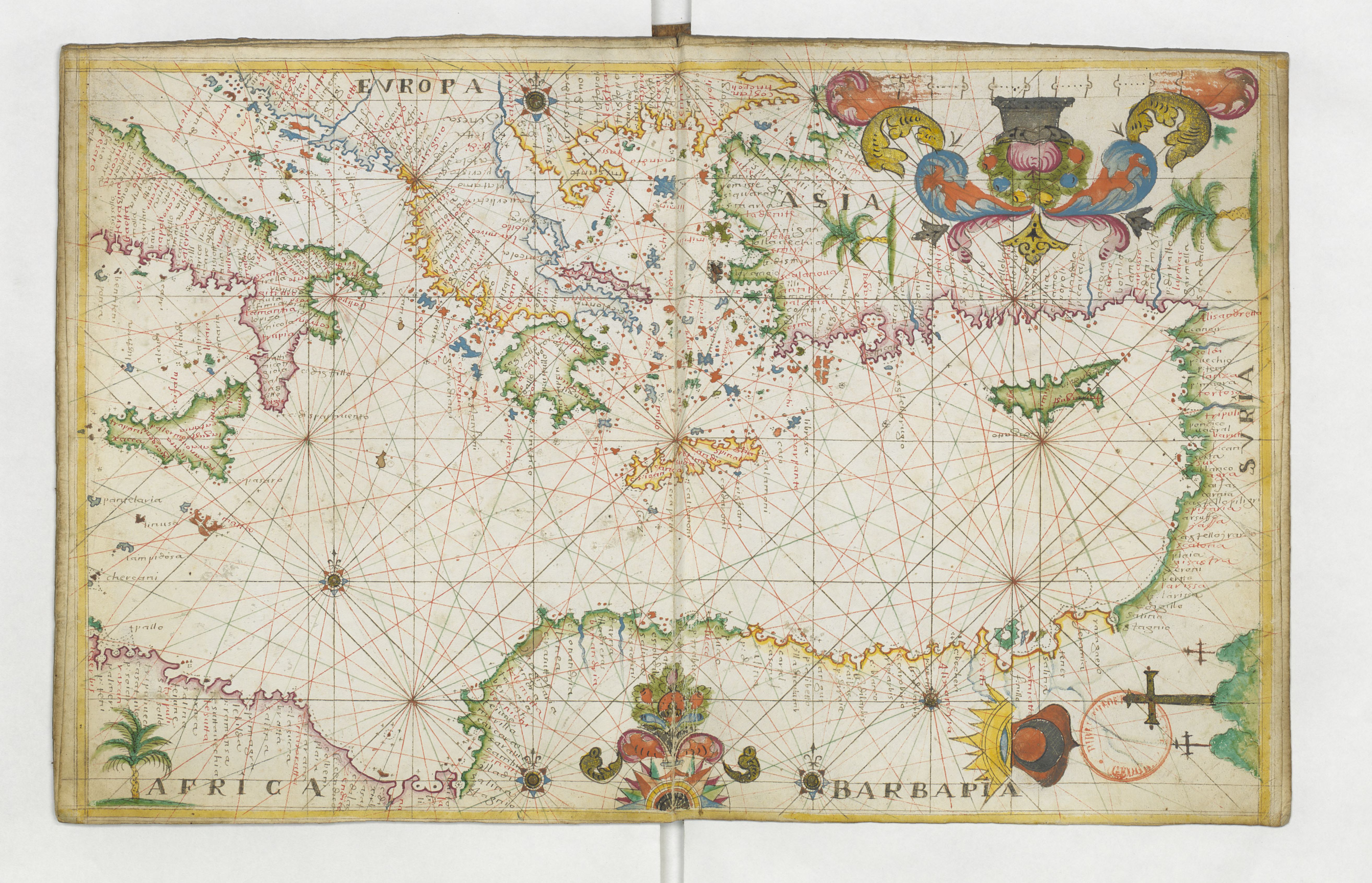
Map of Eastern Mediterranean. HM 34. PORTOLAN ATLAS, anonymous. France (?), ca. 1600.jpg - Geagea
Nautical chart of Mediterranean area, including Europe with British Isles and part of Scandinavia.D.jpg - Geagea

1644 Europa Recens Blaeu cropped.jpg - Fæ

1644 Europa Recens Blaeu East Mediterranean Sea.jpg - Enyavar

Cavallini. Atlas nautique de la Mer Méditerranée et d'une partie de la Mer Noire. 1639. Israel.jpg - Geagea

1680 map Turcicum imperium by Frederik de Wit BPL 15917 detail.png - M2545

Carte du voyage du sieur Daulier Deslandes en Perse (1661).jpg - ThoMiCroN

Accuratissima et maxima totius Turcici Imperii tabula cum omnibus suis regionibus novissima delineatio.jpg - Sabuhi from Baku

Accuratissima et Maxima Totius Turcici Imperii Tabula.jpg - Sabuhi from Baku

Mediterraneo e Colfo di Setelia - Cootwijck Johannes Van - 1619.jpg - Gts-tg

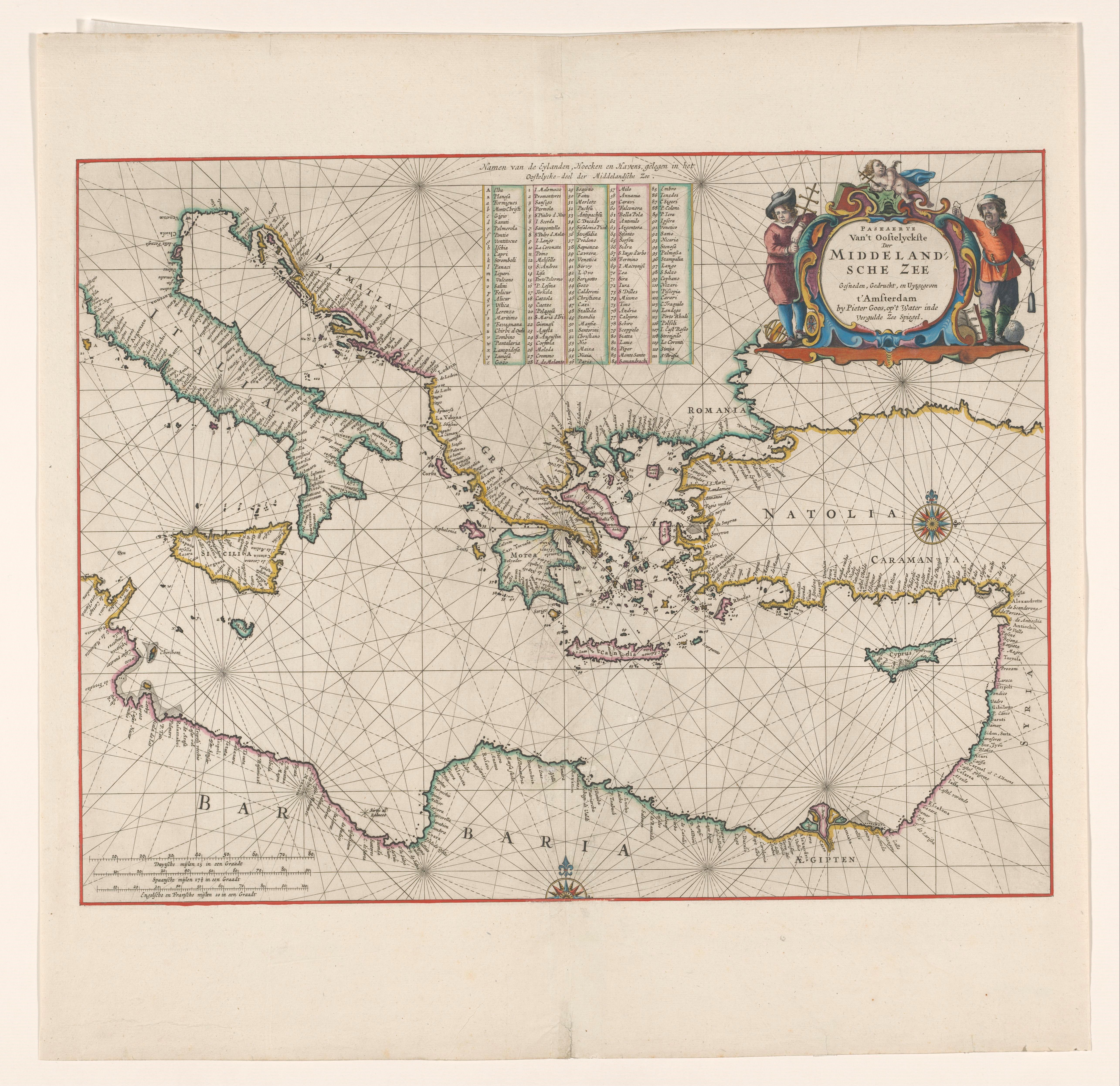
Paskaerte van't oostelijckste der Middelandsche Zee (NYPL b13908778-1619038).jpg - Fæ

Ottoman Empire 1696 by Jaillot (Particolare del Mar Mediterraneo con il tracciato dell'Impresa di Bona).jpg - Roberto.Amerighi

Ottoman Empire 1696 by Jaillot (Particolare del Mar Mediterraneo in alta definizione).jpg - Roberto.Amerighi
A chart of the Levant or easternmost part of the Mediterranean Sea RMG F8068.tiff - Fæ
Eastern Mediterranean RMG F1772.tiff - Fæ
Eastern Mediterranean RMG C4572 2.tiff - Fæ
Eastern Mediterranean RMG F1955.tiff - Fæ

Accuratissima orientalioris districtus maris Mediterranei tabula - CBT 5883615.jpg - Francesco Serra (BIBCOMTN)

17th century Portolan chart of the Eastern Mediterrenean, the Aegean Sea and the Sea of Marmara.jpg - Balkanique

17th century Portolan chart of the Mediterrenean Sea.jpg - Balkanique
1662 Portolan chart of the Central and Eastern Mediterranean Sea by François Ollive.jpg - Balkanique
Kaart van de landen in het Noord-Oosten van de Middellandse Zee, RP-P-1990-415.jpg - Mr.Nostalgic
Cartografie in Nederland, zeekaart van het oostelijk deel van de Middellandse zee, NG-501-52.jpg - Mr.Nostalgic

Ca. 1695 Dutch map - De Beschryvingh Van de Reysen Pauli en Van de Andere Apostelen.png - Balkanique

17th century map of the Eastern Mediterranean by Stefano Scolari.jpg - Balkanique
1669 map of the Mediterranean Sea, Eastern part, by Pieter Goos.tif - Balkanique
1657 map of the Mediterranean Sea, Eastern Part, by Jan Jansson.tif - Balkanique

1700 map of the Eastern Mediterranean by Pieter van der Aa.jpg - Balkanique
1646 map of the Southern coast of Asia Minor by Robert Dudley.pdf - Balkanique
1646 map of the Eastern Mediterranean by Robert Dudley.pdf - Balkanique
1646 map of the Southeastern Mediterranean by Robert Dudley.pdf - Balkanique

1695 map of the Eastern Mediterranean showing the travels of St. Paul.jpg - Balkanique

1695 Dutch map of the Eastern Mediterranean showing the travels of St. Paul.jpg - Balkanique

Map of the Central and Eastern Mediterranean Sea, showing Aeneas' journeys.jpg - Balkanique

Print, book-illustration, map (BM 1972,U.40.4).jpg - Copyfraud
Eastern Sheet - Pas caart van de Middelandsche Zee RMG F8111 (cropped).tiff - Balkanique
Eastern Sheet - Middel-landtsche Zee nieuwlix uytgegeven RMG F8095 (cropped).tiff - Balkanique

Partie Orientalie De Mediterraneo Del Padre Cosmografo Coronelli.jpg - Balkanique

Peregrinationis Divi Pauli Typus Corographicus In quo & novi testamenti, in primis autem apostulorum historiae, a Sancto Luca descripta, omnia fere loca geographica, oculis inspicienda exhbentur.jpg - Balkanique

Atlante Veneto Volume 1 110.jpg - Balkanique

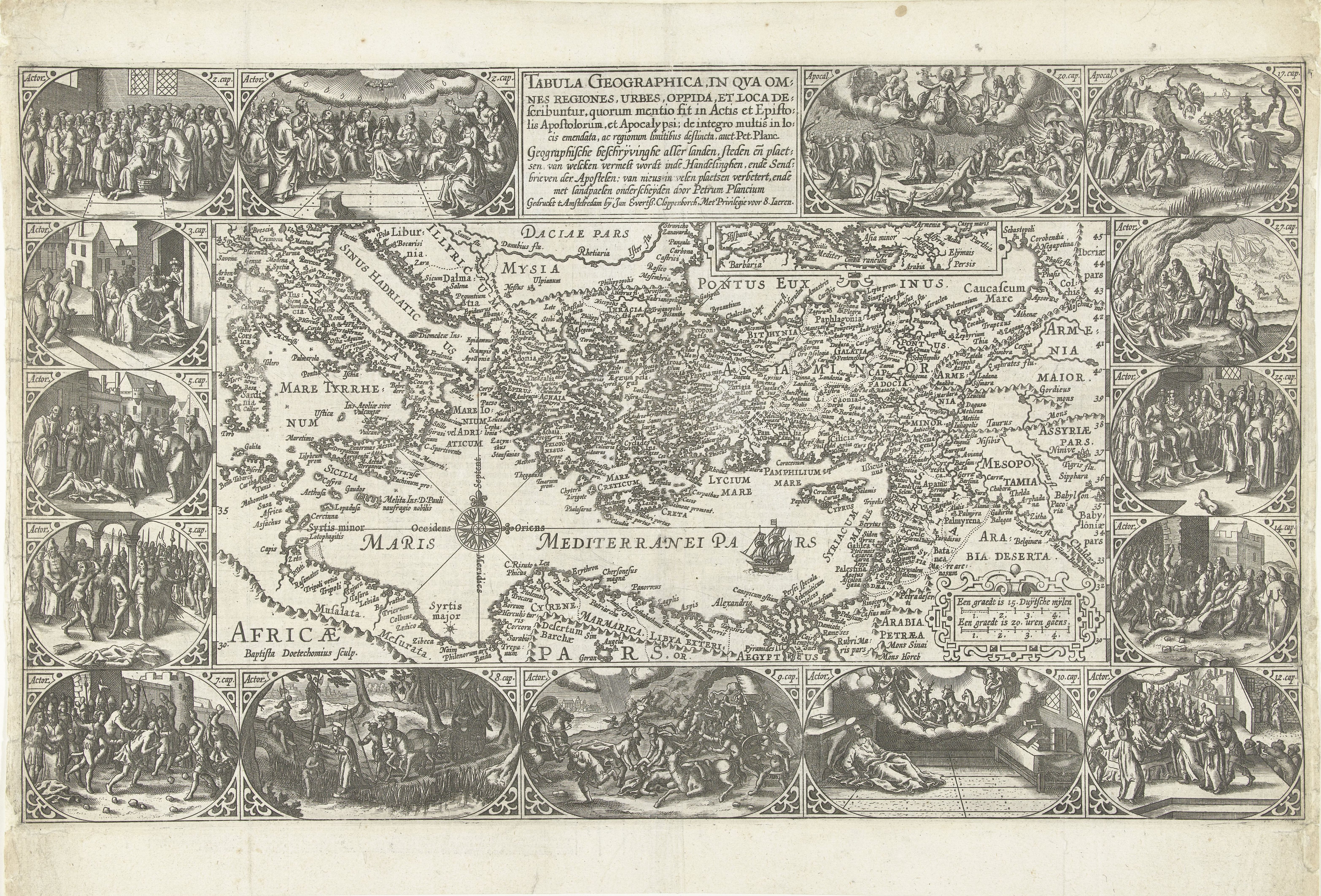
Tabula Geographica, in qua omnes regiones, urbes, oppida, et loca describuntur, quorum mentio fit in Actis et Epistolis Apostolotum, et Apocalypsi; de integro multis in locis emendata, ac regionum limitibus distincta, auct. Pet. Planc.jpg - Balkanique

Pascaerte van't Oostelyckste deel vande Middelandsche Zee.jpg - Balkanique

Sandys, George – Relation of a journey begun Anno Domini 1610, 1632 – BEIC 6086103 Mediterraneo.jpg - Marcella Medici (BEIC)

Atlas minor Gerardi Mercatoris, a I. Hondio plurimis aeneis tabulis auctus atque illustratus - btv1b55013475p (697 of 710).jpg - Gzen92Bot

Carte de la mer Méditerranée présentée à Monseigneur le chevalier de Noailles... ; Suitte de la carte de la mer Méditerranée (sic) - par ses très humbles serviteurs Henry Michelot et Nicolas Therin... - btv1b59634723 (2 of 2).jpg - Gzen92Bot

Atlas nautique de la Mer Méditerranée, de la Mer Noire et de l'Océan Atlantique Nord-Est - btv1b72007602 (7 of 9).jpg - Gzen92Bot

Atlas minor, ou Briefve et vive description de tout le monde et ses parties... - de Guérard Mercator ; traduict de latin en françois, par le sieur de La Popelinière... - btv1b550134836 (670 of 691).jpg - Gzen92Bot

Atlas nautique de la Méditerranée, avec deux cartes muettes - attribué à l'atelier de François Ollive - btv1b101000038 (4 of 6).jpg - Gzen92Bot

Atlas nautique de la Méditerranée, avec deux cartes muettes - attribué à l'atelier de François Ollive - btv1b101000038 (6 of 6).jpg - Gzen92Bot

Atlas de la Méditerranée - Petrus Collin - btv1b55007092q (11 of 17).jpg - Gzen92Bot

Atlas nautique de la Mer Méditerranée - signé G. B. - btv1b5901112h (05 of 10).jpg - Gzen92Bot

Atlas de la mer Méditerranée (Reprod. numérique) - par Brémond - btv1b53028104r (05 of 10).jpg - Gzen92Bot

Atlas nautique de la Mer Méditerranée, de l'Océan Atlantique nord-est et d'une partie de la Mer Noire. A Marseille - par Charlat Ambrosin l'an 1620 - btv1b59010941 (06 of 12).jpg - Gzen92Bot

Carte maritime della prima parte del spechio del mare contenenti tutte le coste porti e baye del mediteraneo - dal cap. Francesco Maria Levanto - btv1b5963471p (2 of 2).jpg - Gzen92Bot

Jesu Christi Salvatoris nostri et Apostolorum Petri, et Pauli mansio.nes, itinera, peregrina.tiones, &c. per Galilaeam, Samarian, Judaeam ; et per Aegyptum, Asiam, Europam - Autore N. Sanson.... Adjecta... - btv1b53179441c (1 of 2).jpg - Gzen92Bot

Aegyptvs et Cyrene - DPLA - 86669494727a6d82393a2f7ab7a60121.jpg - DPLA bot

Eastern Mediterranean (FL13730453 3365857).jpg - Geagea

Willem Blaeu, Pascaarte van't oostelÿcste deel van de Middelandtsche Zee (FL13730450 3365080).jpg - Enyavar