Wikimedi'Òc
Modes d'emploi

Cet album fait partie des albums
Cet album photos contient les sous-albums suivants :


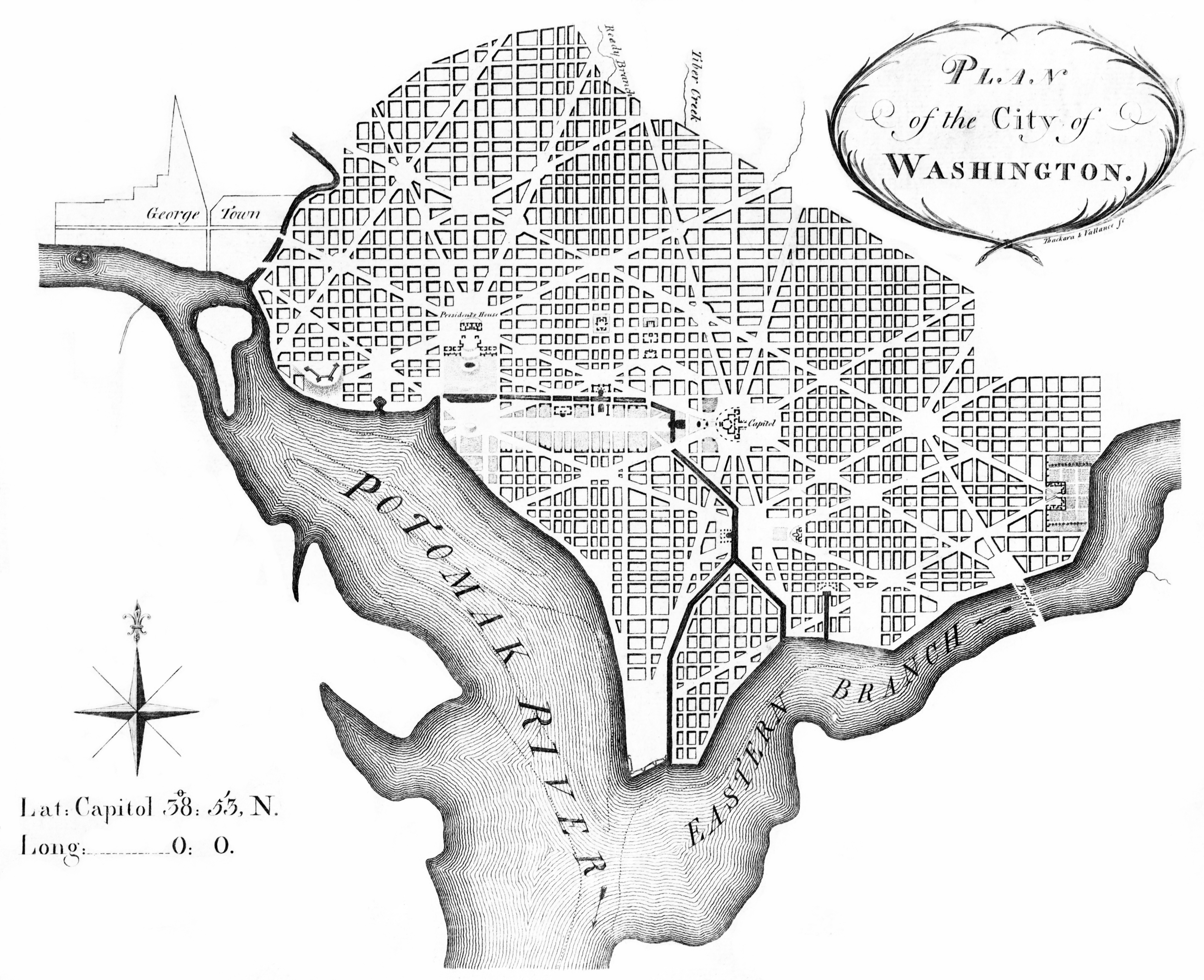
L'Enfant plan.jpg - MattWade

United States 1791-09-1792-03.png - Golbez
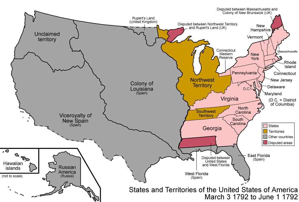
United States 1792-03-1792-06.png - Golbez

L'Enfant plan original.jpg - MattWade
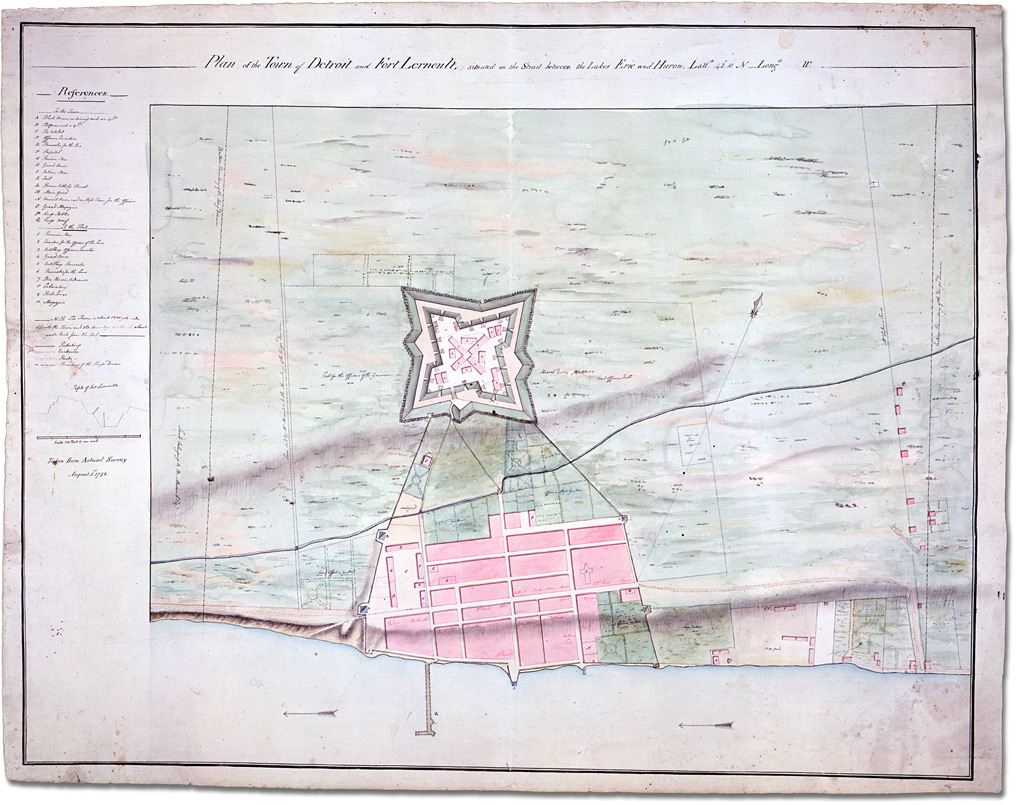
4756 detroit 1020.jpg - Mike Hayes
A map of the states of Virginia, North Carolina, South Carolina and Georgia - comprehending the Spanish provinces of east and west Florida - exhibiting the boundaries as fixed by the late (NYPL b15278421-976321).tiff - SteinsplitterBot
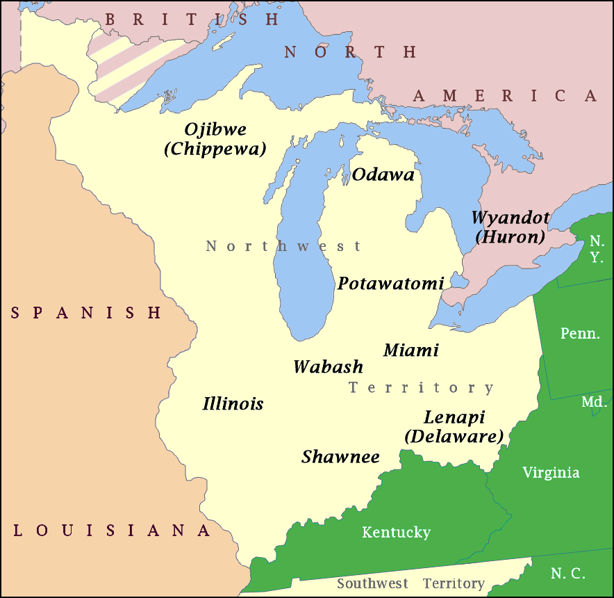
NW Native Tribes, 1792.png - Hohum
View of the city of Washington in 1792. LOC 87694269.tif - Fæ

L'Enfant plan.svg - Rcsprinter123

Glaize.png - Kevin1776