Wikimedi'Òc
Modes d'emploi

Cet album fait partie des albums


Bowles 1797.jpg - Ttocserp

ReveleyThamesscheme1796.JPG - Merchbow~commonswiki

Whitehall1799.jpg - Merchbow~commonswiki

FutureCambridgeHouse1799 edited.jpg - Merchbow~commonswiki
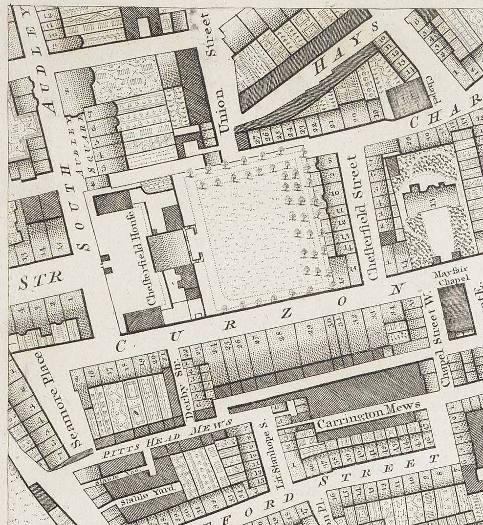
ChesterfieldHouse1799.jpg - Merchbow~commonswiki

St James's Square 1799.jpg - Merchbow~commonswiki
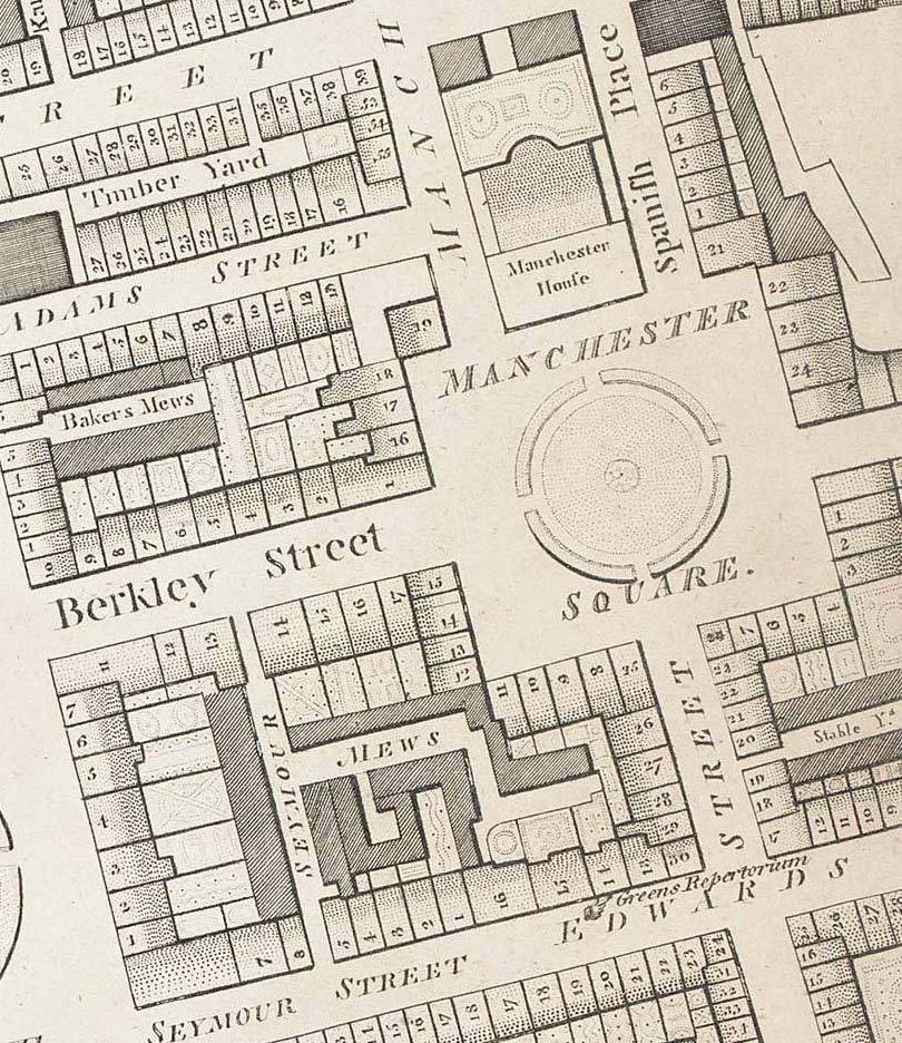
Manchester Square 1799 edited.jpg - Merchbow~commonswiki
PortlandPlace1799 edited.jpg - Merchbow~commonswiki

Extract from John Carey Map of Middlesex 1793.png - Lcarsdata

Map of England in 1791 by Reilly 084.jpg - Ephraim33

Horwood Great Portland Street circa 1793.jpg - Portlandvillage

1795 Bowles Pocket Map of London - Geographicus - London-bowles-1795.jpg - BotMultichillT

Horwood map 1799 St Martins Westminster.jpg - Andrew Dalby

The London directory, or a new & improved plan of London, Westminster, & Southwark, with the adjacent country, the new buildings, the new roads, and the late alterations by opening of new streets, & widening of others (5385391970).jpg - File Upload Bot (Magnus Manske)

Ordnance Survey Drawings - Stratford (OSD 131).jpg - LibraryBot

RSA 2014 - 1790's street plan of this area.JPG - 1Veertje
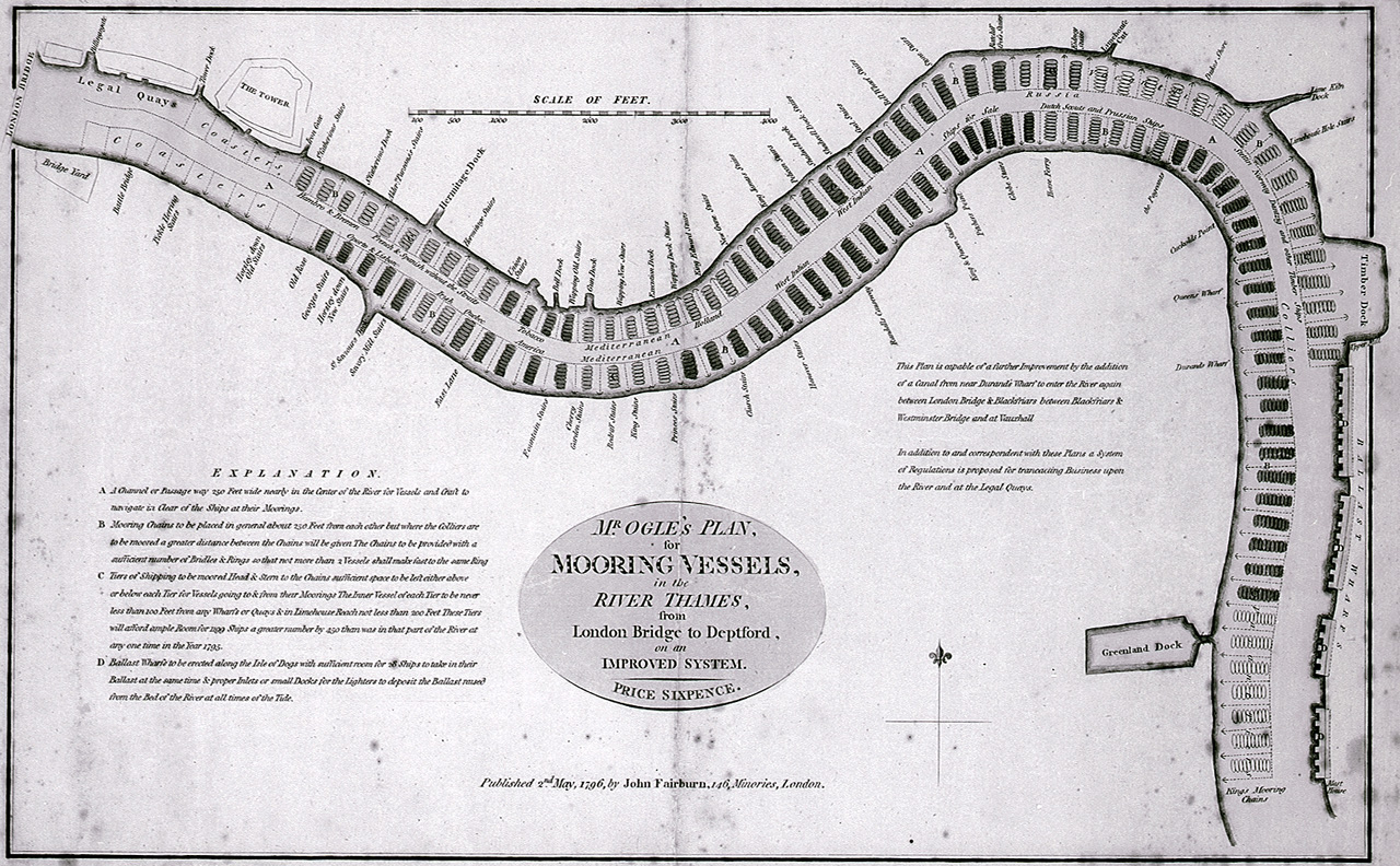
Mr Ogle's plan, for mooring vessels, in the River Thames, from London Bridge to Deptford, on an improved system. RMG E0455.jpg - Fæ
A new and correct chart from the Isle of Dogs, to Prittlewell, and the Nore RMG F8050.tiff - Fæ
Mr Ogle's plan, for mooring vessels, in the River Thames, from London Bridge to Deptford, on an improved system. RMG F0074.tiff - Fæ
The country twenty-five miles round London - planned from a scale of one mile to an inch LOC 2008627963.tif - Fæ

The country twenty-five miles round London - planned from a scale of one mile to an inch LOC 2008627963.jpg - Fæ
Horwood Blackwall.jpg - MIDI

A New and Correct Plan of the Cities, of London & Westminster, Borough of Southwark and parts adjacent (BM Heal,Topography.193).jpg - Copyfraud

A New and Correct Plan of the Cities, of London & Westminster, Borough of Southwark and parts adjacent (BM Heal,Topography.193 1).jpg - Copyfraud

A New and Correct Plan of the Cities, of London & Westminster, Borough of Southwark and parts adjacent (BM Heal,Topography.193 2).jpg - Copyfraud

Print, map (BM 1880,1113.3890).jpg - Copyfraud

The Limehouse end of the Limehouse Cut c.1800.jpg - Ttocserp

Fragment of Cary's map, 1795, showing location of Whitechapel Mount.png - Ttocserp
Bowles 's new plan of London, Westminster and Southwark COLLBN Port 152 N 187 - Sheet 2, COLLBN Port 152 N 187.tif - Mr.Nostalgic

London and Westminster (CBL Wep 4095.86).jpg - Nous

John Fairburn - Fairburn's Plan of the Proposed Wet-Docks and Cut, from New Gravel Lane to Blackwall - B1977.14.14716 - Yale Center for British Art.jpg - SmartifyBot

Harris's Plan of London, Westminster and the borough of Southwark, with all the additional streets, squares, etc., also the improved roads to the year 1797 - btv1b84403466.jpg - Gzen92Bot

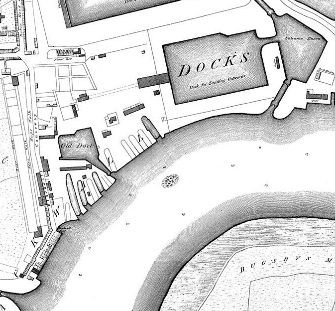
Shipyards at Deptford and Rotherhithe - Horwood’s map of London (1792-99).jpg - Broichmore