×

Priebussischer Creis nebst Herrschaft Muska.png - 32X

Antigua and Barbuda 1745.jpg - Durova

Fotothek df rp-a 0490058 Markranstädt. Atlas von Schenk, Bl. 25, 1745 (Ausschnitt).jpg - FotothekBot

Antwerpen 1708-45 Baillieul.JPG - Joopr

America Map 1745 (rus).jpg - Transcend (rus)

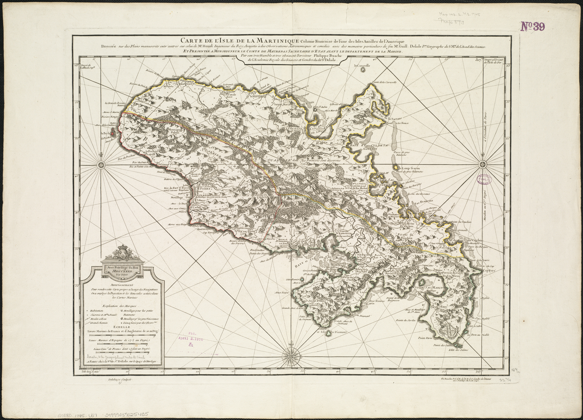
Martinique 1745.jpg - Dr Brains

Hotel-de-Blossac---1745.svg - Trizek

1745 Anson Map or Chart of Zihuatanejo Harbor, Mexico - Geographicus - Seguataneo-anson-1745.jpg - BotMultichill

1745 Seale Map or Chart of the Mediterranean Sea - Geographicus - Mediterranean-seale-1845.jpg - BotMultichillT

Plentzia eta Urduliz.png - Elhuyar Fundazioa

Argonauts path Carli.jpg - TadejM

Plan de la bataille de Fontenoy remportée le 11 mai 1745.jpg - Pygoscelis antarcticus

Plan de Longwy 1745.jpg - Léna

Anville 1745 Carte du Comtat Venaissin.jpg - JPS68

A chart of the western coast of Africa, from the Straits of Gibraltar to eleven degrees of north latitude, including the Canary & Cape Verd Islands (5961367996).jpg - File Upload Bot (Magnus Manske)

A Plan of English Harbour WDL655.png - Fæ

Partie occidentale de la Nouvelle France ou Canada - par Mr. Bellin, ingenieur de la Marine, 1745. NYPL465029.tiff - Fæ

AMH-7903-KB Map of Anjuan.jpg - HuskyBot

Karta över omgivningarna vid Dunkerque, Bergues, Furnes, Gravelines, Calais och andra orter - Skoklosters slott - 98024.tif - LSHuploadBot

Karta över omgivningarna vid Lille, Tournay, Valenciennes, Bouchain, Donay, Arras, Bethune, 1745 - Skoklosters slott - 98034.tif - LSHuploadBot

Karta över omgivningarna vid Menin, Courtray, Ypre, Dixmude et Deynse - Skoklosters slott - 98018.tif - LSHuploadBot

Karta över omgivningarna vid Mons, Ath, Charleroy, Maubeuge, Quesnoy, Coude och andra - Skoklosters slott - 98025.tif - LSHuploadBot

Karta över omgivningarna vid Namur, Huy, Dinant, Philippeville, etc - Skoklosters slott - 98039.tif - LSHuploadBot

Karta över omgivningarna vid Antwerpen, Gent Hulst och hela Waes (tout le pays de Waes), 1745 - Skoklosters slott - 98029.tif - LSHuploadBot

Karta över Böhmen, från 1745 - Skoklosters slott - 97964.tif - LSHuploadBot

Territorio Lugo 1745.jpg - Sentruper

Carte de la Coste d'Arabie, Mer Rouge, et Golfe de Perse.png - Wheeler LIM

Carte de la Coste d'Arabie, Mer Rouge, et Golfe de Perse, Eliminate background.png - Wheeler LIM

Carte Du Golphe Persique.png - Wheeler LIM

Carte Du Golphe Persique (Eliminate background).png - Wheeler LIM

Louisburg fortress and harbour RMG F0186.tiff - Fæ

Bolstra 1745 Nieuwe kaart van het hoogheemraadschap van Rynland als mede van Amstelland en het Waterschap van Woerden.jpg - Egge-Jan Pollé

A plan of English Harbour; with the King's yard and carreening wharfe, 15th. Nov. 1745. LOC 73691522.tif - Fæ

A plan of English Harbour; with the King's yard and carreening wharfe, 15th. Nov. 1745. LOC 73691522.jpg - Fæ

L' hemisphere meridional pour voir plus distinctement les terres australes LOC 2017585769.tif - Fæ

L' hemisphere meridional pour voir plus distinctement les terres australes LOC 2017585769.jpg - Fæ

Map of Ghent by Georges Louis Le Rouge 01.jpg - Donarreiskoffer

Carte d'Amérique dressée pour l'usage du Roy - par Guillaume Delisle... - btv1b8469815q.jpg - Gzen92Bot

Carte du golfe darien depuis l'isle de la tortüe jusqu'à la Caridonne et les Samblasses - btv1b531221507.jpg - Gzen92Bot

Camp de St. Giacomo et la Neve, en avant de Final le 2 Juillet 1745.jpg - N.Longo

Matthäus Seuttetre, Ierusalem (FL6881369 2368181).jpg - Geagea

Richard Pococke, A map of the Holy Land and Syria (FL44436210 2368881).jpg - Geagea

Matthäus Seuttetre, Palaestina seu Terra a Mose et Iosua occupata et inter Iudaeos distributa per XII Tribus vulgo Sancta adpellata (FL56053720 2369046).jpg - Geagea

Carte von Ost - Indien (FL35470358 2513852).jpg - Geagea

George Anson, 1st Baron Anson, A plan of the town of Payta in the kingdom of Santa-Fee (FL13730391 3031827).jpg - Geagea

Charles Price, A correct chart of the Mediterranean Sea from the coast of Portugal to the Levant (FL13730686 3365902).jpg - Geagea

Jacques-Nicolas Bellin, Carte de l'Archipel (FL13730710 3369712).jpg - Geagea

Philip Simms, A plan of Jerusalem according to Josephus and ye Rabbies (FL13733971 3532284).jpg - Geagea

Johann David Köhler, Holy Land (FL13734049 3607376).jpg - Geagea

Sir George Wheler, Carte de la Grece (FL35072731 2534527).jpg - Geagea

Christoph Weigel the Elder, Imperium Moscoviae (FL36378775 2605073).jpg - Geagea

George Anson, 1st Baron Anson, Plan of St. Julian's harbour on the coast of Patagonia (FL37807952 3032979).jpg - Geagea

George Anson, 1st Baron Anson, The form of cruising off Acapulca on the coast of Mexico in the South Seas (FL37808029 3033624).jpg - Geagea

George Anson, 1st Baron Anson, A plan of the harbour of Acapulco on the coast of Mexico in y'e South Sea (FL37808138 3033939).jpg - Geagea

George Anson, 1st Baron Anson, A plan of the east end of the island of Quibo (FL37810089 3033951).jpg - Geagea

George Anson, 1st Baron Anson, A plan of the harbour of Chequetan or Seguataneo (FL37810154 3034009).jpg - Geagea

George Anson, 1st Baron Anson, A survey of the north east side of Iuan Fernandes Island in the South Sea (FL37810280 3033988).jpg - Geagea

Georges-Louis Le Rouge, Carte Topographique Du Cours Du Rhin De Philisbourg à Mayence Contenant Partie de lʹEveché de Spir et de Worms 01-sheet-1 (FL39696689 3017199).jpg - Geagea

Georges-Louis Le Rouge, Carte Topographique Du Cours Du Rhin De Philisbourg à Mayence Contenant Partie de lʹEveché de Spir et de Worms 02-sheet-2 (FL39696691 3017199).jpg - Geagea

John Marchant, A map of ye Holy Land or the Land of Promise (FL46962579 3934716).jpg - Geagea

Sámuel Mikoviny, Adspice Pisonis, speciosa cacumina, turres (FL39908570 3843876).jpg - Geagea

Johann Christian Rhode, Mappa Mundi Generalis (FL80427988 2725384).jpg - Geagea
❮
❯


