Wikimedi'Òc
Modes d'emploi

Cet album fait partie des albums
Cet album photos contient les sous-albums suivants :


Herman Moll Map of France.jpg - AndreasPraefcke
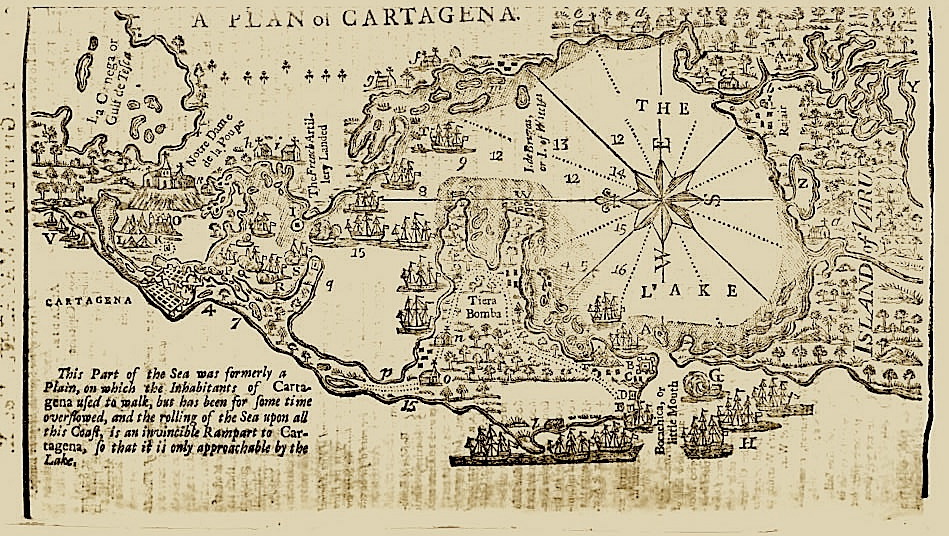
Map of Cartagena2.jpg - TTThom

1740 Zatta Map of Central France and the Vicinity of Paris - Geographicus - FranceCentral-italian-1740.jpg - BotMultichill

Plan der Residenzstadt Meersburg Pozzi 1740.jpg - AndreasPraefcke

E-Kaempfer-Nagasaki-Kaido.jpg - WolfgangMichel

Das Land Appenzell (Gabriel Walser).png - Martin Sauter

Mapa de la Audiencia de Quito (1740), según el Padre Juan Magnin Misionero de la Compañia de Jesús - AHG.jpg - Jojagal

Geographic Map of Brazil WDL1195.png - Fæ

Grundriss des unmittelbaren Reichsstift und Gotteshauses Weingarten HStAS N 34 Nr 77.jpg - AndreasPraefcke

Environs de Paris levés géométriquement par M. l'Abbé de La Grive.png - Ambre Troizat

1740 Seutter Map of Swabia and Wirtenberg, Germany - Suevicus-Seutter-1740 Reprint.jpg - MagentaGreen

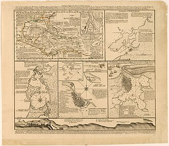
The seat of war in the West Indies 1740.jpg - Hispalois

Map viewed from right hand side (31365190024).jpg - Akbys

Map reference detailing quality and extent of land (31396287663).jpg - Akbys

Tabula anemographica seu pyxis nautica vulgo compass charte (34333419784).jpg - Fæ
A new map or chart of the western or Atlantic ocean with part of Europe, Africa and America- shewing the course of the galleons, flota &c. to and from the West Indies. RMG F0384.tiff - Fæ
South Carolina RMG F0286.tiff - Fæ
Carte du Lac Champlain depuis le Fort Chambly jusqu'a celuyde St. Fréderic. LOC 2008626932.tif - Fæ

Carte du Lac Champlain depuis le Fort Chambly jusqu'a celuyde St. Fréderic. LOC 2008626932.jpg - Fæ
Opulentissimum sinarum imperium juxta recentissimam delineationem in suas provincias disterminatum LOC 2006629413.tif - Fæ

Opulentissimum sinarum imperium juxta recentissimam delineationem in suas provincias disterminatum LOC 2006629413.jpg - Fæ
Plano de la agvada nveva de Pverto Rico es copia del ... sesaco el anno 1740. LOC 73691520.tif - Fæ

Plano de la agvada nveva de Pverto Rico es copia del ... sesaco el anno 1740. LOC 73691520.jpg - Fæ
Terre de Chanaan ou Terre Promise a Abraham, et a sa Posterite de G. Sanson Geographe du Roy LOC 2012590214.tif - Fæ

Terre de Chanaan ou Terre Promise a Abraham, et a sa Posterite de G. Sanson Geographe du Roy LOC 2012590214.jpg - Fæ
Etats du Grand-Seigneur en Asie - Empire de Perse, Pays des Usbecs, Arabie et Egypte LOC 2013593001.tif - Fæ

Etats du Grand-Seigneur en Asie - Empire de Perse, Pays des Usbecs, Arabie et Egypte LOC 2013593001.jpg - Fæ
Accurater Prospect und Grundris der Königl. Gros-Britan̄isch. Haupt- und Residentz-Stadt London LOC 2011590010.tif - Fæ

Accurater Prospect und Grundris der Königl. Gros-Britan̄isch. Haupt- und Residentz-Stadt London LOC 2011590010.jpg - Fæ
L'Amérique - dressée sur les relations les plus récentes, rectifiées sur les dernières observations - dédiée et présentée à sa Majesté très chrestienne Louis XV LOC 80692430.tif - Fæ

L'Amérique - dressée sur les relations les plus récentes, rectifiées sur les dernières observations - dédiée et présentée à sa Majesté très chrestienne Louis XV LOC 80692430.jpg - Fæ
L'expedition d'Alexandre - pour l'Histoire Ancienne de Mr. Rollin LOC 2013593014.tif - Fæ

L'expedition d'Alexandre - pour l'Histoire Ancienne de Mr. Rollin LOC 2013593014.jpg - Fæ
Plano de la aguada de St. Francisco en la ysla de St. Iuan de Puerto Rico. Las dos linias de carmin el punto donde se juntaren es el desecheo a distancia de 4 leguas de la Punta de St. Francisco. LOC 73691521.tif - Fæ

Plano de la aguada de St. Francisco en la ysla de St. Iuan de Puerto Rico. Las dos linias de carmin el punto donde se juntaren es el desecheo a distancia de 4 leguas de la Punta de St. Francisco. LOC 73691521.jpg - Fæ

A SEQUEL of the Seat of WAR in the WEST INDIES, Containing - Emanuel Bowen, 1740 - BL Maps K.Top.124.21 (BLL01018640977).jpg - JhealdBot
This plan of the harbour, town, and forts of Porto Bello (taken by Edward Vernon, esqr. vice admiral of the Blue on the 22d of November 1739 with six men of war only) LOC 2002622163.tif - Fæ

This plan of the harbour, town, and forts of Porto Bello (taken by Edward Vernon, esqr. vice admiral of the Blue on the 22d of November 1739 with six men of war only) LOC 2002622163.jpg - Fæ

Neu und verbesserter Plan der St. u. Hafens Havana auf der Ins. Cvba mit den Wasser Tiefen, Sand Bæncken und Klippen nochmahten übersehen v. Pr. Chassereau Anno 1739. LOC 74690542.jpg - Enyavar
Compass rose in 1740, from- Tabula anemographica seu pyxis nautica vulgo compass charte (34333419784) (cropped).jpg - Tibet Nation

Asia Cum Omnibus Imperiis Provinciis Statibus et Insulis Iuxta Observationes Recentissimas et Accuratissimas Correcte et Adornata.jpg - Balkanique

The City Guide of a Pocket Map of London, Westminster And Southwark With ye Nex Buildings to ye Year 1740 - btv1b530563039.jpg - Gzen92Bot

Le Cours du Po - depuis Turin jusques à ses embouchures dans le fond du golfe de Venise ou est Listrie et les pays dessus et aux environs qui sont les états de Milan, de la République de Venise, de Parme et de... - btv1b10678638b.jpg - Gzen92Bot

Das Land Appenzell der Innern- u. Aussern-Rooden, mit allem Fleis gezeichnet von Gabriel Walser V.D.M.jpg - GeneraleAutunno
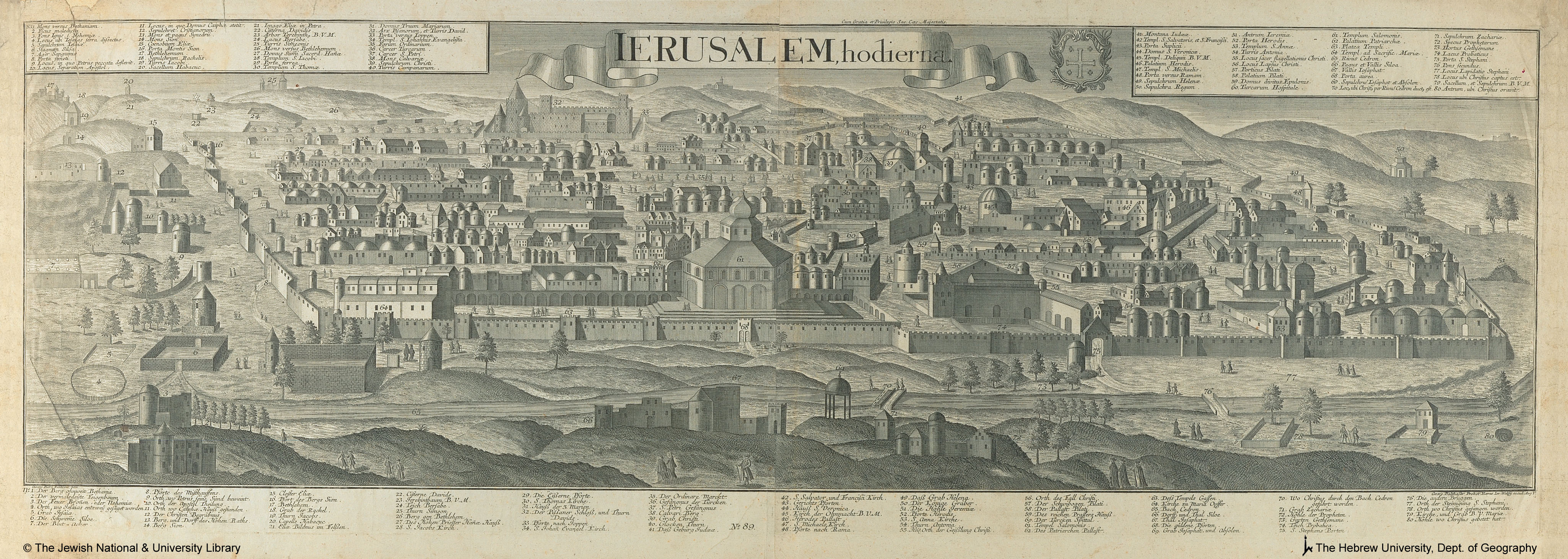
Georg Balthasar Probst, Ierusalem, hodierna (FL6881022 2368159).jpg - Geagea

Georg Balthasar Probst, Ierusalem (FL6881037 2368160).jpg - Geagea

Reinier Ottens, Het Beloofde Landt Israels, Terre Sancta, sive Promissionis, olim Palestina recens delineata et in lucem (FL6882534 2368859).jpg - Geagea

S.W., A Map of the Divisions & Situations of the Tribes of Canaanites, Moabites, Ammonites, Midianites, Edomites, Amalekites & C (FL199992192 2369214).jpg - Geagea

Matthäus Seuttetre, Constantinopolis (FL33122147 2369936).jpg - Geagea

Prag (FL39695549 2369958).jpg - Geagea

Matthäus Seuttetre, Barcino metropolis Hispanici principatus Cataloniae (FL167449107 2397178).jpg - Geagea

Ivan Grimmel, Der Sinus Finnicus von Cronstat bis st. Petersburg benebst den auf seinen KÜsten befindlichen Lusthöfen (FL155322699 2470535).jpg - Geagea

Joseph Goupy, Veduta della citta di Malta (FL13722366 2471658).jpg - Geagea
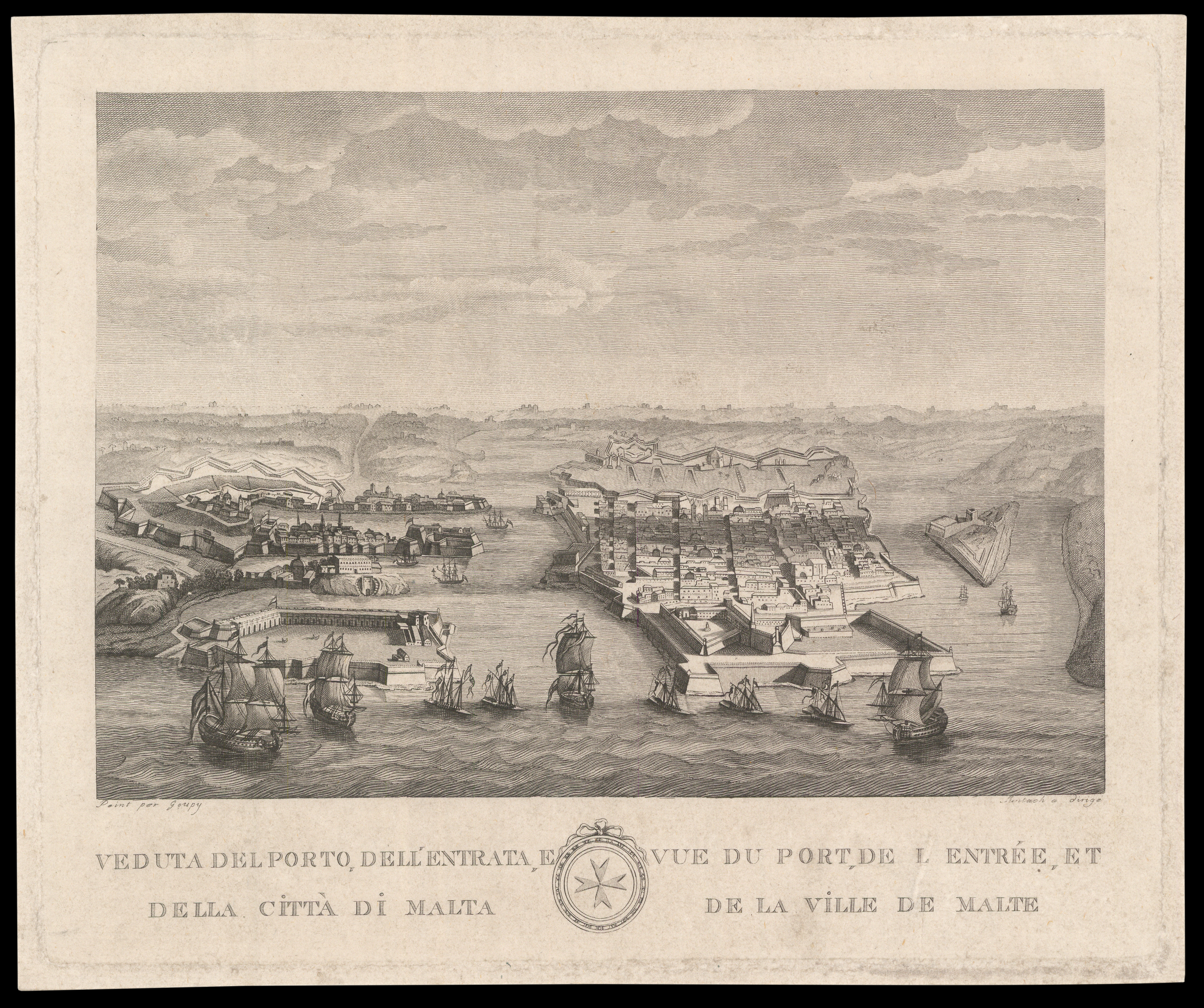
Joseph Goupy, Veu del porto dell entrata e della citta di Malta (FL13722360 2471695).jpg - Geagea

Joseph Goupy, Veduta della citta di Malta dalla parte dei Gesuiti (FL13722363 2471699).jpg - Geagea

Carte de la coste d'Arabie, Mer Rouge, et Golfe de Perse (FL35865376 2492245).jpg - Geagea

Reinier Ottens, Insula Ceilon et Madura, exactissimè delineate et nuperrimè (FL35472086 2514044).jpg - Geagea

William Henry Toms, Syria (FL13729074 2515284).jpg - Geagea

The travels of the Children of Israel out of Ægypt (FL13733989 3561251).jpg - Geagea

Plan de l'Ancienne Jerusalem (FL13735712 3607383).jpg - Geagea

Carl von Frauendorff, Verus Chersonesi Tauricae Seu Crimeae Conspectus (FL147394463 2607436).jpg - Geagea

Ivan Grimmel, Ладожское озеро и Финскіий заливъ съ прилѣжащими мѣстами (FL147457845 2607285).jpg - Geagea

Edmond Halley, A view of ye general and coasting trade winds, monsoons or ye shifting trade winds through the world, variations & c (FL157437595 2726320).jpg - Geagea

Tabula geographica ad Florum (FL33132637 2522057).jpg - Geagea

Gallia Vetus (FL33133783 2584906).jpg - Geagea

Gallia Vetus (FL33133795 2585024).jpg - Geagea

John Speed, The Travels of the Children of Israel; out of Egypt through the Red Sea and the Wilderness, into Canaan or the Holy Land (FL35084255 3890738).jpg - Geagea

Natolie ou Turquie d'Asie (FL35866737 2645229).jpg - Geagea

Carte de la coste d'Arabie, Mer Rouge, et Golfe de Perse (FL35868131 2725034).jpg - Geagea

Matthäus Seuttetre, Imperium Turcicum per Europam Asiam et Africam (FL36010543 2715960).jpg - Geagea

Gerard Valck, Imperium Turcicum in Europa, Asia, divisum in sua Regna et Regions, nempe Græciam, Natoliam, Armenian, Arabiam, Ægyptum, Regna Algeriæ, Tunetanum, Tripoleos et Barcæ (FL36010589 2715977).jpg - Geagea

Isaak Tirion, Kaart van't Joodsche Land ten tyde van onzen zaligmaaker (FL36556329 3899766).jpg - Geagea

Platte grond van Jerusalem.volgens Josefus en de Rabbynen (FL36558882 3901677).jpg - Geagea

Nicolaes Visscher II, Austriæ Archiducatus Pars Inferior (FL37099024 2526782).jpg - Geagea

Johann Jacob Schmidt, Facies vrbis Hierosolymae olim in IV montibus (FL45593348 3931760).jpg - Geagea
Johann Jacob Schmidt, Conspectus Peraeae sive totius regionis transior danicae (FL45593360 3931465).jpg - Geagea

Johann Jacob Schmidt, Regni Israelitici prout olim sub Davide & Dalomone regibus ab Aegypto & Mari Rubro ad Hemath & Euphratem usq' sese extenderit (FL45593373 3931299).jpg - Geagea

Horizon de Paris, 1740.jpg - Universalis