Wikimedi'Òc
Modes d'emploi

Cet album fait partie des albums
Cet album photos contient les sous-albums suivants :


Moll - The north part of Great Britain called Scotland.png - Frank Schulenburg

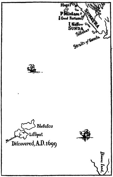
Map of Lilliput - Gulliver's Travels 1726 edition.png - Cmdrjameson

Brobdingnag map.jpg - Goustien
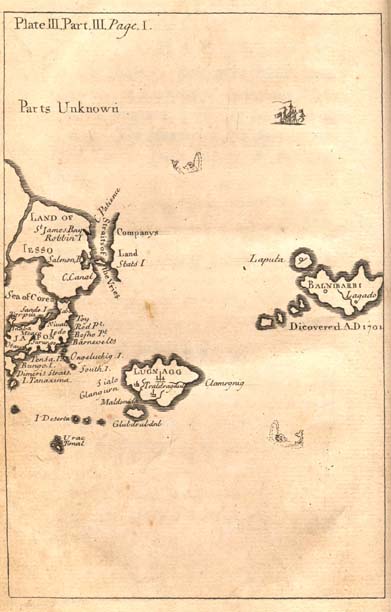
Lugnagg.jpg - Goustien
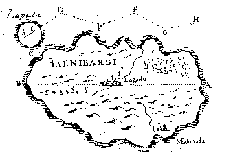
Laputa map.gif - Goustien

Map of Houyhnhnms land.jpg - Goustien

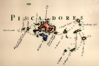
Dutch-pescadores.png - Taiwantaffy

1747 La Feuille Map of Holland - Geographicus - Holland-lafeuille-1747.jpg - BotMultichillT
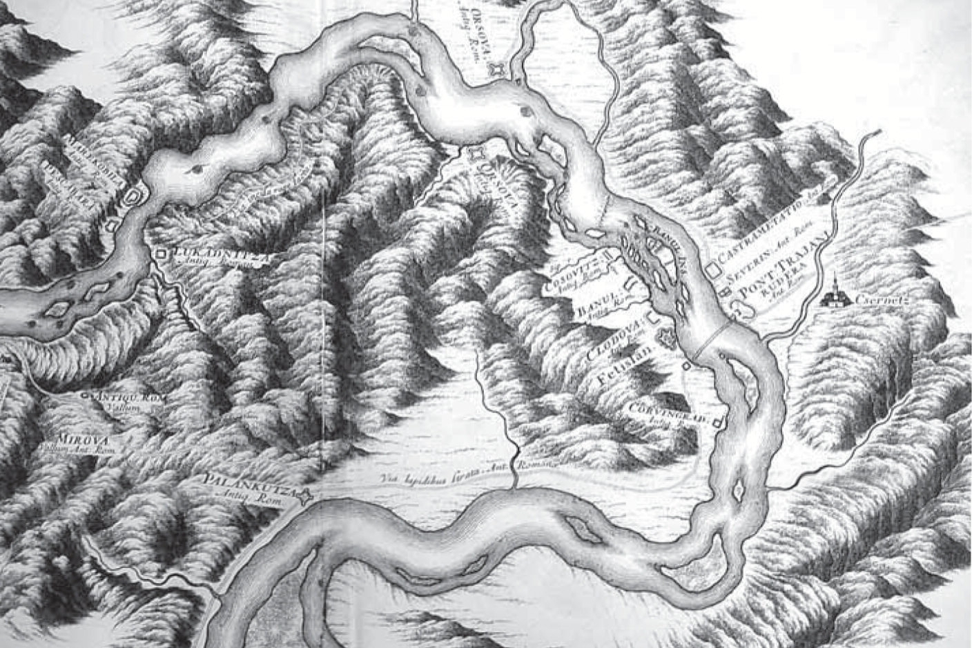
Map with Trajans Bridge and Roman Ruins in Danubius Pannonico-Mysicus 1726 by Marsigli.jpg - Codrinb

Watercolor with Trajans Bridge in Danubius Pannonico-Mysicus 1726 by Marsigli.jpg - Codrinb
Viagens de Gulliver 009.jpg - Claudio Pistilli

AMH-7259-KB Map of Bengal.jpg - HuskyBot

AMH-7260-KB Map of the Middle East.jpg - HuskyBot

AMH-7267-KB Map of Oostenburg Fort and a map of the region between Baticaloa and Tricoenmale.jpg - HuskyBot

AMH-7268-KB Map of the Malabar coast.jpg - HuskyBot

AMH-2496-NA Plan of the old fortification A and the new fort B at Rio de la Goa.jpg - HuskyBot

AMH-2555-NA Map of the bay of Rio de Lagoa.jpg - HuskyBot

Felibien & Lobineau, Plan de Paris, 1726 - Middlebury College.jpg - Paris 16
Karta över Kaspiska havet med omgivande länder, från 1726 - Skoklosters slott - 97955.tif - LSHuploadBot
UBBasel Map 1726 VB A2-2-20.tif - Basel University Library

Carte du Lac Ontario et de la Riviere jusques au dela de L Isle de Montreal celle de Niagara et partie du Lac Erie.JPEG - Jeangagnon

310 of 'Swift, Selections from his Works. Edited with life, introductions and notes by H. Craik' (11217943963).jpg - Artix Kreiger 2

A map of the world with ships DUKE & DUTCHESS' tract round it from 1708 to 1711, by Herman Moll, geographer LCCN2007677057.jpg - Fæ
Tabula Indiae Orientalis et Regnorum adjacentium. LOC 2014588025.tif - Fæ

Tabula Indiae Orientalis et Regnorum adjacentium. LOC 2014588025.jpg - Fæ

A New & Exact MAP of the Coast, Countries and Islands within ye LIMITS of ye SOUTH SEA COMPANY - Herman Moll, 1726 - BL Maps K.Top.124.7 (BLL01018640971).jpg - JhealdBot

Plan des bois de Crepey (...) Hocquard (1726) gallica.jpg - LetazWiki2

A new & exact map of the coast, countries and islands within the limits of ye South Sea Company.png - Austiger

Kaart der Reyse van Abel Tasman volgens syn eygen opstel.png - Austiger

Insulae Palaos seu Novae Philippinae 87, alias Archipelagus S. Lazari vel Carolinae.png - Austiger

"A Plan of Fort St. George and the City of Madras," by Herman Moll, from 'Modern History or, the Present State of all Nations', by Thomas Salmon, published by Bettesworth & Hitch, London, 1726.jpg - Baddu676

Antoine Augustin Calmet, Novus conspectus Veteris Ierusalem ex authoris mente (FL6879190 2367993).jpg - Geagea

Antoine Augustin Calmet, Plan et distribution de la Terre de Chanaan, suivant la Vision d'Esechiel Chap.XLVIII Laquelle ne fut jamais exécutée a la lettre, depuis le retour de la Captivité (FL199985293 2368421).jpg - Geagea

Antoine Augustin Calmet, Carte de La Terre Promise (FL200036731 2368422).jpg - Geagea

Antoine Augustin Calmet, Carte pour les Actes des Apotres (FL200036705 2368423).jpg - Geagea
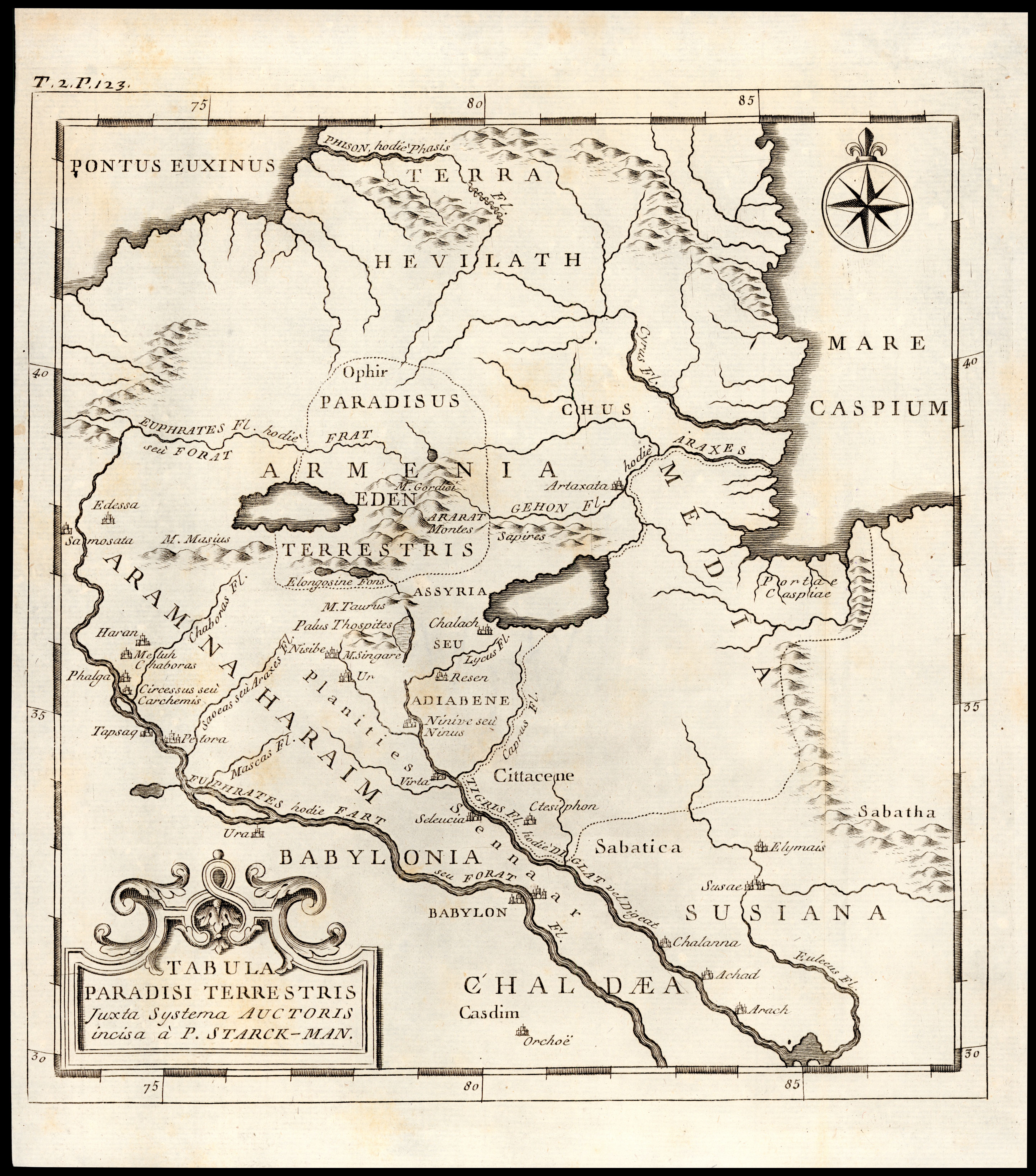
Antoine Augustin Calmet, Tabula Paradisi Terrestris (FL170208093 2368429).jpg - Geagea

Jacques-André Cobbé, Partie du Gange où sont les etablissements (FL35470342 2513529).jpg - Geagea

Henri Michelot, Nouvelle carte generalle de la Mer Mediterranée 01-west (FL13730716 3368056).jpg - Geagea

Henri Michelot, Nouvelle carte generalle de la Mer Mediterranée 03-east (FL13730717 3368056).jpg - Geagea