Wikimedi'Òc
Modes d'emploi

Cet album fait partie des albums
Cet album photos contient les sous-albums suivants :


Atlas Ortelius KB PPN369376781-086av-086br.jpg - HuskyBot

Ortelius - Maris Pacifici 1589.jpg - Jan Arkesteijn

1592 Insullae Moluc. Plancius.jpg - Joopr

Pacific ocean 1589.jpg - Dencey~commonswiki
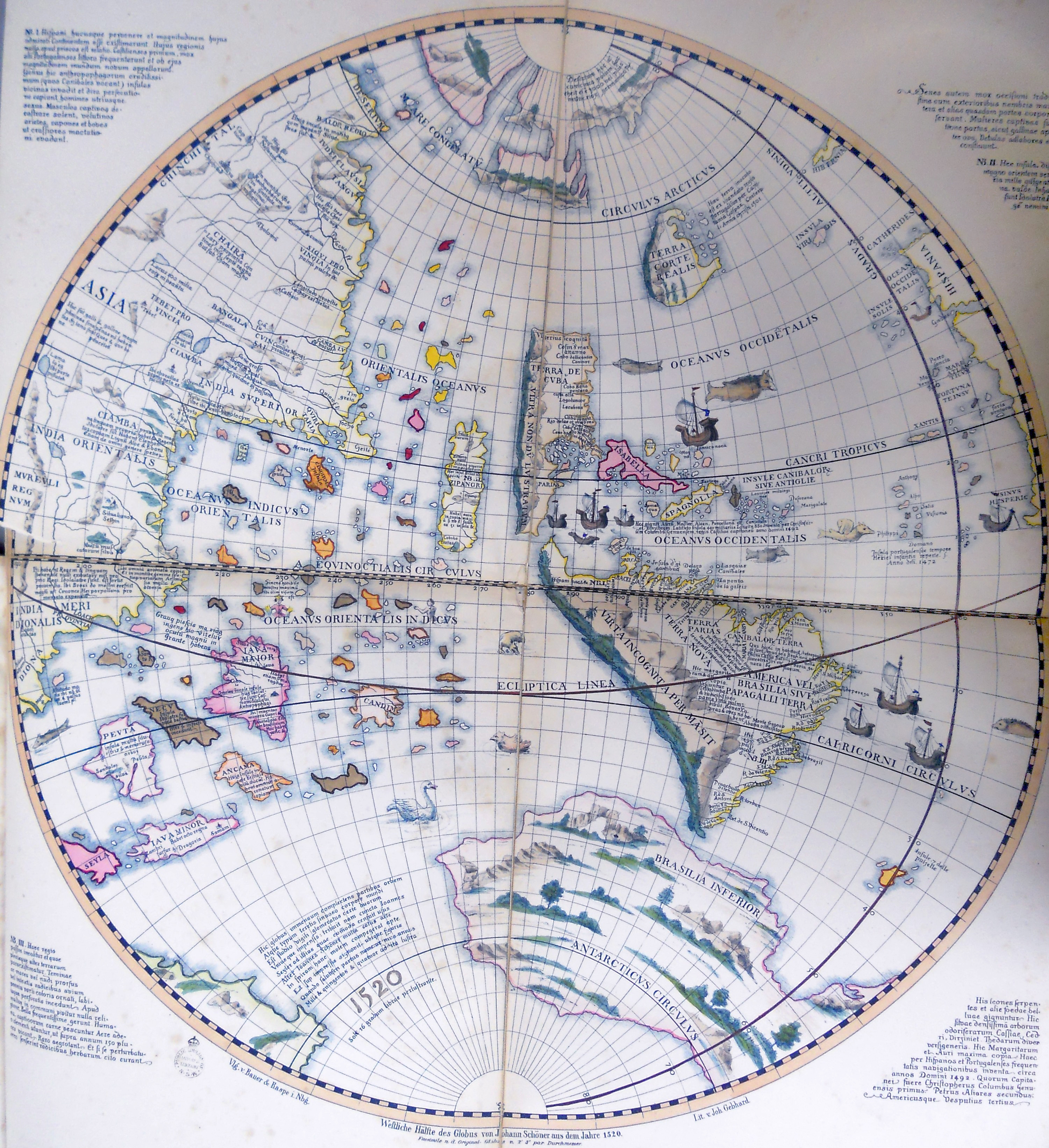
Schöner globe 1520 western hemisphere.jpg - Maelcum

Maris Pacifici Quad Vulga Mar del Zur - Abraham Ortelius, 1595.jpg - JJ Harrison

A chronological history of the discoveries in the South Sea or Pacific Ocean; illustrated with charts (1803) (14598126759).jpg - Fæ

Map of the Pacific Ocean by Abraham Ortelius.jpeg - Enyavar

Nma.img-ci20082088-143-ei-vs1.jpg - NatMuseumAust

Map of Americas(1600) south west.jpg - Baddu676
Gerard Mercator's 1569 map of the world - Sheet 08.tif - Balkanique

Map 1520 Schöner-globe western hemisphere.jpg - JMetrope

1551 map of the Western Hemisphere by Sancho Gutiérrez.jpg - Balkanique

Ortelius Maris Pacifici 1589 UTA.jpg - Michael Barera

Atlas nautique portugais - btv1b53074825v (15 of 16).jpg - Gzen92Bot

Abraham Ortelius - Maris Pacifici (c 1589).jpg - Crisco 1492

Nordenskiöld 1897 Figure 91 LOC Image 200.jpg - Kognos

Glareanus Map JCB 8959-3.png - Kognos

Portolan atlas of 9 charts and a world map, etc. Dedicated to Hieronymus Ruffault, Abbot of St. Vaast LOC 98687206-5.jpg - Fæ