Wikimedi'Òc
Modes d'emploi

Cet album fait partie des albums
Cet album photos contient les sous-albums suivants :


Si0157x1024.jpg - Ævar Arnfjörð Bjarmason
Si0050x1024.jpg - Ævar Arnfjörð Bjarmason

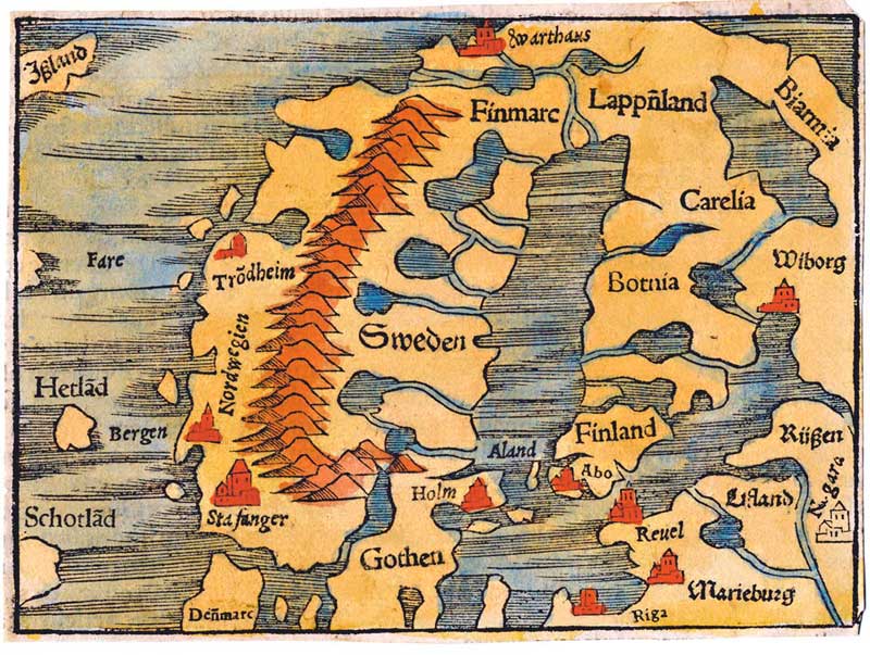
Olaus Magnus Scandza.gif - Pieter Kuiper

Abraham Ortelius Nordmeer Theat orb terr 1573.png - File Upload Bot (Magnus Manske)
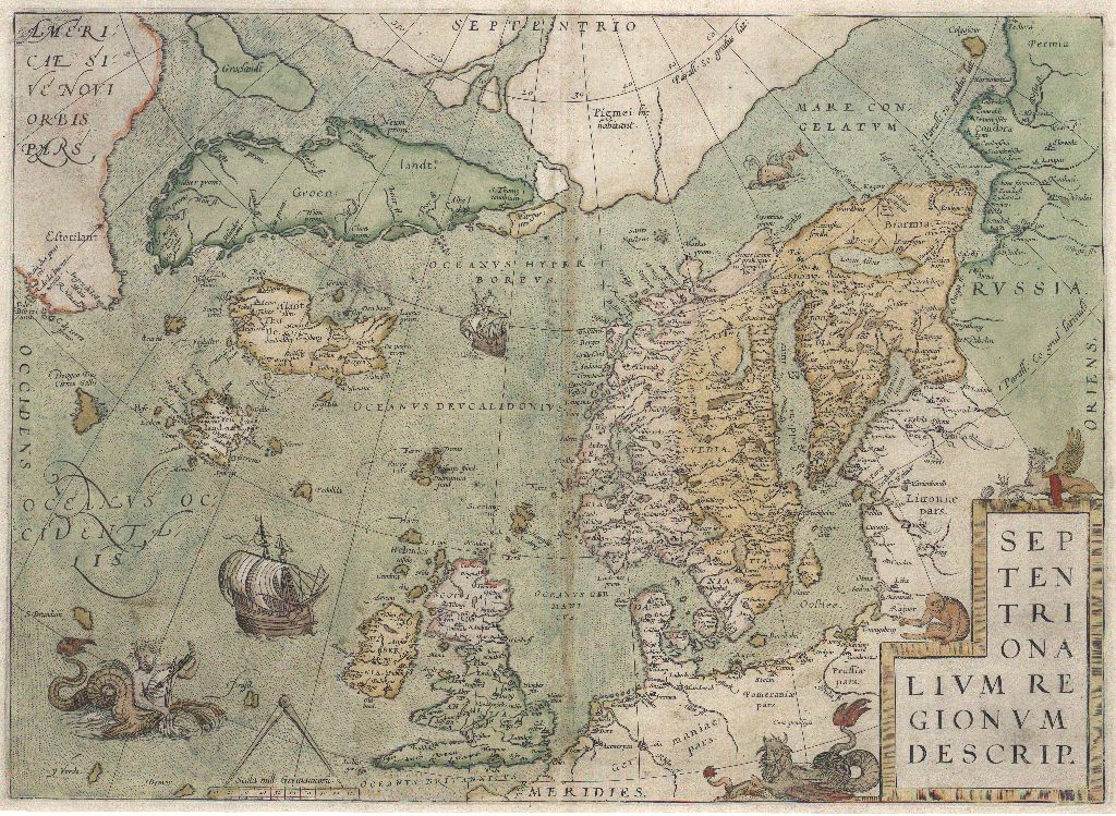
Ortelius, Abraham Septentrionalivm regionvm descrip.jpg - Jan Arkesteijn

Nord- amerika u.europa , Grönland (1595).jpg - Huhu Uet
Jacob Zieglers nordenkart, 1532 eller 1536.jpg - Flickr upload bot
Karta över Norden - Kungliga Biblioteket - 10397840.tif - L PBot

Karta över Norden - Kungliga Biblioteket - 10397840-thumb.png - L PBot

Sebastian Münster - Map 18 Northern Europe - 1545.jpg - Thesupermat
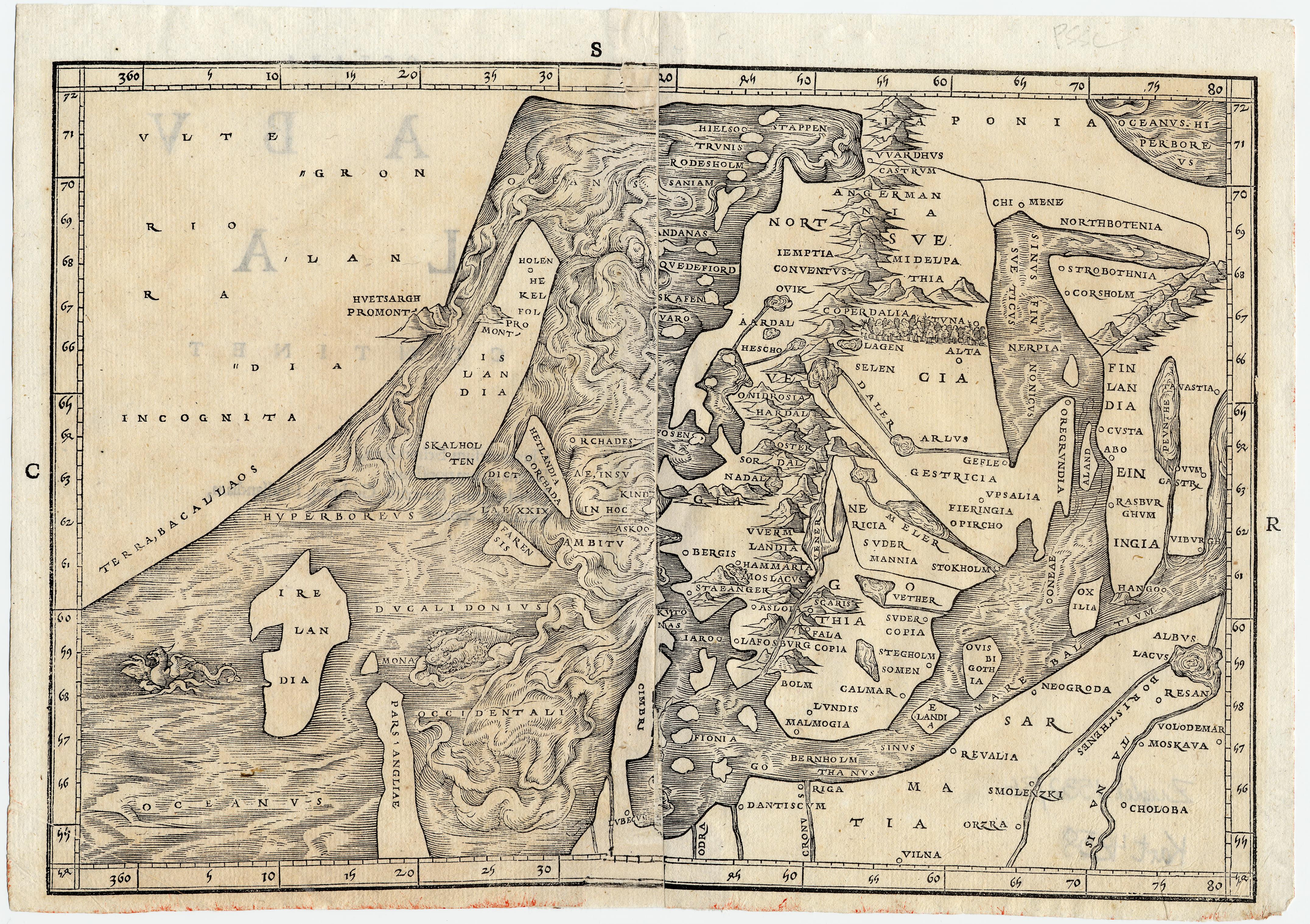
1544 biarm.jpg - UWCTransferBot
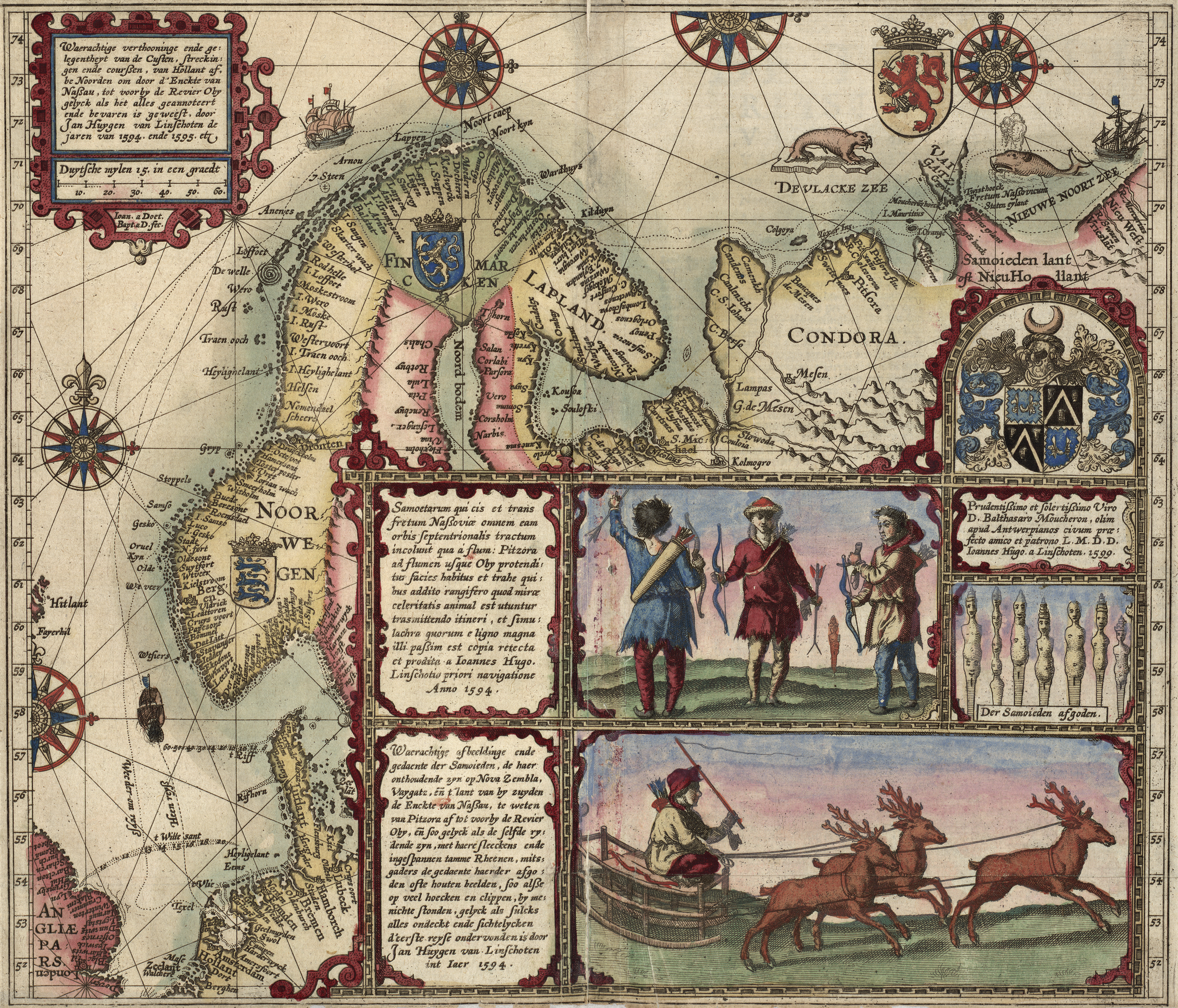
Linschotens nordenkart, 1601 (12067624705).jpg - Alonso de Mendoza

The voyage of the Vega round Asia and Europe; with a historical review of previous journeys along the north coast of the Old World (1882) (14779798331).jpg - Fæ

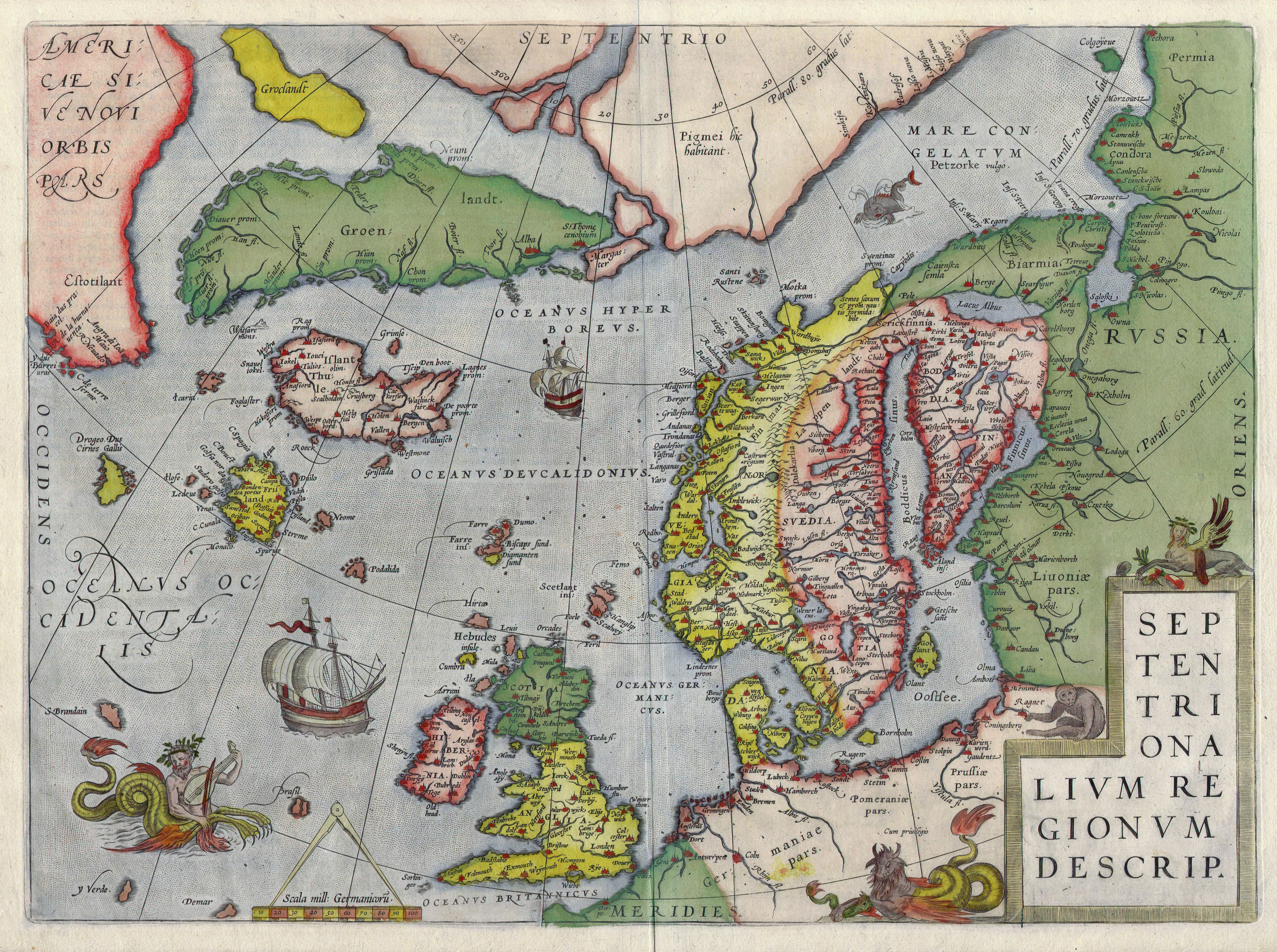
Map of Scandinavia by Abraham Ortelius.jpeg - File Upload Bot (Kaldari)

Map of Scandinavia (1600) Large.jpg - Baddu676

Linschotens nordenkart, 1601 (12067624705) (2).jpg - Wolfmann

11 of 'The Principal Navigations, Voyages, Traffiques and Discoveries of the English Nation. Collected by R. Hakluyt, and edited by E. Goldsmid' (11167919655).jpg - Artix Kreiger 2

10 of 'The principal Navigations, voyages, traffiques, and discoveries of the English nation. Collected by R. H. ... Edited by E. Goldsmid. L.P' (11175094013).jpg - SteinsplitterBot

1593 map of Northern Europe by Gerard de Jode.jpg - Balkanique

Print, book-illustration, map (BM 1982,U.2454).jpg - Copyfraud

Cosmographia - Beschreibung aller Lender durch Sebastianum Munsterum (1545) 20.jpg - Balkanique

La Geografia di Claudio Tolomeo Alessandrino, Tradotta di Greco nell'Idioma Volgare Italiano da Girolamo Russcelli (1598) 46.jpg - Balkanique

La Geografia di Claudio Tolomeo Alessandrino, Tradotta di Greco nell'Idioma Volgare Italiano da Girolamo Russcelli (1598) 68.jpg - Balkanique

Geographiae Claudii Ptolemaei Alexandrini (Münster, 1552) 47.jpg - Balkanique

Atlas type Lafréri - btv1b52511601q (086 of 226).jpg - Enyavar

Accipe... lector... Suetiae, Gotiae, Norvegiae, Prusiae, Pomeraniae, ducatus Megapolensis, Frisiae, Geldriae, Altae Marchiae, Lusatiae... descriptionem... - btv1b53093871d (1 of 2).jpg - Gzen92Bot

Terrae Sanctae, quam Palaestinam nominant, Syriae, Arabiae, AEgypti et Schondiae doctissima descriptio - authore Jacobo Zieglero Landaus Bavaro... - btv1b55007847x (31 of 41).jpg - Gzen92Bot

1513 map of the North Sea showing Greenland connected to Scandinavia.jpg - Enyavar

Linschoten Map of Scandinavia.jpg - LlywelynII

Nordenskiöld 1897 Plate 34 LOC Images 357 358.jpg - Kognos
Mitternachtliche Lander RMG F1746.tiff - Fæ