Wikimedi'Òc
Modes d'emploi

Cet album fait partie des albums
Cet album photos contient les sous-albums suivants :


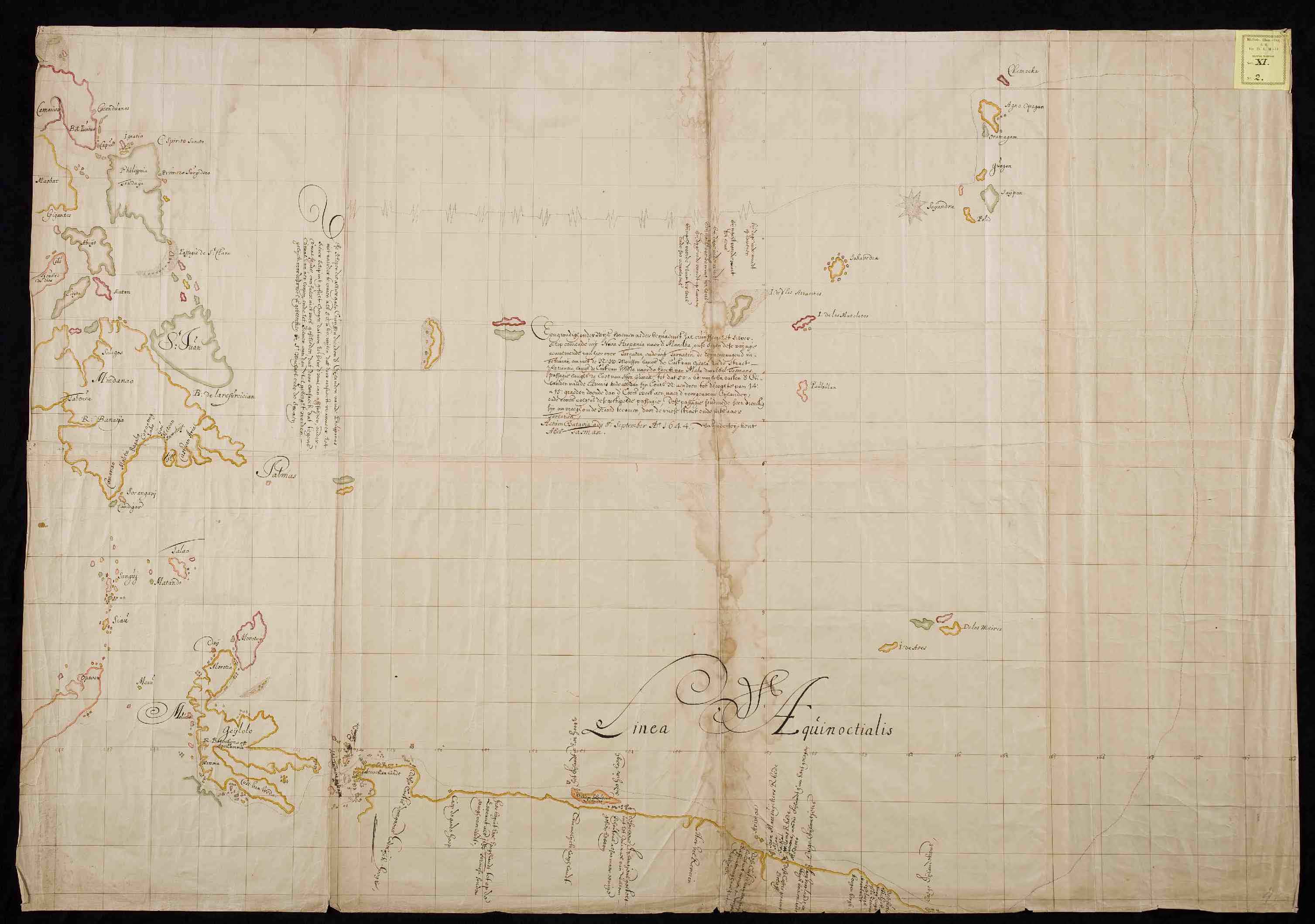
Abel Tasman - Hand drawn map of 1644.jpg - Hansmuller

Arctic 1644.jpg - Eivindgh

Waterverftekening van VOC-fort Zeelandia op het eiland Formosa.jpg - Shizhao

Brazil1644.jpg - Niptium

Atlas Blaeu-Van der Hem - Taioan.jpg - Wildcursive

Map of Roads and Cultivated Fields in the Saccam Area, 1644.jpg - Hst0129

AMH-4601-NA Estates at Saccam.jpg - HuskyBot

AMH-5413-NA Chart showing the Wancan region on Formosa.jpg - HuskyBot
UB Utrecht - Moll 627 (Dk50-3) - 1644.jpg - Spinster
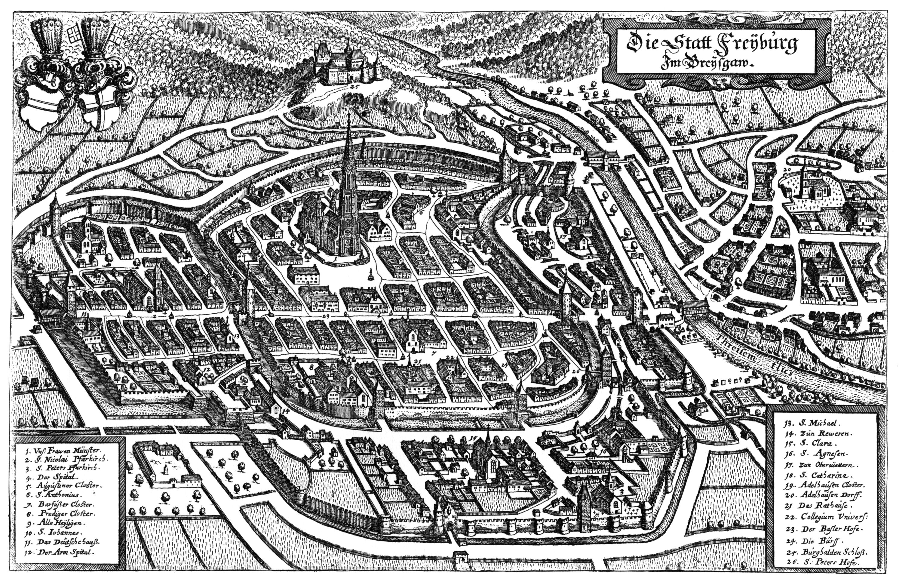
Merian Freiburg im Breisgau.jpg - 2only2
Karta över del av nordvästra Frankrike vid Nordsjökusten (dåvarande Sydflandern). Från 1640-talet - Skoklosters slott - 98003.tif - LSHuploadBot

Lionnois, Forest, Beauiolois et Masconnois - 1644.jpg - Laurent Jerry

Acta Societatis Scientiarum Fennicae (1891) (16745981916).jpg - Fæ

New Amsterdam and its people; studies, social and topographical, of the town under Dutch and early English rule (1902) (14763742024).jpg - Fæ

Mediterranean and part of the Black Sea RMG K1028.jpg - Fæ

การพิชิตหมิงของชิง.png - Shoshui

View of the town Taioan and Fort Zeelandia.jpg - Dquai

Landkaart van Engeland en Wales New & Exact Mappe of England (titel op object), RP-P-1920-2663.jpg - Mr.Nostalgic

Topographie francoise ou Representations de plusieurs villes, bourgs, chasteaux, maisons de plaisance, ruines & vestiges d'antiquitez du royaume de France designez par deffunst Claude Chastillon, - bpt6k1523713w (125 of 575).jpg - Gzen92Bot

Frans van Schooten, Tabula Bergarum ad Zomam Stenbergae et novorum ibi operum (FL35073104 2536425).jpg - Geagea

Jean Boisseau, Carte generalle de la Grande Bretagne, jadis Albion, et du Royaume d'Irlande ou Hybernie (FL35475255 2582320).jpg - Geagea