Wikimedi'Òc
Modes d'emploi

Cet album fait partie des albums
Cet album photos contient les sous-albums suivants :


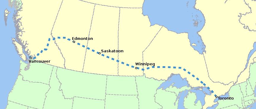
SuperContinental RouteMap.png - Al guy~commonswiki
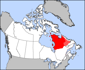
District-Ungava-1898.png - Joseph B~commonswiki
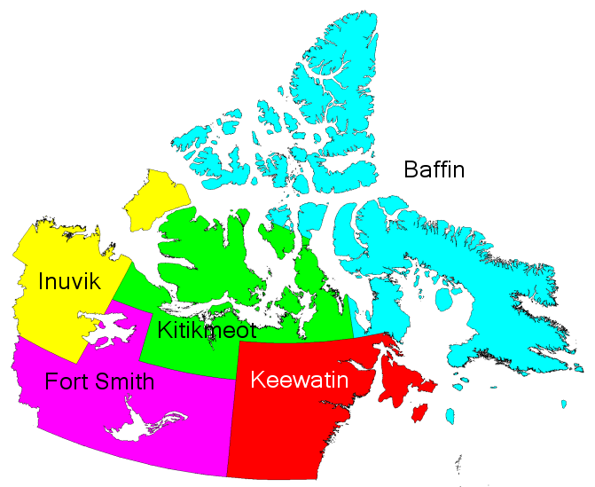
Northwest Territories Regions pre 1999.png - Keith Edkins

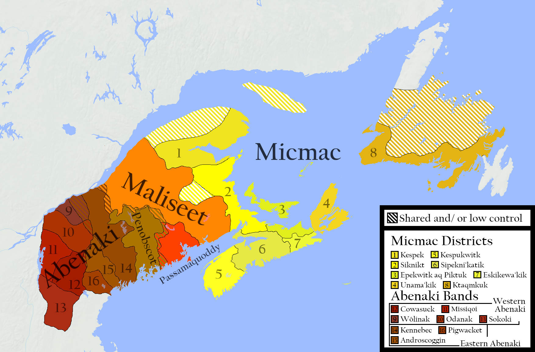
Mikmaq-Stammesgebiet.png - Mikmaq

Les Micmacs.png - Mikmaq

The Mi'kmaq.png - Mikmaq

Die Akadier.png - RokerHRO

Els Acadians.png - Mikmaq

Los Acadianos.png - Mikmaq

Els Micmac.png - Mikmaq

Los Micmac.png - Mikmaq

The Mi'kmaq raw version.png - Mikmaq
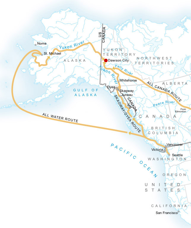
Klondike Routes Map.png - Soerenfm

Long Gull Pond.jpg - WayneRay
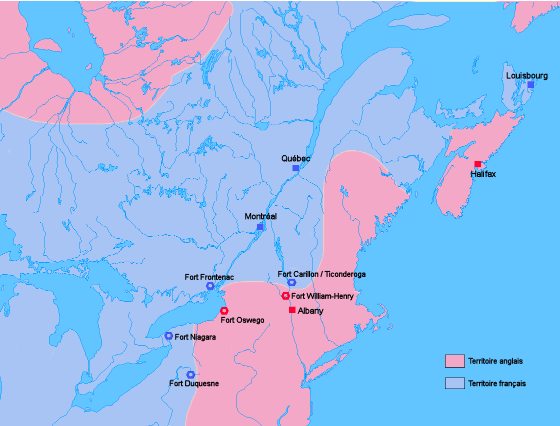
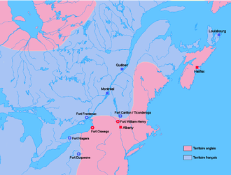
Carte Guerre de 7 ans Amérique du nord.PNG - Wordelle

Vinland-travel.jpg - Finn Bjorklid
N FR.JPG - Hillock65
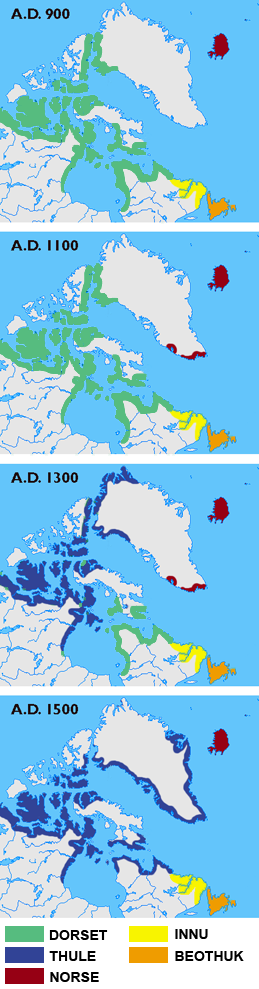
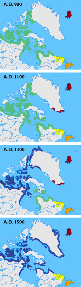
Arctic cultures 900-1500.png - Kmusser
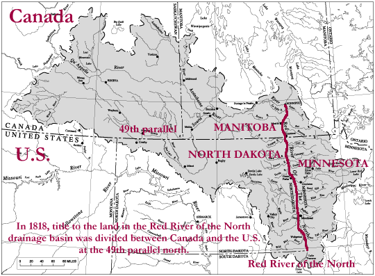
Red-river-basin.png - MECU

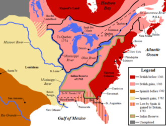
British colonies 1763-76 shepherd1923.jpg - Rursus

Map1775.jpg - Imagewikipedia

Map1776.jpg - Imagewikipedia

Map1781b.jpg - Imagewikipedia

Map1780b.jpg - Imagewikipedia

Map1779b.jpg - Imagewikipedia
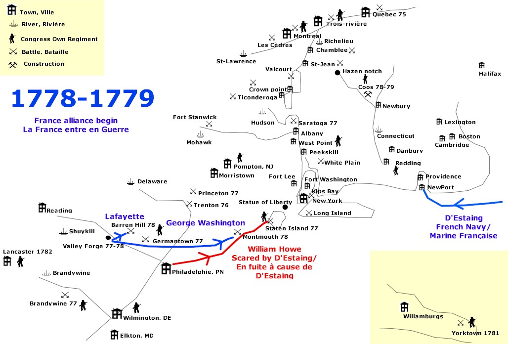
Map1778b.jpg - Imagewikipedia
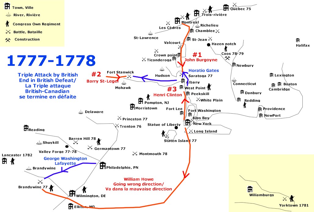
Map1777b.jpg - Imagewikipedia

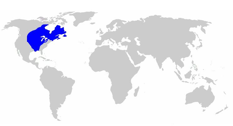
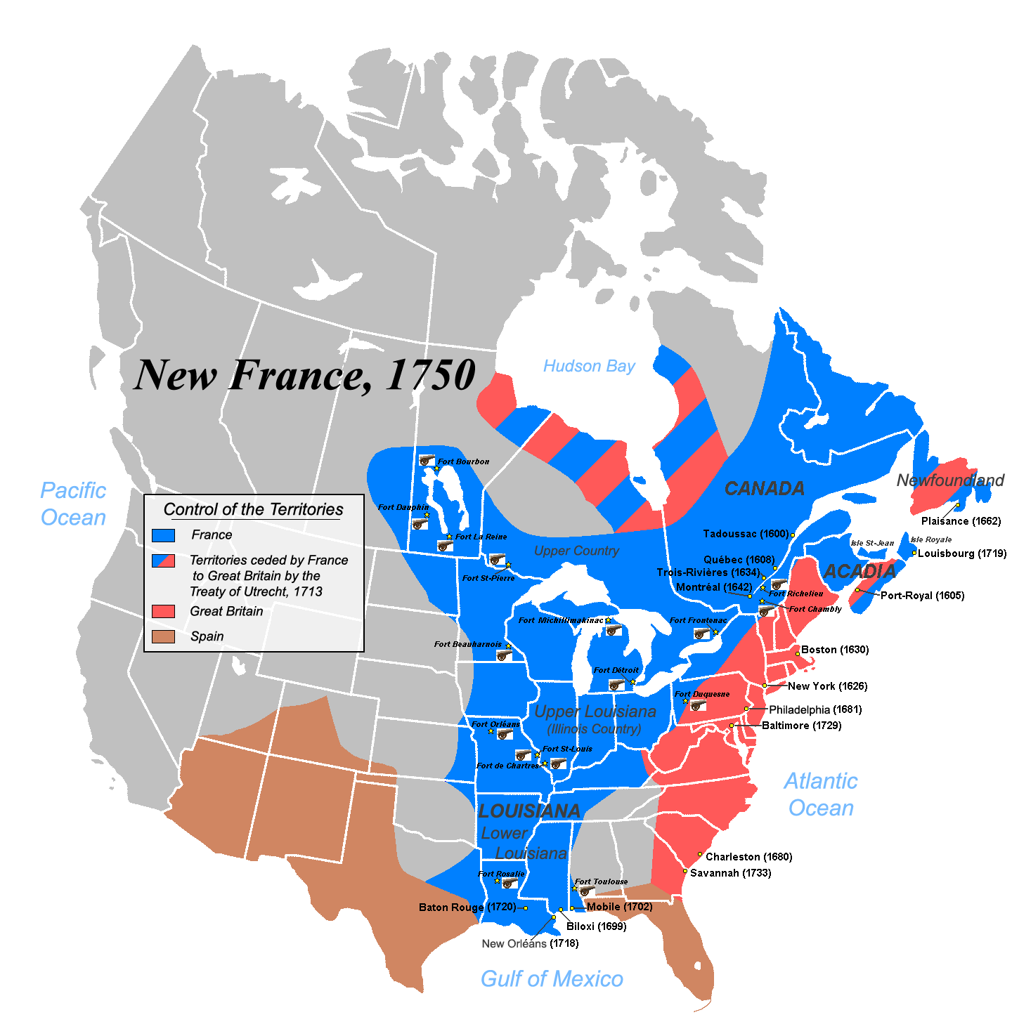
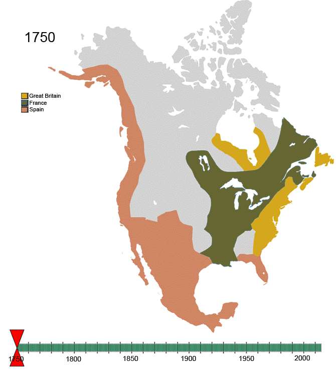
Nouvelle-France1750.jpg - JF Lepage

Nouvelle-France1750.png - JF Lepage

Canada provinces evolution frame.png - Xiong Chiamiov
New-France1750.png - Kmusser

FormerNWTcapitals.png - Poromiami
Canada Provinces Territories 1870.png - Poromiami
Canada Provinces Territories 1905.png - Diannaa

Nouvelle-France map-fr.svg - JoanSMF

Canada-1882.png - SriMesh

Canada-1895.png - SriMesh

Canada provinces evolution de.gif - Golbez

British colonies 1763-76 shepherd1923.PNG - Tm

Nouvelle-France map-en.svg - Tcr25

1926 Canada-Alaska 1903 boundary-map.jpg - File Upload Bot (Magnus Manske)

1926 Canada-Alaska 1903 boundary-map.png - File Upload Bot (Magnus Manske)

1903 Alaska boundary dispute.png - Skeezix1000

Basques Newfoundland.gif - OgreBot

Red River Trails Locator Map cropped.PNG - Mahahahaneapneap

Franklin Last Expedition Map.jpg - Finetooth
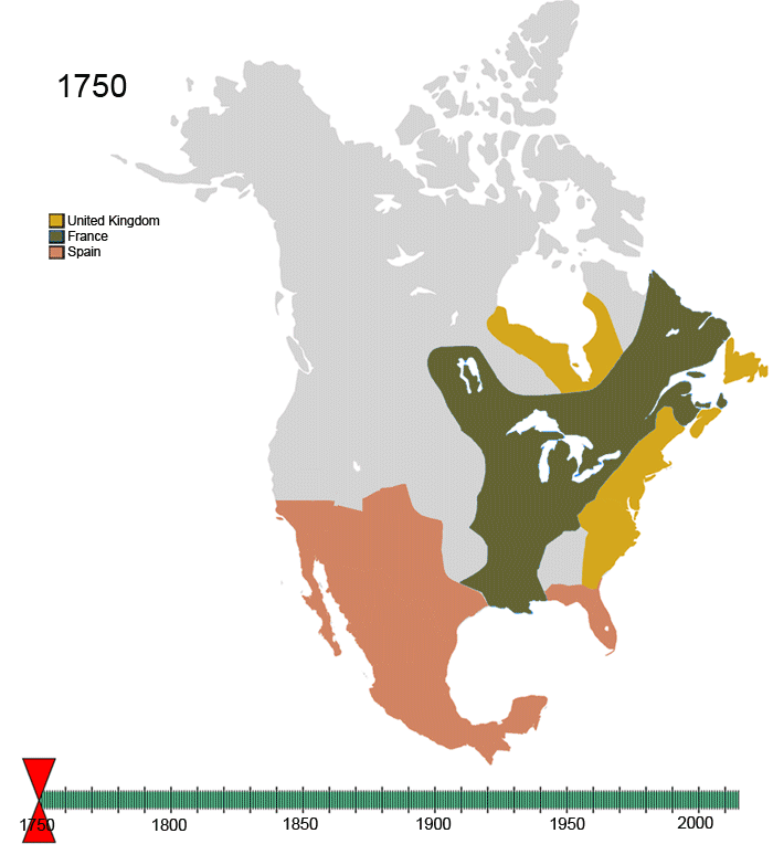
Non-Native American Nations Control over N America 1750-2008.gif - Artemco
Canada Provinces Territories 1949.png - Glacier Wolf

York-Factory-Express.png - Pfly
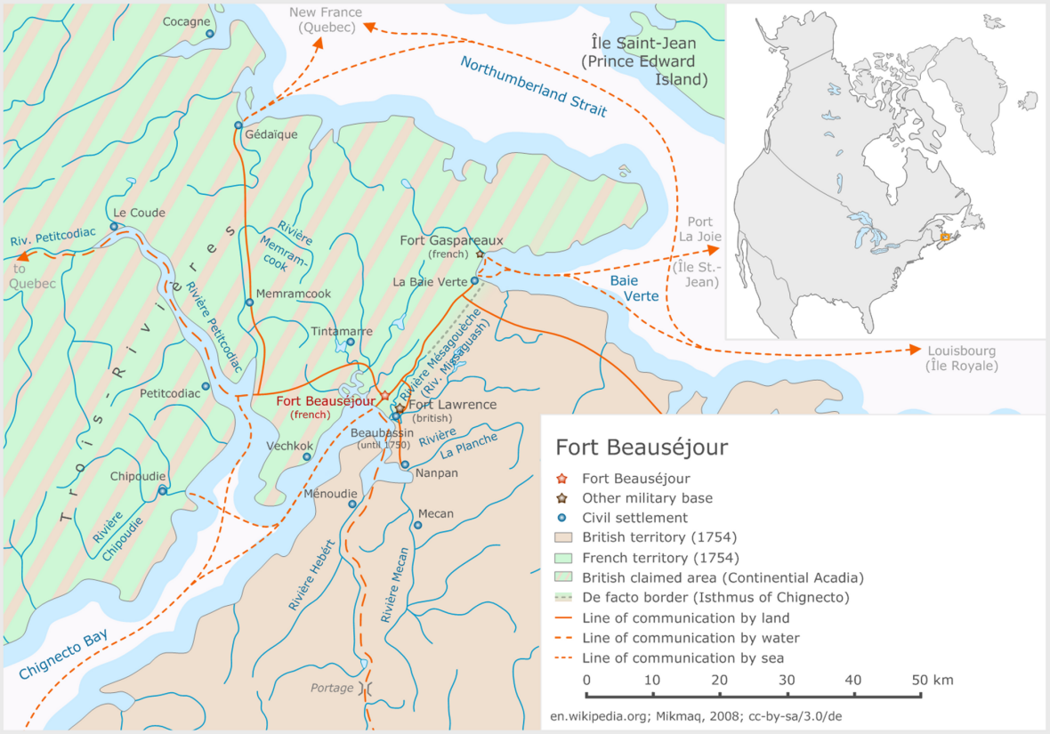
Fort-Beausejour en.png - Mikmaq

Fort-Beausejour fr.png - Mikmaq

Anglo American War 1812 Locations map-fr.svg - Lalpino

Franklin's lost expedition map.png - Like tears in rain

IsleRoyaleAgreement.jpg - CJLippert

N-France.png - Ursutraide

New France.jpg - Aikonido

NorthAmerica1762-83.png - Creysmon07

Nouvelle-France map-fr it.svg - Lusum

Keewatin1876.png - SriMesh
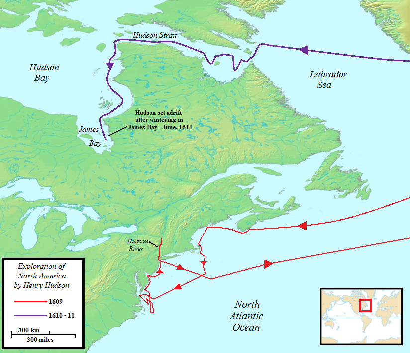
Henry Hudson Map 26.png - AlexiusHoratius~commonswiki

Non-Native American Nations Control over N America 1800.png - Esemono

New France (orthographic projection).svg - Martin23230
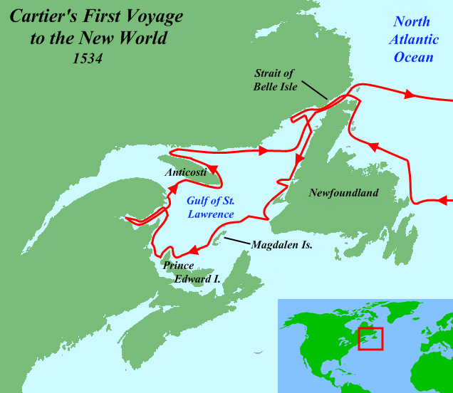
Cartier First Voyage Map 1.png - AlexiusHoratius~commonswiki

Cartier Second Voyage Map 1.png - AlexiusHoratius~commonswiki

A Draught Brought by Two Northern Indians Leaders Calld Meatonabee & Idotlyazee of ye Country to ye Northward of Churchill River 1765 (1969).jpg - Geo Swan

Native Map Seventeen Rivers beyond Churchill 1719 (1969).jpg - Geo Swan
Non-Native-American-Nations-Territorial-Claims-over-NAFTA-countries-1750-2008.gif - Esemono

Non-Native Nations Claim over NAFTA countries 1750.png - Esemono

Non-Native Nations Claim over NAFTA countries 1759.png - Esemono

Non-Native Nations Claim over NAFTA countries 1774.png - Esemono

Non-Native Nations Claim over NAFTA countries 1783.png - Esemono

Non-Native Nations Claim over NAFTA countries 1784.png - Esemono

Non-Native Nations Claim over NAFTA countries 1791.png - Esemono

Non-Native Nations Claim over NAFTA countries 1792.png - Esemono

Non-Native Nations Claim over NAFTA countries 1796.png - Esemono

Non-Native Nations Claim over NAFTA countries 1798.png - Esemono

Non-Native Nations Claim over NAFTA countries 1799.png - Esemono

Non-Native Nations Claim over NAFTA countries 1803.png - Esemono

Non-Native Nations Claim over NAFTA countries 1805.png - Esemono

Non-Native Nations Claim over NAFTA countries 1810.png - Esemono

Non-Native Nations Claim over NAFTA countries 1812.png - Esemono

Non-Native Nations Claim over NAFTA countries 1816.png - Esemono

Non-Native Nations Claim over NAFTA countries 1817.png - Esemono

Non-Native Nations Claim over NAFTA countries 1818.png - Esemono

Non-Native Nations Claim over NAFTA countries 1819.png - Esemono
Non-Native Nations Claim over NAFTA countries 1821.png - Esemono

Non-Native Nations Claim over NAFTA countries 1824.png - Esemono

Non-Native Nations Claim over NAFTA countries 1763.png - Esemono

Non-Native Nations Claim over NAFTA countries 1778.png - Esemono

Non-Native Nations Claim over NAFTA countries 1802.png - Esemono

Non-Native Nations Claim over NAFTA countries 1820.png - Esemono

Non-Native Nations Claim over NAFTA countries 1790.png - Esemono
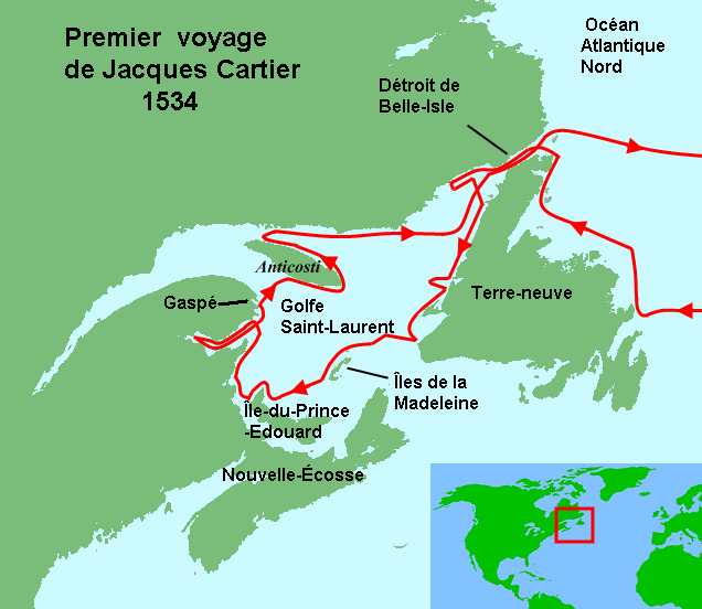
Cartier First Voyage Map 1 fr.png - Pierre cb

Cartier Second Voyage Map 1 fr.png - Pierre cb

Nouvelle-France map-ru.svg - Tcr25
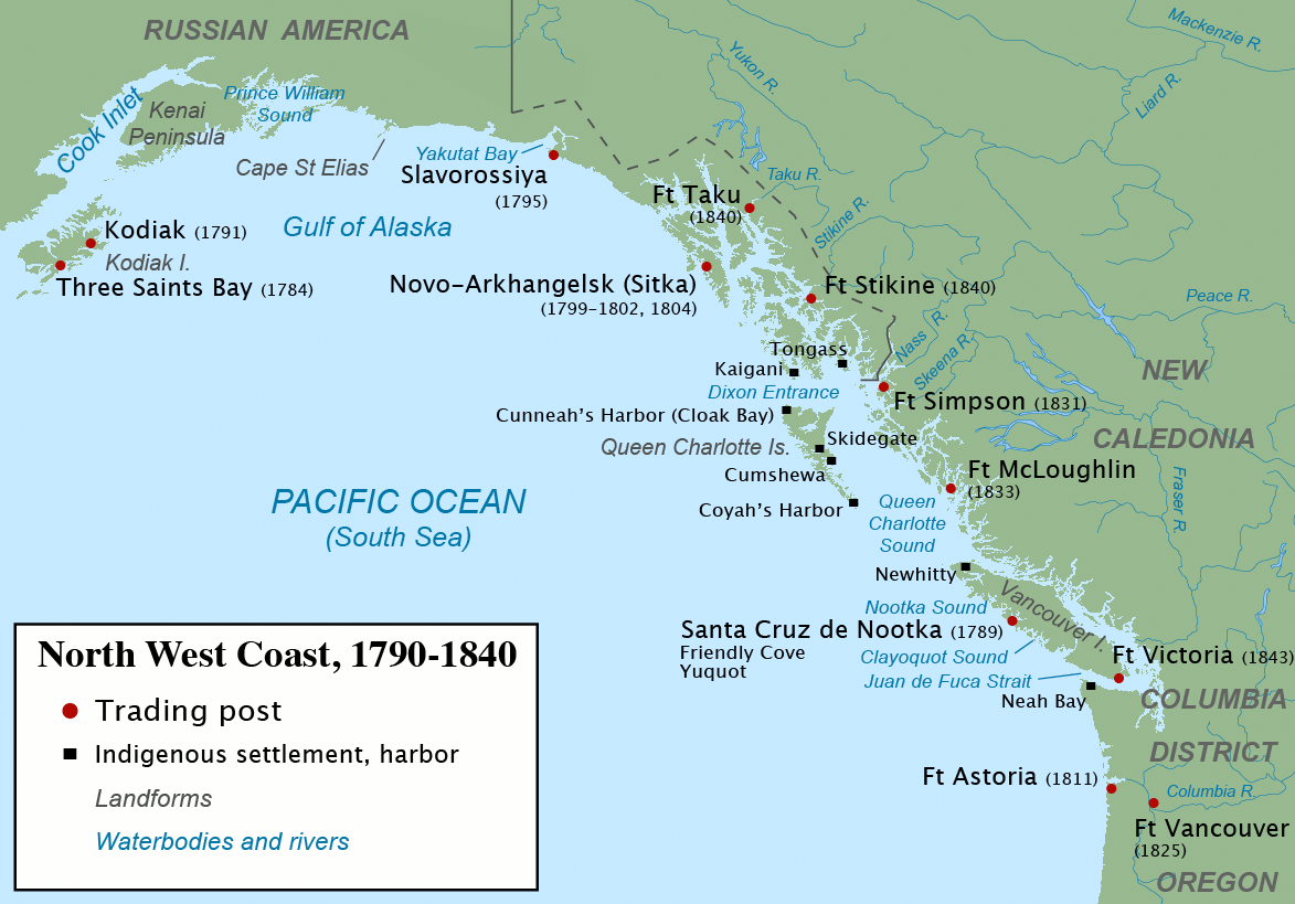
Maritime Fur Trade-NorthWestCoast.png - PawełMM

La Vérendrye Map.jpg - Urdangaray

Canada 1867.svg - Neeters

French possessions in the Americas (1534-1803).png - Victor falk~commonswiki

Klondike Routes Map.svg - Carport

British America.png - Vadac

Anglo American War 1812 Locations map-en.svg - Hunter9502

Treaty Shore of Newfoundland.png - Flappiefh

Numbered-Treaties-Map.svg - Themightyquill
Franklin's lost expedition map ru.png - Dangaard

Canoe River train crash.svg - MissMJ

Anglo American War 1812 Locations map-en he.svg - Amirki

Nouvelle-France map-he.svg - Tcr25

Montreal GareCentrale NouvelleLigneThornton.gif - MTLskyline

Neufrankreich.svg - Tcr25

NouvelleFrance-Vraie-Version.png - Hypersite

Route of the Expedition from Isle a la Crosse to Fort Providence in 1819 & 20 (1823).jpg - Kayoty

Anglo American War 1812 Locations map-es.svg - Rowanwindwhistler
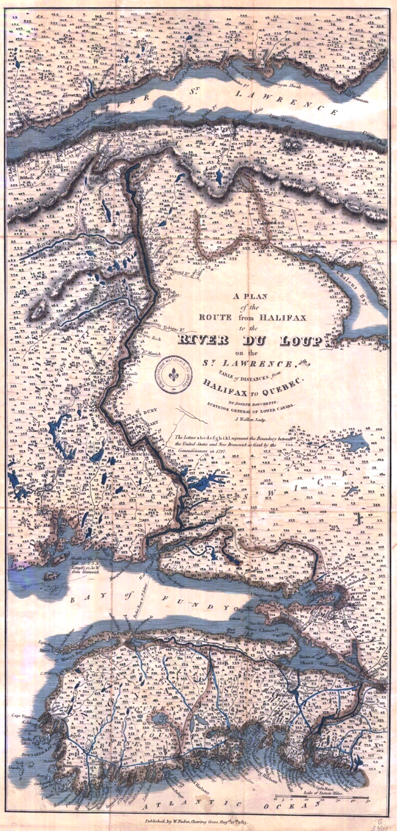
A Plan of the route from Halifax to River du Loup on the St. Lawrence.png - Jeangagnon

Nouvelle-France map-sr.svg - BokicaK

De Mi'kmaq.png - Mikmaq
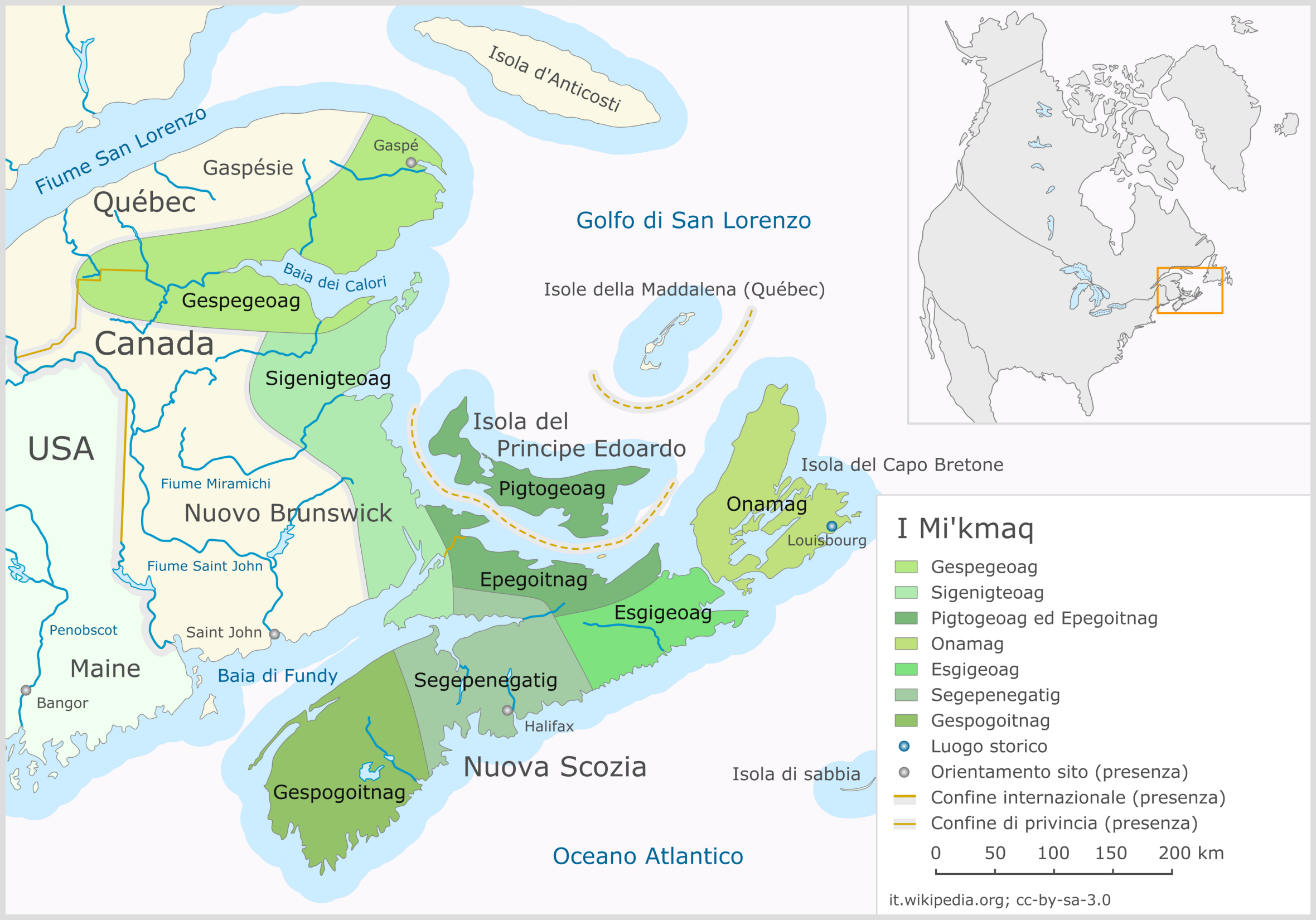
I Mi'kmaq.png - Mikmaq

(1860) Map of the probable routes taken by HMS Erebus and HMS Terror during Franklin's lost expedition & results of McClintock's Arctic Expedition.jpg - Metilsteiner
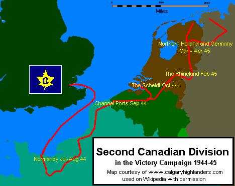
2ndcdndivwwiieurmap.gif - EChastain

Huronie.JPG - Donnacona
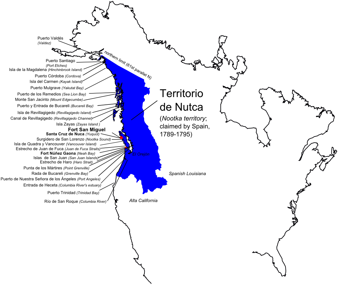
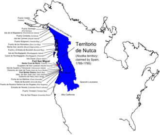
NutcaEN.png - Nagihuin

Republic of Canada 1837.svg - Elevatorrailfan

Carte de la Baye de Hudson, pour servir a l'histoire général des voyages (14457952933).jpg - Fæ

Carte de la partie intérieure de l'Amérique Septentrionale ou est démontrée la très grande probabilité d'une navigation intérieure depuis la Baye d'Hudson jusqu'à la côte Nord-Ouest (14251160420).jpg - Fæ

British possessions in North America (14166789160).jpg - Fæ

British possessions in North America (14236338202).jpg - Fæ

British North America (14168300682).jpg - Fæ

Carte des parties nord et ouest de l'Amérique dressée d'apres les relations les plus authentiques (13903437950).jpg - Fæ

British North America (14017027783).jpg - Fæ

British colonies in North America (13997468724).jpg - Fæ

British colonies, in North America from the best authorities (14017028493).jpg - Fæ

British North America (13407301623).jpg - Fæ

British possessions in America (13407180395).jpg - Fæ
British dominions, in North America (13149900243).jpg - Fæ

Carte des parties nord et ouest de l'Amérique dressée d'apres les relations les plus authentiques (13150064744).jpg - Fæ

British North America (13149900843).jpg - Fæ

An exact chart of the river St. Laurence, from Fort Frontenac to the Island of Anticosti shewing the soundings, rocks, shoals &c with views of the lands and all necessary instructions for navigating (13149899733).jpg - Fæ

British North America (12973239563).jpg - Fæ

Britisches Nord-America (12796647275).jpg - Fæ

British possessions in North America (12797057864).jpg - Fæ

Modern and contemporary European history (1815-1921) (1922) (14597706830).jpg - SteinsplitterBot

Nouvelle-France map-es.svg - Tcr25

Alaska boundary dispute.jpg - AnonMoos

A memoir of Jacques Cartier, sieur de Limoilou - his voyages to the St. Lawrence. A bibliography and a facsimile of the manuscript of 1534, with annotations, etc. (1906) (14744152146).jpg - Fæ
Count Frontenac and New France under Louis XIV BHL21318159.jpg - Fæ

Riviere de St Laurens depuys Montreal jusqu a Tadoussac - 1641.jpg - Jeangagnon

Carte du Lac Ontario et de la Riviere jusques au dela de L Isle de Montreal celle de Niagara et partie du Lac Erie.JPEG - Jeangagnon
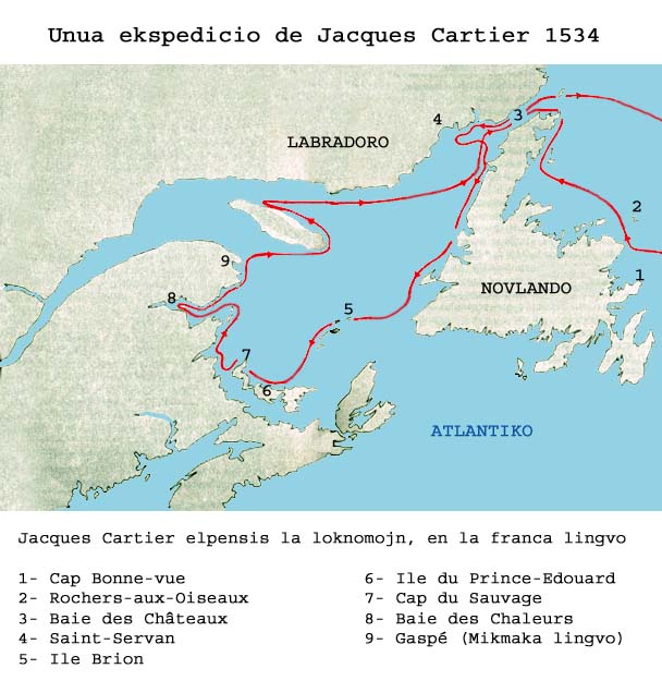
1voyageJacquesCartier.jpg - NMaia

Vinland-travel-hy.jpg - Հայկ Ափրիկյան

Battle of Chippawa.gif - Muhranoff

180 of 'The History of Canada' (11195602836).jpg - FlickreviewR 2

20 of 'Count Frontenac and New France under Louis XIV. ... Fourteenth edition' (11179455774).jpg - Artix Kreiger 2

20 of 'The Old Régime in Canada (1653-1763) ... Fourteenth edition' (11181188004).jpg - Artix Kreiger 2

Les Micmacs (multilingual).svg - NordNordWest
Arctic cultures 900-1500 (no caption).png - Jay D. Easy
Non-Native Nations Claim over NAFTA countries 1790 (cropped).png - SelfieCity

NBC Networks Feb 1933.jpg - Munion

Map of the Toronto Carrying Place (1619-1793), which was the portage route from the Holland Marsh to Lake Ontario.jpeg - Geo Swan

Ontario Métis Community Councils map.jpg - Aheath096

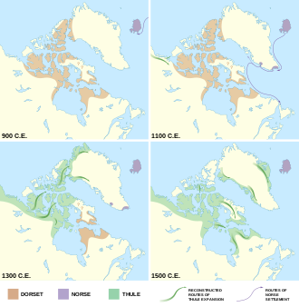
Dorset, Norse, and Thule cultures 900-1500.svg - Ytteroy

Dorset, Norse, and Thule cultures 900-1500 (vertical)-01.svg - Noahedits
Shepherd - The British colonies in North America, 1763-1775 in Historical Atlas, 1911.xcf - Ambre Troizat

Peninsule acadienne (multilingue).svg - Mikmaq

Jaques-cartier-1-bidaia-eus.svg - Batix Ezeiza

Jaques-cartier-2-bidaia-eus.svg - Batix Ezeiza

The North-West Territory shewing British Columbia, Vancouver Island, Red River and Saskatchewan Settlements, for the Canadian Almanac 1870 CTASC.jpg - Kcohenp

Partie de l'Amérique septent? qui comprend la Nouvelle France ou le Canada CTASC.jpg - Kcohenp

Map of Eastern Canada.jpg - Zoozaz1

Carte Guerre de 7 ans Amérique du nord2.PNG - ויקי4800

Arctic cultures 900-1500 (square).png - Premeditated Chaos

Western Canadian Province Proposals.png - AristarchusValen

Nouvelle-France map-zh-hans.svg - Buernia

Nouvelle-France map-ar.svg - Tcr25

NorthAmerica1762-83-ar.png - باسم

Carte de la baie des Chaleurs a la cote Occidentale du golfe de St. Laurent.jpg - Jeangagnon

Can high arctic relocation from Port Harrison and PondInlet.svg - Kikos
Wabanaki Confederacy (Anglicised Names).png - Grug-Jack

Wabanaki Confederacy (Native Names).png - Grug-Jack

Nouvelle-France map-ca.svg - Manlleus

Anglo American War 1812 Locations map-ar.svg - Sgh45

L'Anse aux Meadows National Historic Site - features map with labels - 2025.svg - Beneathtimp

L'Anse aux Meadows National Historic Site - features map without labels - 2025.svg - Beneathtimp

Heawood 1912 363 Mackenzie.jpg - Kognos