Wikimedi'Òc
Modes d'emploi

Cet album fait partie des albums
Cet album photos contient les sous-albums suivants :


Great Britain template.png - Ningyou

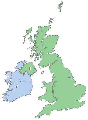
British Isles - UK & Ireland.png - AnonMoos
LAndsEndJohnoGroats.png - Kicior99

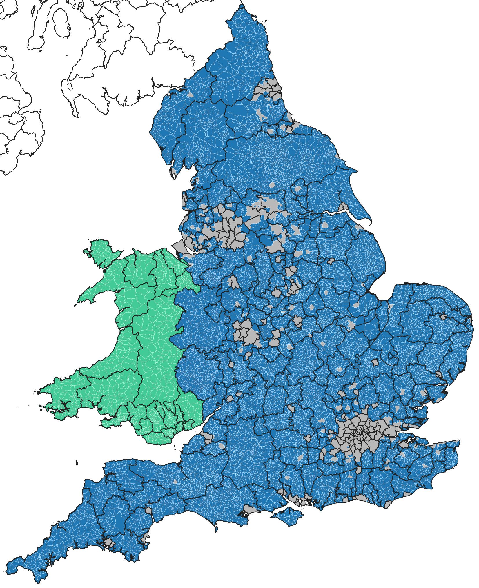
Map of the administrative geography of the United Kingdom.png - NordNordWest

Map of the administrative geography of the British Isles.jpg - Chumwa

Map of the administrative geography of the British Isles with postcode areas.jpg - Chumwa

NationsConstitutivesRU.png - Darkbowser

PoliceBTP.PNG - Addihockey10
Uk parishes.png - Mirrorme22

Northern England in England.png - Adam Dent

Northern England.svg - Glrx

Northern England-Historic counties.svg - Inops

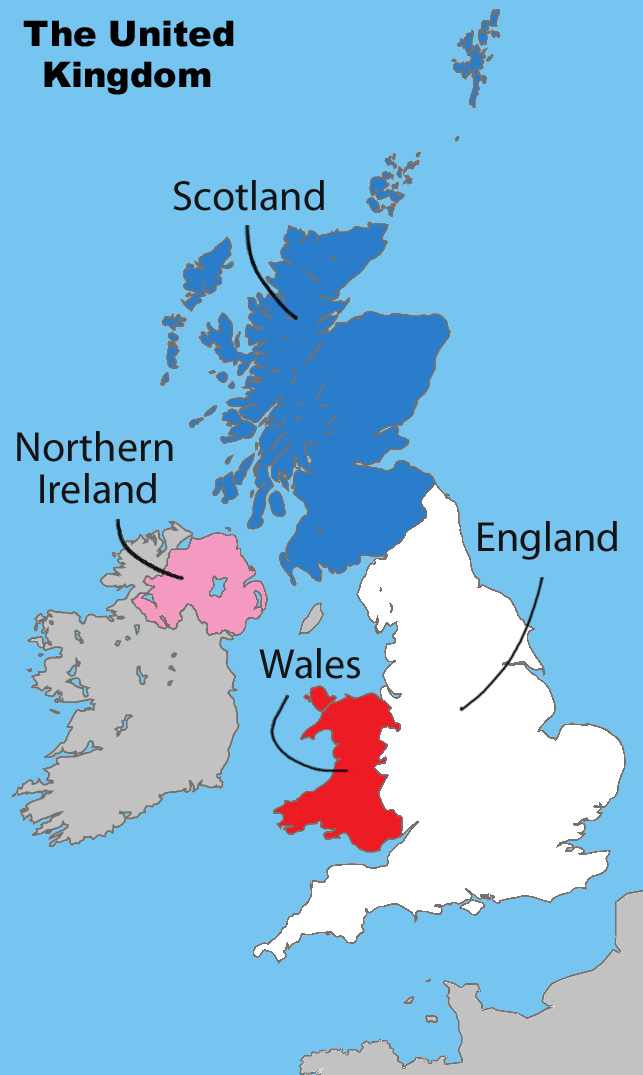
United Kingdom labelled map1.png - Matt Lewis

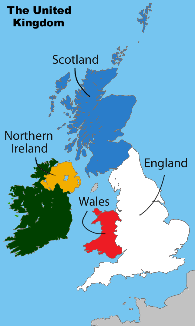
United Kingdom labelled map2.png - Matt Lewis

United Kingdom labelled map3.png - Matt Lewis

United Kingdom labelled map4.png - Matt Lewis
United Kingdom labelled map5.png - Matt Lewis

United Kingdom labelled map6.png - Matt Lewis

United Kingdom labelled map8.png - Padijow

United Kingdom labelled map11.png - Evertype

United Kingdom labelled map12.png - Evertype
United Kingdom labelled map13.png - Evertype

United Kingdom labelled map15.png - Evertype

United Kingdom labelled map16.png - Evertype

United Kingdom labelled map14.png - Evertype

Island-of-Ireland2.PNG - Matt Lewis

Island-of-Ireland5.PNG - Matt Lewis