Wikimedi'Òc
Modes d'emploi

Cet album fait partie des albums
Cet album photos contient les sous-albums suivants :


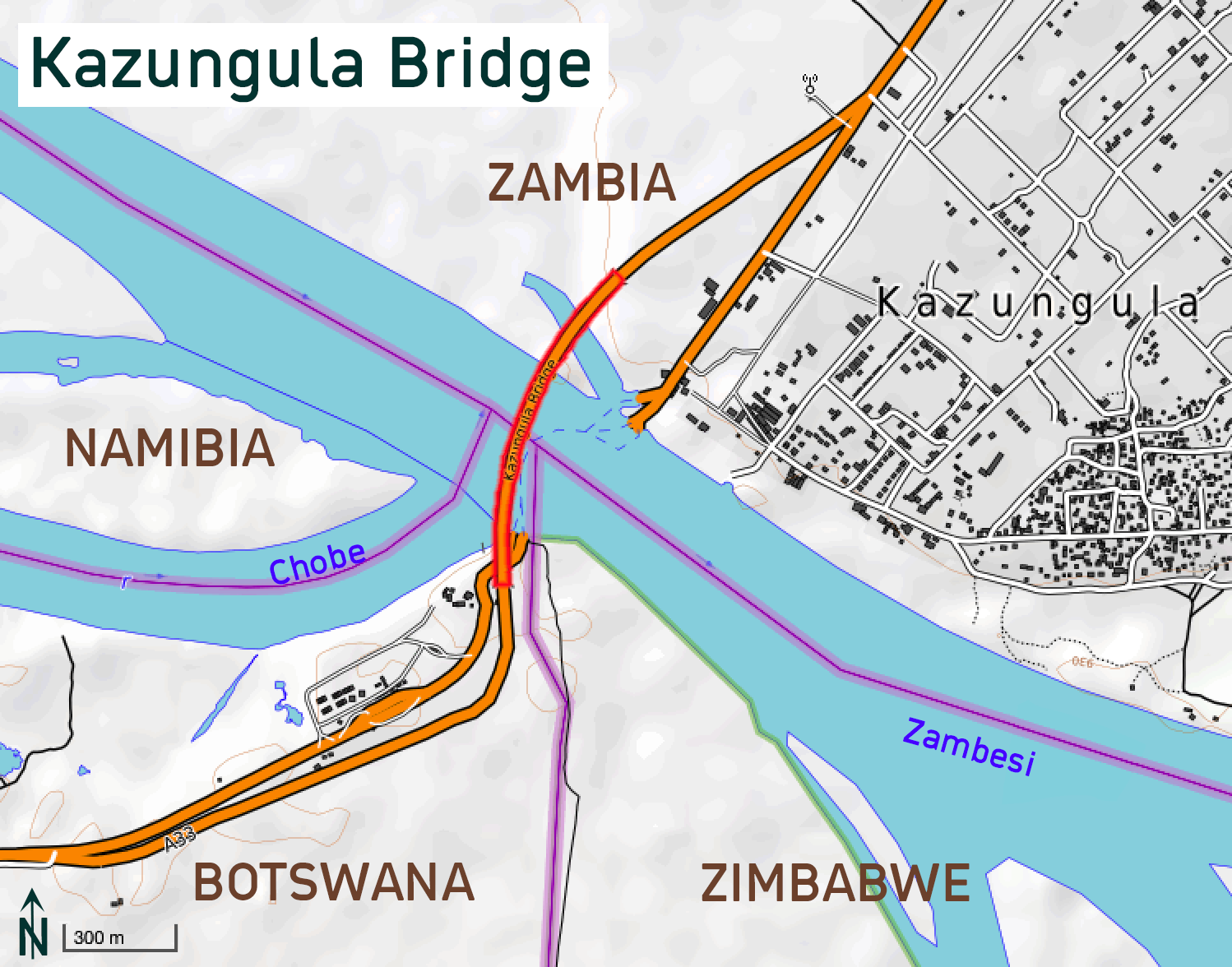
Kazungula Bridge Map.png - Albinfo
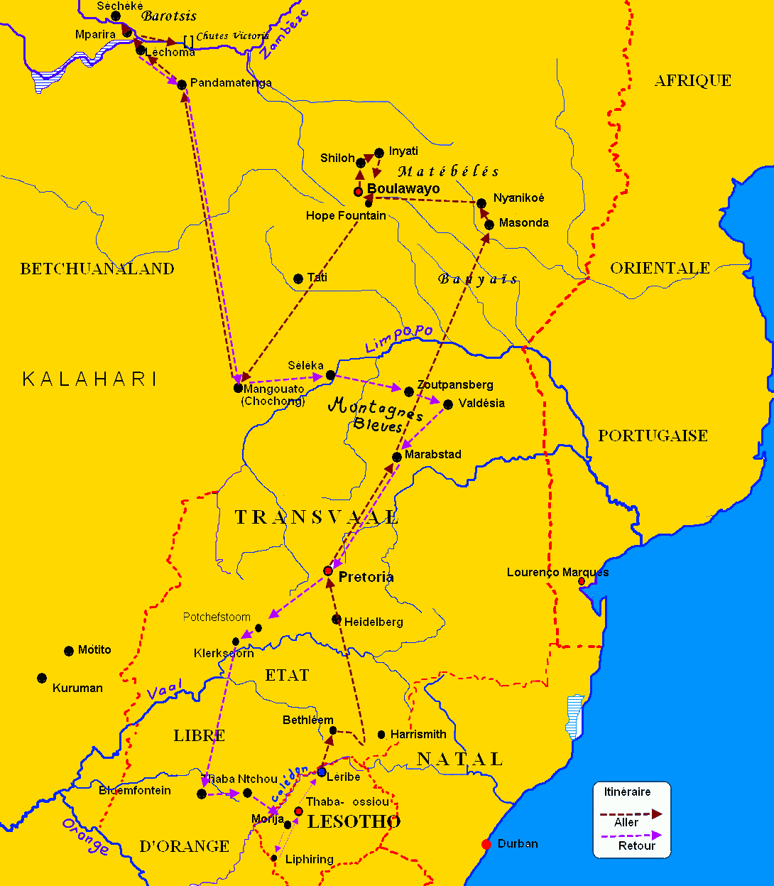
Voyage exploratoire de François Coillard.gif - Bertrand99

Le Barotseland.jpg - Bertrand99

Old Portuguese map of SA 549.JPG - Discott

Zambezi.svg - Hel-hama

Zambezi-es.svg - Rowanwindwhistler

Annual report of the Board of Regents of the Smithsonian Institution (1905) (17813658534).jpg - Fæ

Africa Zambezi Location Map.svg - MellonDor

Africa Zambezi Relief Location Map.jpg - MellonDor

In remotest Barotseland; being an account of a journey of over 8,000 miles through the wildest and remotest parts of Lewanika's empire (1904) (14781348201).jpg - Fæ

The Castle Line atlas of South Africa - a series of 16 plates, printed in colour, containing 30 maps and diagrams, with an account of the geograaphical features , the climate, the mineral and other (14765771302).jpg - Fæ

19 of 'Conférences et lettres de P. Savorgnan de Brazza sur ses trois explorations dans l'Ouest africain, de 1875 à 1886. Ouvrage illustré de deux eaux-fortes, etc. (Texte publié et coordonné par N. Ney.)' (11191335745).jpg - FlickreviewR 2
110 of 'How I crossed Africa- from the Atlantic to the Indian Ocean ... Translated from the author's manuscript by A. Elwes ... Containing ... maps and ... illustrations' (11082032335).jpg - Artix Kreiger 2
111 of 'How I crossed Africa- from the Atlantic to the Indian Ocean ... Translated from the author's manuscript by A. Elwes ... Containing ... maps and ... illustrations' (11080723244).jpg - Artix Kreiger 2

Victoria Falls National Park marker.jpg - Pi3.124

Cataratas Victoria 26.jpg - LBM1948

Zambezi Slope.svg - Peter in s

Admiralty Chart No 648 Africa east coast Delagoa Bay to River Zambezi, Published 1886.jpg - Kognos

Upper Zambezi OSM.png - Peter in s

EB1911 Victoria Falls.jpg - Bob Burkhardt

Zambèze entre Téte et Kaborabassa - btv1b84413527.jpg - Gzen92Bot

Sketch Map of Mr. Baines' Routes Between the Limpopo and Zambesi Rivers - DPLA - f3a7046828d5e5e62592afe44a1725c7.jpg - DPLA bot