Wikimedi'Òc
Modes d'emploi

Cet album fait partie des albums
Cet album photos contient les sous-albums suivants :


Anchorage Alaska 1943.jpg - Marsonmars
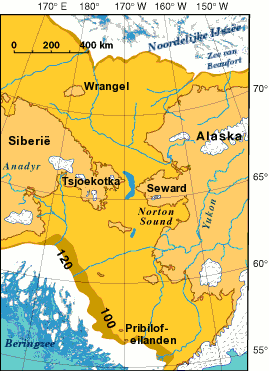
Beringia - present day.png - RokerHRO

Alaska population density 2020.png - Crossover1370

Alaska-fhwa-map.jpg - Adam~commonswiki

Alaska administrative units rus.jpg - Dbenbenn

Alaska 90.jpg - Flominator

PribilofIslands.jpg - Nordelch
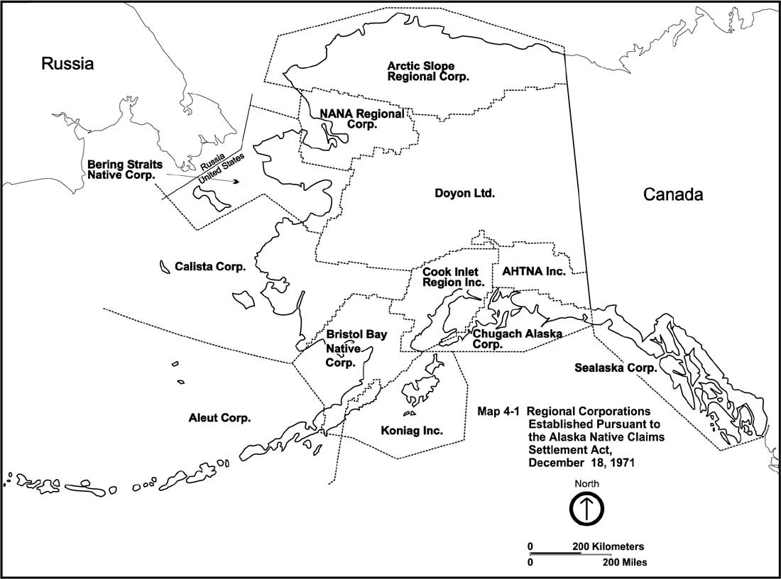
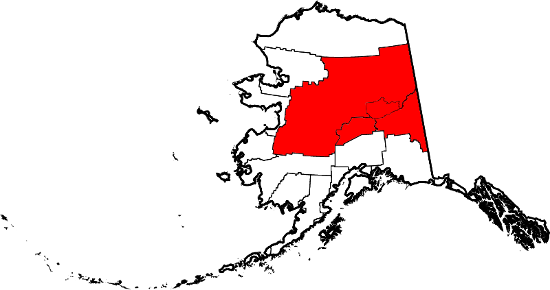
ANCSA Regional Corporations Map.jpg - FreplySpang

ALASKAcolshade.jpg - Maksim
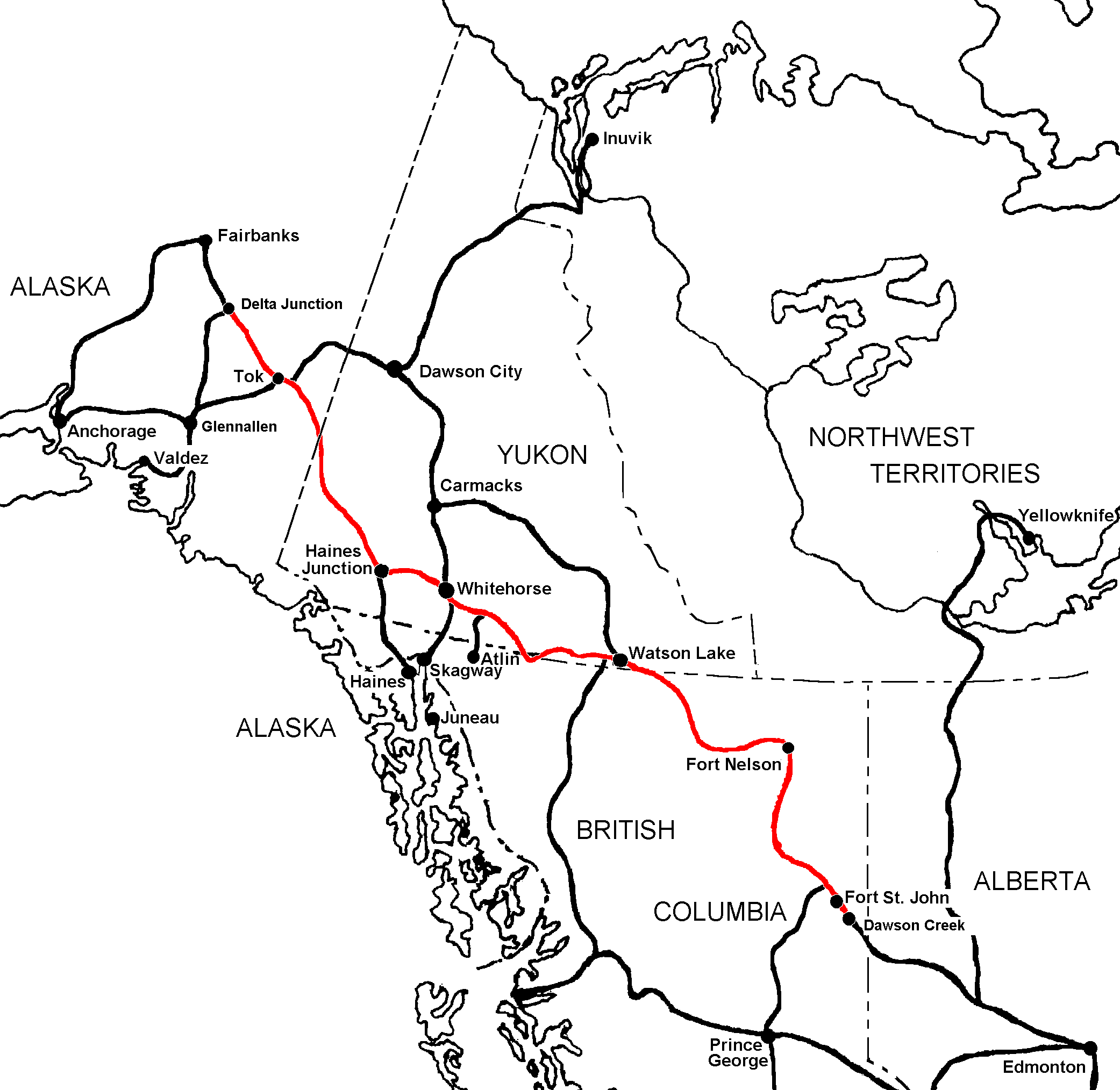
Alaska Highway1.png - Luigizanasi

Valdez BlighReef.jpeg - Clipper

West Coast of North America satellite orthographic.jpg - NorCalHistory
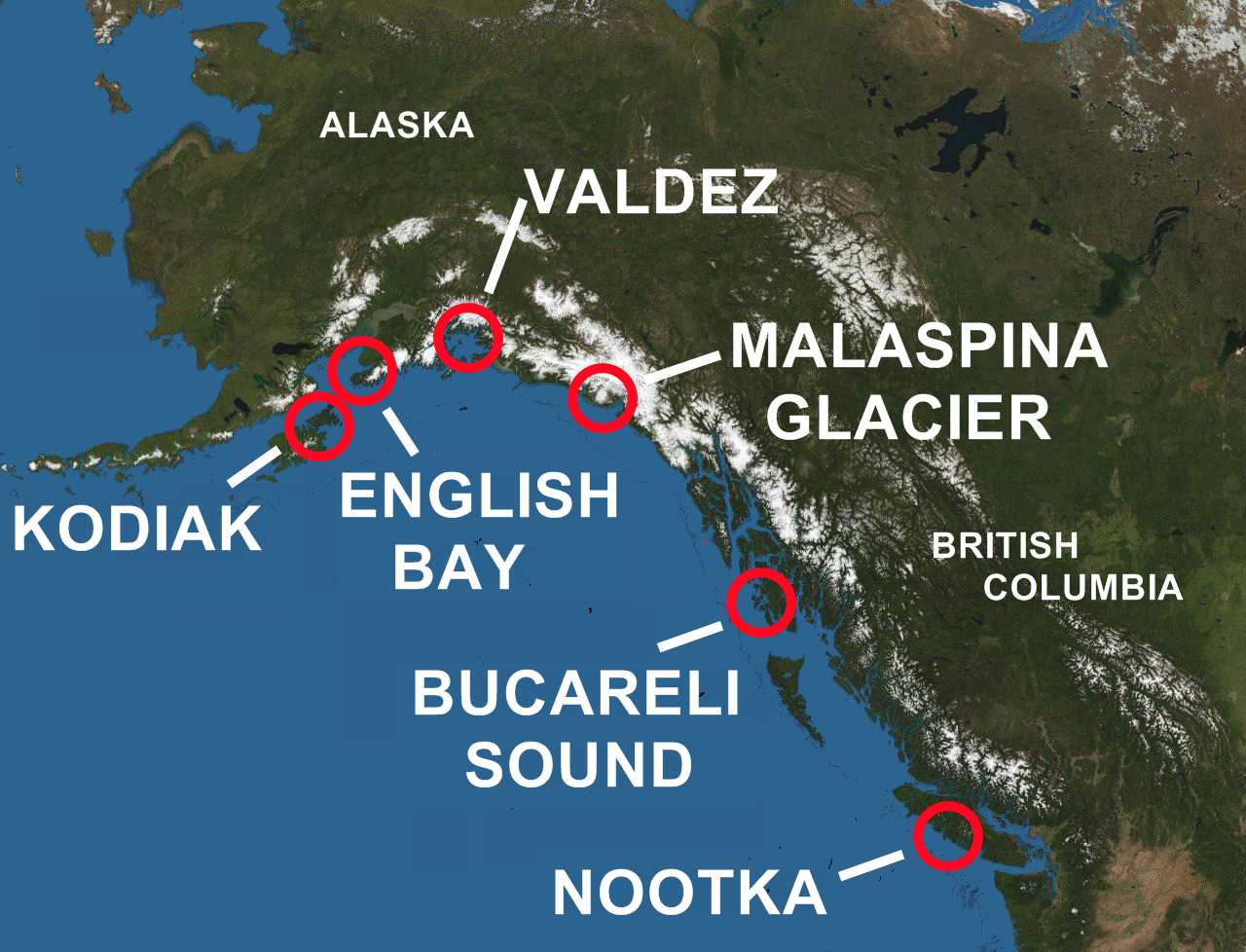
Spanish contact in BC and Alaska.jpg - NorCalHistory
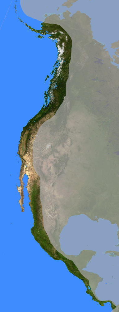
West Coast of North America satellite orthographic.png - NorCalHistory
Blueak.png - Patricknoddy~commonswiki

Gulfofalaskamap.png - McZusatz
Map of Alaska, southwest.gif - Aconcagua

Map of Alaska, wrangell area.gif - Aconcagua

Map of Alaska, interior.gif - Aconcagua

Map of Alaska, northern.gif - Aconcagua

Alaska overlaid on US.gif - DieBuche

Gray alaska.png - Calliopejen
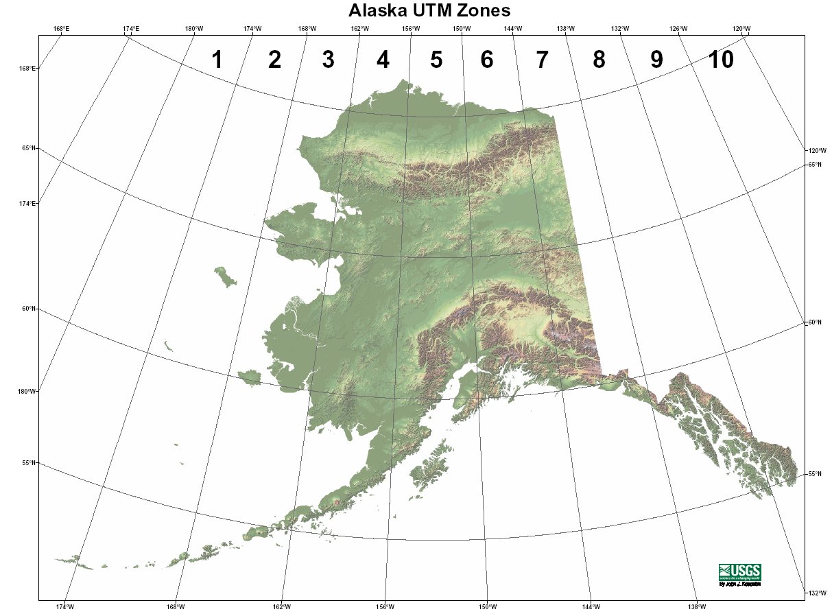
UTM Zones AK.jpg - Aconcagua

Locmap-QCS-Hecate-Dixon.png - Pfly

Kasegaluk Lagoon location map.png - Mohonu~commonswiki
NPRA F1lg.gif - Work permit
Interior Alaska Stub.png - L'Aquatique

Alaska wind resource 50m 800.jpg - Teratornis

Rampart Dam site.jpg - JKBrooks85

Alaska iditarod route.png - EncMstr
Alaska(clear).JPG - Fredy.00
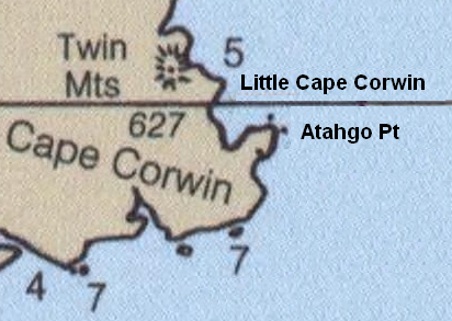
Cape Corwin.PNG - Dankarl

Etolin Strait.PNG - Dankarl
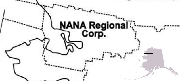
NANA Region.jpg - Thester11
Beringlandbrug - eind Weichselien.png - BotMultichill
Aian ak.pdf - Smallman12q

Txu-pclmaps-topo-us-ketchikan-1954.jpg - Ratzer

PSM V35 D171 Map of southeastern alaska.jpg - Ineuw

800x598-Carte-Alaska-R.jpg - Wikisoft*

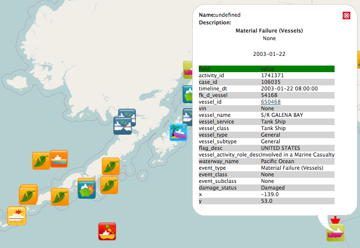
ASC Ports of Call.PNG - File Upload Bot (Magnus Manske)
Misle-ak-osm.png - Goatbar
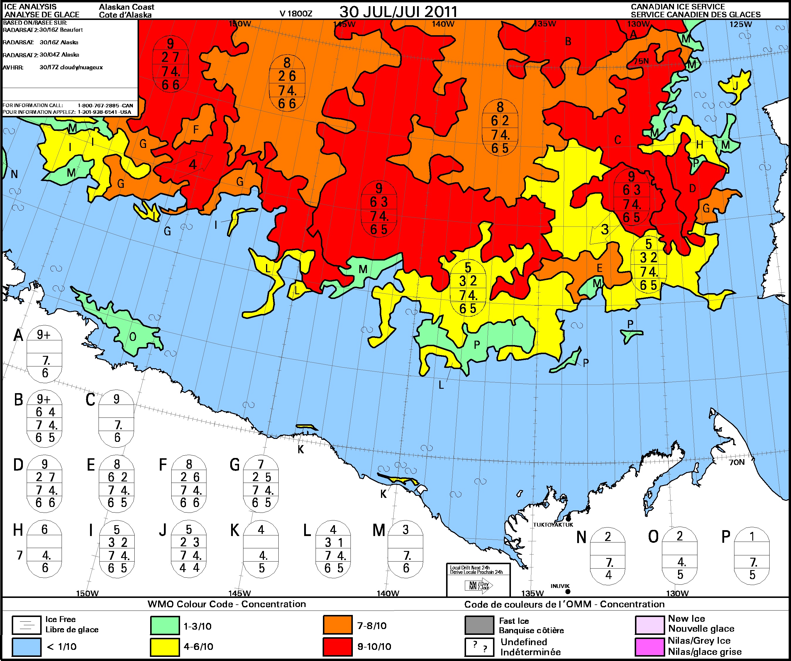
Carte d'analyse des glaces.jpg - BluesyPete

Portal d'Alaska.png - JaumeBG

Alaska Regions identifier map.png - Dankarl

AKeiamap.jpg - Dankarl
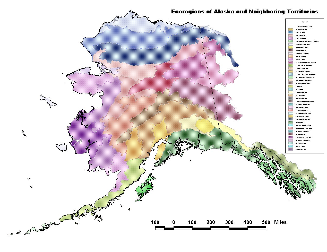
Akecoregions.jpg - Dankarl

Alaska land resources 2002.PNG - Dankarl
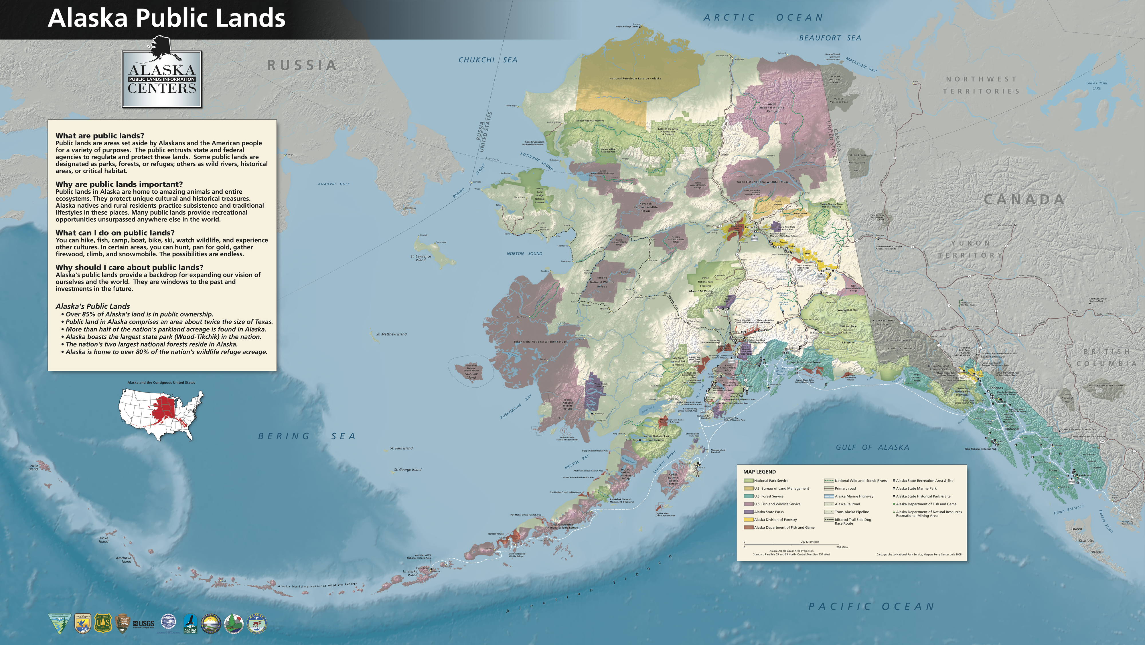
Alaska Public Lands Map4000x2255.png - Dankarl

USBLM meridian map Alaska.jpg - OgreBot
Alaska compared to the United States Map.png - DrRandomFactor

Alaska map over US map.jpg - RadioKAOS
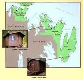
Afognak Map.jpg - RangerRichard

Afogcabinmap.jpg - RangerRichard

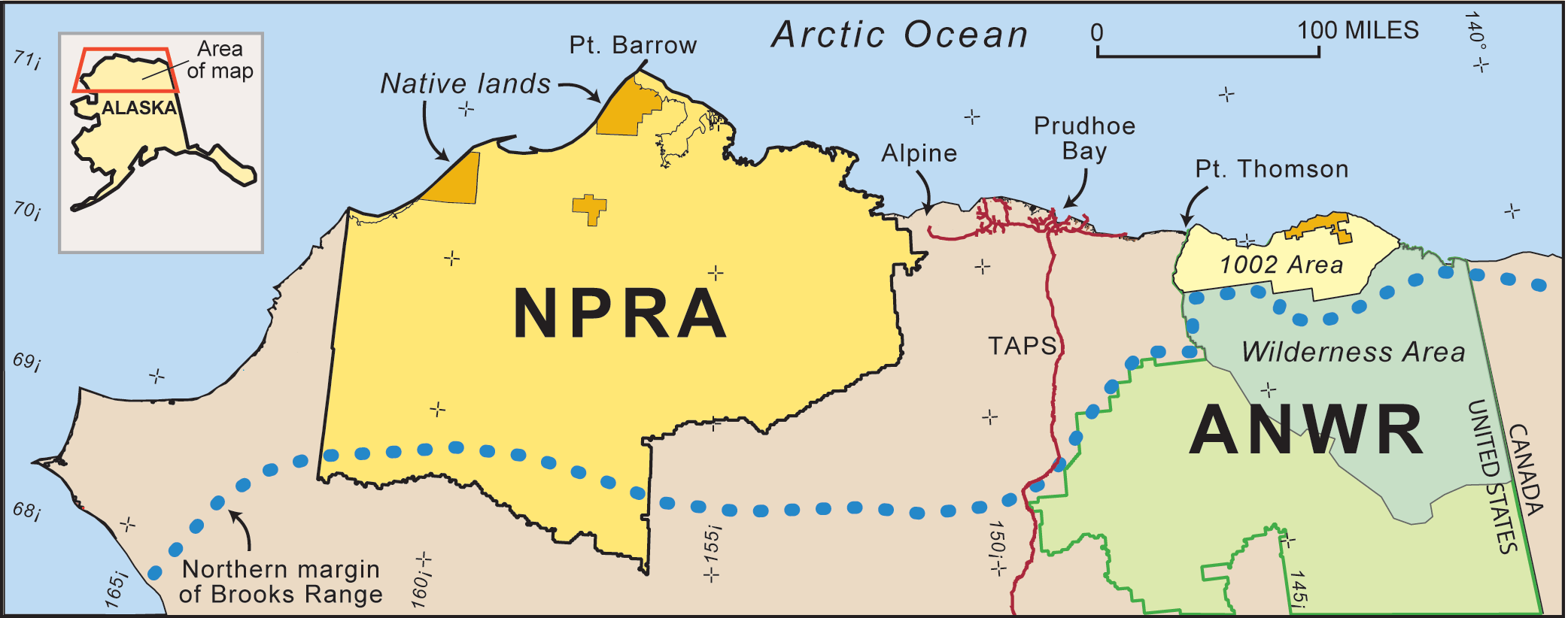
Special Areas within the NPR-A.jpg - Jytdog
Map ShantatilikCreekFire Information 071209 1400.jpg - File Upload Bot (Magnus Manske)

AK - Trooper Detachment Map.jpg - Addihockey10

AlaskaLogo.png - GifTagger
Maritime Fur Trade-NorthWestCoast ru.png - Dante1717mx

Drift River Terminal Facility.jpg - Diannaa

Operational Navigation Chart C-8, 2nd edition.jpg - Revent

Operational Navigation Chart C-9, 6th edition.jpg - Revent

Map of Northern District, Alaska 1880-1900 01.png - TorbjørnS

Map of Southern District, Alaska 1880-1900 02.png - TorbjørnS

Operational Navigation chart D-10, 4th edition.jpg - Revent

Operational Navigation Chart D-11, 5th edition.jpg - Revent

Operational Navigation Chart D-12, 6th edition.jpg - Revent
SW Alaska slope map.png - PawełS

NW Alaska slope map.png - PawełS

Iditarod HQ at the Millenium Hotel in Anchorage (8538136228).jpg - Harmonia Amanda

North Slope Oil Fields.jpg - Hvanwy1

In the Alaskan wilderness (1917) (14754444306).jpg - Fæ

Report of the committee appointed by the B.C. Board of Trade to enquire into the resources and trading prospects of the Yukon (microform) (1896) (20590932326).jpg - Fæ
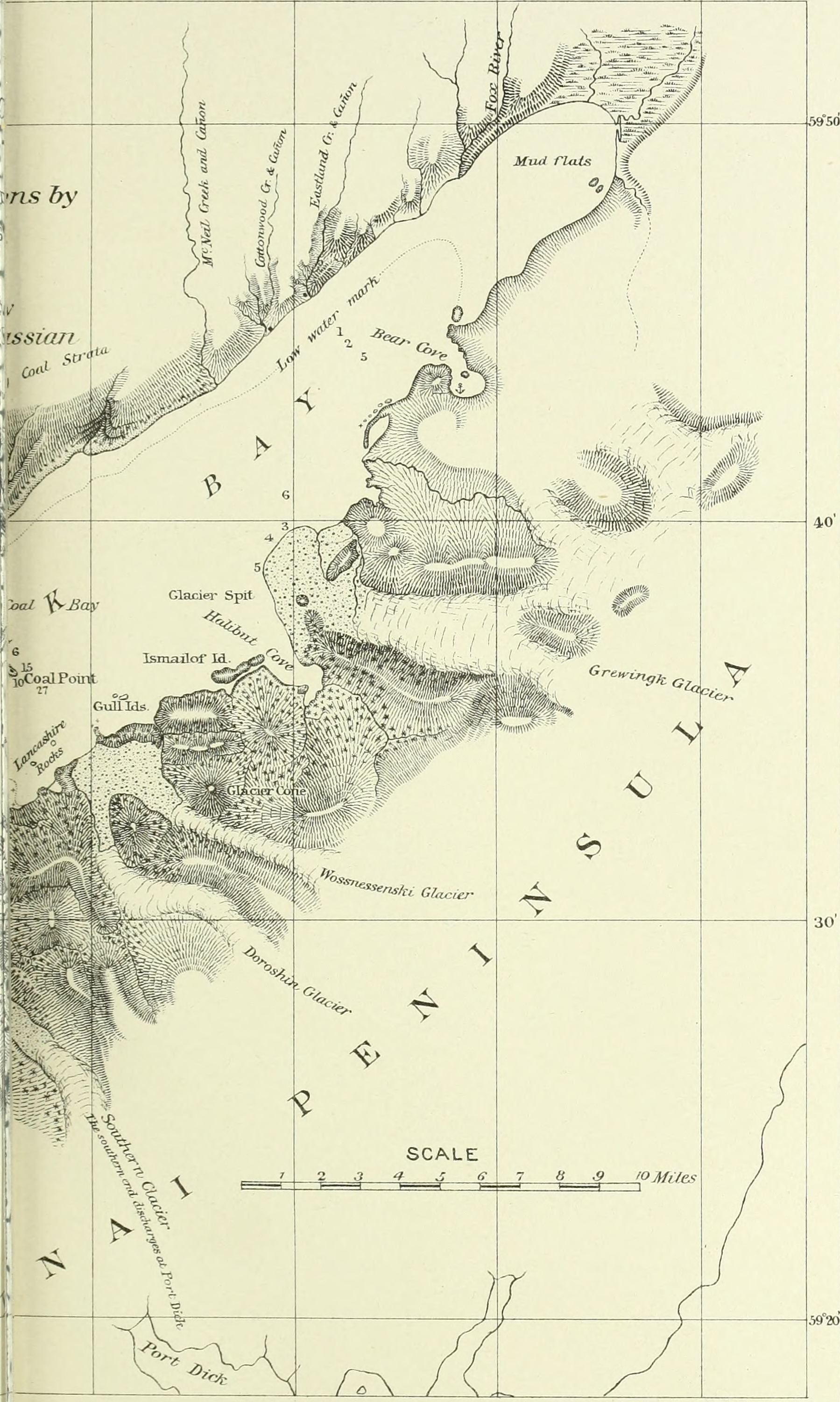
Annual report of the United States Geological Survey to the Secretary of the Interior (1895) (14594838438).jpg - Fæ

The Encyclopædia britannica; a dictionary of arts, sciences, literature and general information (1910) (14788669093).jpg - SteinsplitterBot

In the Alaskan wilderness (1917) (14754440426).jpg - Fæ

Reports of the Department of the Interior for the Fiscal Year ended June 30, 1909 (1910) (14763940522).jpg - Fæ

Atlas and zoogeography of common fishes in the Bering Sea and Northeastern Pacific - M. James Allen, Gary B. Smith (1988) (20336260802).jpg - Fæ

Atlas and zoogeography of common fishes in the Bering Sea and Northeastern Pacific - M. James Allen, Gary B. Smith (1988) (20344955825).jpg - Fæ

Atlas and zoogeography of common fishes in the Bering Sea and Northeastern Pacific - M. James Allen, Gary B. Smith (1988) (19724027983).jpg - Fæ

Atlas and zoogeography of common fishes in the Bering Sea and Northeastern Pacific - M. James Allen, Gary B. Smith (1988) (20344760155).jpg - Fæ

Atlas and zoogeography of common fishes in the Bering Sea and Northeastern Pacific - M. James Allen, Gary B. Smith (1988) (20156942770).jpg - Fæ
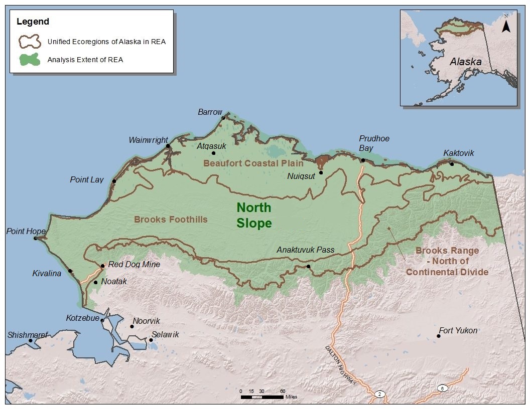
North Slope Ecoregions.jpg - Mario1952

Bering Strait depth.gif - FastilyClone

Map-alaskatsunami.jpg - Lepelaar

AK-patotenilo.png - NMaia

KantishnaGeologicMap.png - Pi3.124
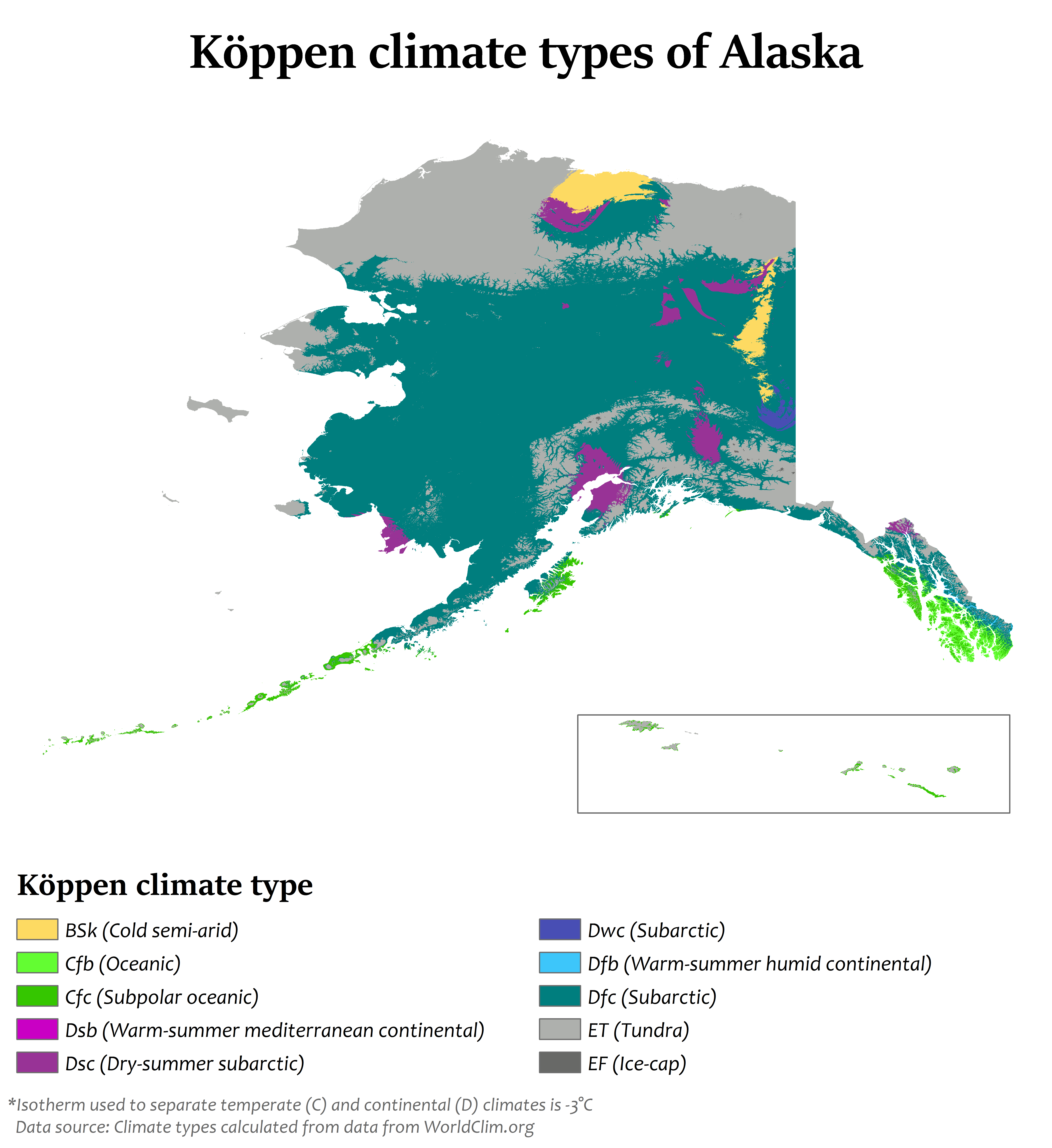
Alaska Köppen.png - Redtitan
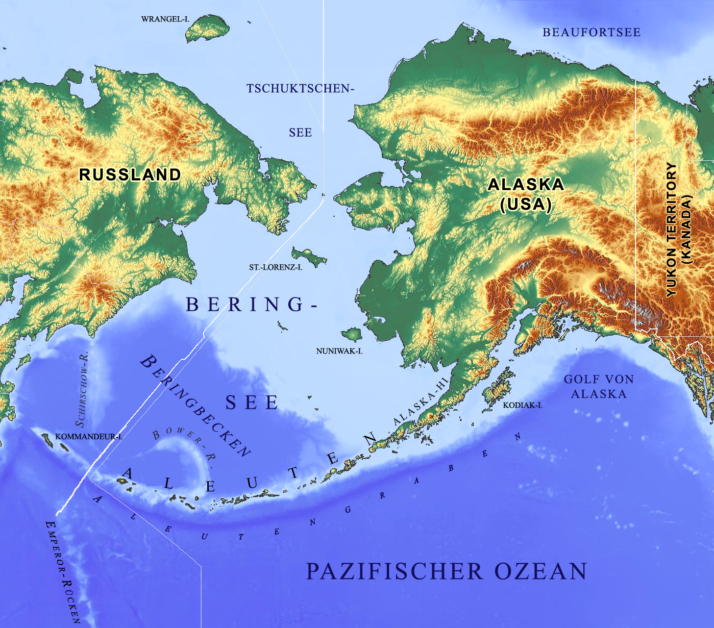
Beringmeer-Aleuten-Karte.png - Gretarsson

AKsizemap.gif - BD2412

Maps (n.d.) (36068421014).jpg - Rudolphous

Figure 1- Alaska and Adjacent Bodies of Water (14259518733).jpg - Artix Kreiger 2

RS2477 Trails in Alaska.png - BenDVu
Redoubt-third-doppler.gif - Innotata

Exhibit of Alaskan petroleum in various stages of refinement, Alaska Building, Alaska-Yukon-Pacific-Exposition, Seattle (AYP 1048).jpg - BMacZeroBot

800x598-Carte-Alaska - Autostrada Steese.jpg - UltimoGrimm

Lago Summit (Paxson, Alaska).png - UltimoGrimm

Klondike Cigars (1898) (ADVERT 265).jpeg - BMacZeroBot

Alaska map showing land areas suitable for cultivation (AL+CA 2848).jpg - BMacZeroBot

Alaska ADIZ 2009.jpg - Rolypolyman

35th Edition - NARA - 140696294.jpg - US National Archives bot

36th Edition - NARA - 140696292.jpg - US National Archives bot

37th Edition - NARA - 140696290.jpg - US National Archives bot

Alaskan Traverses - NARA - 100307270.jpg - US National Archives bot

Area North and East of the Wrangell Mountains - NARA - 100307286.jpg - US National Archives bot

Area North of the Wrangell Mountains - NARA - 100307284.jpg - US National Archives bot

Delta Chistochina Watershed - NARA - 100307274.jpg - US National Archives bot

Map of Mount McKinley Region - NARA - 100307278.jpg - US National Archives bot

Map of Projected Railway Location - NARA - 100307276.jpg - US National Archives bot

Alaska north shore.png - Geo Swan

Loc-QCS-Hecate-Dixon.png - Myrhonon

Alaskan timezone photo.png - TotallyLegitFactz

Alaska POI.png - Mpwood33

Dyea Map 1898.jpg - Estabiano

DL Region.jpg - CKKUPLACK

Hope, AK- Map of Hope Townsite Alaska Survey No 1485 - DPLA - 0575d6307f19a248b6c26bd6e38c5928.jpg - DPLA bot

Pacific Steamship Co Explanation of Routes, 1917 (MOHAI 14769).jpg - BMacZeroBot

Intermontane-Plateaus (North).png - Fährtenleser

Karte Alaska Methanhydrat-Körper.png - Pechristener

Alaska and the Aleutians Map.jpg - Zoozaz1

Upside down alaska.jpg - SteinsplitterBot

Poker Creek–Little Gold Creek Border Crossing 2021.jpg - Samuell

Trails on Unalaska Island (35789912521).jpg - Ltn12345

Map of Kashega (35514202060).png - Ltn12345

Map of proposed combined Alaska-Yukon territory.png - Fay2

The Exploration and Survey of the 141st Meridian Alaska Nelles 1913 Map.jpg - Kognos
Alaska Territorial Guard map.jpg - JayGriffin

Beaufort Sea Withdrawal NPR-A Special Areas.jpg - Michael.C.Wright

Willow Development Lease Map.jpg - Michael.C.Wright

Alaska and Hawaii.jpg - Zhyena28
District of Alaska.png - Louis kong di hao

Spruce-bud-blight-cumulative-detection-map-2022-Alaska.png - MPF
Geothermal resources of Alaska.pdf - Jengod

ANCSA Regional Corporations on Alaska Map.svg - Themightyquill
Plate-2 Map of geothermal resources of Alaska and Hawaii.pdf - Jengod

Maniilaq Service Area.png - Sipik06

Alaska 1960-1970 Census Areas.svg - LeonEpik

Alaska 1970-1980 Census Areas.svg - LeonEpik

Alaska 1980-1990 Census Areas.svg - LeonEpik

Alaska 1990-2000 Census Areas.svg - LeonEpik
Alaska Time Zone Map.png - Sbb1413

Proposed Ambler Road Project overview map.png - Sipik06

Map of Place Names, Telaquana Corridor (f75c20ac-1dd8-b71b-0b52-79401be977f2).png - BMacZeroBot

Alaska in the United States.png - Lexitwo