Wikimedi'Òc
Modes d'emploi

Cet album fait partie des albums
Cet album photos contient les sous-albums suivants :


Former St Aidan's Mission Church, Bailiff Bridge - geograph.org.uk - 7427071.jpg - GeographBot

Lewins - Bull Green - geograph.org.uk - 698387.jpg - GeographBot

18C cottages, New Hey Road, Rastrick - geograph.org.uk - 189853.jpg - GeographBot

Bottom end of Bolton Brow, Sowerby Bridge - geograph.org.uk - 195771.jpg - GeographBot

Holy Well, Holywell Green, Stainland - geograph.org.uk - 254569.jpg - GeographBot

Building at Clay Well, Golcar (2) - geograph.org.uk - 407506.jpg - GeographBot

Milestone, Stainland Road, Greetland - geograph.org.uk - 586696.jpg - GeographBot

A Mill - Dean Clough - geograph.org.uk - 606733.jpg - GeographBot

Akroydon - Boothtown Road - geograph.org.uk - 606465.jpg - GeographBot

Britannia Road, Slaithwaite - geograph.org.uk - 625124.jpg - GeographBot

Brighouse Bottom Lock - geograph.org.uk - 707055.jpg - GeographBot

Two faces of the old milestone, Norland - geograph.org.uk - 986919.jpg - GeographBot

Former warehouse,Saddleworth Road B6114, Greetland - geograph.org.uk - 991793.jpg - GeographBot

Milestone, Rochdale Road B6113, Greetland - geograph.org.uk - 991819.jpg - GeographBot

The boundary stone between Stainland and Greetland. - geograph.org.uk - 1023513.jpg - GeographBot

Both equal distance - geograph.org.uk - 1117836.jpg - GeographBot

The 'Castle' Holywell Green - geograph.org.uk - 1229366.jpg - GeographBot

Derelict Property - Northgate - geograph.org.uk - 1452272.jpg - GeographBot
Coach House Entrance, Boothtown Road, Halifax - geograph.org.uk - 1574834.jpg - GeographBot

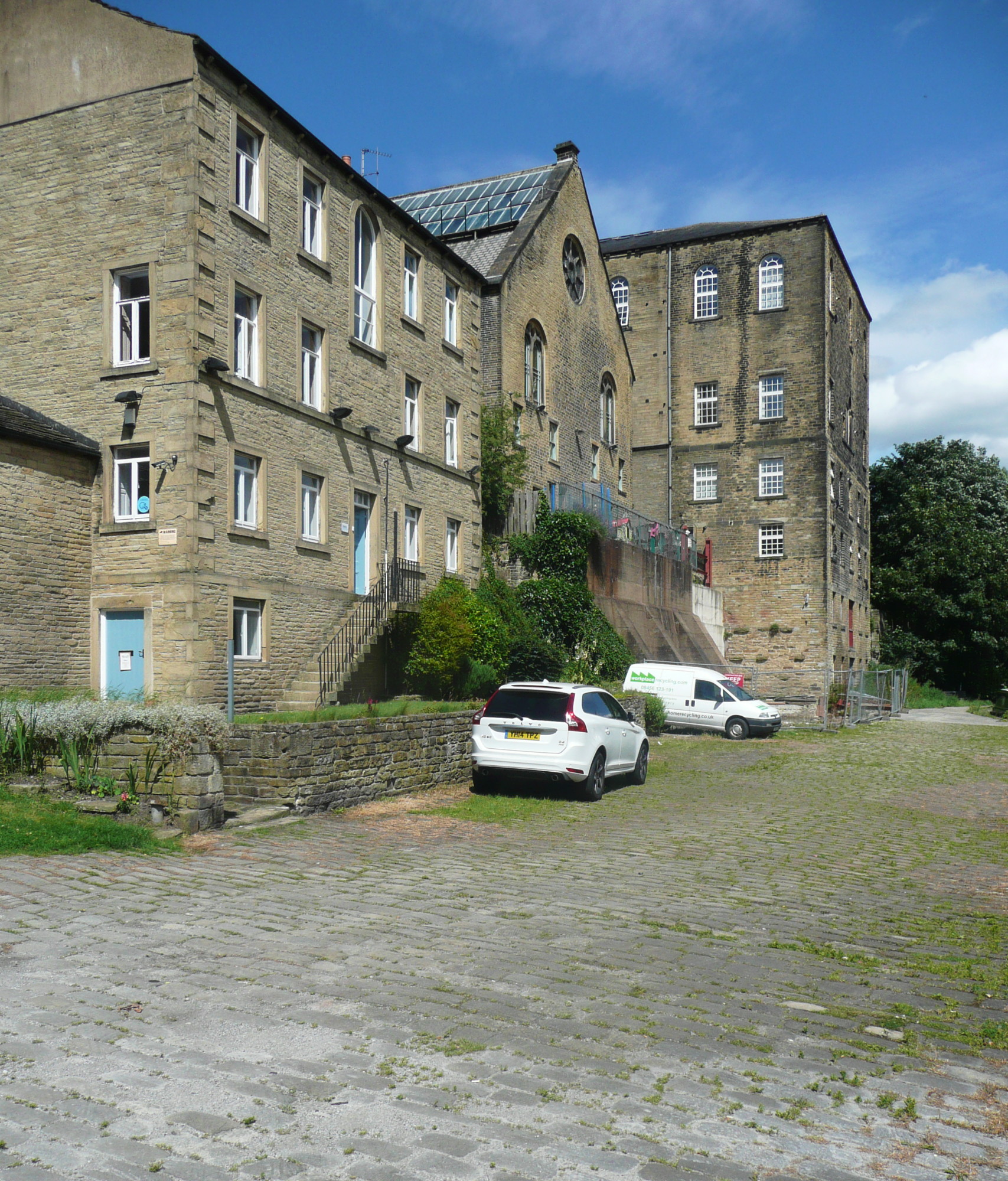
Bailey Hall Mill, Halifax, from the tower of Halifax Minster (6144701131).jpg - INeverCry

Britannia House (8229906243).jpg - INeverCry

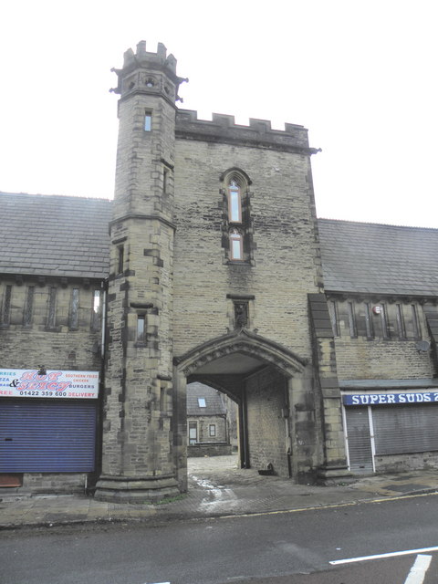
Gatehouse, Shaw Park, Holywell Green (5704578084).jpg - INeverCry

Brookfoot Lock, Brighouse.jpg - Peter I. Vardy

Canal Milestone near Crowther Bridge, Brighouse.jpg - Peter I. Vardy

Civic Hall, Brighouse.jpg - Geograph Update Bot

Canal milepost, Elland.jpg - Peter I. Vardy

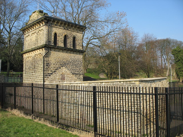
Shaw Park Folly.jpg - Peter I. Vardy
Aviary, Shaw Park.jpg - Peter I. Vardy

Boundary Stone on Norland Road.jpg - Geograph Update Bot

Burial Ground, Providence Chapel, Stainland.jpg - Peter I. Vardy

Milestone opposite Ingwood Mill.jpg - Peter I. Vardy
Calder House, Sowerby Bridge.jpg - Geograph Update Bot

31 Square Road, Halifax.jpg - Peter I. Vardy

Albany Club, Halifax.jpg - Geograph Update Bot

2-8 Clare Road, Halifax.jpg - Peter James

8-12 Horton Street, Halifax.jpg - Peter James

8-12 Crossley Street and 1-3 Wesley Court, Halifax.jpg - Peter James

25-33 Northgate, Halifax.jpg - Peter James

4 Crossley Street, Halifax.jpg - Peter James

21 Crossley Street, Halifax.jpg - Peter James

17 and 19 Crossley Street, Halifax.jpg - Peter James

7 and 9 Crossley Street, Halifax.jpg - Peter James

1 and 3 Crossley Street, Halifax.jpg - Peter James

17-23 Northgate, Halifax (2).jpg - Peter James

17-23 Northgate, Halifax (1).jpg - Peter James
Bailey Hall Mill, Halifax.jpg - Peter James

2 and 4 West Parade, Halifax.jpg - Peter James

An older house in Rishworth - geograph.org.uk - 2100906.jpg - GeographBot

Shaw Park Gateway - geograph.org.uk - 2733211.jpg - GeographBot

Shaw Park Folly - geograph.org.uk - 2733238.jpg - GeographBot

Shaw Park Folly - geograph.org.uk - 2733244.jpg - GeographBot

Former wool warehouses, Halifax - geograph.org.uk - 3779872.jpg - GeographBot

The King's Centre - geograph.org.uk - 3814084.jpg - GeographBot

Sowerby Bridge Bridleway 27 approaching Greave House - geograph.org.uk - 4242534.jpg - GeographBot

Sowerby Bridge Bridleway 27 at Greave House - geograph.org.uk - 4242546.jpg - GeographBot

Holdsworth Farm - geograph.org.uk - 4345736.jpg - GeographBot

Toothill Court - geograph.org.uk - 4412599.jpg - GeographBot

Sowerby Hall, Towngate - geograph.org.uk - 6826970.jpg - GeographBot

Stocks next to Lock Up - geograph.org.uk - 7135328.jpg - GeographBot