Wikimedi'Òc
Modes d'emploi

Cet album fait partie des albums
Cet album photos contient les sous-albums suivants :


1855 PRR.jpg - SPUI~commonswiki

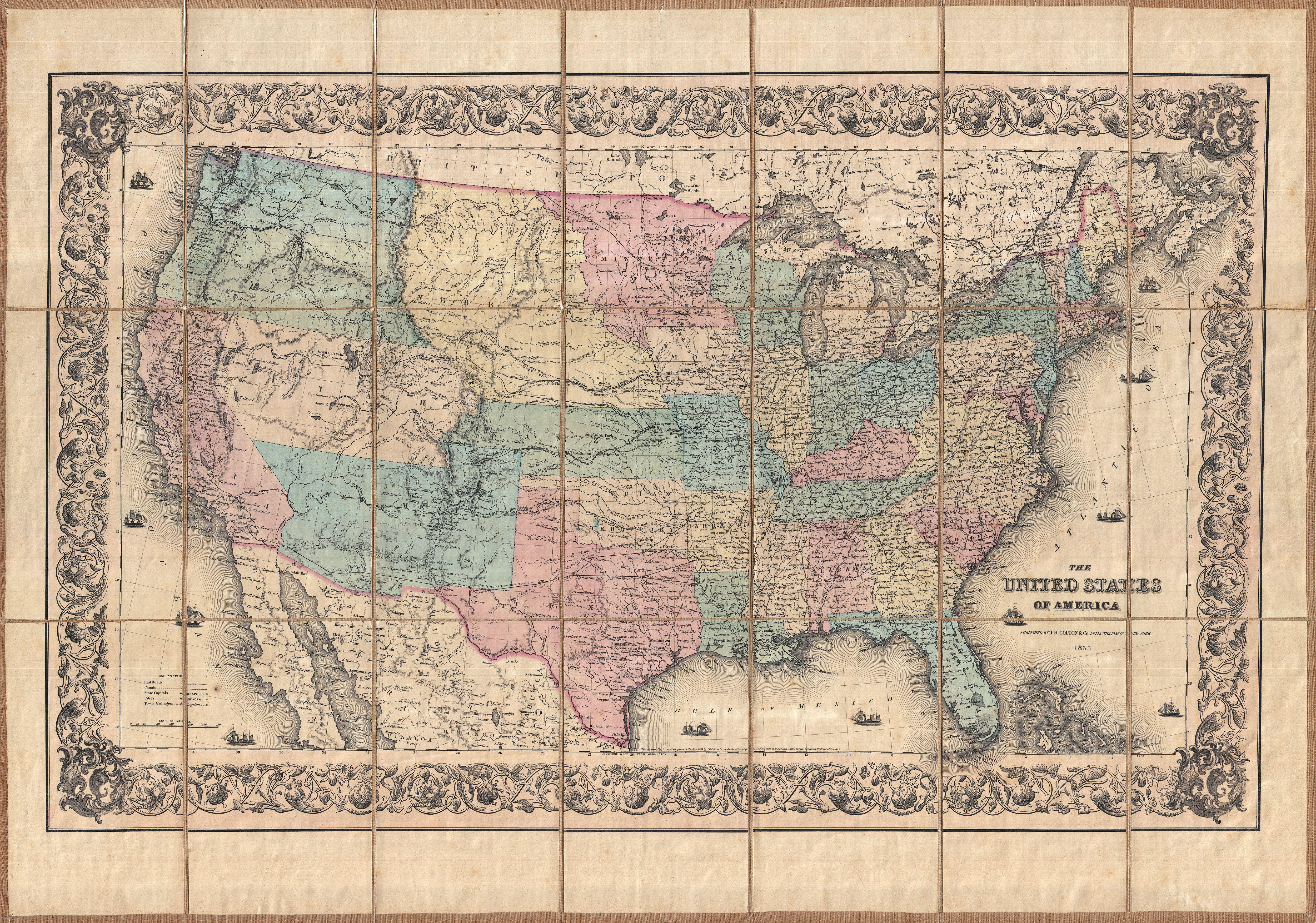
1855 Colton Map of the United States - Geographicus - UnitedStates-colton-1855.jpg - BotMultichillT

1855 U.S. Coast Survey Chart or Map of Chesapeake Bay and Delaware Bay - Geographicus - ChesapeakeBay-uscs-1855.jpg - BotMultichillT
1855 Colton Pocket Map of the United States - Geographicus - UnitedStatesPk-colton-1855.jpg - BotMultichillT
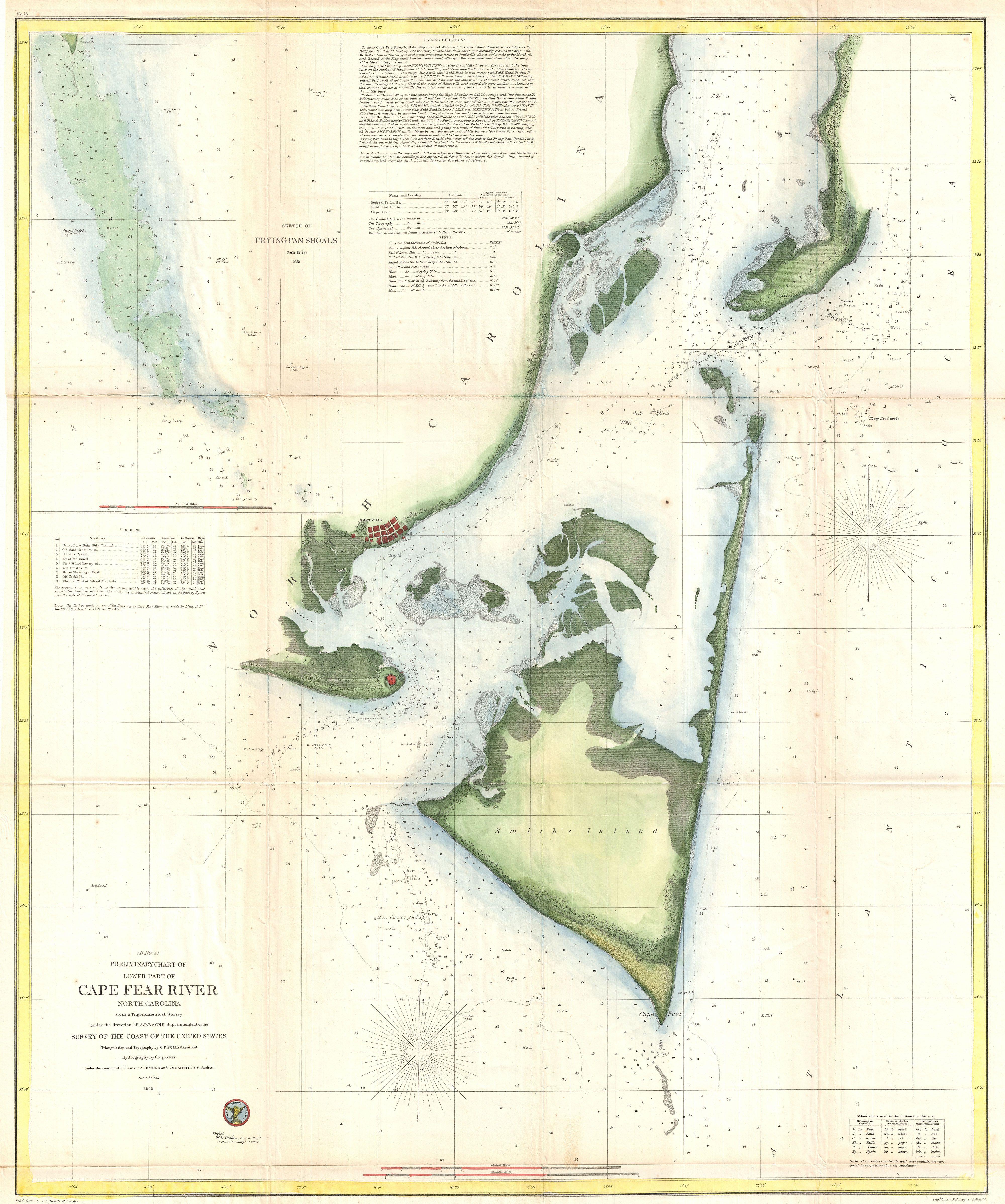
1855 U.S.C.S. Map of Cape Fear and Vicinity, North Carolina - Geographicus - CapeFear-uscs-1855.jpg - BotMultichillT

1855 U.S. Coast Survey Map of the Chesapeake Bay Entrance - Geographicus - ChesapeakeBayEntrance-uscs-1855.jpg - BotMultichillT
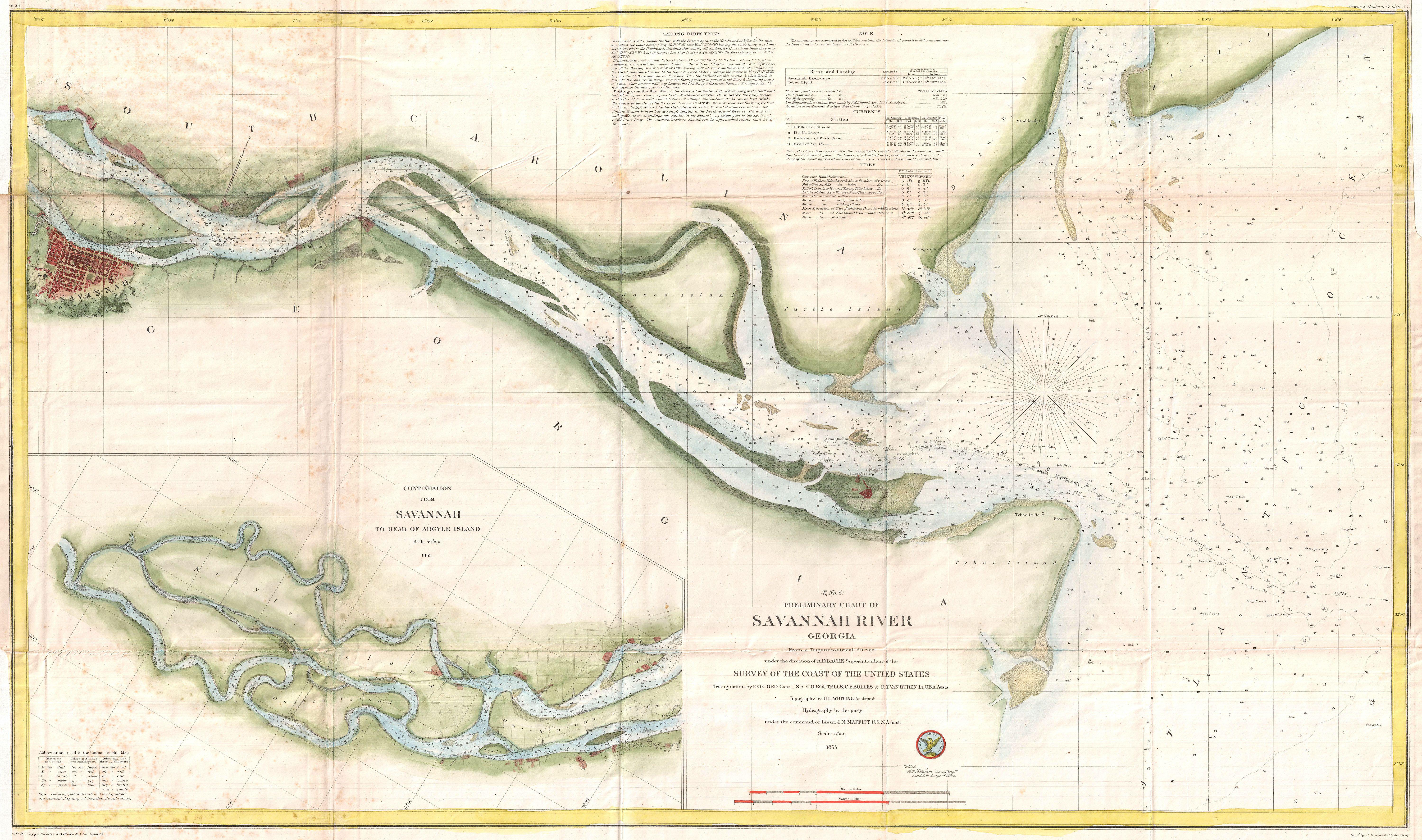
1855 U.S. Coast Survey Chart or Map of the Savanna River, Georgia - Geographicus - SavannahRiver-uscs-1855.jpg - BotMultichillT

1855 U.S. Coast Survey Chart or Map of Chesapeake Bay and Delaware Bay - Geographicus - ChesapeakeBay3-uscs-1855.jpg - BotMultichillT

1855 U.S. Coast Survey Chart or Map of Chesapeake Bay and Delaware Bay - Geographicus - ChesapeakeBay4-uscs-1855.jpg - BotMultichillT

1855 U.S. Coast Survey Map of the Delta of the Mississippi River - Geographicus - GulfCoast-uscs-1855.jpg - BotMultichillT

1855 U.S. Coast Survey Nautical Chart or Map of the Chesapeake Bay - Geographicus - ChesapeakeBayHd-uscs-1855.jpg - BotMultichillT

MN WI 1855.jpg - Gwester

Map of the United States exhibiting the several collection districts (7557433102).jpg - File Upload Bot (Magnus Manske)

Map of routes for a Pacific railroad (5121143386).jpg - File Upload Bot (Magnus Manske)

1855 Telegraph and Rail Road Map of the New England States.jpg - Pi.1415926535

A cyclopedia of missions - containing a comprehensive view of missionary operations throughout the world - with geographical descriptions, and accounts of the social, moral, and religious condition of (14740251016).jpg - Fæ
The United States of America (NYPL b20643913-5564104).tiff - Fæ
Map of the United States of America showing the rail roads (NYPL b20643909-5564107).tiff - Fæ
Delaware and Maryland. LOC 2017593561.tif - Fæ
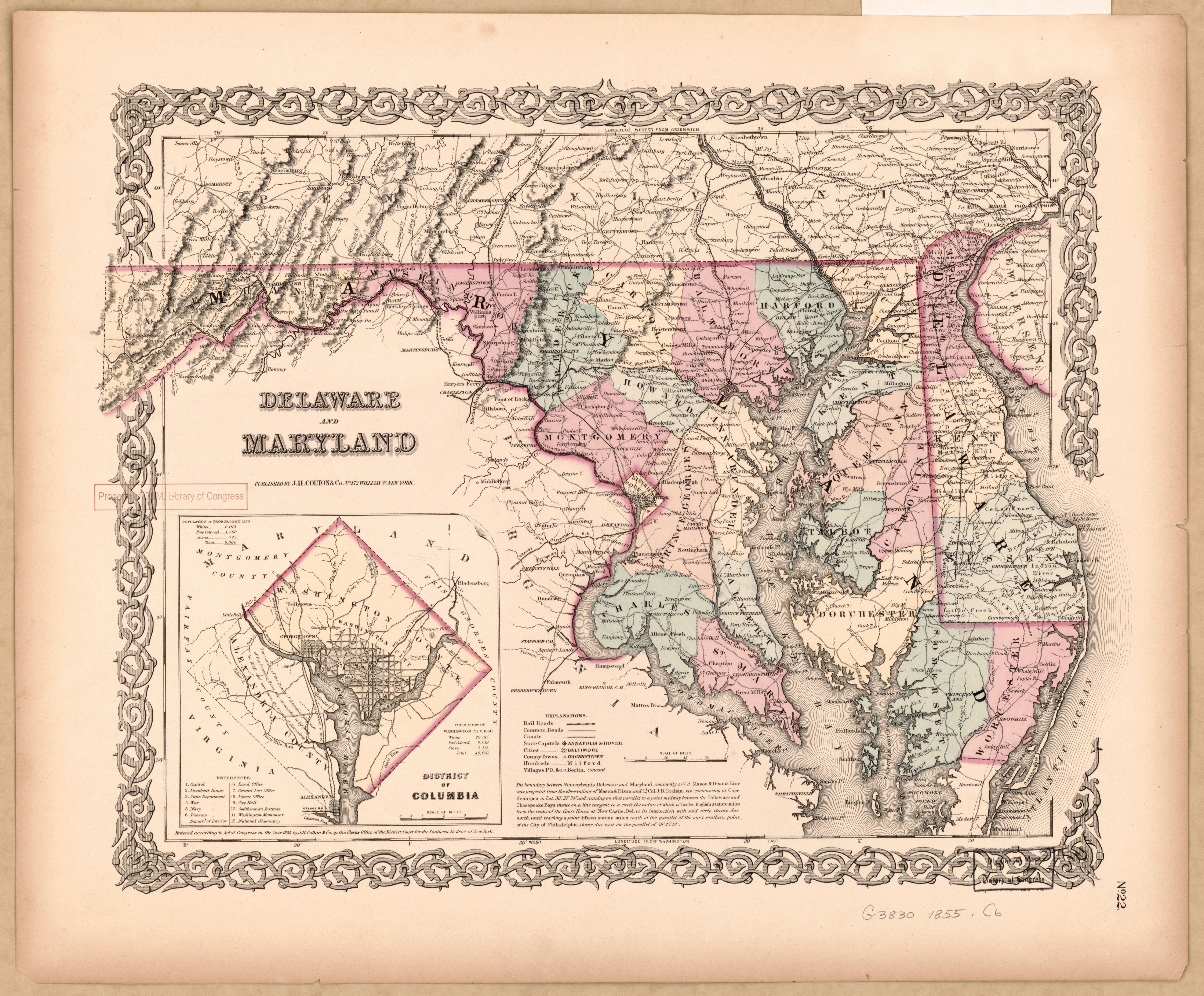
Delaware and Maryland. LOC 2017593561.jpg - Fæ
Map of routes for a Pacific railroad, compiled to accompany the report of the Hon. Jefferson Davis, sec. of war. LOC gm70005365.tif - Fæ

Map of routes for a Pacific railroad, compiled to accompany the report of the Hon. Jefferson Davis, sec. of war. LOC gm70005365.jpg - Fæ
Colton's Georgetown and the city of Washington - the capital of the United States of America ; Colton's map showing part of Virginia, Maryland, Pennsylvania, New Jersey & New York. LOC 88694033.tif - Fæ

Colton's Georgetown and the city of Washington - the capital of the United States of America ; Colton's map showing part of Virginia, Maryland, Pennsylvania, New Jersey & New York. LOC 88694033.jpg - Fæ
Post-kanal-und eisenbahnkarte der verbeinigten staaten von nord-amerika. LOC 2001620438.tif - Fæ

Post-kanal-und eisenbahnkarte der verbeinigten staaten von nord-amerika. LOC 2001620438.jpg - Fæ
A section of Colton's large map of Indiana with the Fort Wayne and Southern Rail Road marked upon it, as located also a map of the United States showing Road and its connections together with a LOC 98688661.tif - Fæ

A section of Colton's large map of Indiana with the Fort Wayne and Southern Rail Road marked upon it, as located also a map of the United States showing Road and its connections together with a LOC 98688661.jpg - Fæ
Mississippi. LOC 2012586806.tif - Fæ

Mississippi. LOC 2012586806.jpg - Fæ
Map of routes for a Pacific railroad LOC 2007626788.tif - Fæ

Map of routes for a Pacific railroad LOC 2007626788.jpg - Fæ
1855 United States Explorations For Railroad Route (IA 1855UnitedStatesExplorationsForRailroadRoute).pdf - Fæ

Colton's Map of the United States of America 1855 UTA.jpg - Michael Barera